North American Cordillera
This attraction is related to the countries:UNITED STATESUnited States , CanadaUnited States , MexicoGuatemalaThe Cordilleras of North America is part of the Cordillera mountain system, extending within Mexico, the United States (including the state of Alaska), and Canada. Its total length is over 7,000 kilometers (from 19°N to 69°N). The width of the mountain belt in Alaska reaches 1100-1200 km, in Canada – up to 800 km, on the territory of the USA – about 1600 km, in Mexico – up to 1000 km. The southern boundary of the Cordilleras of North America is the tectonic depression of the Balsas River valley, which separates North and Central America.
Video: Cordilleras of North America
General Information
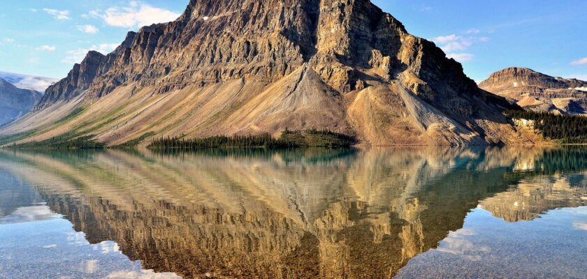
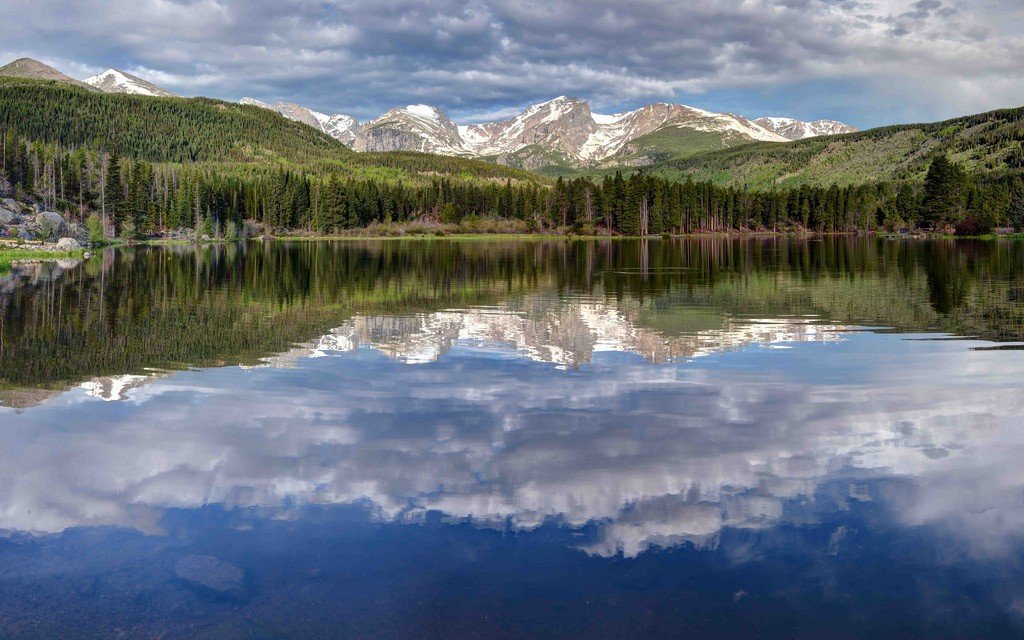
The Rocky Mountain range is considered the longest in length, with an elevation of 4,339 meters (Mount Elbert). Mount McKinley is considered the highest peak in the North American section of the Cordilleras, at 6,193 meters. The Cordilleras reach a width of 1,600 meters in the Americas.
.
There are three longitudinal belts distinguished in the Cordilleras of North America: eastern, inner, western.
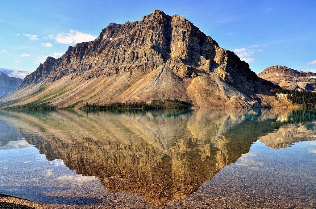
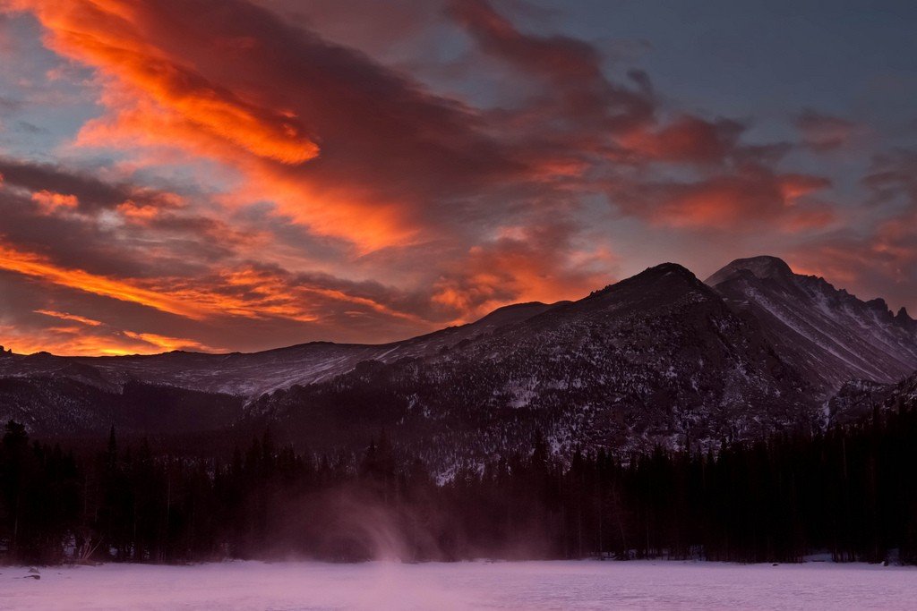
The eastern belt, or Rocky Mountain belt, consists of a chain of high, massive ridges, mostly serving as a watershed between the Pacific Ocean basin and the basins of the Gulf of Mexico and Arctic Ocean. In the east, the belt is interrupted by a foothill plateau (Arctic, Great Plains). In the west, it is in some places bounded by deep faults (“Rocky Mountain Ditch”) or the valleys of large rivers (Rio Grande). In places it gradually changes into mountain ranges and plateaus. In Alaska, the Rocky Mountain belt includes the Brooks Range, in northwestern Canada – the Richardson Range and the Mackenzie Mountains, bounded to the north and south by the through valleys of the Peel and Liard rivers..
Inner Cordillera belt, consisting of plateaus and highlands, lies between the eastern belt and the Pacific Ranges belt to the west. In Interior Alaska, it includes very broad tectonic depressions occupied by river floodplains and interspersed with hill massifs up to 1500-1700 m high (Kilbuck, Kuskokwim, and Ray Mountains). This includes mountain massifs and ridges as high as the Rocky Mountain ranges (Cassiar-Omineca Mountains, 2590 m). Within the United States proper, there are high mountain massifs in Idaho (elevation up to 3,857 m).
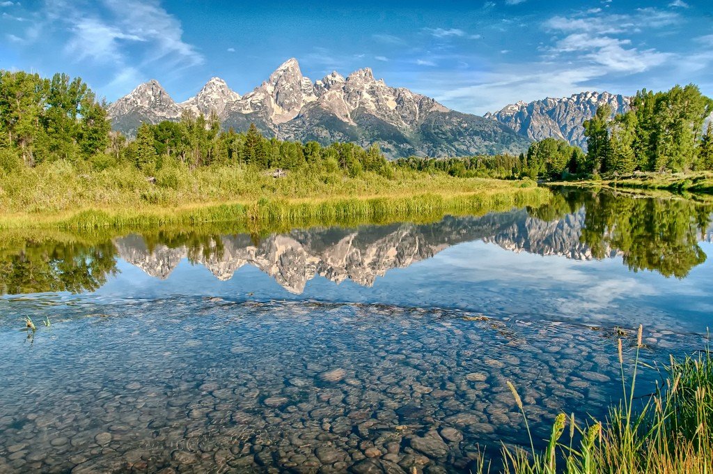
Western>. The Western Belt consists of the Pacific Ridge Belt, the Intermountain Lakes Belt, and the Coast Range Belt. The Pacific Ranges belt, which covers the interior region of the Cordilleras, consists of high mountain formations. It includes the Alaska Range with Mt. McKinley (6193 m), the volcanic Aleutian Islands chain, the Aleutian Range (Iliamna Volcano, 3075 m), the high-mountain node of the St. Elias Massif, and the Coast Range, which forms a sea gulf with rocky shores throughout its entire length. In the United States, this belt includes the Cascade Volcanic Mountains (Rainier Volcano, 4392 m), the ranges: the Sierra Nevada (Mount Whitney, 4418 m), the mountains of the California Peninsula (elevation up to 3078 m), the Transverse Volcanic Sierra with the volcanoes of Orisaba (5700 m), Popocatepetl (5452 m), Nevado de Colima (4265 m).
Offshore bays and straits (Cook Inlet, Shelikhov Strait, Georgia Strait, Sebastian-Viscaino Bay) alternate with lowlands and plateaus (Susitna Lowlands, Copper River Plateau, Willamette Valley, Greater California Valley). Coastal ranges consist of low to mid-elevation formations (U.S. Coast Ranges, Sierra Vizcaino on the California Peninsula) and mountainous coastal islands (Cadiak, Queen Charlotte, Vancouver, Alexander Archipelago). This belt reaches its highest elevation in southern Alaska, in the Chugach Mountains (Marques Baker, 4016 m).
.Climate
Because the Cordilleras of North America occupy a stretch of 7,000 kilometers, the climate differs from belt to belt. For example, in the northern part, where the Arctic (Brooks Range), and sub-Arctic (part of Alaska) zones run, there is glaciation at summits of 2250 meters. The snow boundary is at 300-450 meters.
.Zones in close proximity to the Pacific Ocean are characterized by mild climates, more oceanic (at the latitude of San Francisco – Mediterranean), in the interior – continental. On the Yukon Plateau, the average winter temperature ranges from -30°C, summer temperatures up to 15°C. In the Great Basin, winter temperatures can be as low as -17°C, and summer temperatures often exceed 40°C (absolute maximum 57°C). Humidity in different areas of the Cordilleras depends on the distance from the coastline. Thus, in the west there is higher humidity and, consequently, more precipitation. Toward the west to the east, there is less precipitation in the central part. Towards the east, the tropical climate increases humidity. Therefore, the average annual precipitation ranges from 3000-4000 mm in southern Alaska, on the coast of British Columbia – up to 2500 mm, on the inland plateau of the United States it decreases to 400-200 mm.
.Rivers and lakes
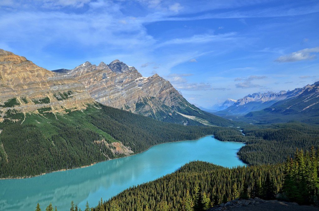
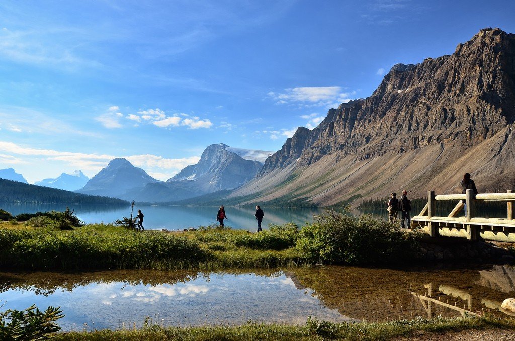
The Cordilleras have many lakes of mountain-glacial and volcanic origin. These include the Great Salt Lake, Tahoe. Missouri, Yukon, Colorado, and Columbia rivers originate in the Cordilleras of North America. Because the eastern belt of mountains is a natural watershed, most of the precipitation that falls within this range drains westward to the Pacific Ocean. North of 45-50° N latitude on the Pacific Coast, rivers are replenished by snowmelt and spring flooding. The southern part of lakes and rivers exists due to precipitation in the form of rain and snow. Most recharge is from snowmelt with a winter maximum on the Pacific Coast and a spring/summer maximum in the interior. The Cordilleras of the southern zone have no runoff to the ocean and are replenished by short-term watercourses ending in drainless salt lakes (the largest of them is the Great Salt Lake). In the northern Cordilleras there are freshwater lakes of glacio-tectonic and backwater origin (Atlin, Kootenay, Okanagan, etc.).
.Mountainous river topography with waterfall areas are used for power generation. The fullest water sources are used for agricultural purposes, particularly for irrigation of fields. Some natural headwaters on the Columbia River are used for hydroelectric power plants (Grand Coulee, Te Dals, etc.).
.Natural Areas
Because the Cordilleras cross the subarctic, temperate, subtropical and tropical belts, they are divided into 4 main natural areas: Northwest Cordilleras, Canadian Cordilleras, U.S. Cordilleras, and Mexican Cordilleras.
.
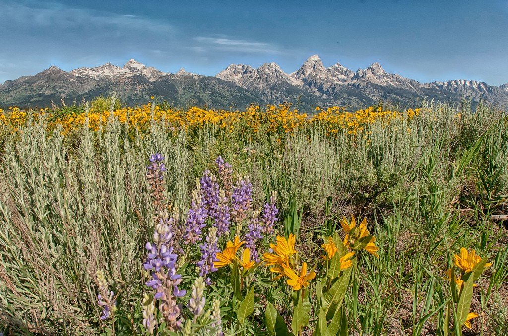
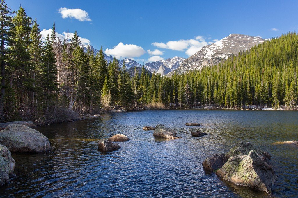
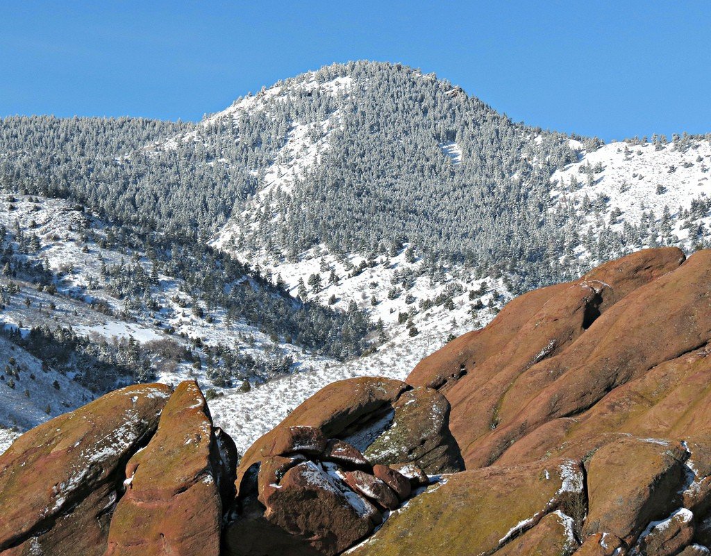
The U.S. Cordilleras stand out for their large width of 1,600 kilometers, so they are characterized by a wide range of climates, landscape and fauna. High forested ridges covered with snowfields and glaciers directly neighbor here with vast treeless desert plateaus. The climate is subtropical, Mediterranean on the coast and arid in the interior. On the slopes of high ridges (Front Range, Sierra Nevada) there are belts of mountain pine forests (American spruce, larch), coniferous subalpine sparse forests and alpine meadows. The low Coast Ranges are home to mountain pine forests, sequoia groves, and evergreen hardwood shrubs.
.There were many forests in the western Cordilleras until the 19th century, but in the 19th and especially the 20th centuries the forests were heavily logged and burned, and the area under them was greatly reduced (Sitka spruce, Douglas-fir, which survives in small numbers on the Pacific coast, were particularly affected). Low zones of the inner plateau are occupied by wormwood and shrubby semi-deserts and deserts, low ridges – by pine and pine-juniper sparse forests.
.In areas inhabited by humans, large animals have either been destroyed or are on the verge of extinction. Bison, the rarely seen antelope – vilorog are preserved only thanks to national programs. Rich animal life can be observed only in nature reserves (Yellowstone National Park, Yosemite National Park, etc.). In semi-desert areas predominantly rodents, snakes, lizards, and scorpions are common. Population is concentrated near the Pacific coast, where large cities (Los Angeles, San Francisco) are located. In the river valleys are masses of irrigated lands used for subtropical fruit crops. Subtropical sparse forests and shrub deserts are used as pastures.
.