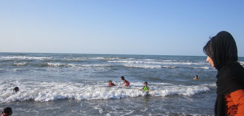
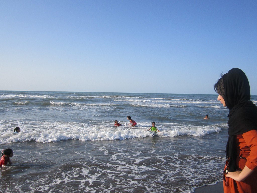
Caspian Sea
This attraction is related to the countries:KazakhstanKazakhstan , RussiaKazakhstan , TurkmenistanIranAzerbaijanThe Caspian Sea is the largest lake on Earth, located at the junction of Europe and Asia, called a sea because of its size. The Caspian Sea is a drainless lake and its water is salty, ranging from 0.05 ‰ near the mouth of the Volga River to between 11-13 ‰ in the southeast. The water level is subject to fluctuations, currently about -28 m below the level of the World Ocean. The area of the Caspian Sea is currently approximately 371,000 km², with a maximum depth of 1,025 m.


General information
The Caspian Sea is located at the junction of two parts of the Eurasian continent, Europe and Asia. The Caspian Sea is similar in shape to the Latin letter S. The length of the Caspian Sea from north to south is about 1200 kilometers (36°34′ – 47°13′ N), from west to east – from 195 to 435 kilometers, on average 310-320 kilometers (46° – 56° E).
.The Caspian Sea is conditionally divided by physiographic conditions into 3 parts – the North Caspian, the Middle Caspian and the South Caspian. The conditional border between the North and Middle Caspian is along the line Chechen (island) – Tyub-Karagan cape, between the Middle and South Caspian – along the line Zhiloy (island) – Gan-Gulu (cape). The area of the Northern, Middle and Southern Caspian Sea is 25, 36, 39 percent, respectively.
.
According to one hypothesis, the Caspian Sea got its name in honor of the ancient tribes of horse breeders, the Caspians, who lived before our era on the southwestern coast of the Caspian Sea. Throughout its history, the Caspian Sea has had about 70 names from different tribes and nations: Hyrkan Sea; Khvalyn Sea or Khvalis Sea – Old Russian name derived from the name of the inhabitants of Khorezm, trading on the Caspian Sea – Khvalis; Khazar Sea – name in Arabic (Bahr-al-Khazar), Persian (Darya-e Khazar), Turkish and Azerbaijani (Khazar Denizi) languages; Abeskun Sea; Saray Sea; Derbent Sea; Sikhai and other names. In Iran, the Caspian Sea is still called the Khazar Sea or the Mazenderan Sea (after the name of the people inhabiting the coastal province of the same name in Iran).
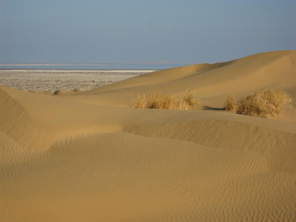
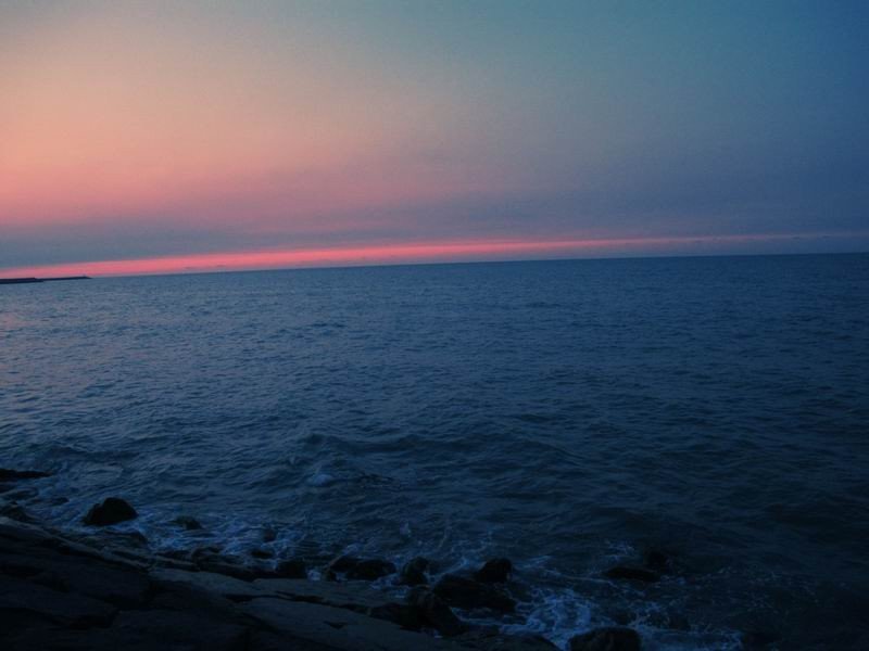
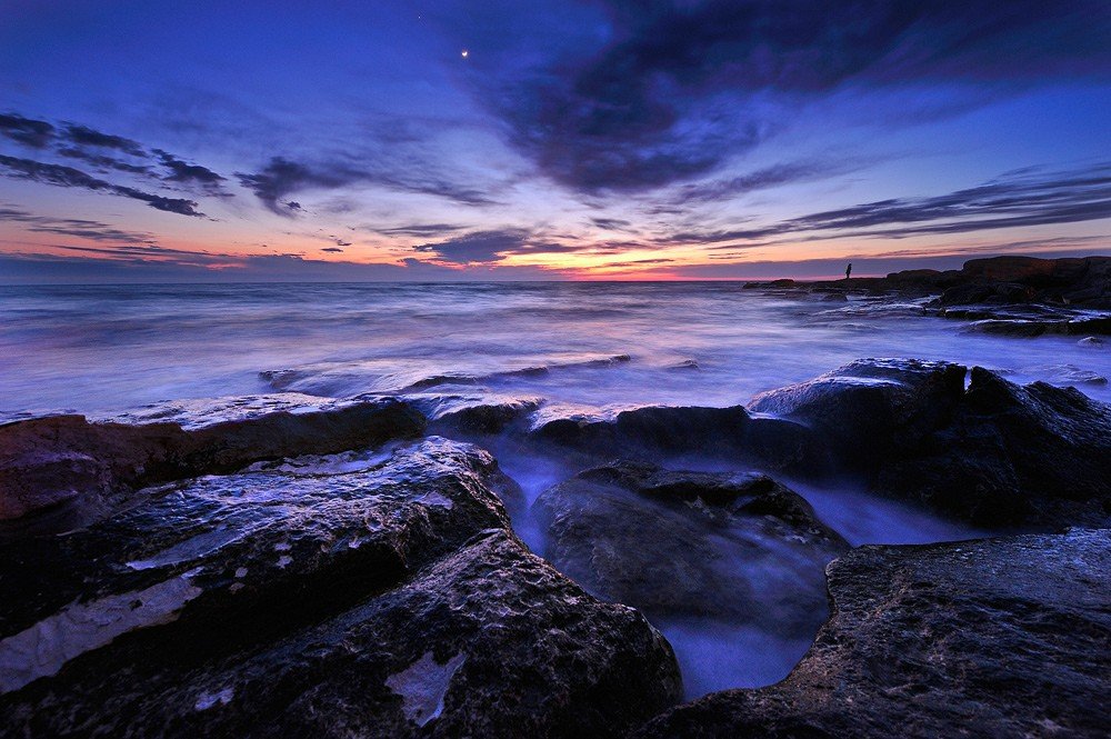
.The coastline of the Caspian Sea is estimated to be about 6,500 to 6,700 kilometers, with islands up to 7,000 kilometers. The shores of the Caspian Sea in most of its territory are low-lying and smooth. In the northern part, the coastline is cut by water streams and islands of the Volga and Ural deltas, the shores are low and swampy, and the water surface is covered with thickets in many places. The eastern coast is dominated by limestone shores adjacent to semi-deserts and deserts. The most winding shores are on the western coast in the area of the Apsheron Peninsula and on the eastern coast in the area of the Kazakh Gulf and Kara-Bogaz-Gol.
.Major peninsulas of the Caspian Sea: Agrakhan Peninsula, Apsheron Peninsula, Buzachi, Mangyshlak, Miankale, Tub-Karagan.
.There are about 50 large and medium-sized islands in the Caspian Sea with a total area of about 350 square kilometers. The largest islands are Ashur-Ada, Garasu, Gum, Dash, Zira (island), Zyanbil, Kyur Dashy, Hara-Zira, Sengi-Mugan, Chechen (island), and Chygyl.
.Major bays of the Caspian Sea: Agrakhan Bay, Komsomolets (bay) (formerly Dead Kultuk, formerly Tsesarevich’s Bay). Tsesarevich Bay), Kaidak, Mangyshlak, Kazakh (bay), Turkmenbashi (bay) (former Krasnovodsk), Turkmen (bay), Gizilagach, Astrakhan (bay), Gizlar, Girkan (former Astarabad) and Enzeli (former Pahlavi).
.Near the eastern coast is the salt lake Kara Bogaz Gol, which until 1980 was a bay-lagoon of the Caspian Sea, connected to it by a narrow strait. In 1980 a dam separating Kara-Bogaz-Gol from the Caspian Sea was built, in 1984 a culvert was built, after which the level of Kara-Bogaz-Gol dropped by several meters. In 1992, the strait was restored and water flows from the Caspian Sea to Kara-Bogaz-Gol and evaporates there. Every year 8 – 10 cubic kilometers of water (according to other data – 25 thousand kilometers) and about 150 thousand tons of salt come from the Caspian Sea to Kara-Bogaz-Gol.
.There are 130 rivers flowing into the Caspian Sea, of which 9 rivers have an estuary in the form of a delta. Major rivers flowing into the Caspian Sea are the Volga, Terek (Russia), Ural, Emba (Kazakhstan), Kura (Azerbaijan), Samur (Russia’s border with Azerbaijan), Atrek (Turkmenistan) and others. The largest river flowing into the Caspian Sea is the Volga, its average annual flow is 215-224 cubic kilometers. The Volga, Ural, Terek and Emba provide up to 88-90% of the annual Caspian Sea drainage.
.
The area of the Caspian Sea basin is approximately 3.1 to 3.5 million square kilometers, which is about 10 percent of the world’s closed water basins. The length of the Caspian Sea basin is about 2,500 kilometers from north to south and about 1,000 kilometers from west to east. The Caspian Sea basin covers 9 states – Armenia, Azerbaijan, Georgia, Iran, Iran, Kazakhstan, Russia, Uzbekistan, Turkey and Turkmenistan.
The Caspian Sea washes the shores of five coastal states:
.- Russia (Dagestan, Kalmykia, and Astrakhan Oblast) – in the west and northwest, with a coastline length of 695 kilometers
- Kazakhstan – in the north, northeast and east, coastline length 2320 kilometers
- Turkmenistan – in the southeast, with a coastline length of 1,200 kilometers
- Iran – in the south, with a coastline length of 724 kilometers .
- Azerbaijan – in the southwest, coastline length 955 kilometers
The largest port city on the Caspian Sea is Baku, the capital of Azerbaijan, which is located in the southern part of the Absheron Peninsula and has a population of 2,070,000 (2003). Other major Azerbaijani Caspian Sea cities are Sumgait, which is located in the northern part of the Absheron Peninsula, and Lenkoran, which is near Azerbaijan’s southern border. To the southeast of the Absheron Peninsula, there is the oil workers’ settlement of Neftyaniye Kamni, whose structures stand on artificial islands, trestles, and technological sites.
Major Russian cities – the capital of Dagestan, Makhachkala, and the southernmost city of Russia, Derbent – are located on the western coast of the Caspian Sea. Astrakhan is also considered a Caspian Sea port city; however, it is not located on the Caspian Sea coast, but in the Volga Delta, 60 kilometers from the northern coast of the Caspian Sea.
.On the eastern shore of the Caspian Sea is the Kazakh port city of Aktau, in the north in the delta of the Urals 20 kilometers from the sea is the city of Atyrau, south of Kara-Bogaz-Gol on the northern shore of the Gulf of Krasnovodsk is the Turkmen city of Turkmenbashi, formerly Krasnovodsk. Several Caspian Sea cities are located on the southern (Iranian) coast, the largest of which is Enzeli.
.
The area and volume of water in the Caspian Sea varies significantly with water level fluctuations. At a water level of -26.75 m, the area was approximately 392600 square kilometers and the water volume was 78648 cubic kilometers, which is approximately 44 percent of the world’s lake water. The maximum depth of the Caspian Sea is in the South Caspian Depression, 1,025 meters from its surface level. In terms of maximum depth, the Caspian Sea is second only to Baikal (1,620 meters) and Tanganyika (1,435 meters). The average depth of the Caspian Sea calculated from the bathygraphic curve is 208 meters. At the same time, the northern part of the Caspian Sea is shallow, its maximum depth does not exceed 25 meters, and its average depth is 4 meters.
.The water level in the Caspian Sea is subject to significant fluctuations. According to modern science, over the last 3 thousand years, the amplitude of changes in the water level of the Caspian Sea was 15 meters. Instrumental measurement of the Caspian Sea level and systematic observations of its fluctuations have been carried out since 1837, during this time the highest water level was registered in 1882 (-25.2 meters), the lowest – in 1977 (-29.0 meters), since 1978 the water level has been rising and in 1995 it reached -26.7 meters, since 1996 there has been a downward trend again. Scientists attribute the causes of changes in the water level of the Caspian Sea to climatic, geological and anthropogenic factors.
.Water temperature is subject to significant latitudinal changes, most clearly expressed in winter, when the temperature varies from 0 – 0.5 °C at the ice edge in the north of the sea to 10 – 11 °C in the south, i.e. the difference in water temperature is about 10 °C. For shallow areas with depths of less than 25 m, the annual amplitude can reach 25 – 26 °C. On average, the water temperature at the western coast is 1 – 2 °C higher than at the eastern coast, and in the open sea the water temperature is 2 – 4 °C higher than at the coasts. According to the nature of the horizontal structure of the temperature field in the annual cycle of variability, three time intervals in the upper 2-meter layer can be distinguished. From October to March, the water temperature increases in the south and in the east, which is particularly well traced in the Middle Caspian. Two stable quasi latitudinal zones where temperature gradients are elevated can be distinguished. These are, firstly, the boundary between the North and Middle Caspian, and secondly, between the Middle and South Caspian. At the ice edge, in the northern frontal zone, the temperature in February-March increases from 0 to 5 °C, and in the southern frontal zone, near the Apsheron Threshold, from 7 to 10 °C. During this period, the waters in the center of the Southern Caspian Sea, which form a quasi-stationary core, are the least cooled. In April-May, the area of minimum temperatures moves to the Middle Caspian, which is associated with faster warming of waters in the shallow northern part of the sea. However, at the beginning of the season in the northern part of the sea a large amount of heat is spent on ice melting, but already in May the temperature rises here to 16 – 17 °C. In the middle part the temperature at this time is 13 – 15 °C, and in the south it increases to 17 – 18 °C. Spring warming of the water equalizes horizontal gradients, and the temperature difference between the coastal areas and the open sea does not exceed 0.5 °C. Warming of the surface layer starting in March disrupts the homogeneity in temperature distribution with depth. In June-September, there is horizontal homogeneity in the temperature distribution in the surface layer. In August, which is the month of greatest warming, the water temperature is 24 – 26 °C throughout the sea, rising to 28 °C in the southern areas. In August, water temperatures in shallow bays, such as Krasnovodskoye, can reach 32 °C. The main feature of the water temperature field at this time is upwelling. It is observed annually along the entire eastern coast of the Middle Caspian and partially penetrates even into the Southern Caspian. The upwelling of cold deep water occurs with varying intensity as a result of the prevailing northwesterly winds in the summer season. Winds of this direction cause the outflow of warm surface waters from the coast and the rise of colder waters from intermediate layers. Upwelling starts in June, but reaches its greatest intensity in July-August. As a consequence, a decrease in temperature (7 – 15 °C) is observed at the water surface. Horizontal temperature gradients reach 2.3 °C at the surface and 4.2 °C at 20 m depth. The upwelling center gradually shifts from 41 – 42°N in June to 43 – 45°N in September. Summer upwelling is of great importance for the Caspian Sea, fundamentally changing the dynamic processes in the deep water area. In the open areas of the sea in late May – early June, the formation of a temperature jump layer begins, which is most clearly expressed in August. It is most often located between the horizons of 20 and 30 m in the middle part of the sea and 30 and 40 m in the southern part. Vertical temperature gradients in the jump layer are very significant and can reach several degrees per meter. In the middle part of the sea, the surge layer rises close to the surface due to the runup off the eastern coast. Since the Caspian Sea lacks a stable baroclinic layer with a large potential energy reserve similar to the main thermocline of the World Ocean, with the cessation of the prevailing winds causing upwelling and the onset of autumn-winter convection in October-November there is a rapid readjustment of the temperature fields to the winter regime. In the open sea, water temperature in the surface layer decreases in the middle part to 12 – 13 °C and in the southern part to 16 – 17 °C. In the vertical structure, the surge layer is eroded by convective mixing and disappears by the end of November.
.
The salt composition of the waters of the enclosed Caspian Sea differs from the oceanic waters. There are significant differences in the ratios of concentrations of salt-forming ions especially for the waters of the areas directly influenced by the mainland runoff. The process of metamorphization of sea waters under the influence of mainland runoff leads to a decrease in the relative content of chlorides in the total sum of sea water salts, and an increase in the relative amount of carbonates, sulfates, calcium, which are the main components in the chemical composition of river waters. The most conservative ions are potassium, sodium, chlorine and magnesium. Calcium and hydrocarbonate ions are the least conservative. In the Caspian Sea, the content of calcium and magnesium cations is almost twice as high as in the Sea of Azov, and sulfate-anion content is three times higher. Water salinity varies particularly sharply in the northern part of the sea: from 0.1 psu in the Volga and Ural estuaries to 10-11 psu at the border with the Middle Caspian. Mineralization in shallow saline bays-kultuk can reach 60 – 100 g/kg. In the Northern Caspian Sea, a salinity front of quasi latitudinal location is observed throughout the ice-free period from April to November. The greatest desalinization associated with river runoff spreading over the sea area is observed in June. The wind field has a great influence on the formation of the salinity field in the North Caspian Sea. In the middle and southern parts of the sea, salinity fluctuations are small. It is mainly 11.2 – 12.8 psu, increasing in the southern and eastern directions. Salinity increases insignificantly with depth (by 0.1 – 0.2 psu). In the deep-water part of the Caspian Sea, the vertical profile of salinity shows characteristic isohaline deflections and local extrema in the area of the eastern continental slope, which testify to the processes of benthic slumping of waters salinizing in the eastern shallow waters of the South Caspian Sea. The magnitude of salinity also strongly depends on sea level and (interrelatedly) on the volume of continental runoff.
.
The relief of the northern part of the Caspian Sea is a shallow undulating plain with banks and accumulative islands, the average depth of the Northern Caspian Sea is about 4 – 8 meters, the maximum depth does not exceed 25 meters. The Mangyshlak Threshold separates the North Caspian from the Middle Caspian. The Middle Caspian is quite deep, the water depth in the Derbent depression reaches 788 meters. The Apsheron Threshold separates the Middle and South Caspian. The South Caspian is considered deep water, the water depth in the South Caspian depression reaches 1025 meters from the surface of the Caspian Sea. Shell sands are widespread on the Caspian shelf, deep water areas are covered with muddy sediments, in some areas there is an outcrop of bedrock.
.
The climate of the Caspian Sea is continental in the northern part, temperate in the middle part and subtropical in the southern part. In winter, the average monthly temperature of the Caspian Sea varies from -8 -10 in the northern part to +8 – +10 in the southern part, in summer – from +24 – +25 in the northern part to +26 – +27 in the southern part. The maximum temperature was recorded on the eastern coast – 44 degrees.
.Average annual precipitation is 200 millimeters per year, ranging from 90-100 millimeters in the arid eastern part to 1,700 millimeters near the southwestern subtropical coast. Evaporation of water from the surface of the Caspian Sea is about 1,000 millimeters per year, with the most intense evaporation in the area of the Apsheron Peninsula and in the eastern part of the South Caspian Sea, up to 1,400 millimeters per year.
.Winds often blow on the territory of the Caspian Sea, their average annual speed is 3-7 meters per second, the wind rose is dominated by northerly winds. In autumn and winter months the winds increase, the wind speed often reaches 35-40 meters per second. The most windy areas are the Apsheron Peninsula and the vicinity of Makhachkala-Derbent, where the highest wave of 11 meters was recorded.
.
Water circulation in the Caspian Sea is related to water flow and winds. Since most of the water flow is to the North Caspian, northern currents prevail. The intense northerly current carries water from the North Caspian along the western coast to the Apsheron Peninsula, where the current splits into two branches, one moving further along the western coast, the other going to the Eastern Caspian.
.The animal world of the Caspian Sea is represented by 1,810 species, of which 415 are vertebrates. 101 species of fish have been recorded in the Caspian, and it also contains the majority of the world’s sturgeon stocks, as well as freshwater fish such as roach, carp, and pikeperch. The Caspian Sea is the habitat of such fish as carp, mullet, sprat, kutum, bream, salmon, perch, and pike. The Caspian Sea is also home to a marine mammal, the Caspian seal. Since March 31, 2008, 363 dead seals have been found on the coast of the Caspian Sea in Kazakhstan.
.
The plant world of the Caspian Sea and its coast is represented by 728 species. Of the plants in the Caspian Sea, algae – blue-green, diatoms, red, brown, khara and others – predominate; of the flowering plants – Zostera and Ruppia. In terms of origin, the flora is mainly of Neogene age, but some plants were brought into the Caspian Sea by man deliberately or on the bottoms of ships.
.