Barents Sea
The attraction is related to the countries:RussiaNorwayBarents Sea is a marginal sea of the Arctic Ocean. It washes the coasts of Russia and Norway. The sea is bounded by the northern coast of Europe and the archipelagos of Spitsbergen, Franz Josef Land and Novaya Zemlya. The area of the sea is 1424 thousand km², depth up to 600 m.


General information
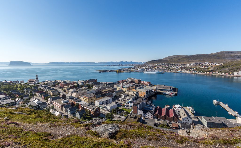
The Barents Sea is located on the continental shelf. The southwestern part of the sea does not freeze in winter due to the influence of the North Atlantic Current. The southeastern part of the sea is called the Pechora Sea. The Barents Sea is of great importance for transportation and for fishing – major ports are located here – Murmansk and Vardø (Norway). Until World War II, Finland also had access to the Barents Sea: Petsamo was its only ice-free port. Radioactive contamination of the sea due to the Soviet/Russian nuclear fleet and Norwegian radioactive waste treatment plants is a serious problem. Recently, the sea shelf of the Barents Sea towards Spitsbergen has become the object of territorial disputes between Russia and Norway (as well as other states).
The Barents Sea is rich in various species of fish, plant and animal plankton and benthos. Seaweeds are common off the southern coast. Of the 114 fish species inhabiting the Barents Sea, 20 species are the most important for commercial purposes: cod, haddock, herring, sea bass, catfish, flounder, halibut and others. Among mammals there are: polar bear, seal, harp seal, beluga whale, etc. Seal fishery is carried out. Bird markets abound on the coasts (kaira, teal, gulls). In the 20th century, the Kamchatka crab was introduced, which was able to adapt to the new conditions and began to reproduce intensively.
.
The shores of the Berentsev Sea have been inhabited by Finno-Ugric tribes – the Saami (Lapps) since ancient times. The first visits of non-autochonous Europeans (Vikings, then Novgorodians) began probably from the end of the 11th century, and then intensified. The Barents Sea was named in 1853 in honor of Dutch navigator Willem Barents. The scientific study of the sea was started by the expedition of F. P. Litke 1821-1824, and the first complete and reliable hydrological characterization of the sea was compiled by N. M. Knipovich in the early 20th century.
.
The Barents Sea is a marginal area of the Arctic Ocean on the border with the Atlantic Ocean, between the northern shore of Europe in the south and the islands of Vaygach, Novaya Zemlya, Franz Josef Land in the east, Spitsbergen and Bear Island in the west.
.It borders the Norwegian Sea basin in the west, the White Sea in the south, the Kara Sea in the east, and the Arctic Ocean in the north. The area of the Barents Sea east of Kolguyev Island is called the Pechora Sea.
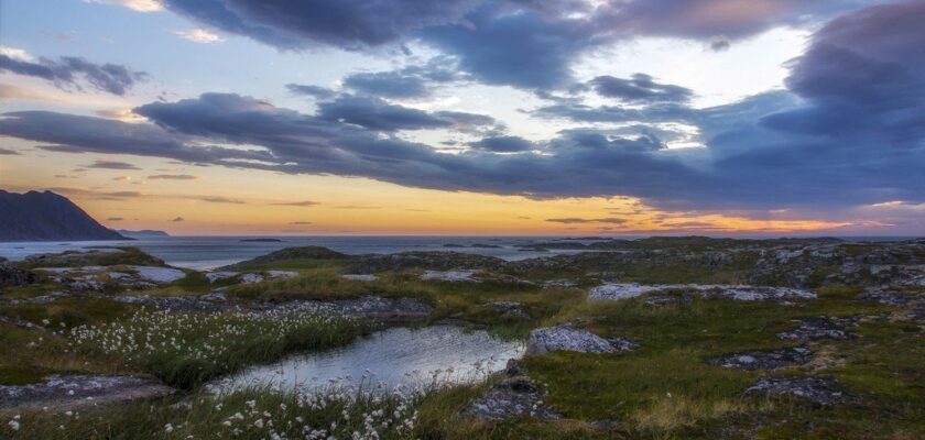
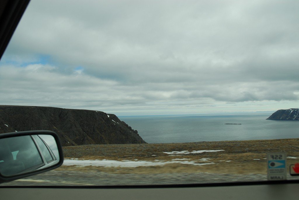
The shores of the Barents Sea are predominantly fjord-like, high, rocky, and heavily indented. The largest bays are Porsanger Fjord, Varangian Bay (also known as Varanger Fjord), Motovsky Bay, Kola Bay, and others. East of the Kanin Nos Peninsula the coastal relief changes dramatically – the coasts are predominantly low and poorly indented. There are 3 large shallow bays: (Chyoshskaya Bay, Pechorskaya Bay, Khaipudirskaya Bay), as well as several small bays.
.The largest rivers flowing into the Barents Sea are the Pechora and Indiga.
.The surface currents of the sea form a counterclockwise circulation. Along the southern and eastern periphery move eastward and northward the Atlantic waters of the warm Nordkapp Current (a branch of the Gulf Stream system), the influence of which can be traced to the northern shores of Novaya Zemlya. The northern and western parts of the circulation are formed by local and Arctic waters coming from the Kara Sea and the Arctic Ocean. In the central part of the sea there is a system of intra-circular currents. The circulation of the sea waters changes under the influence of changes in winds and water exchange with adjacent seas. Tidal currents are of great importance, especially near the coasts. Tides are semidiurnal, their greatest value of 6.1 m off the coast of the Kola Peninsula, in other places 0.6-4.7 m.
.Water exchange with neighboring seas is of great importance in the water balance of the Barents Sea. During the year, about 76,000 km³ of water enters the sea through the straits (and the same amount leaves it), which is about 1/4 of the total volume of water of the sea. The largest amount of water (59 000 km³ per year) is carried by the warm Nordkapp Current, which has an exceptionally large influence on the hydrometeorological regime of the sea. The total river discharge to the sea averages 200 km³ per year.
.The salinity of the surface water layer in the open sea throughout the year is 34.7-35.0 ppm in the southwest, 33.0-34.0 in the east, and 32.0-33.0 in the north. In the coastal strip of the sea in spring and summer salinity decreases to 30-32, by the end of winter increases to 34.0-34.5.
.The Barents Sea occupies the Barents Sea plate of Proterozoic-Early Cambrian age; bottom elevations are anteclises, depressions are syneclises. Of the shallower landforms are the remains of ancient shorelines, at depths of about 200 and 70 meters, glacial-denudation and glacial-accumulative forms and sand ridges formed by strong tidal currents.
.The Barents Sea is located within the mainland shoal, but unlike other similar seas, most of it is 300-400 m deep, with an average depth of 229 m and a maximum depth of 600 m. Plains (Central Plateau), uplands (Central, Perseus (minimum depth 63 m)>, depressions (Central, maximum depth 386 m) and troughs (Western (maximum depth 600 m) Franz-Victoria (430 m) and others) are distinguished. The southern part of the seabed is pimply less than 200 m deep and is characterized by a leveled relief..
From the cover of bottom sediments in the southern part of the Barents Sea prevails sand, in some places – pebbles and gravel. On the uplands of the central and northern parts of the sea – silty sand, sandy silt, in depressions – silt. The admixture of coarse clastic material is noticeable everywhere, which is connected with ice spreading and wide distribution of relict glacial deposits. Sediment thickness in the northern and middle parts is less than 0.5 m, as a result of which on some elevations ancient glacial deposits are practically on the surface. The slow rate of sedimentation (less than 30 mm per 1,000 years) is explained by the insignificant inflow of terrigenous material – no major rivers flow into the Barents Sea due to the coastal relief (except the Pechora, which leaves almost all its alluvium within the Pechora estuary), and the land shores are composed mainly of strong crystalline rocks.
.The climate of the Barents Sea is influenced by the warm Atlantic Ocean and the cold Arctic Ocean. Frequent intrusions of warm Atlantic cyclones and cold Arctic air determine great variability in weather conditions. Southwestern winds prevail over the sea in winter and northeastern winds in spring and summer. Storms are frequent. The average temperature in February varies from -25 °C in the north to -4 °C in the southwest. The average temperature in August is 0 °C, 1 °C in the north, 10 °C in the southwest. During the year, overcast weather prevails over the sea. Annual precipitation ranges from 250 mm in the north to 500 mm in the southwest.
.Harsh climatic conditions in the north and east of the Barents Sea determine its large ice cover. In all seasons of the year only the southwestern part of the sea remains ice-free. The ice cover reaches its greatest extent in April, when about 75% of the sea surface is occupied by floating ice. In exceptionally unfavorable years at the end of winter, floating ice approaches directly to the shores of the Kola Peninsula. The least amount of ice is at the end of August. At this time, the ice boundary moves beyond 78°N. In the northwest and northeast of the sea, ice is usually present all year round, but in some favorable years the sea is completely free of ice.
.
The inflow of warm Atlantic waters determines relatively high temperature and salinity in the southwestern part of the sea. Here in February-March the water temperature at the surface is 3 °C, 5 °C, rising to 7 °C, 9 °C in August. North of 74°N and in the south-eastern part of the sea, the surface water temperature is below -1 °C in winter and 4 °C, 0 °C in the north and 4 °C, 7 °C in the south-east in summer. In summer in the coastal zone, the surface layer of warm water 5-8 meters thick can warm up to 11-12 °C.
.
The sea is rich in various species of fish, plant and animal plankton and benthos, so the Barents Sea is of great national and economic importance as an area of intensive fishing. In addition, the sea route connecting the European part of Russia (especially the European North) with the ports of western (since the 16th century) and eastern countries (since the 19th century), as well as Siberia (since the 15th century) is very important. The main and largest port is the ice-free port of Murmansk, the capital of Murmansk Oblast. Other ports in the Russian Federation are Teriberka, Indiga, and Naryan-Mar (Russia); Vardø, Vadsø, and Kirkenes (Norway).
.The Barents Sea is the region of deployment of not only merchant, but also the Russian Navy, including nuclear submarines.
.