Lake Maracaibo
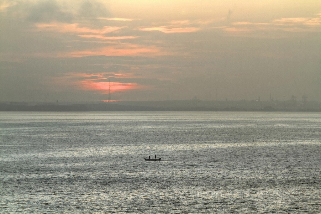
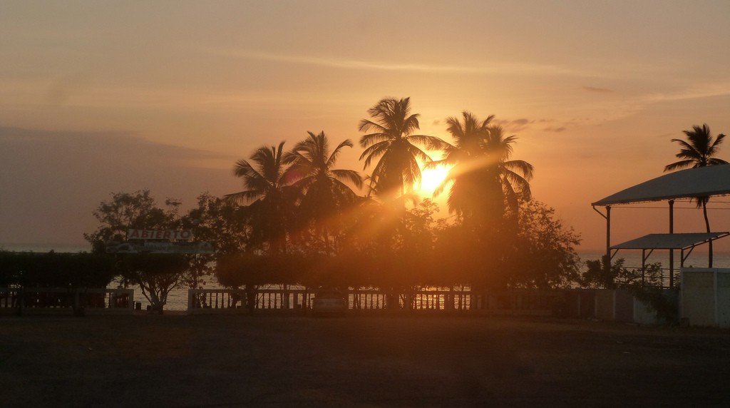
Lake Maracaibo is a vast freshwater body of water in Latin America, located in northwestern Venezuela. Its shores are home to one-fourth of the country’s population. The lake is connected to the Caribbean Sea by a narrow strait, and its water is brackish. At the bottom of the ancient reservoir are concentrated the largest oil and gas reserves on the planet, and for over a hundred years, an integral part of the landscape of Maracaibo are drilling rigs installed on stilts across its surface. Tourists are also attracted to Maracaibo’s exclusive attractions – the piled fishermen’s villages and the strange phenomenon of endless lightning over the mouth of the Catatumbo River, which flows into the lake.
Video: Lake Maracaibo and lightning over Catatumbo
Contents- Highlights
- History of Lake Maracaibo
- Geography
Climate - Lake Maracaibo Sights
- Beaches
- How to get there
Highlights
Lake tours begin in Maracaibo, Venezuela’s second largest city and a major tourist center in the country. The city has preserved colonial-era buildings such as luxurious palaces, public buildings, churches and cathedrals. Museums, art galleries, and theaters introduce the history and culture of the region.
.
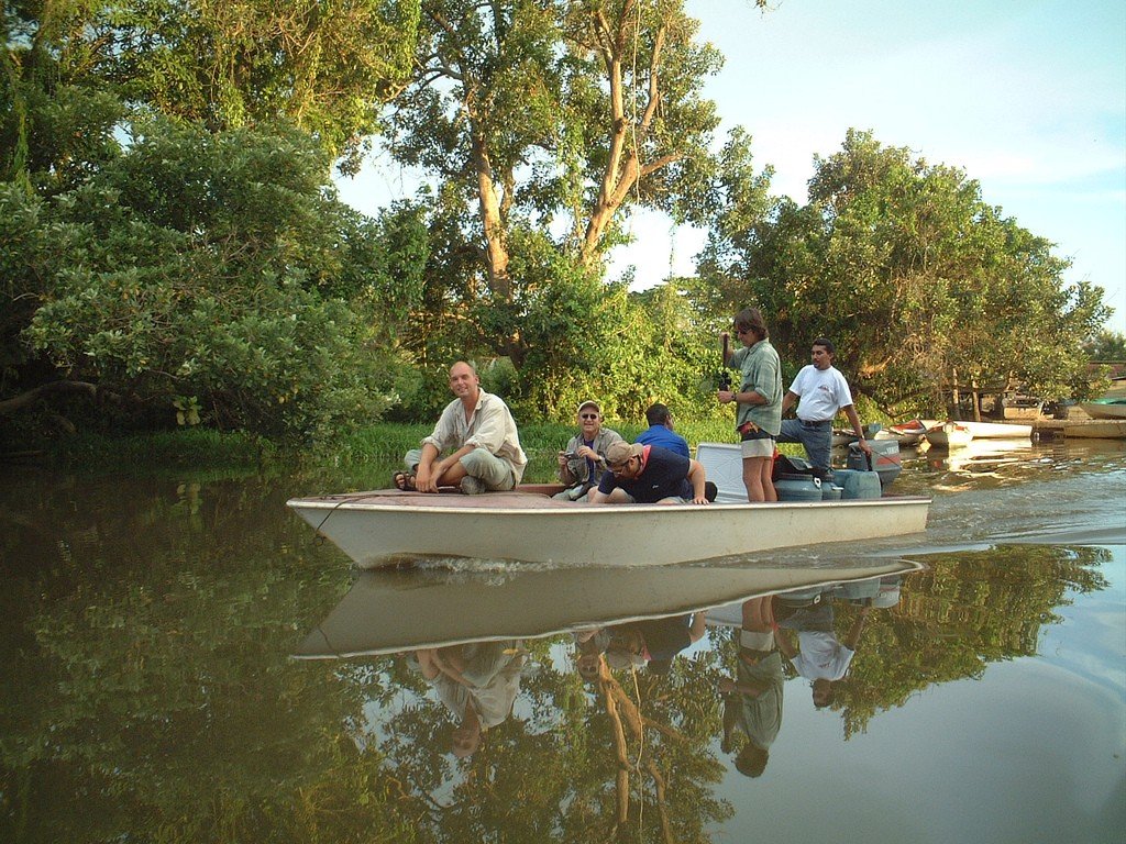
One of the main attractions of Lake Maracaibo are the ancient villages of local fishermen, erected in the coastal waters on wooden stilts. Especially vivid – in every sense – impressions of travelers leave tours to the southern shores of Maracaibo, where almost every night the sky cuts through the dazzling flashes of lightning. Such excursions are popular with lovers of extreme adventure.
Oil extraction has adversely affected the ecology of the lake. In many places the water is polluted, swimming there is not recommended. But the southern shores of Maracaibo are still clean. There are sandy beaches, to them go passenger ferries and pleasure boats.
.History of Lake Maracaibo
Geologists have determined that Lake Maracaibo was a closed freshwater body of water about 30 million years ago. As a result of powerful earthquakes, the cofferdam that separated it from the Caribbean Sea split. A strait, now known as the Venezuelan Strait, was formed. Maracaibo can therefore be considered both a lake and a gulf of the sea.
The first European navigators entered the waters of Maracaibo in 1599. They were caravels of one of Christopher Columbus’ companions, Captain Alonso de Ojeda. One of the members of the expedition was the Genoese traveler Amerigo Vespucci.
.
The region was home to warlike tribes of the indigenous Wayuu (Guajiro) people who fought the invaders for almost the entire colonial period. Surrounded by mountains, the Maracaibo Valley was an isolated and troubled part of the Spanish possessions in South America for about 400 years. The largest rebellion against the colonizers broke out in 1769, when as many as 20,000 Indians took up arms.
.
Since 1529, the Spanish had repeatedly tried to establish a city on the shores of Lake Maracaibo, but its buildings and fortifications were destroyed by rebels and Caribbean pirates. In 1669, Maracaibo was sacked by the famous corsair Henry Morgan. In July 1823, a decisive battle with the Spanish fleet took place on Lake Maracaibo, which became the prologue of Venezuela’s independence.
.
At the beginning of the last century, colossal oil reserves were discovered at the bottom of the lake. The fields became the basis for the prosperity of the region and the entire country.
.
Geography
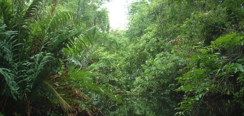
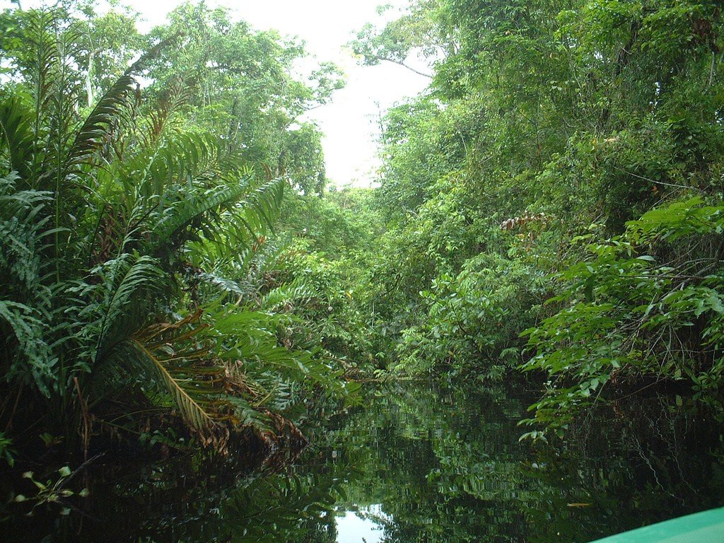
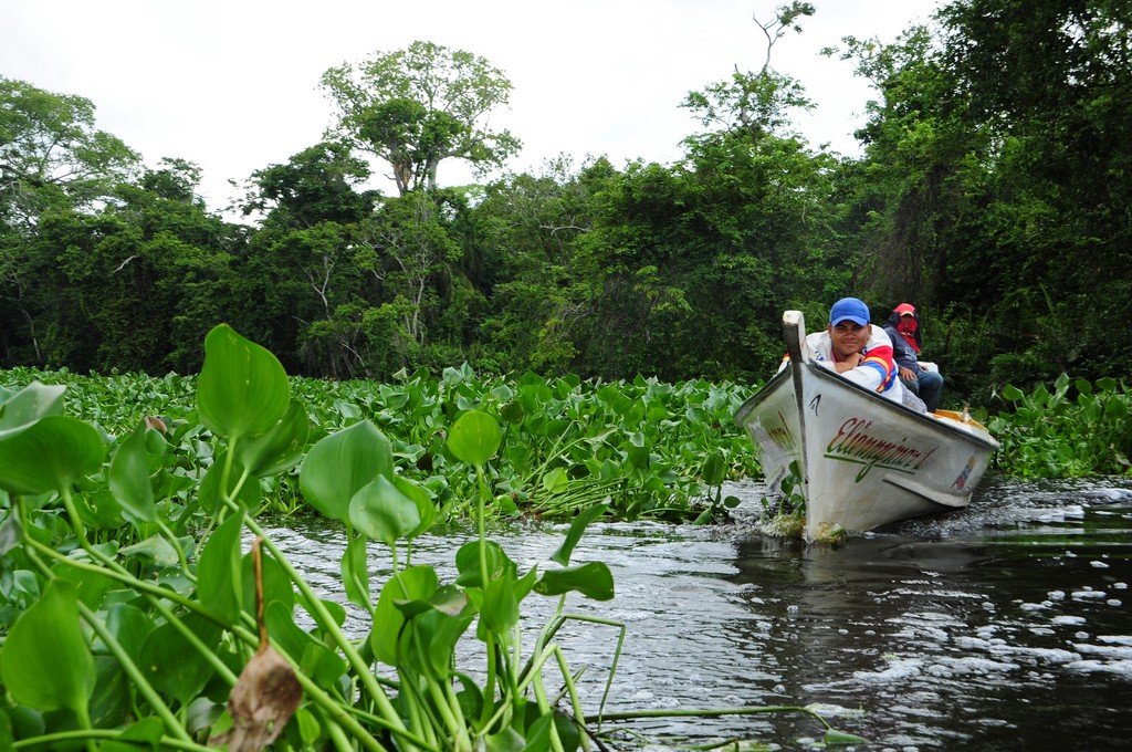
The vast valley of Lake Maracaibo is surrounded on three sides by the Andes, a jungle-covered mountain range. A horseshoe of ridges opens northward to the Caribbean Sea. Numerous rivers flowing into the lake originate in the mountains, the largest of which is the Catatumbo. Coffee and cacao, rice, corn, cassava, and sugar cane are grown on the shores of the lake.
.
River sedimentation is gradually reducing the water mirror of Maracaibo. Today, its area is about 13,200 km². In the northern part, the lake is connected to the Caribbean Sea by a strait 6 to 22 kilometers wide, where storms and tides mix salt water with fresh water. This environment is home to a special ichthyofauna that is on the verge of extinction.
.
On the northwestern shore of the lake is the capital of the state of Sulia, the city of Maracaibo, the second most populous city in Venezuela, second only to the capital Caracas. The neck of the lake, the Strait of Venezuela, which goes out to sea, is crossed by a huge highway bridge 8.67 kilometers long. It was erected from concrete modules in 1962 and named after the national hero of the period of the struggle for independence, General and politician Rafael Urdaneta.
.
The central 235-meter spans are held up by steel cables attached to powerful pylons. Ocean tankers carrying Venezuelan oil around the world pass beneath them unimpeded.
.
In the second half of the 20th century, this structure was considered an engineering marvel, topping the list of the longest bridges on the planet. Today, the colossal structure over Lake Maracaibo occupies a modest place in the sixth ten of the longest modern crossings, but even now the bridge Urdaneta impressive. It is from here that the most spectacular panoramic photographs of the vast lake are taken.
.Climate
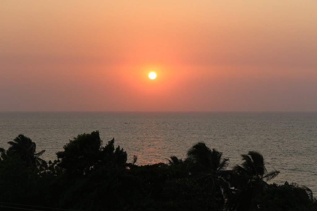
The climate in the Maracaibo region is tropical equatorial. These regions are considered the hottest in Venezuela. The average air temperature throughout the year fluctuates within +26…+28 °С, but there are periods of heat up to +35…+38 °С. The recorded record of air temperature in the shade was +41 °С.
.
In Maracaibo valley there are four annual seasons. Heavy rains come in September-December. Rainy weather in January-April is replaced by a dry season, favorable for tourism. Then a short period of inclement weather and rain follows in late April-May. The main flow of travelers arrives here from late May to mid-September. During this time, the shores of Lake Maracaibo are dry and warm.
.Sights of Lake Maracaibo
An amazing natural phenomenon occurs at the southern tip of Lake Maracaibo, in the skies above the mouth of the Catatumbo River. As soon as the hour of pre-dawn twilight arrives, the clouds perpetually swirling over the mountain peaks are illuminated by powerful flashes. Thunderstorms are rarely accompanied by showers. Lightning strikes the river delta and lake surface for nine hours straight, about every two seconds. The surrounding landscape is illuminated for a moment for tens of kilometers and immediately plunged into pitch blackness, but a moment later there is another flash.
.
The stroboscopic glow of the sky at night is visible even from the Caribbean. Skippers of sailing ships of the Spanish conquistadors used it as a beacon pointing to the strait leading into the lake, and nicknamed the phenomenon Faro de Maracaibo – Maracaibo Lighthouse. Ancient aboriginal legends claim that in the skies above the delta of Catatumbo there is an eternal battle of the quarreling gods. And in modern science this unique phenomenon has its own term: Catatumbo Lightning – Catatumbo Lightning. Scientists believe that the secret of dry thunderstorms lies in the unique topography of the area. At sunset, warm, moist vapor from the surface of the lake rises rapidly through a narrow gorge cut by the river and collides with icy streams of air coming down from the mountains. There are other theories.
.Physicists assure that each discharge of the Catatumbo Lightning has the energy to light 100 million 100-watt electric light bulbs. The power of a celestial fireworks display would be enough to light up all the cities in South America.
The zarnitsa parade does not always happen, but very often: lightning flashes over the lake about 300 evenings a year. In September and November, the phenomenon is activated almost daily. The city of Maracaibo offers night tours for those wishing to observe the enchanting dance of lightning from as close but safe a distance as possible. Desperate travelers go to the Cienagas del Catatumbo National Park and stay in a specially equipped campsite, from where the lightning flashes are clearly visible at night. The guides organizing the trip are experts in lightning photography. They will help you to set up your cameras and camcorders correctly. Daredevils are rewarded with stunning photos and videos, which they post on their pages in social networks. But it is very dangerous to go out on a boat in the lake at such hours.
.On the opposite shore of the lake from the city of Maracaibo is the protected park Cienaga de los Olivitos. On an area of 260 km² pristine jungle with rich fauna is preserved, on the coast in the mangroves inhabited by pink flamingos.
.
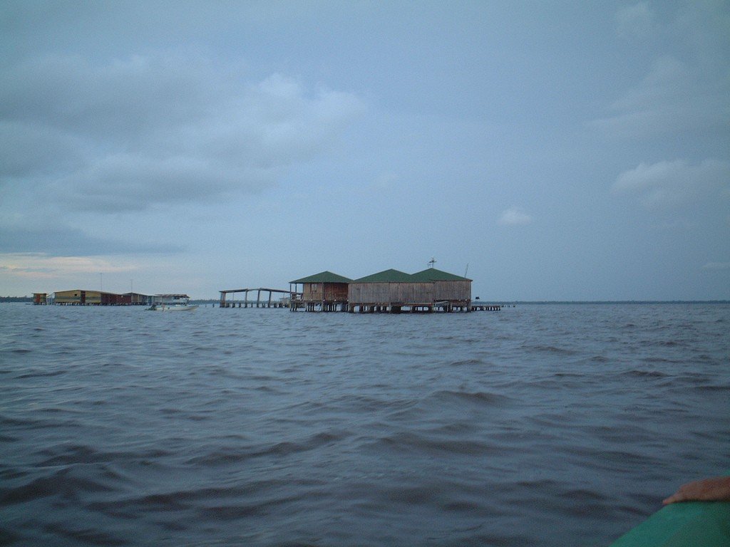
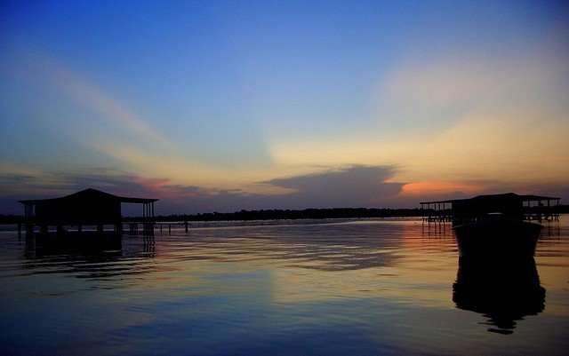
The most unusual historical attraction of Lake Maracaibo are the country’s indigenous villages built on stilts right in the water. Here they are called Palafitos. And European conquerors, who appeared here on the verge of the XV-XVI centuries, dubbed these villages “little Venice”. Over time, the apt name spread throughout the country.
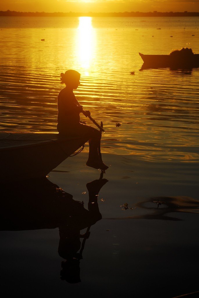
Shabby plywood huts, covered with tin, stand on separate platforms-palaces. Narrow boardwalks are built in front of the facades to serve as docks and front entrances, and they are decorated with brightly colored flower beds in old basins and barrels. Here, freshly washed laundry is hung on ropes, children play, and dogs laze in the sun. The inhabitants use light canoes or motorboats as transportation. Solid barges of traveling salesmen deliver “colonial goods” among the palafitos huts. But the villages have their own grocery stores, pharmacies and clinics, chapels and taverns, police stations and other buildings necessary in any settlement. Many structures are built especially for tourists, the locals are happy to receive guests. With fishermen you can cast rods right from the bench at the door to the house, ride a boat on the lake, snorkeling in search of crabs, and then the hostess will cook your catch and invite you to the table.
.
One of the villages of palafitos is located within the city limits of Maracaibo. The most visited floating village by tourists is located in the Sinamay Lagoon in the northern state of Sulia.
.
Beaches
Long gone are the days when you could swim right off the waterfront of Maracaibo City. Decades of intensive oil extraction from deposits under the lake bed have rendered the water in much of the reservoir unsuitable for swimming and beach activities. A shimmering oil film floats on the surface, it’s not easy to wash off, and swimsuits will be hopelessly ruined. Coastal sand also does not shine cleanliness. The situation became quite catastrophic in October 2019, when a lot of oil seeped into the water from abandoned wells. Still, there are still beach vacation spots on Lake Maracaibo.
.Clean beaches can be found 40 kilometers north of the city of Maracaibo, along the shores of the Strait of Venezuela, which juts out into the Caribbean Sea, and on the offshore islands. Passenger ferries run to these vacation spots from the port of Maracaibo city.
.The most romantic beach is located on the island of San Carlos, at the foot of the Castillo de San Carlos fortress, built by the Spanish in the XVII century to protect against pirates. The beach is a five-minute walk from the ferry dock.
.To the east of San Carlos can be seen the island of Zapara. It can be reached by rented boat. The wild beaches are among 40-meter sand dunes covered with palm trees. There is no infrastructure, but there are very few tourists. Take your own food supplies and make sure to agree with the boatman on the time of the return trip, so as not to miss the last ferry.
.
The island of Toas is also accessible by boat. There are three beaches: Clam Chocal, Copacabana and La Playita. There are few tourists here, and the locals – fishermen and oil workers – swim here.
.
How to get there
The city of Maracaibo is home to La Chinita International Airport. Venezuelan domestic airliners fly here from Caracas several times a day. The flight time is 1 hour.
.From the capital of Venezuela to Maracaibo leads highway. The distance is 520 km, a shuttle bus covers the way in 6 hrs. 30 min. As you approach Lake Maracaibo, you will pass through the famous Urdaneta Bridge.