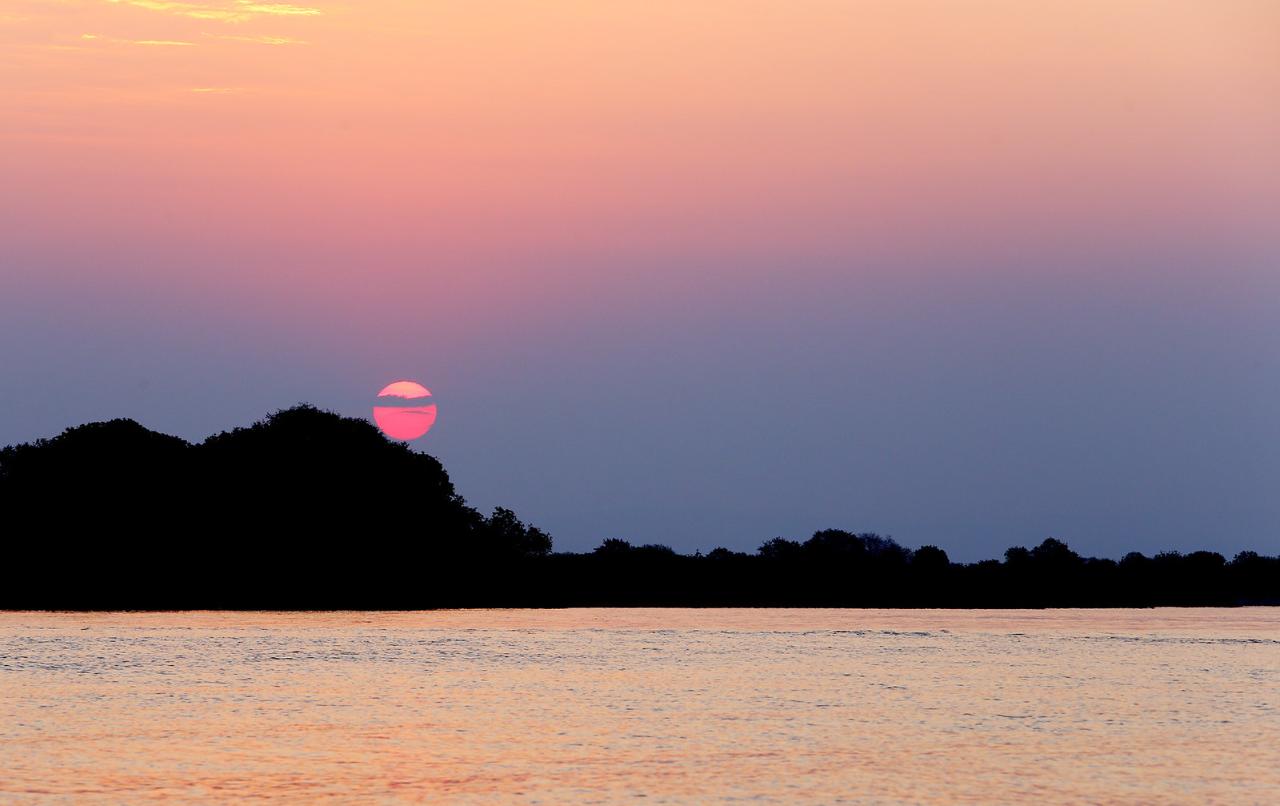
Zambezi River
This sightseeing attraction is related to the countries:MozambiqueZimbabweZambiaZambia , NamibiaAngolaBotswanaZambezi is the fourth greatest river in Africa, behind the Nile, Congo and Niger. Its length is 2,574 kilometers. It is the largest African river flowing into the Indian Ocean and the continent’s largest waterway flowing eastward. On the banks of the Zambezi there are nature reserves and national parks inhabited by many wild animals. Picturesque landscapes and tropical nature, serving as a luxurious backdrop to the majestic African river, attract travelers from all over the world.
Video: Zambezi
Contents- Highlights
- History of the Zambezi River
Geography - Zambezi fauna
- Climate and weather
- Bridges and crossings
Zambezi Sightseeing - Outdoor activities
- Shopping
Cafes and restaurants - Where to stay
- Transportation
- How to get there
Highlights
The Zambezi River either crosses territories or serves as a water cordon of 6 states in southeastern Africa. The great river begins in Zambia, flows through Angola before returning to Zambia and acting as a natural border with Namibia, Botswana and Zimbabwe, crossing Mozambique and flowing into the Indian Ocean just opposite the island of Madagascar. Within Zambia and Zimbabwe is the famous Victoria Falls, one of Africa’s most famous natural wonders.
.
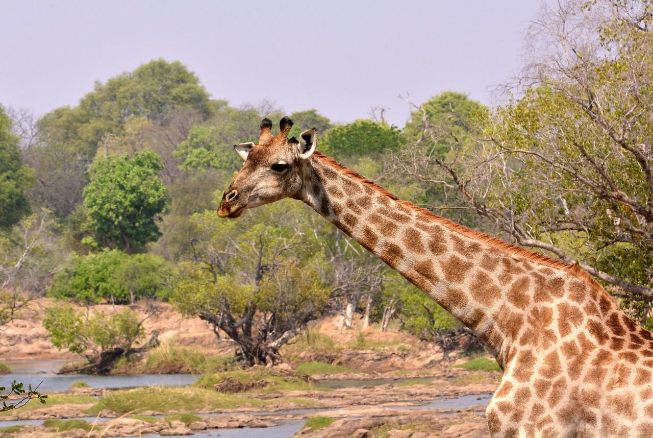
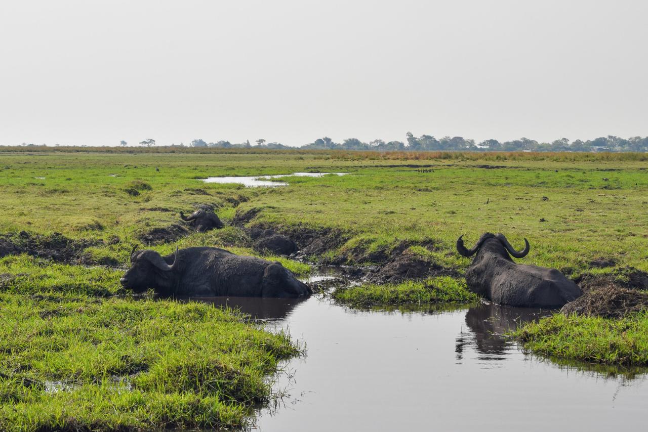
At watering holes on the banks of the Zambezi, countless herds of buffalo and antelope can still be seen in the wild, elephants and giraffes roam the savannahs, predatory lions and leopards lurk in the grass. The greatest diversity of wildlife is represented in the national parks of the countries through which the Zambezi flows. In Zambia alone there are two dozen such reserves.
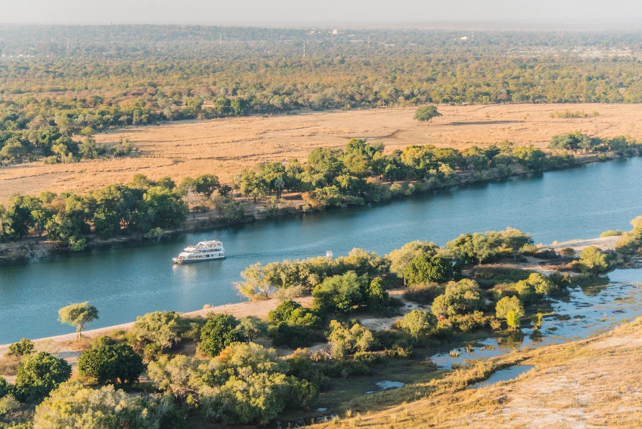
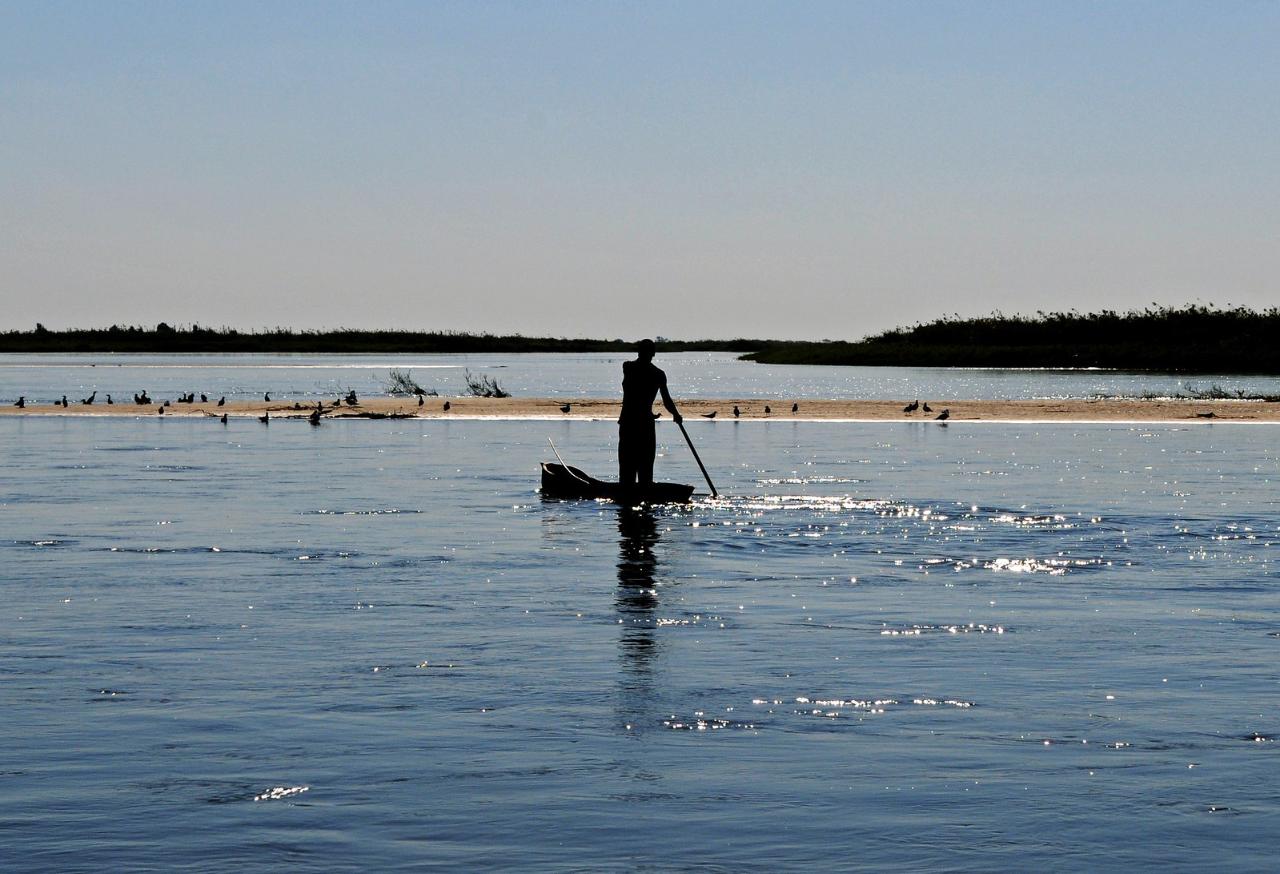
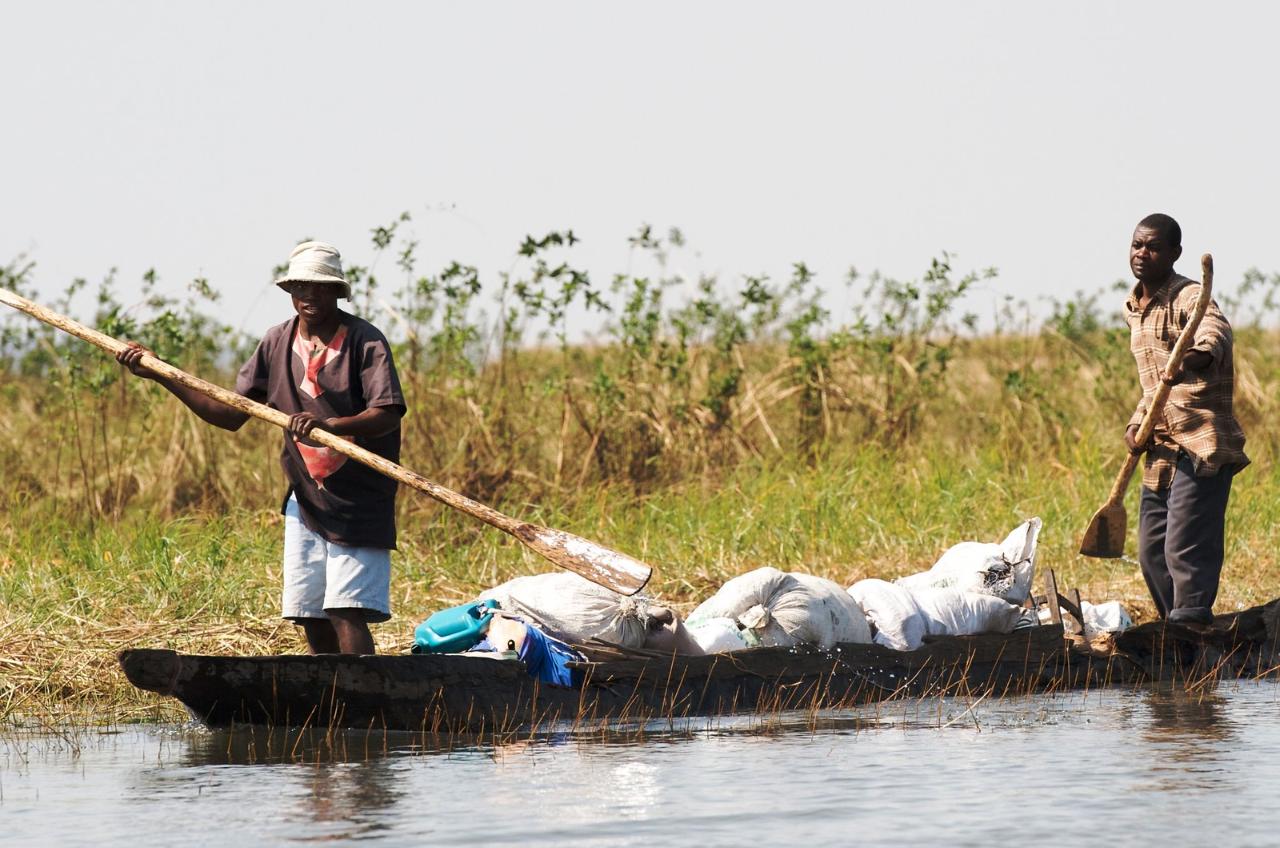
.Because of the many rapids and shoals through commercial navigation on the Zambezi is impossible. Only certain sections of the riverbed are available for ships. On these sections for tourists organized cruises on the river, pleasure boats are running.

.
The first European to reach the mouth of the Zambezi was the famous Portuguese captain Vasco da Gama. In January 1498, on his way to India, his sailing ship anchored in the delta of the vast river, which the pioneer mapped as Rio dos Bons Sinais (“River of Good Omens”). Over the next 400 years, Portuguese colonists developed land only in the lower reaches of the Zambezi.
.
In the first half of the 19th century, the river was explored by Scottish missionary and traveler David Livingstone. In 1855, his party came to a waterfall of breathtaking beauty. Amazed by the grandiose spectacle, Livingstone, in the style of a Christian preacher, wrote in his diary: “The view is so beautiful that it delights the angels who pass here”. Livingstone named the falls after Queen Victoria, who ruled at the time.
.
Meanwhile, historical experience shows that inquisitive travelers are followed by traders, followed by expeditionary corps of colonial troops. The Zambezi River region soon became a colony of the British Empire. Among the aristocrats, a new entertainment became fashionable – African safaris with wildlife hunting.The countries of South Africa gained independence in the second half of the 20th century. After a period of instability, international tourism boomed in the region. Now African safaris have a slightly different meaning: travelers come here to enjoy the picturesque landscapes of the banks of the Zambezi, to visit national parks inhabited by a variety of animals. Tourists take home not lion skins and elephant tusks, but wonderful photos of the inhabitants of the savannahs.
.
Geography
The Zambezi River originates in the northwest of the Republic of Zambia, 50 kilometers north of the town of Mwinilunga. Here, in the Central African Highlands, the river’s main channel forms among the lakes and swamps of a hilly plateau at 1,524 meters above sea level. This is one of the wettest regions of Zambia with annual rainfall of about 1400 mm. The rainy season here lasts more than half a year, from October to May. To the east of the birthplace of the Zambezi is a low mountain range separating the Congo River watershed. In the upper and middle reaches of the Zambezi, the landscapes are dominated by savannahs covered with low grasses, shrubs and sparse woodland.
.
Near the town of Chavuma, located at an altitude of 1070 meters above sea level, the river returns to the territory of Zambia. A little downstream in the channel of the Zambezi piled rocky rapids. Here a cascade of small waterfalls known as Chavuma forms. These waterfalls, several meters high, are only visible during the dry season, and during the rainy season they are hidden by flood waters.
.
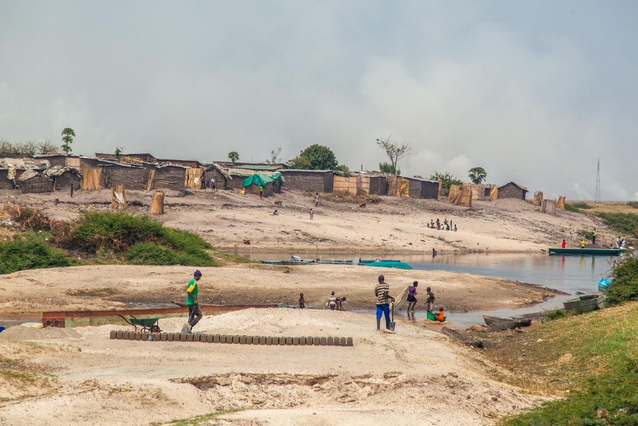
In the vicinity of Lukulu town, the largest tributaries of its upper reaches, the Kabompo (440 km) and Lungwebungu (645 km) rivers, flow into the Zambezi. From here the Zambezi flows through wide floodplain valleys with lush grasses and picturesque groves of deciduous trees. The largest of them is the swampy Barotse plain, dotted with lakes and pools. During floods the valley is flooded, the width of the Zambezi riverbed reaches 25 kilometers.
.
Local farmers have long grown rice, sugarcane and other moisture-loving crops in the fertile floodplain of the river. The vast plain stretches from west to east for 500 km. In its western part, in the floodplain of the Luambimba and Luangiinga rivers, the Liuwa Plain National Park has been in operation since 1972. The 3369 km² reserve is home to numerous herds of antelope and zebra, leopards, lions and cheetahs. There are 334 species of birds nesting in the forests and poisonous snakes in the shallow swamps.
.
Liuwa Plain National Park is in a rugged area, with few tourists. In 2014, South African company African Parks built a luxury safari hotel with six villas in the reserve. Travelers are flown there by helicopter from the nearby town of Kalabo.
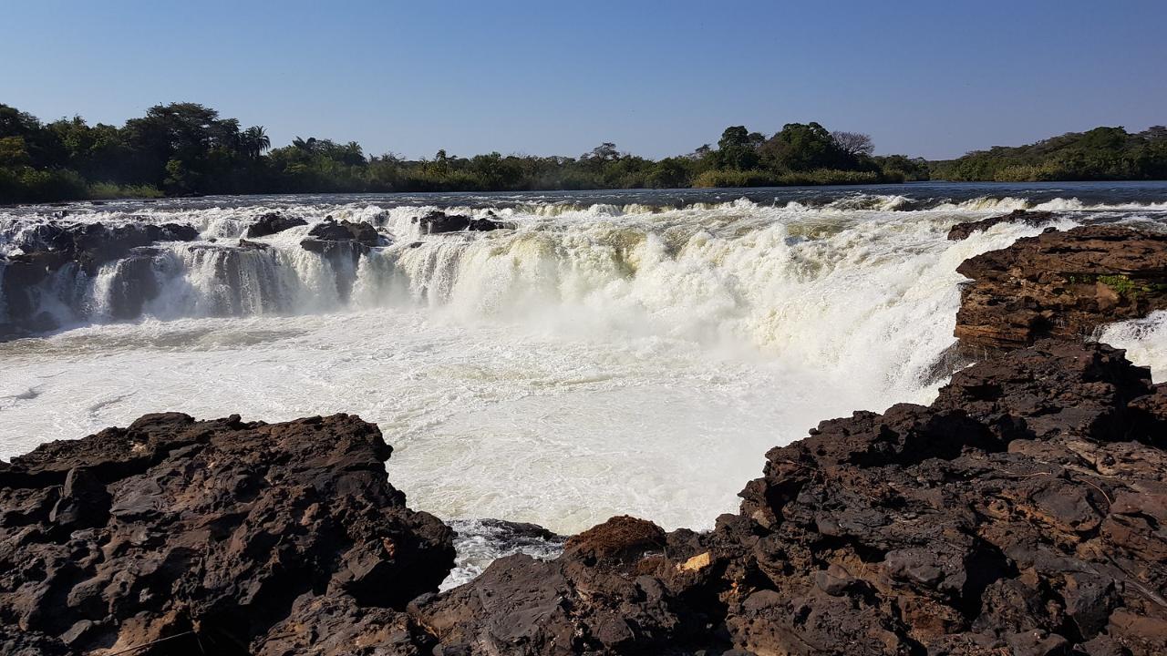
.The fertile Barotse Valley culminates in a gully with the picturesque Ngonje Waterfall near the town of Sioma. Here jets of water fall from a wide rocky ledge 25 meters high, crossing the Zambezi riverbed in an irregular crescent. Ngonye Falls is little known to tourists, it is not easy to get to it through the jungle.
.
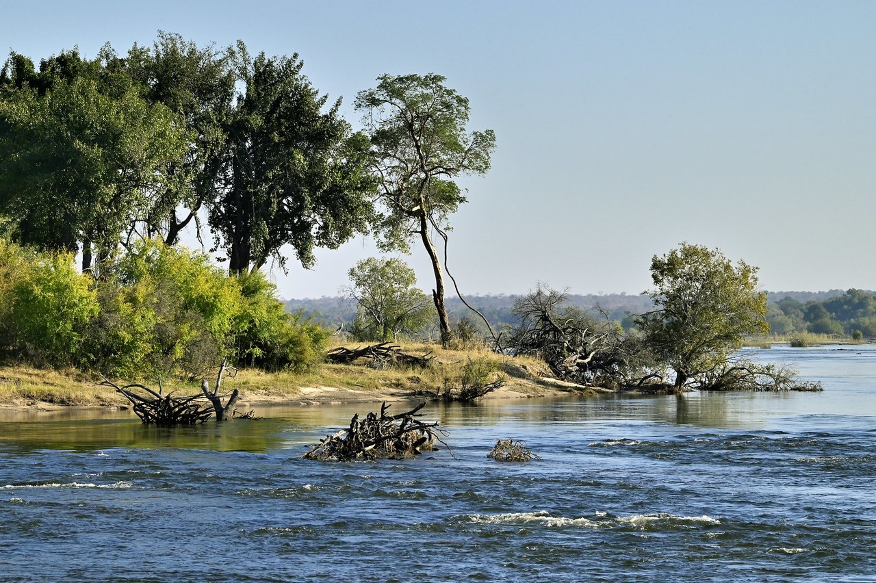
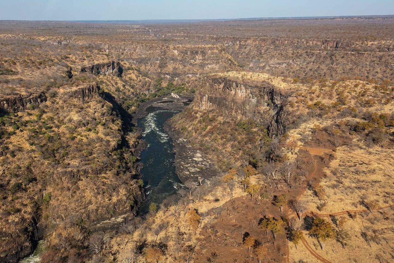
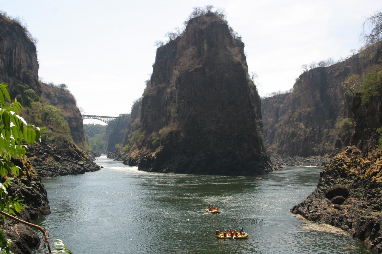
Further down the Zambezi riverbed, rocky rapids cluster. For 150 kilometers, the river forms a natural border between Zambia and Namibia. At this section, the full-flowing Kwando (731 km) flows into the river. After passing the border with Botswana, the Zambezi forms a bend and directs its waters to the east, separating Zambia from Zimbabwe.
.From the mouth of the Kwando to Victoria Falls, the width of the Zambezi River channel varies. In the open grassland lowlands, the river swells widely, washing over many sandy islands covered with palm trees. Encountering black basalt cliffs, the Zambezi’s course splits into narrow branches cutting through rapids canyons with rocky islets..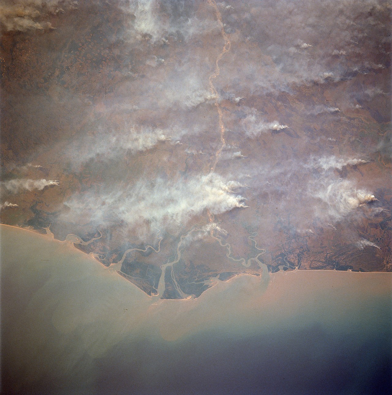
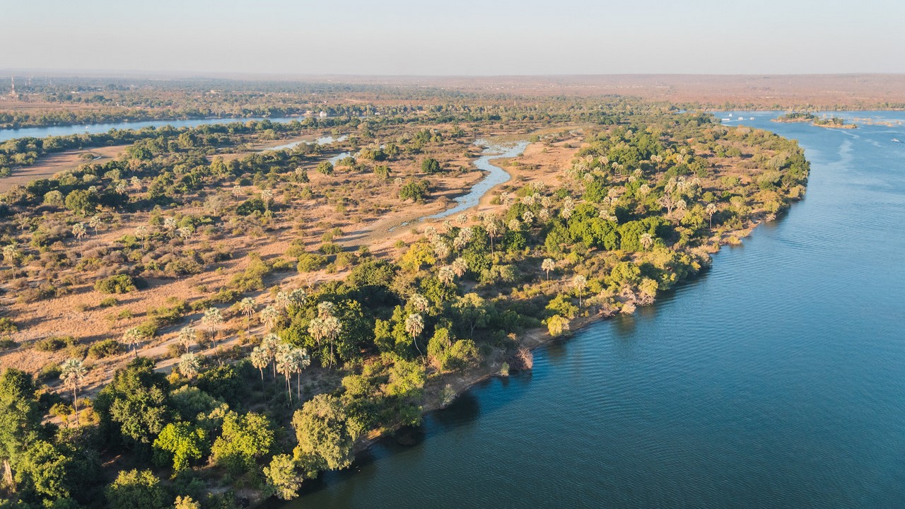
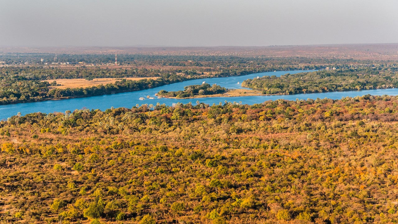
The middle reaches of the Zambezi River extend from Victoria Falls to the northeast for 965 km. This section is notable for two artificial reservoirs created by hydroelectric dams, Lake Kariba and Lake Cahora-Basa, which occupy most of the riverbed.
.The Kahora-Basa hydroelectric dam conventionally marks the beginning of the 650 km long lower Zambezi. Here the riparian scenery changes, with deciduous forests giving way to palms and lianas. At the confluence with the Kafue River (1,576 km), the Zambezi turns eastward through narrow gorges. Then the great river leaves the mountainous Central African plateau and descends to the coastal plain, crossing Mozambique. 100 km from its mouth, the Zambezi receives its last major tributary, the Shire River (402 km), flowing out of Lake Nyasa.
.
After traveling 2,574 kilometers from its source, the Zambezi reaches the coast of the Indian Ocean. Here the river forms a wide marshy delta with mangrove forests and many shallow branches. Some of them are cleared of silt deposits and are suitable for navigation. Ships use mainly the northern arm called Chinde to enter the Zambezi channel.
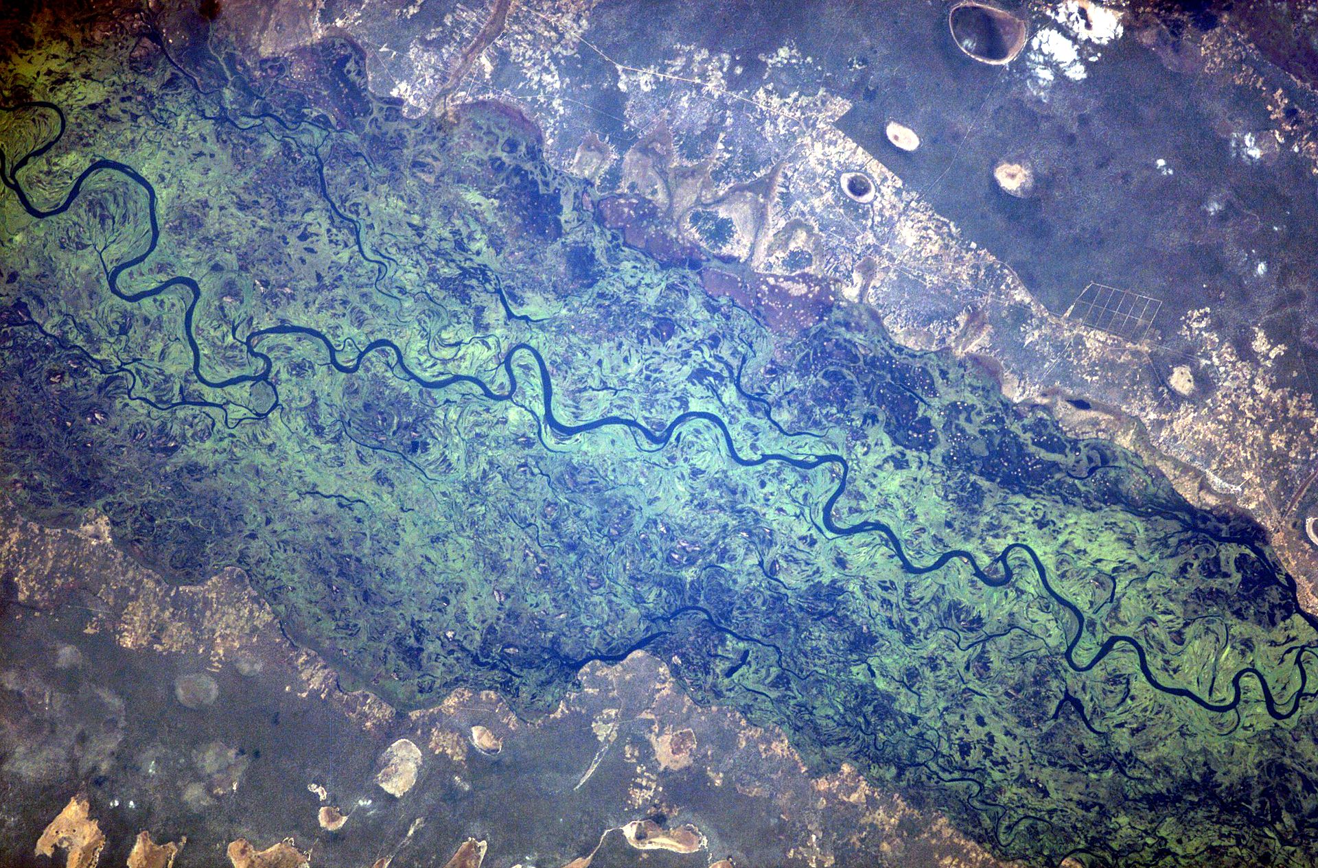
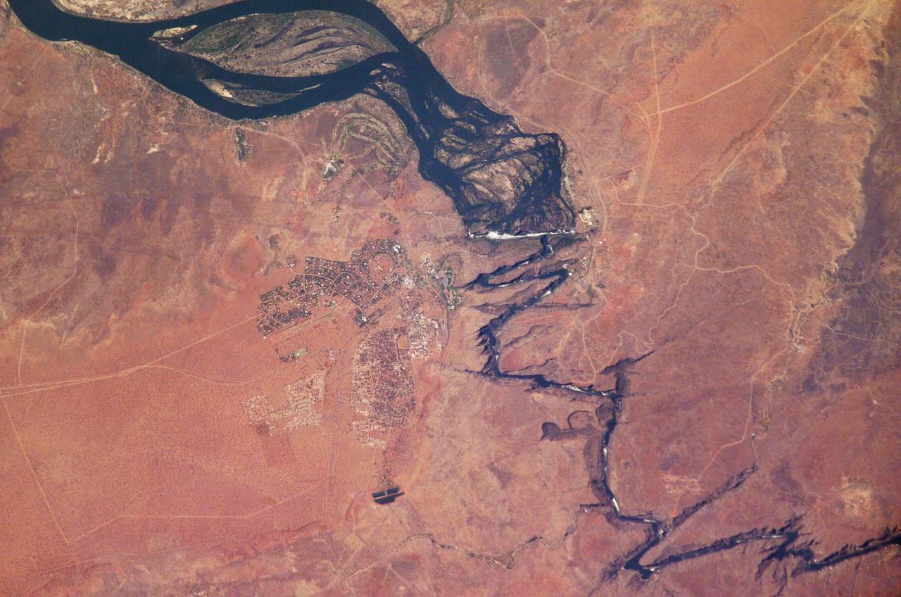
 ‘ Eastern edge of the Zambezi floodplain from satellite
Zambezi fauna
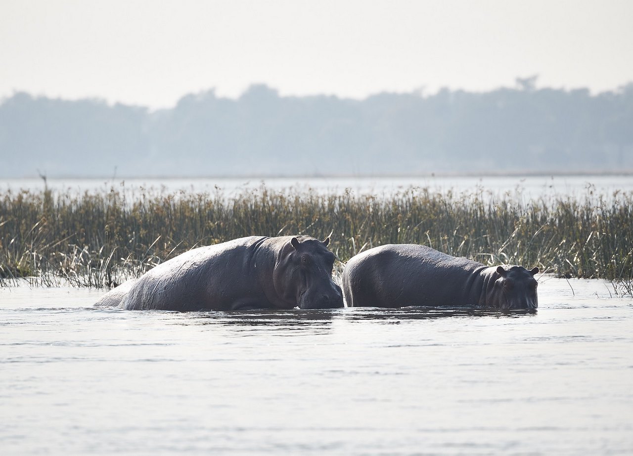
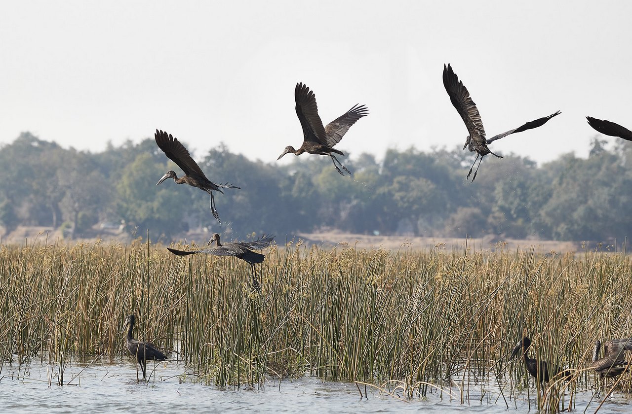
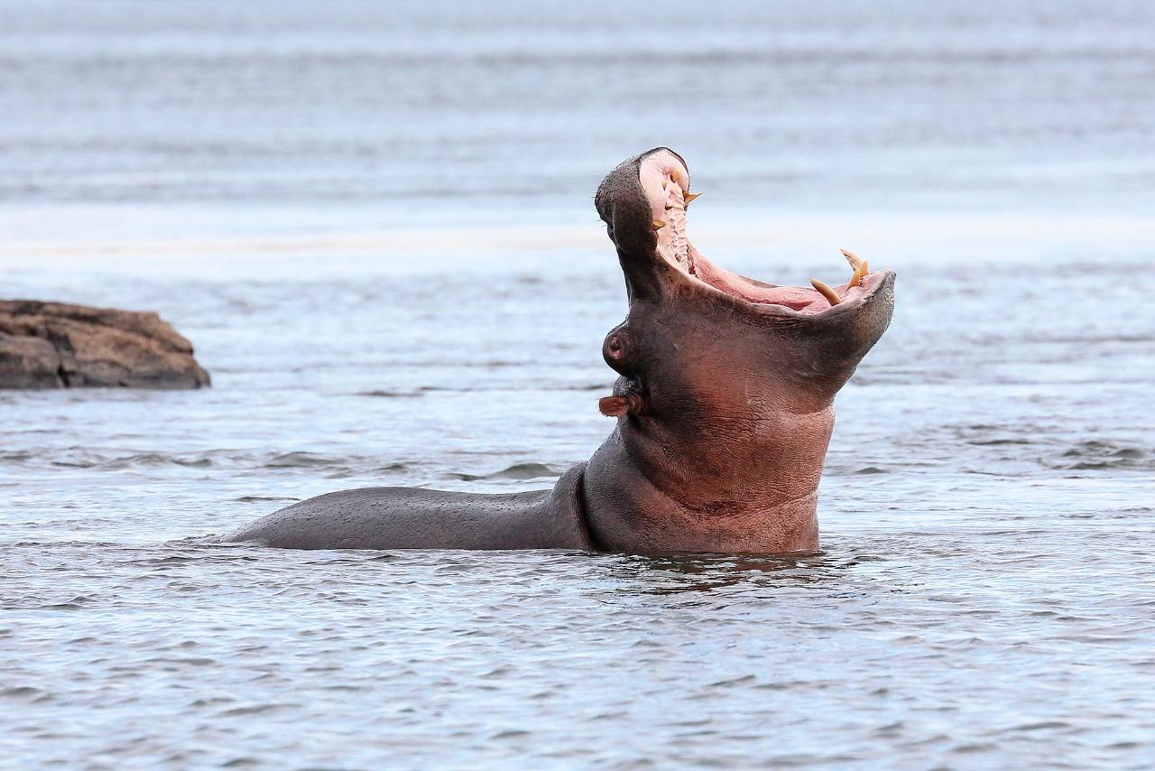
The waters of the Zambezi are teeming with crocodiles in both the upper and lower reaches of the river. These creepy reptiles avoid the rough currents and inhabit quiet backwaters, marshy swamps, pools and lakes. Alligators are neighbors with hippos. Adults reach a weight of one and a half tons. Hippos spend most of the day in the water, coming ashore only at night. Good swimmers and varans – giant lizards, living on the coast of the river.
.
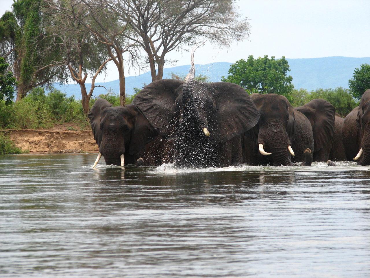
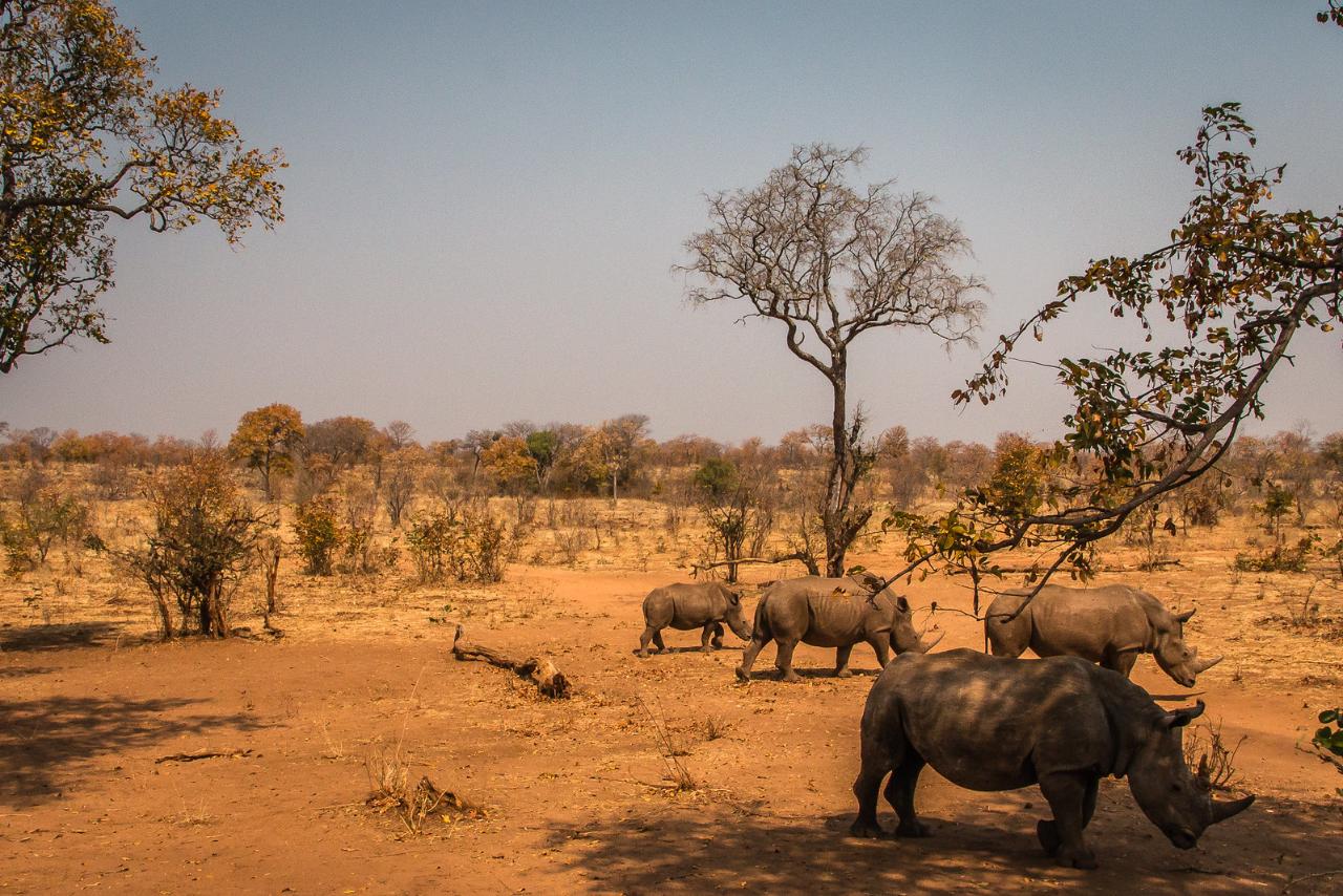
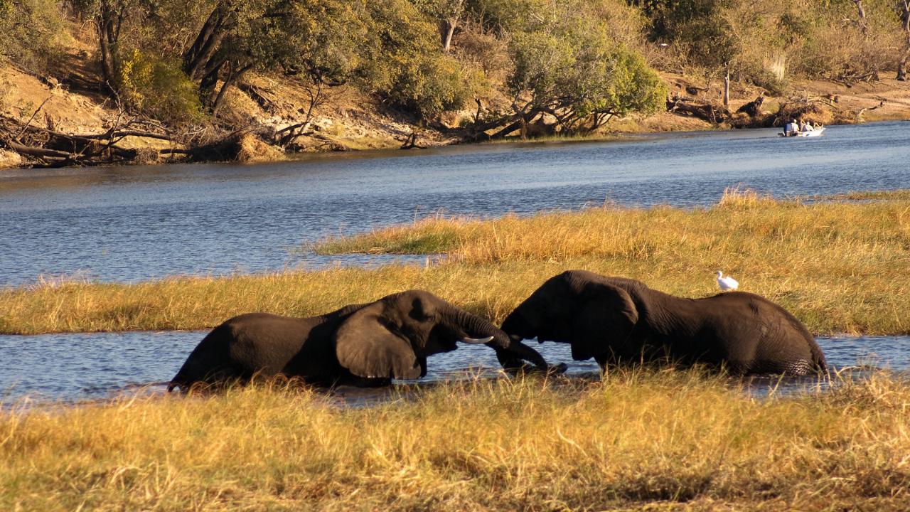
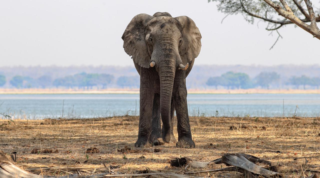
In the valleys of the Zambezi lives a large population of elephants, rhinos, preserved hundreds of lions and leopards. Cheetahs and caracals, African wild cats, are less common. Species of animals approaching the brink of extinction are relocated to national parks and strictly protected.
.
South African pythons and venomous reptiles are found in the savannahs, on the marshy banks of the Zambezi and in the river delta. Especially dangerous are boomslangs, green tree-dwelling snakes that camouflage well in the foliage. In evergreen forests live Gabonese vipers with marvelous patterns on their scaly skin. These snakes hunt at night and are often found near village dwellings and coffee plantations. In the lower reaches of the river live black mambas up to 2-3 meters long, large black-necked cobras, spitting venom. In the Zambezi basin travelers should be wary of blood-sucking insects that spread serious diseases – malaria mosquitoes and the infamous tsetse fly.
.
Climate and weather
‘
Bridges and crossings
There are currently a dozen bridges spanning the Zambezi, with highways also passing over the crests of the Kariba and Kaora Basa hydroelectric dams. Most of the bridges have been built in the last 50 years, but there are clearly not enough crossings. Many ferry crossings operate on the river, transporting passengers and vehicles from shore to shore.
.
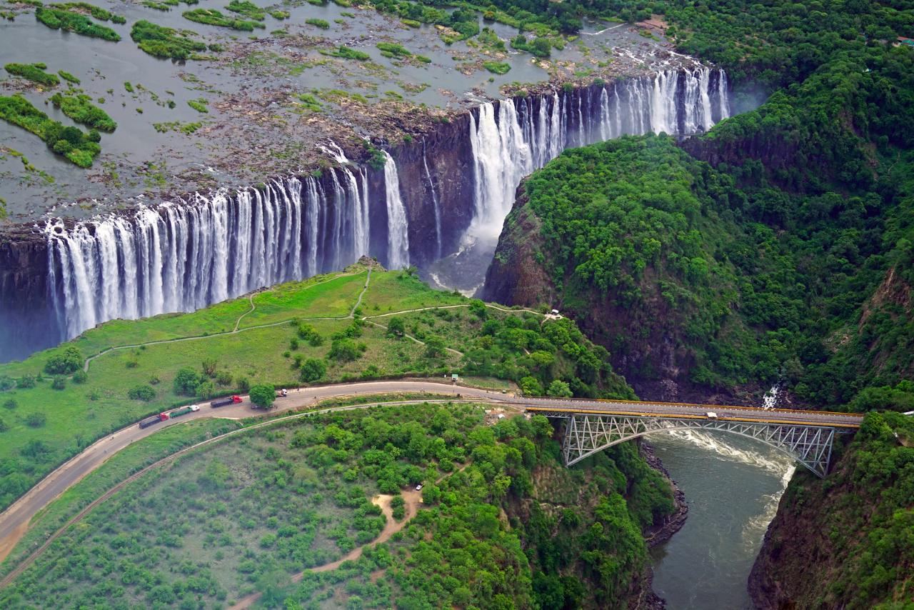
The oldest bridge on the river is built at Victoria Falls. It crosses the gorge over the turbulent Zambezi a few hundred meters below the famous falls. The steel structures of the arch crossing were made in England in 1904. They were delivered by steamship to the port of Beira (Mozambique), and from there with great difficulty transported to the place of assembly. The bridge was opened in September 1905, the construction took only 14 months. The length of the crossing is 198 m, from the roadway to the river level is 128 m. The bridge is crossed by a highway, a railroad line and a railing-fenced pedestrian walkway. Excursions are organized to attract tourists to the historic bridge. It is also home to a jumping attraction.
.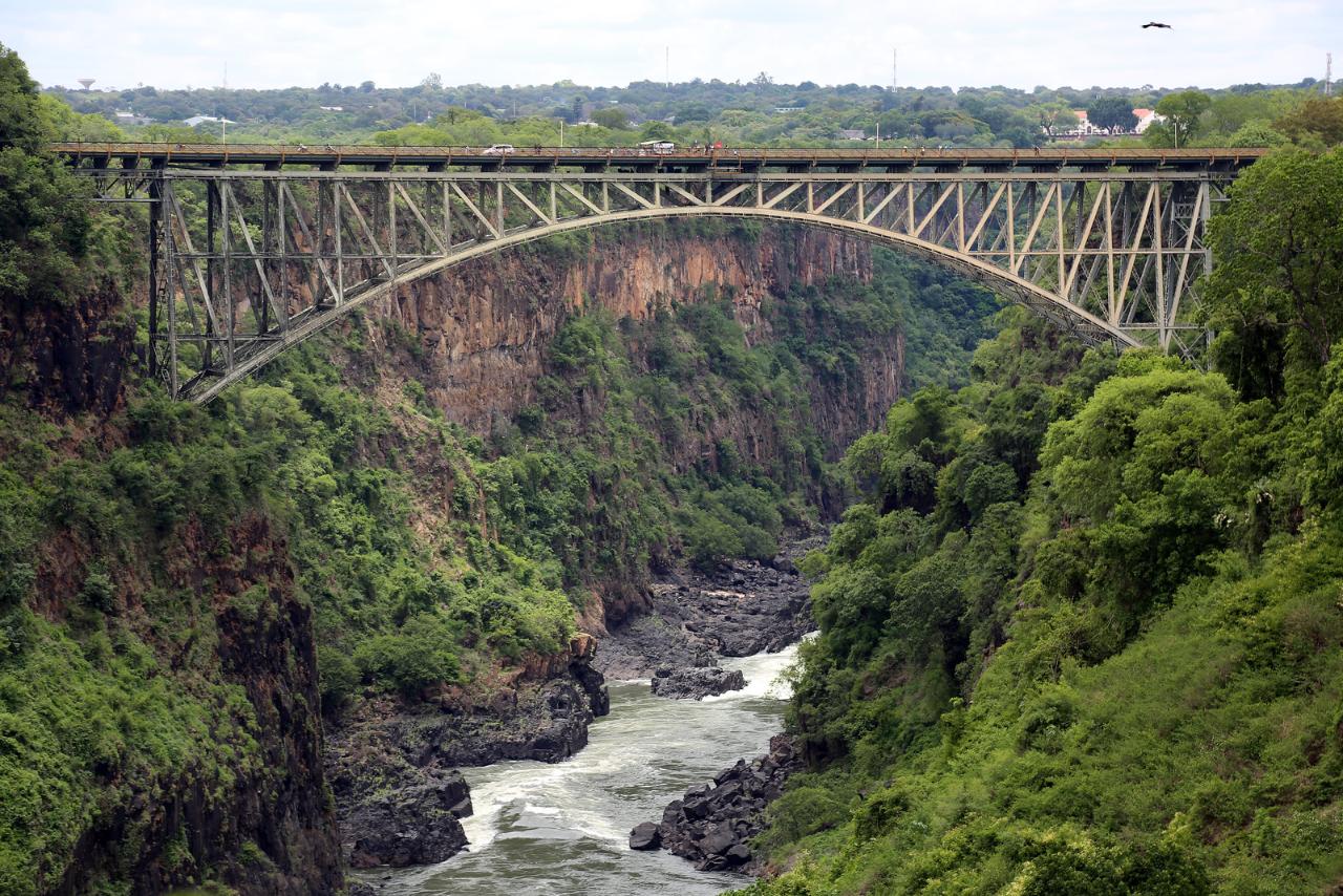
Since the river at Victoria Falls carries the border between Zambia and Zimbabwe, there are border posts on the approaches to the bridge. One is located on the north bank of the Zambezi in Livingstone, Zambia, and the other is located on the south bank in Victoria Falls, Zimbabwe.
.
Tourists arriving from Livingstone are able to pay for short-term visas here to see Zimbabwe’s national parks, while travelers staying at hotels in Victoria Falls get a chance to see the sights of neighboring Zambia. Visas can be purchased for $15-$30, depending on the nationality of the tourist and the length of stay.
.
.
Before Christmas 2002, 90 meters upstream of the river, a new road bridge was built in Chirundu. Its 400-meter-long roadbed was laid on three reinforced concrete piers. The width of the carriageway is 10.3 meters, and cars move in two rows. Thus, Chirundu became the only city on the river where the Zambezi crosses two bridges at once.
.
The longest bridge crossing is 2376 meters long and was built in 2009, in the wide lower reaches of the Zambezi, on the territory of Mozambique. It is named after the country’s former president Armando Emilio Guebuza. In the evenings, the bridge shines with a necklace of lights reflecting in the waters of the Zambezi. The M1 highway that connects the Mozambican provinces of Sofala and Zambezia passes over the bridge. Traffic on the bridge is tolled. Passage by passenger car is charged at $3.
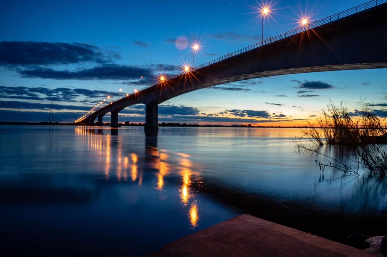 ‘ Armando Emilio Gebuza Bridge
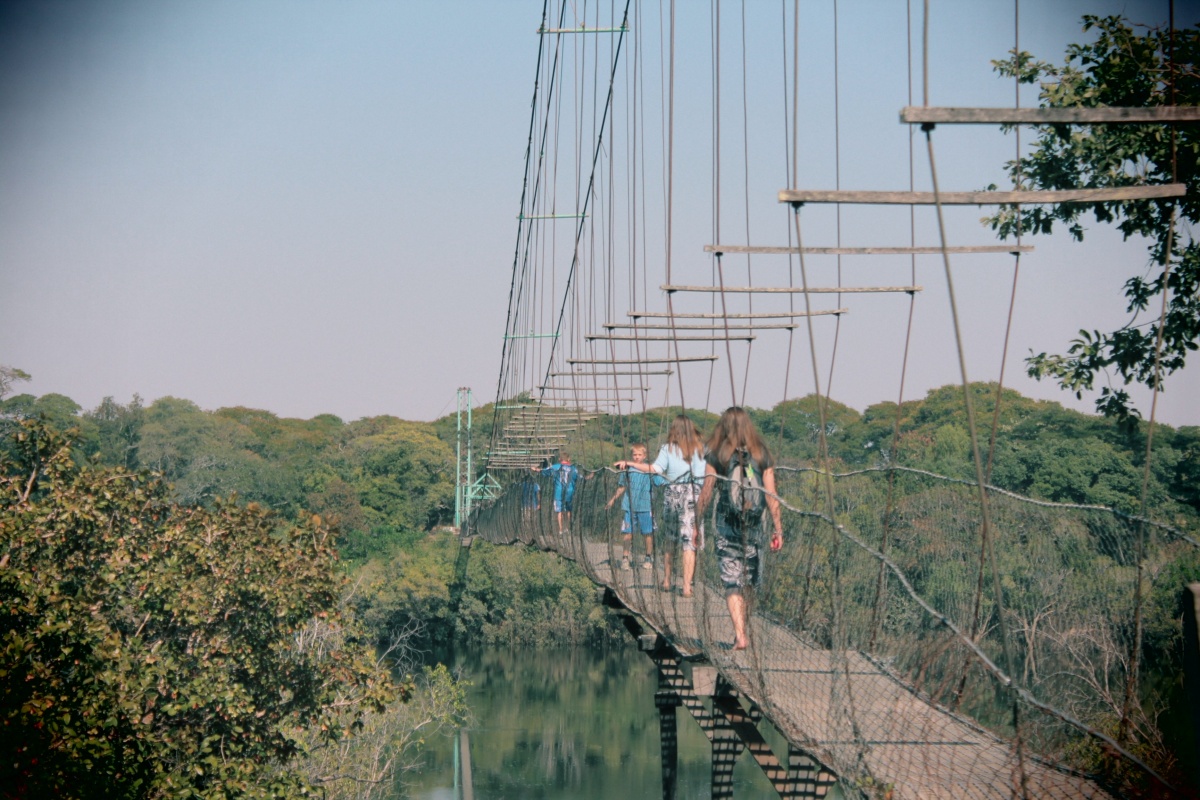
The Chinyinggi Bridge can be classified as one of the most curious sights, but few travelers have visited this sparsely populated area. Getting here is difficult, there are no roads, and there is no tourist infrastructure.
.
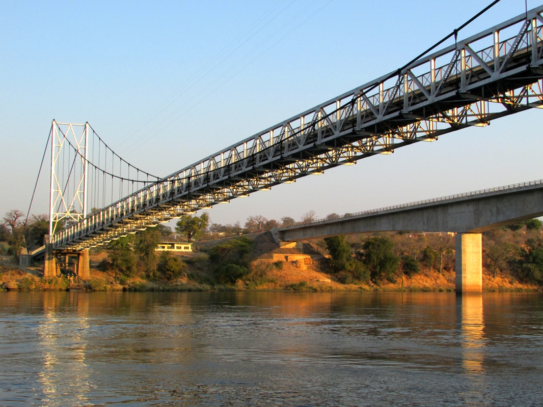
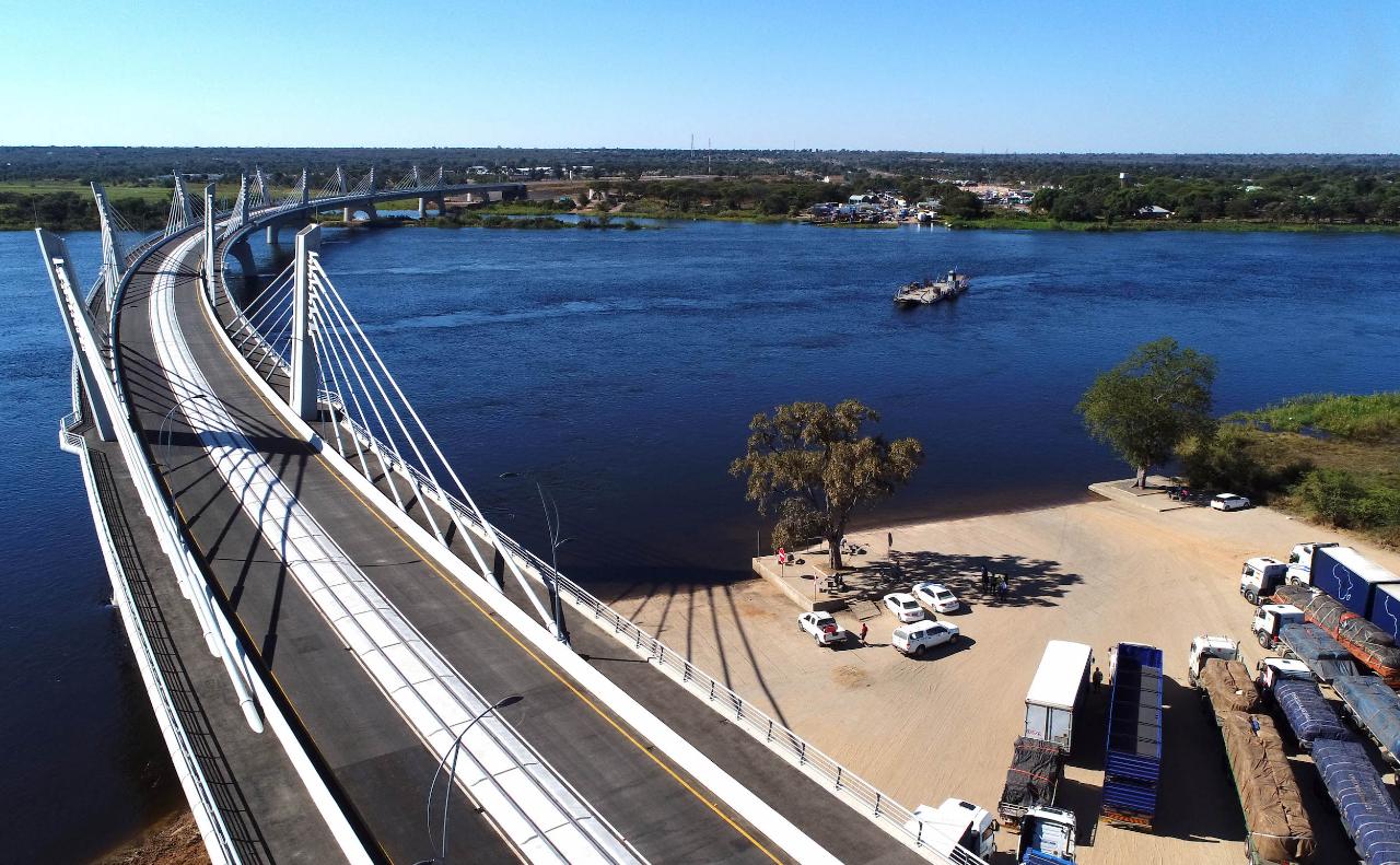
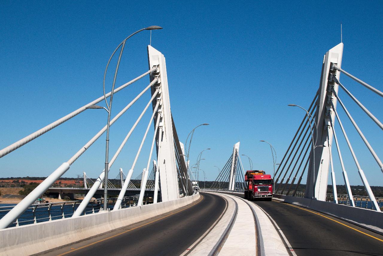
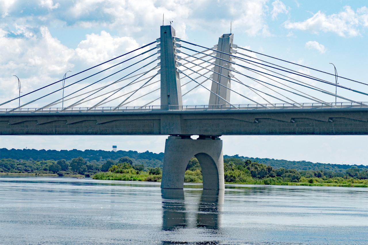
In May 2021, a 923-meter cable-stayed road and rail bridge was opened near the town of Kazungula on the north bank of the Zambezi, linking Zambia with Botswana. Previously, the two countries were connected by a ferry crossing. On the southern bank, the borders of Namibia and Zimbabwe reach the river a few hundred meters from the bridge. By intergovernmental agreement, these countries can also use the new bridge crossing.
.
Zambezi Sights
.
In the middle of the ancient bridge at Victoria Falls is the blood-chilling Shearwater bungee jumping attraction. After paying $160, desperate extremists jump into the canyon, tying 110-meter elastic cord around their legs. No less adrenaline is released and those who want to swing on a bungee swing hanging over the abyss ($155), or fly over the water on a ziplane. On the left bank, at the entrance to the bridge there is a small museum and a cafe from where you can watch people jumping into the abyss.
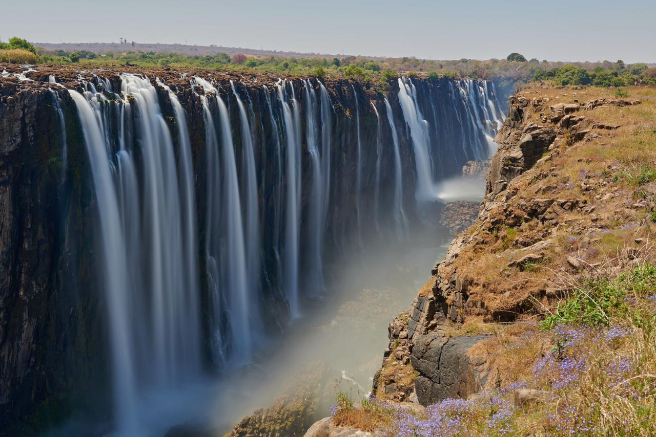
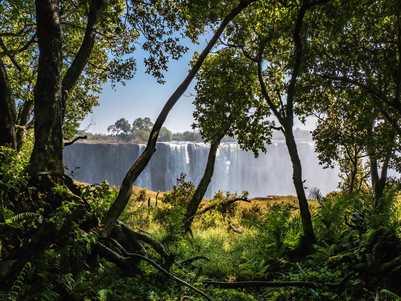
.Victoria Falls is included within the boundaries of two national parks located on opposite banks of the Zambezi – Mosi-oa-Tunya in Zambia and Victoria Falls in Zimbabwe. The parks are open all year round, but the best time to see the falls is from November to March, during the rainy season, when the wall of falling water is most spectacular. In the dry season, from April to September, the falls are not as impressive, and in October you will be disappointed by the sparse trickles of water, but you will see grottoes, the Devil’s Cataract and other signs of the ongoing erosion of the rocky escarpment. During this brief period, the waterfall’s precipice can be safely accessed by boat and you can even swim at the rock face of the precipice, peering into the 120-meter abyss..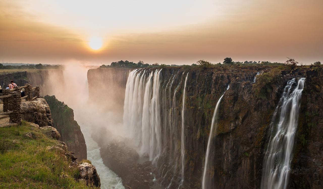
Ten kilometers north of the falls is the town of Livingstone, which holds the title of Zambia’s tourist capital. A cab ride from the city center to the falls will cost $5-6$. Many tourists prefer to ride to the falls by bicycle. Right from the southwestern outskirts of the city begin the protected areas of the Mosi-oa-Tunya National Park, a World Heritage Site. It is home to elephants, a small group of white rhinos, African buffalo, and antelope. Birds nest in the dense crowns of the tropical forest, flocks of monkeys frolic. Excursions to the park usually last 4-5 hours, the cost of the tour – from $ 40 per person.
.
There are several museums in Livingstone. The most interesting of them is the ethnographic village of Maramba, where tourists get acquainted with the life of indigenous Africans. It is worth visiting and a curious exposition of the Field Museum of Victoria Falls, where the stages of formation of the waterfall are clearly presented. Geological exhibits are located in the open air, along the steep bank of the Zambezi. A rock record tells how, over the past 20,000 years, the falls have retreated 8 kilometers to the headwaters of the river, gradually wearing away basalt cliffs and eroding less resistant rocks.
.
You can also watch the sunset from the veranda of Buffalo Bar in Victoria Falls Safari Lodge, located on a hill 200 meters from Victoria Falls. It’s a great location for animal watching as well. At sunset, elephants, buffalo and other inhabitants of the floodplain head for the banks of the Zambezi. Quenching their thirst, the animals peacefully neighbor, giving way to those who are bigger and stronger. On the territory of the hotel there is a night restaurant, casino operates.
.
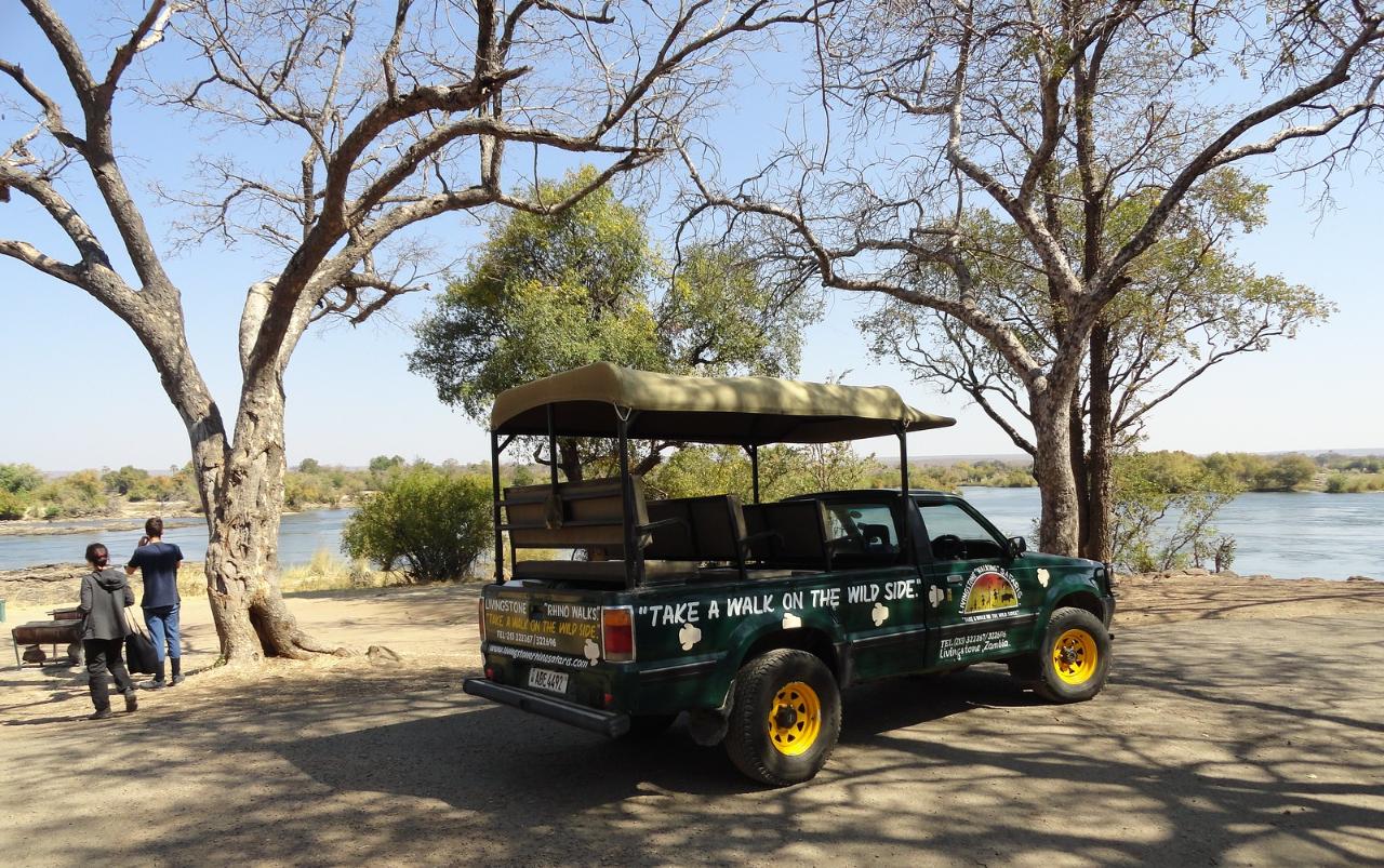
Livingstone offers excursions to Zambia’s national parks. Hotels can also join trips to the reserves of neighboring countries. For example, if you have a Botswana visa, you can take a day tour of Chobe National Park, known for its variety of wildlife and Africa’s largest elephant population ($150 per person).
.Across the river lies the town of Victoria Falls, Zimbabwe’s unofficial “Adventure Capital”. Near the town is the Victoria Falls National Park, the “twin” of Mosi-oa-Tunya Park. Animals and birds know no boundaries and migrate freely from one park to the other.
.Active recreation
The Zambezi riverbed in the gorge below Victoria Falls is considered one of the most spectacular rafting locations in the world. The best time for such an adventure is in August and lasts until December, when the river has its lowest water levels of the year. During this period, the weather is beautiful and the water in the Zambezi is warm. Experts classify the rapids as III-V level of difficulty. There is a route accessible to tourists with minimal sports training. Turbulent streams alternate with relatively calm ponds, where you can take a break before the next stage of the adventure.
.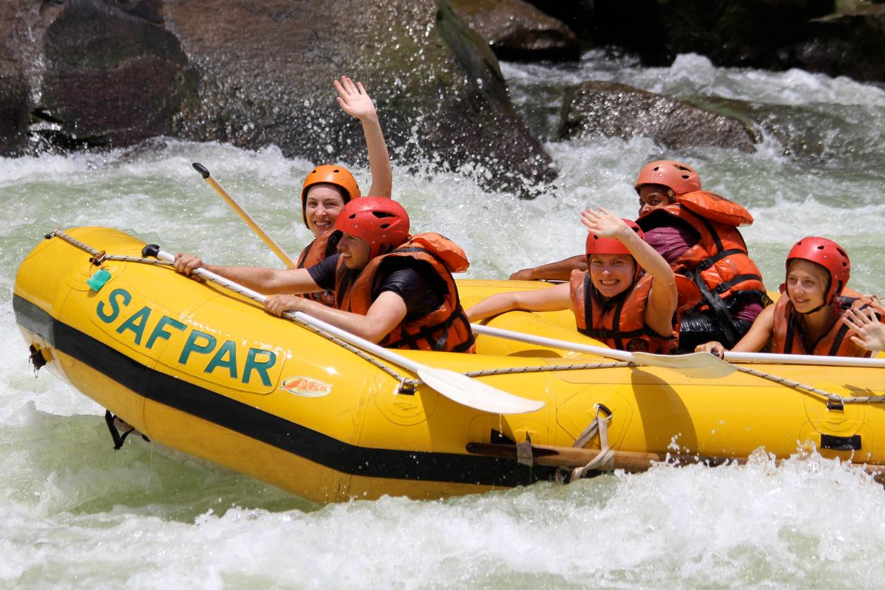
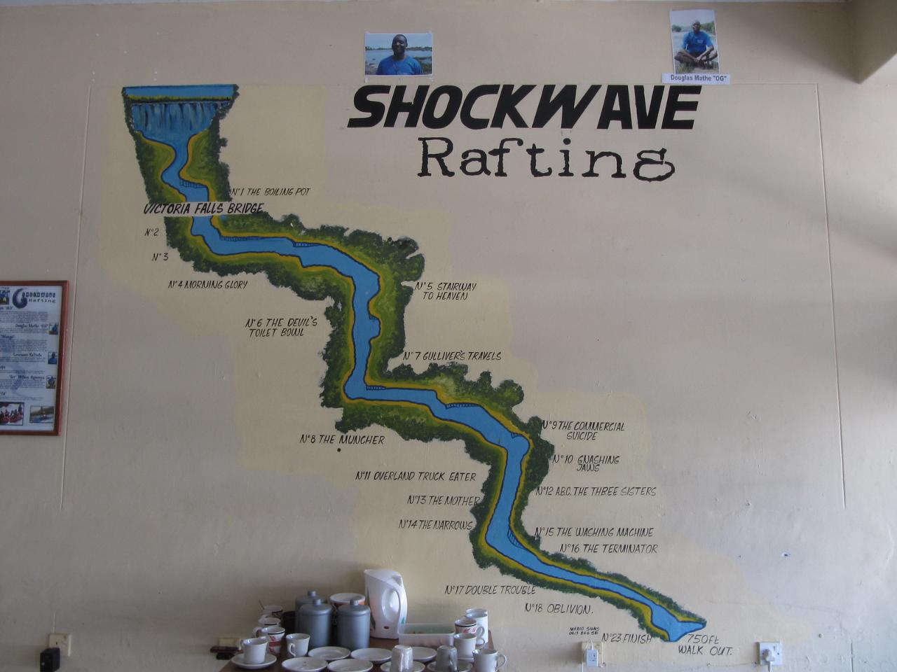
Rafting, tubing, kayaking and canoeing lasts 4 hours and the tour costs from $153 per person. An additional $10 is charged for entrance to the protected area. The price includes the rental of life jackets, helmets and paddles, as well as transportation and lunch in the wilderness. A longer rafting trip with an overnight stay in tent camping is also available, starting at $320 per person.
.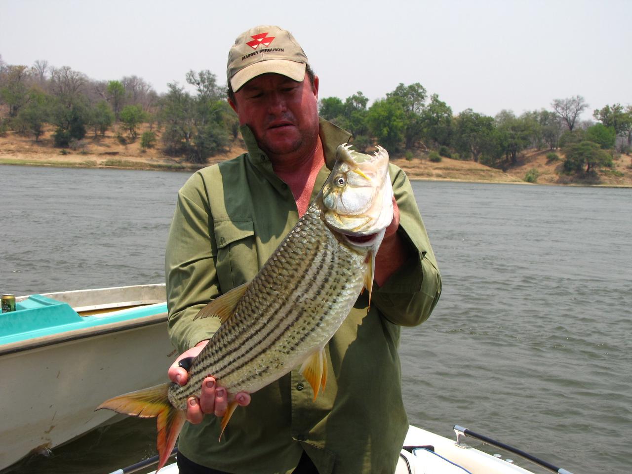
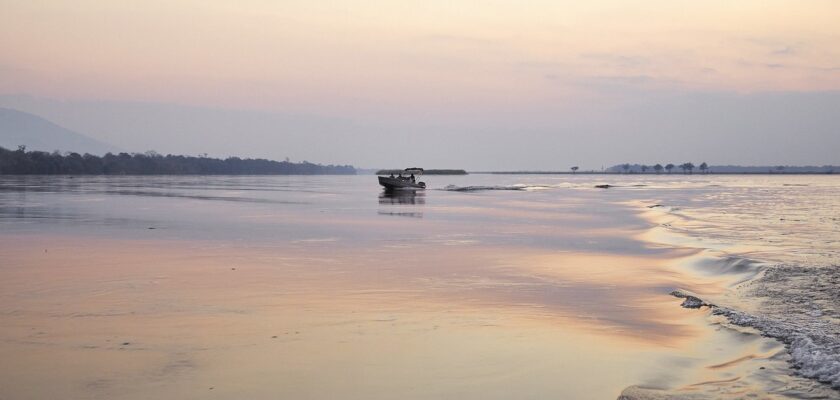
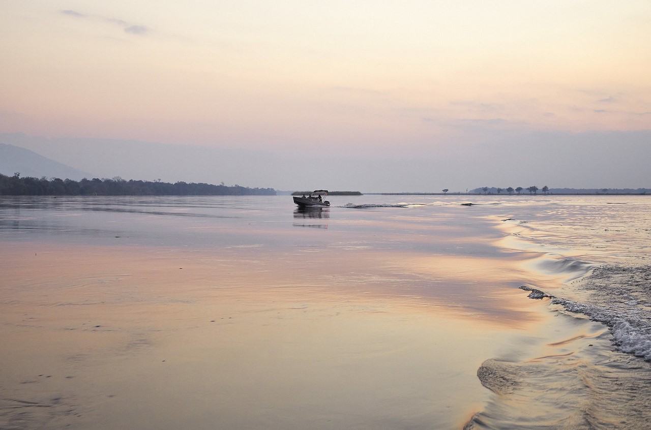
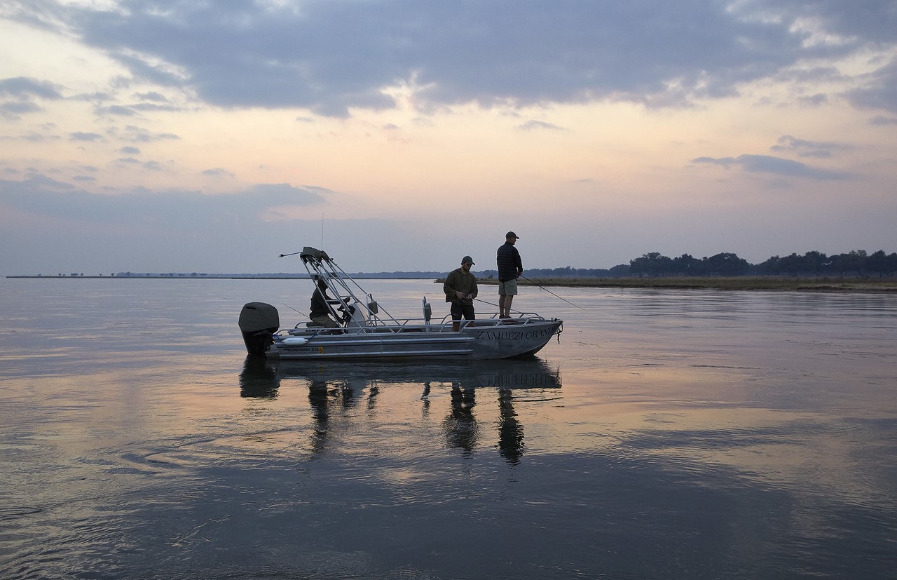
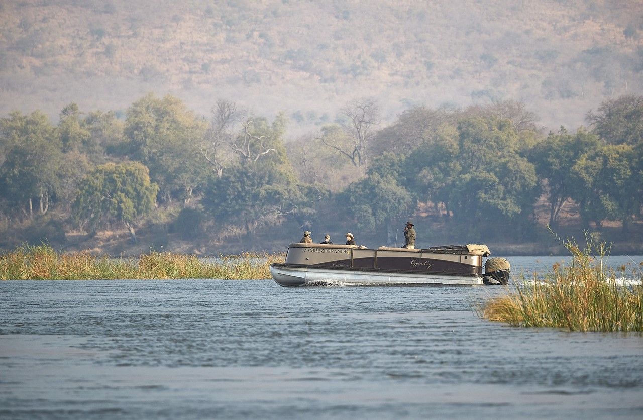
A 5-7 h day fishing tour is available at any Livingstone hotel. The cost of the adventure is $120-160 per person. The price includes transfers, gear and boat rental with a motorist guide, snacks and refreshments, and lunch. The presence of an accompanying guide is obligatory, because often fishermen are watched by crocodiles stretching on the nearest shoal. The guide will timely notice the dangerous neighborhood and change the course of the boat. He will also point out to tourists-fishermen proven fish spots. But caught prey can not be fried: sport fishing here is held on the principle of “caught – let go.”
.Travelers are invited to see Victoria Falls from the window of a private helicopter. A 45-minute flight costs $135.85 per person, while a 2-hour helicopter tour of the national park costs from $265.
.
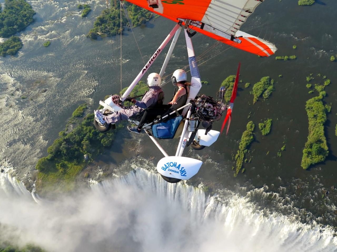
The breathtaking Angel Flight in a two-seat motorized hang glider allows you to get a closer look at the falls and feel the water spray on your face. The 15-minute flight costs $140.
.

Shopping
In the countries of South Africa operates a network of large shopping centers Shoprite Supermarket with a wide range of a variety of goods. The mode of operation is 08:00-19:00. There are large stores in capital cities and busy tourist locations. For example, in Livingston, shoppers can find Falls Park Shopping Center and Pick N Pay Supermarket, as well as many souvenir shops. However, the largest selection of souvenirs can be found in the local bazaars.
.For example, Chavuma, on the banks of the Zambezi River on the Zambian-Angolan border, is home to an ancient agricultural and handicraft market. Here traders from both neighboring countries display their wares. At the bazaar you can buy wonderful souvenirs inexpensively. Popular exotic ritual masks, animal figures, skillfully carved from precious wood. Tourists buy African jewelry and mystical amulets made of leather and metal, accessories made of crocodile skin, small humming drums, bright national clothing. By the way, in any African country in the markets and stores willingly accept dollars, and change is given exclusively in local bills.
.
ATMs are installed in airports, large hotels and shopping centers. But when traveling in the national parks and savannahs of the Zambezi, it is impossible to pay for purchases with a bank card.
.
Cafes and restaurants
In African villages on the banks of the Zambezi, you can feed an entire group of tourists for a couple of dollars. A hearty lunch in city cafes and restaurants will cost 5-7 $ per person. For lunch it is worth ordering a good wine from wineries in South Africa. European alcohol is expensive here.
.
Where to stay
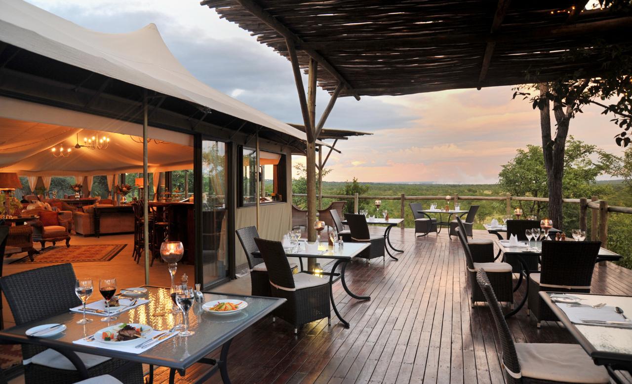
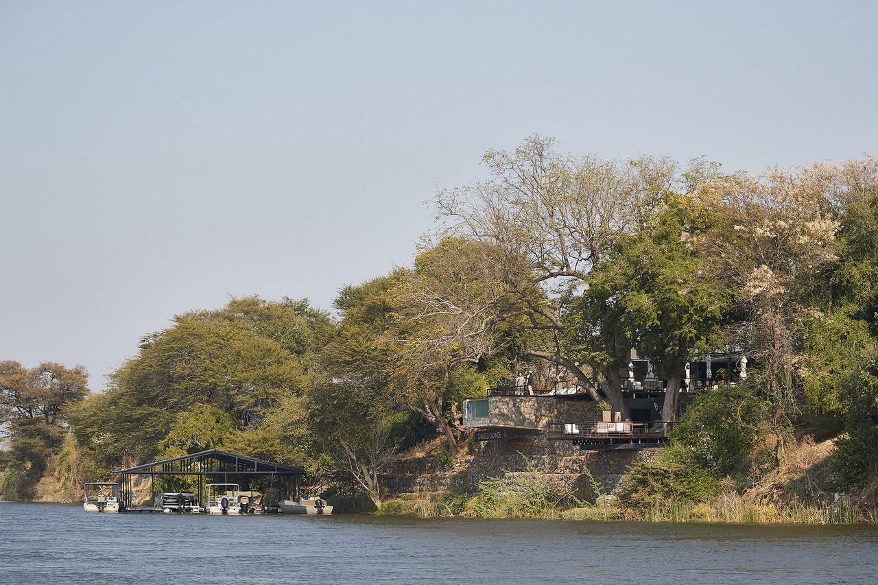
The coastal towns and villages of all the countries through which the Zambezi flows have to a greater or lesser extent been turned into centers of tourism and entertainment. The best hotels are built in Livingstone and Victoria Falls, worthy to receive travelers chalets in national parks. The hotels organize impressive evening shows with dynamic African dances to the rhythmic beat of drums.
.