Victoria Falls
The attraction is related to the countries:ZambiaZimbabweVictoria Falls is a stunning natural phenomenon, located on the Zambezi River on the border of Zambia and Zimbabwe, 18 km south of Livingstone.
Video: Victoria Falls
Highlights
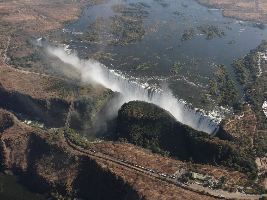
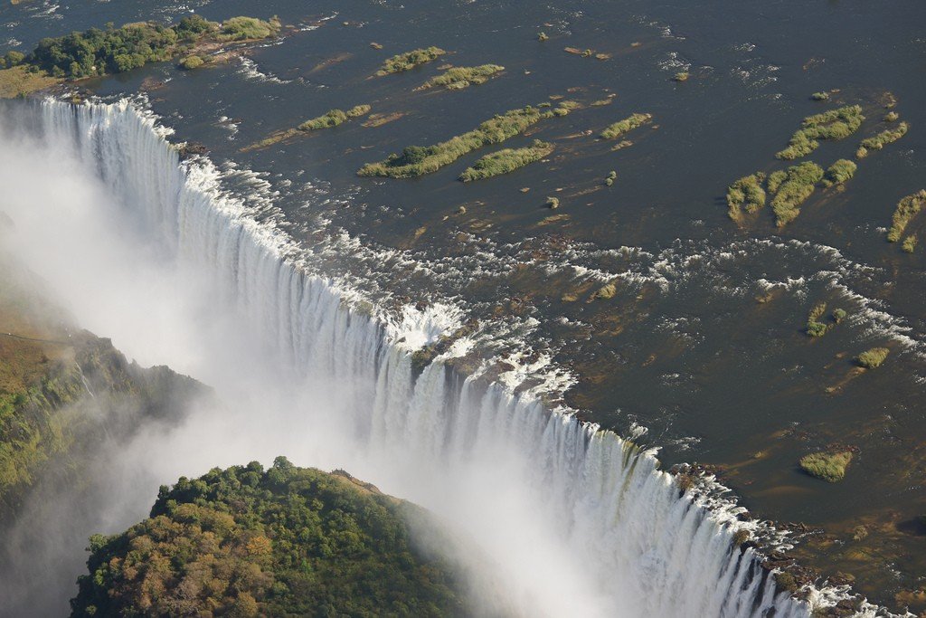
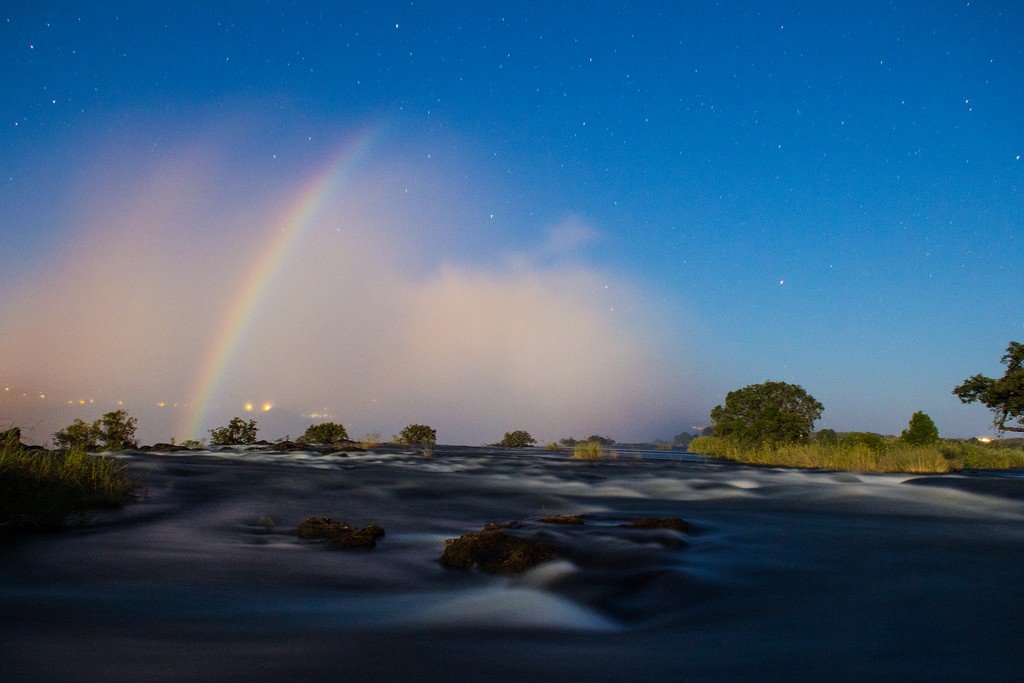
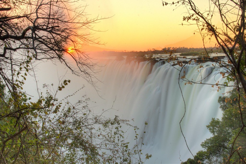
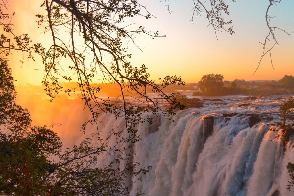
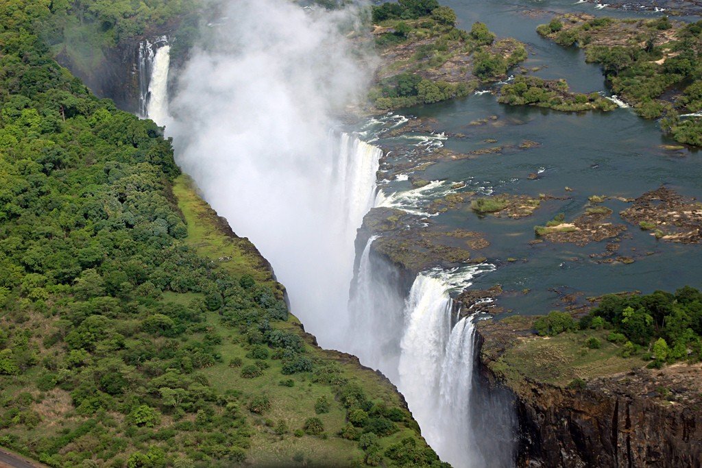
The Cololo tribe who lived in this area in the 1800s called the waterfall Mozi-oa-Tunya, Rattling Smoke, or The Greatest Curtain of Falling Water. The majestic Victoria Falls, or rather the huge cloud of spray rising above it, can be seen from a distance of 64 km as the water rushes vertically down from a height of 100 meters. At the peak of the rainy season, 546 million cubic meters of water rushes every minute into the 2 km wide basalt rift. At this point, the Zambezi transforms from a calm and shallow river into a veritable underworld of boiling water.
Dr. David Livingstone, the first European to visit Victoria Falls, named this natural phenomenon after the Queen of England. In the damp, misty rain forest at the top of the falls is a path from which the brave visitor, who is not afraid of getting soaked to the skin in a huge cloud of spray, can enjoy the incredible spectacle.
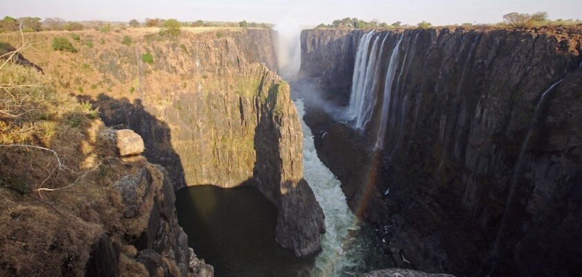
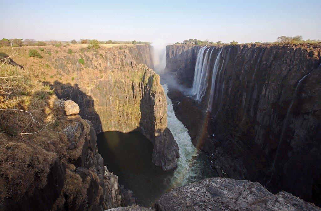
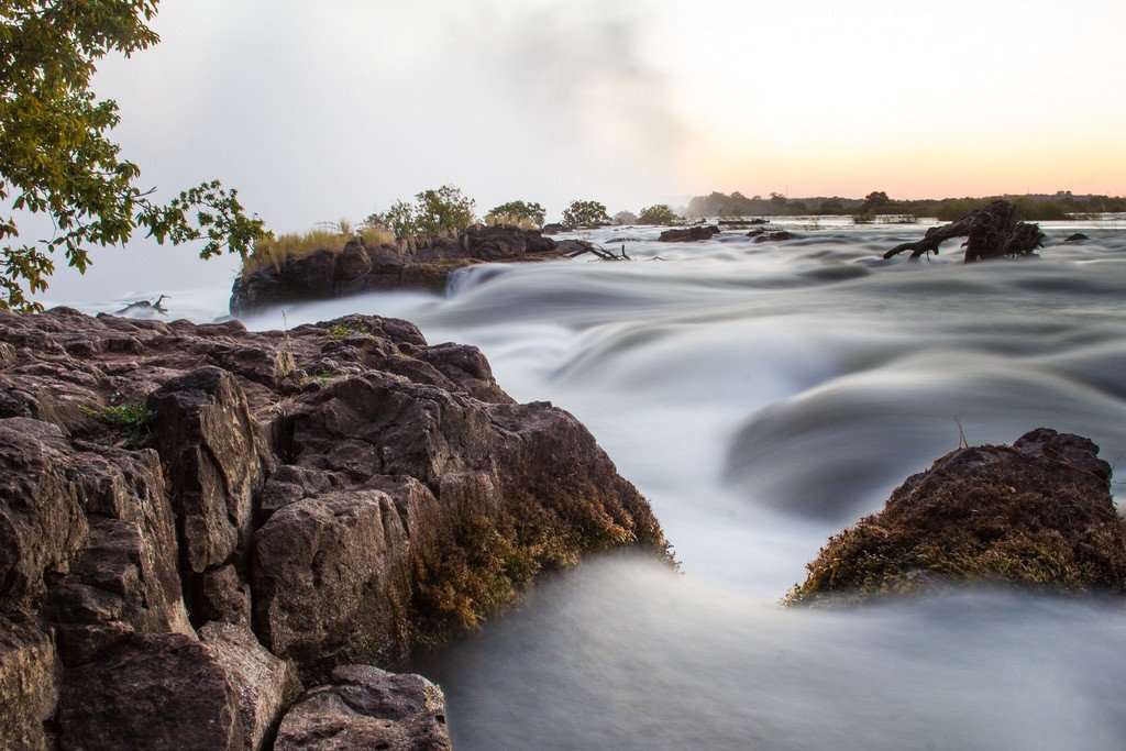
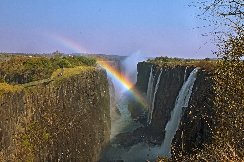
The falls are extremely wide, approximately 1,800 meters wide, with the height of the water fall varying from 80 meters at the right bank of the falls to 108 meters in the center. Victoria Falls is about twice the height of Niagara Falls and more than twice as wide as its main part (“Horseshoe”). The falling water forms spray and mist that can rise to heights of 400 meters or more. The mist created by the waterfall can be seen up to 50 kilometers away..Victoria Falls is divided into four parts by islands on the edge of the abyss. Near the right bank of the river is a sloping stream 35 meters wide called “jumping water”, then beyond Boarooka Island (300 meters wide) is the main waterfall about 460 meters wide. Livingstone Island separates the main waterfall from the second stream (approximately 530 meters wide), with the eastern waterfall located at the very left bank of the river.
.
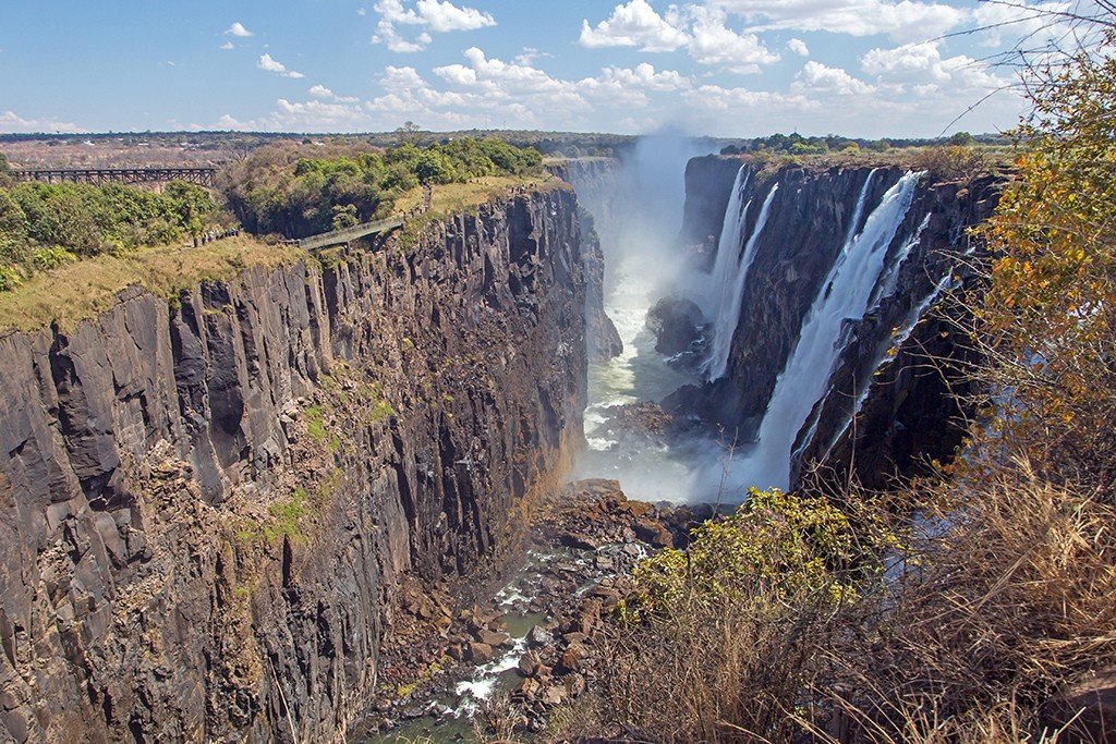
The only way out of the crevasse where the water now falls is a rather narrow channel punctured by water in its wall about 2/3rds of the distance from the west end. This channel is about 30 meters wide. The entire volume of water passes through it for about 120 meters, after which the river enters a zigzag gorge. The river does not leave this gorge for about 80 kilometers, until it leaves the basalt plateau.
.Tourists
To appreciate the incredible size of the falls and the gigantic power of the water that has carved deep gorges 8 km away, you must view the falls from the air or, if you wish, from a raft below. Pilots fly over the Upper Zambezi and down into the gorges – it’s unlikely you’ll ever be able to forget this amazing experience.
.Another vantage point is on the other side of the Knife Blade Bridge, which was built in 1900 by Cecil Rhodes. There is also a “lookout tree” from where you can enjoy panoramic views of the falls and fully appreciate the rumbling splendor. The combination of the dark green river below at the glistening rock formations and emerald green foliage makes for a truly unforgettable sight.
.
Immediately after the waterfall begins a section of the river with numerous rapids, which attracts kayak and rafting enthusiasts. The rapids are safe enough for beginners, with high water flow there are no dangerous rocks and after all the rapids there are stretches of smooth water.
Zimbabwe and Zambia allow day trip visas for border crossings without prior application, but these visas are considered expensive.
.