Sa Pa
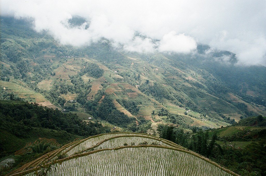
Sapa is a mountainous area, a land of clouds, waterfalls and terraced fields in northwest Vietnam. The starting point here is usually the city of Laocai, the capital of the province of the same name, located 340 kilometers from the capital and 40 kilometers southeast of Sapa. Four trains leave Hanoi’s Le Zuan Street station daily in the direction of Laocai. Three of them depart in the evening (it is better to choose the one that leaves around 23 h) – in their air-conditioned compartments the traveler can have a great rest and sleep (1st class – 30 USD). The only morning train is much less convenient: it has only hard seating and the ticket is more expensive than traveling on buses, which also make trips to Laocai from Hanoi train station (10 hours, 60,000 VND). Overnight trains arrive in Laocai around 5 -6 am. This city of more than half a million people was one of the main targets of the Chinese invasion in February 1979. Shelling and fierce street fighting reduced Laocai to rubble. Now you will not see any traces of war – the city has long been rebuilt and looks cozy and peaceful. Moreover, there is a border crossing 3 km north of it, through which you can enter the territory of the former enemy. There is nothing worth seeing in Laokai itself.

History
Satisfied with the fat lands of the coastal plains, the Viets never had any interest in the rugged mountains lying on the border of China’s Yunnan Province. Populated by numerous hill tribes, Sapa was “discovered” by the French in the late 1880s. In 1903, a military post was established on the site of the future city – so the name “Sapa” first appeared on a map of the area drawn up by army surveyors two years earlier.
.
In 1912, a sanatorium for officers of the Tonkin troops appeared here, and from 1914, government officials began to spend the hot summer months in cool Sapa. In 1917, a tourist bureau started operating in Sapa, which laid out the now famous hiking trails in the vicinity. Very quickly, by the early 1920s, the town had grown to include hotels and private villas. The French, who had taken a fancy to the place, called it Chapa, emphasizing the last syllable. Following the colonizing tourists, the Vietnamese came to Sapa to serve their needs.
.
With the outbreak of World War II, the resort quickly fell into disrepair – in those difficult times there was no time to relax. Things got even worse in 1947, when the summer capital of French Indochina was first attacked by Viet Minh units. Two years later, the colonial troops finally abandoned the city, and in 1952 the French air force subjected Sapa to a “farewell” bombing, which destroyed most of the colonial buildings, which by then numbered almost two hundred. The Vietnamese population of Sapa left the destroyed city for a long time. In 1979, Sapa became the extreme point of Chinese troops’ advance deep into Vietnamese territory. In 1993, due to the general changes in the country, the region was opened to international tourism. Today, there are 44 hotels of varying levels in and around Sapa.Location and transportation
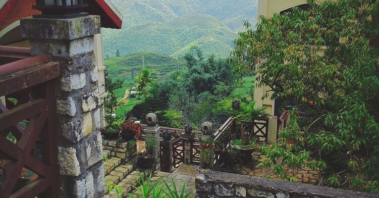
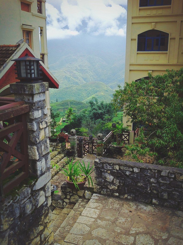
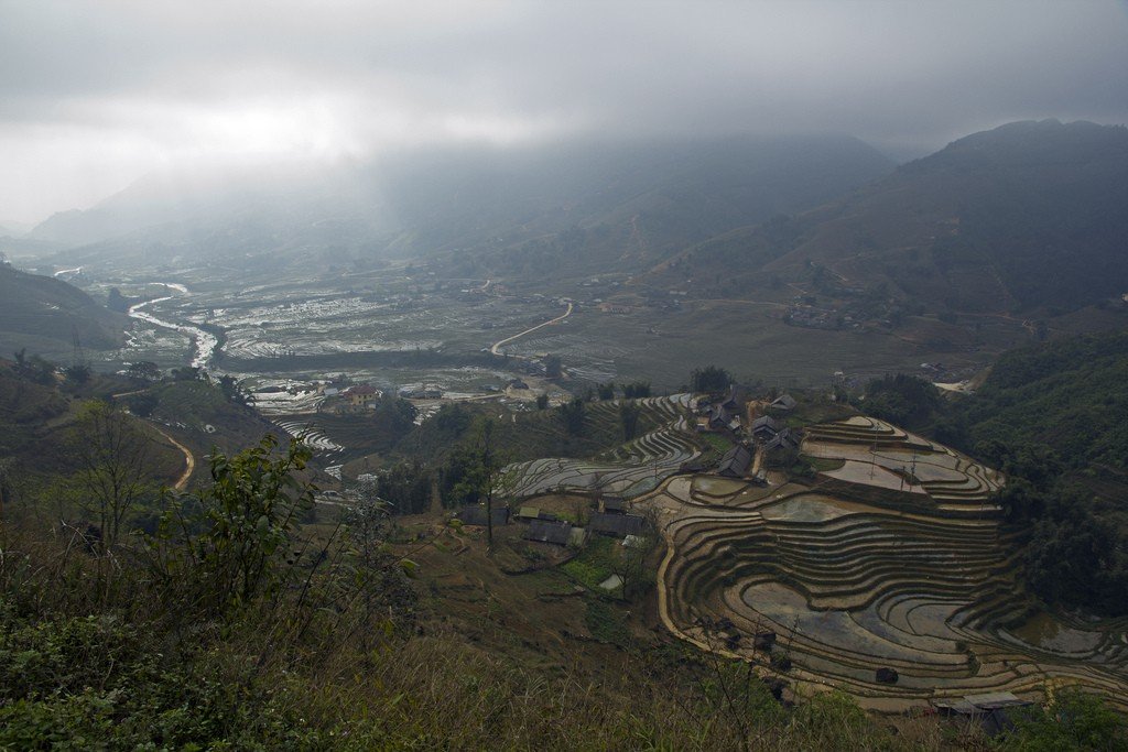
Sapa is home to the city of the same name, it is located on a small plateau at the foot of Ham Rong Mountain in the Hoang Lien range system at an altitude of about 1500 meters above sea level. In the center of the city is a square, which is flanked on different sides by a park, a stadium, a market and a small stone church built in 1934. A small lake glistens nearby, another center of attraction for city life.
Muong Hoa St. and Cau May St. are the busiest streets in the city. The main market, tourist information center, hotels and restaurants are located here. In the southeastern direction from the church leaves Ham Rong Street, where the main post office is located and begins to climb to the top of the mountain of the same name, where you can enjoy amazing views of the city and the surrounding area.
.
There are minibuses from Laocai Station to Sapa – traffic begins with the arrival of the first Hanoi train and ends around 3pm. The fare will cost VND30,000. Se om to Sapa will cost about VND70,000.
.Climate
The coldest time of year in Sapa is January and February (temperatures mostly range from 5-15 °C, but can drop to 0 °C). The dry season lasts from January to June, with mostly clear and sunny weather in March, which lasts until the end of May (air temperature 15-19 °C). At this time, a variety of flowers bloom on the mountain slopes.
.From June to August there are abundant warm rains (air temperature about 20 ° C), and from September the temperature begins to slowly decline. However, it is the fall months that are considered the best for visiting Sapa. The period from mid-October to mid-December is the best time for trekking and mountain climbing.
.Attractions
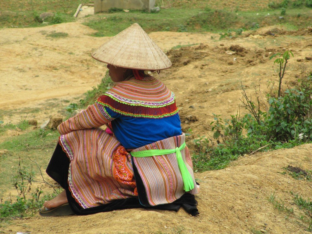
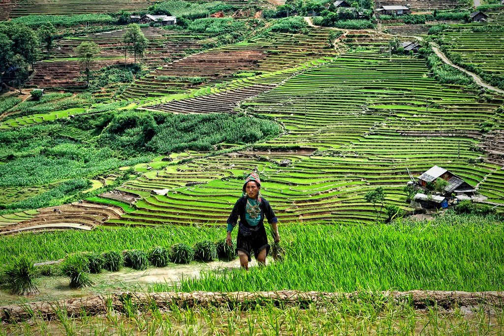
The alpha and omega of Sapa is the market. Even without leaving the city, here you can meet representatives of all the local peoples, take the most successful photos and buy souvenirs. Even today, Goryanka women still wear colorful traditional clothes and silver jewelry – this is not for the benefit of tourists. Representatives of the Tszao people can be recognized by the red scarves tied around their heads. The Hmong wear mostly black or blue costumes decorated with hand embroidery. The characteristic knitted gaiters seen on women’s legs are called la peng pe (la peng pe). The market in Sapa is best visited on Sundays, when people from nearby villages come here.
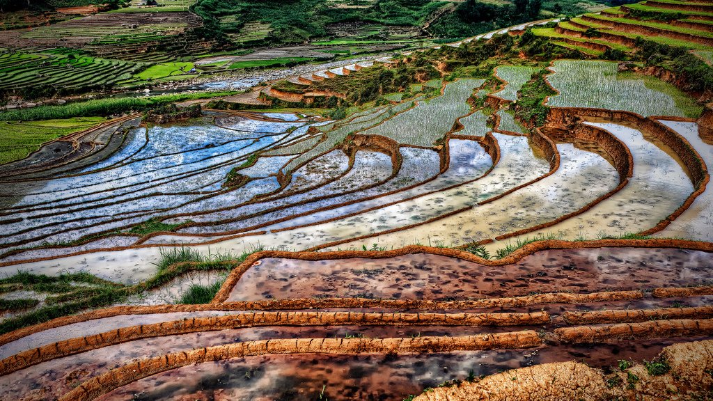
.Vietnam’s highest mountain Fan Si Pan (3143 meters above sea level) is not far away – at a distance of 19 km from the city. However, the road to its foot is so difficult that even experienced athletes have to spend 2 – 3 days to overcome this distance. The lower slopes of Fanshipan are covered with forests, and due to local peculiarities, the air there is extremely humid. If you climb above 1500 meters, you will be exposed to cold and cloudy weather. No special training or equipment is required for the climb (with the exception of an alpenstock, trekking shoes and warm clothing).
.In clear weather, Fanshipan is clearly visible from Sapa – just like the other peaks of the Hoanglien chain. Not for nothing was this mountain system nicknamed the “Tonkin Alps” during the colonial era. In general, the mountain vistas are the main reason to come to Sapa. On a clear day, get up early and witness the amazing play of sunlight on the green slopes. French poet Georges Riman, who served in Indochina, wrote in his diary while in Sapa: “The sun appeared at the same level as me, and if the mountain was big, my shadow became infinite. I never realized that I was so large. Alas, it lasted only a minute!”
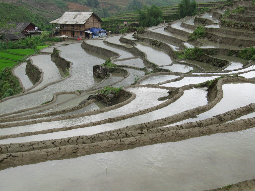
.A nice excursion can be made by driving from Sapa to Tambak Waterfall (Tham Vas, or Silver Falls) and Chumton Pass (Tram Ton). Cham Ton is the highest pass in Vietnam (1900 meters above sea level), located 15 km from Sapa, on the northern slope of Fanshipan. This pass is passed on the road to Lai Chau. Although it is cold and foggy at the highest point of the pass, it is always sunny on the slope facing Lai Chau: the pass is the border of two weather zones. he Silver Waterfall is located 5 km from the pass towards Sapa – entrance to the viewing platform costs 3000 VND. A se om to the pass with a stop at the waterfall will cost 50,000-60,000 VND (round trip takes about an hour).
.Trekking
A variety of trekking in the mountains of Vietnam, including in the “Tonkin Alps”, can be offered by many travel agencies. Handspan Travel (www.handspan.com), Topas Travel (www.topas-adventure-vietnam.com) and Active Travel Vietnam (www.activetravelvietnam.com) are considered professional and reliable in this field.
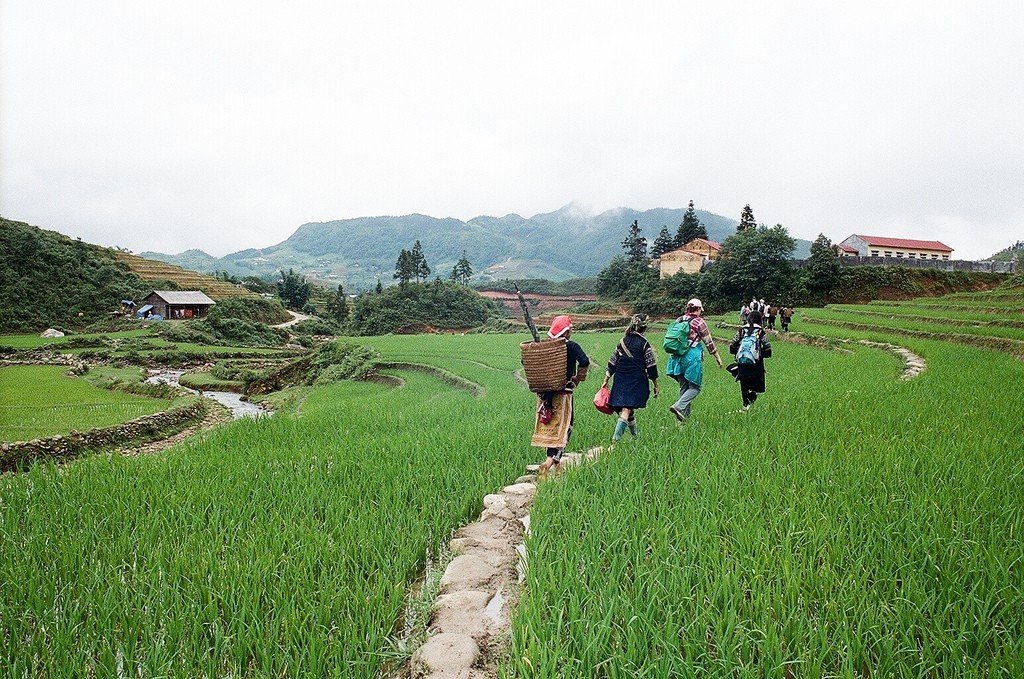
.A short day trek can be easily organized in Sapa. The shortest and easiest hiking route is to walk from Sapa in a southwesterly direction to Sin Chai via Cat Cat village. There is a well-traveled, well-marked trail with no difficult branching paths. The distance is about 6 kilometers and the total time to walk is about 4 to 5 hours. Nearby Katkat is the waterfall of the same name.
.From Sapa to Tawan (Ta Van) via Laotiai (Lao Chai). The 9km trek runs in a southeastern direction through the scenic Myong Hoa valley. The duration is about 5 hours and the cost is 10 USD.
.From Sapa to Tafin (Ta Phin) via Macha (Ma Cha). The end point of the trek is 10 kilometers north of Sapa. Here, several colorful villages inhabited by the Black Hmong and Tzao (interesting www.taphin-sapa.info) are nestled on the mountain slopes. Close to Tafin are some interesting caves (entrance 36,000 dong). The drive by car or motorcycle from Sapa takes about half an hour, and you will have to walk for about 6 hours. The cost of the trek is 15 USD.
.Accommodation
Prices for accommodation in Sapa vary quite a lot and depend not only on the season, but also on the day of the week: on weekends the flow of visitors increases due to excursionists from Hanoi and hotels become more expensive. Another thing that affects the price of a room is the view from the window. Sapa is also unique in that it is the only place in Vietnam where hotels have heating. Older establishments have fireplaces and stoves, while newer establishments have electric heaters.
Useful information
Not so long ago it was impossible to find a bank in Sapa, and foreign currency was changed only by hotels, not forgetting the exchange rate “margin”. Now there is a branch of BIDV Bank (Ngu Chi Son St., tel. 020-872569, 7.00-11.30/13.30-16.30) equipped with an ATM.
.
If you’re short on time, an alternative to Sapa is Tam Do, a national park and mountain resort 85 kilometers northeast of Hanoi. From May to October, it offers walks of varying lengths through mountains teeming with rivers, waterfalls and rainforests. Guides, who can be hired at any hotel, cost around 4 USD. A day trip from Hanoi by rented car will cost about 50 USD. The road from Hanoi to Tamdo goes past the ancient Koloa Fortress.
.You can get to Tamdo from Hanoi’s Kim Ma bus station (Ben Xe Kim Ma). A shuttle bus will take you to Vinh Yen (Vinh Yen, 20,000 VND), which is 60 kilometers from the capital. To get from Vinh Yen to Tamdo, you can take a se om (VND50,000 for 25 km). Nights in Tamdo can be cold (especially in May and September) – don’t forget a sweater and jacket. Hotels offer rooms ranging from 8 to 80 USD.
.