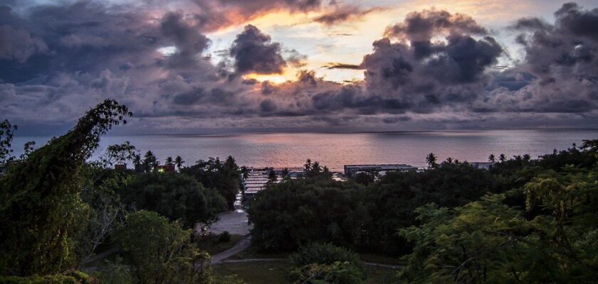
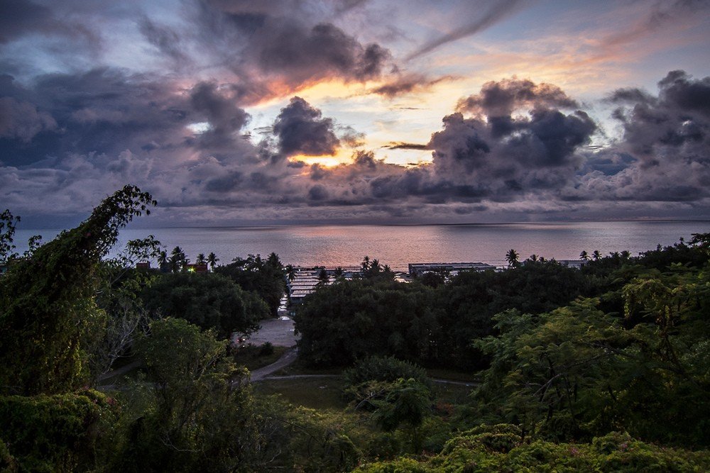
Nauru Island
Nauru Island is an island located in the western Pacific Ocean in Micronesia. The island’s name most likely comes from the Naurian word “Naoero”, which is an abbreviation of the expression “a-nuau-a-a-a-ororo”, translated literally as “I go to the seashore.”
.The island of Nauru has an area of just over 21 square kilometers.
.The island of Nauru is currently home to the state of the Republic of Nauru, which is the smallest republic on Earth in terms of territory.
History
The island of Nauru was most likely colonized by Polynesians and Micronesians about 3,000 years ago. The first settlers on the island of Nauru were the Bismarck Islanders.
>For Europeans, the island of Nauru was discovered on November 8, 1798, by British Captain John Fearn during his voyage to China from New Zealand. The discoverer then gave the island the name “Pleasant” (English version – Pleasant Island), which was used on English-language maps for the next century.
.At the time of the discovery of the island by Europeans, the aboriginal population of Nauru lived virtually under a primitive communal system, engaged in fishing and cultivation of coconut palms and pandanus.
.In the mid-19th century, the first Europeans arrived on Nauru, bringing to the island both incurable diseases and internecine conflicts that significantly reduced the Aboriginal population.
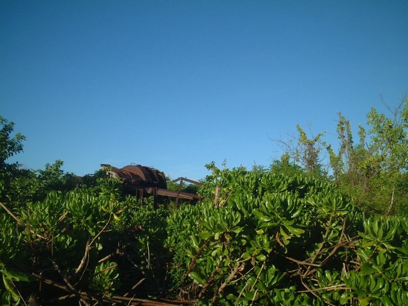
In the early 20th century, large deposits of phosphate rock were discovered on Nauru. In 1906, the Australian Pacific Phosphate Company (Pacific Phosphate Company) began to develop these resources, having previously obtained permission from the German authorities.
After the outbreak of World War I, Nauru’s phosphate deposits were discovered.
After the outbreak of World War I in Europe, Australian troops captured the island of Nauru on August 17, 1914, ahead of the Japanese.
.
Following the outcome of World War I in 1923, a League of Nations mandate placed the island of Nauru under the joint administration of Australia, New Zealand and the United Kingdom, but the administration still remained with Australia. The Nauru-mandated countries established a joint corporation, the British Phosphate Company, which mined and sold phosphate until the beginning of World War II.
.
In early December 1940, two German auxiliary cruisers Orion and Komet, with the help of Soviet icebreakers on the Northern Sea Route, attacked Allied merchant ships near the island of Nauru, most of which were sunk. On December 27, 1940, the cruiser Komet, which returned to Nauru, destroyed the island’s port facilities and stacks of mined phosphate rock.
On August 25, 1942, Japan captures Nauru, with the island not being liberated until September 13, 1945, following the Japanese surrender in World War II. During the Japanese occupation of the island, over 1,200 locals were taken to the Chuuk Islands (Truk at the time), where many of them died, with the remainder not returning home until early 1946.
.After the end of World War II, Australia, New Zealand and Britain still administered Nauru, while continuing phosphate mining.
.In the early 1950s, a movement for national independence for the island took shape on the island.
Today, the Republic of Nauru is a developing state that has built its economy on phosphate mining and tourism.
.Origin and geography of the island
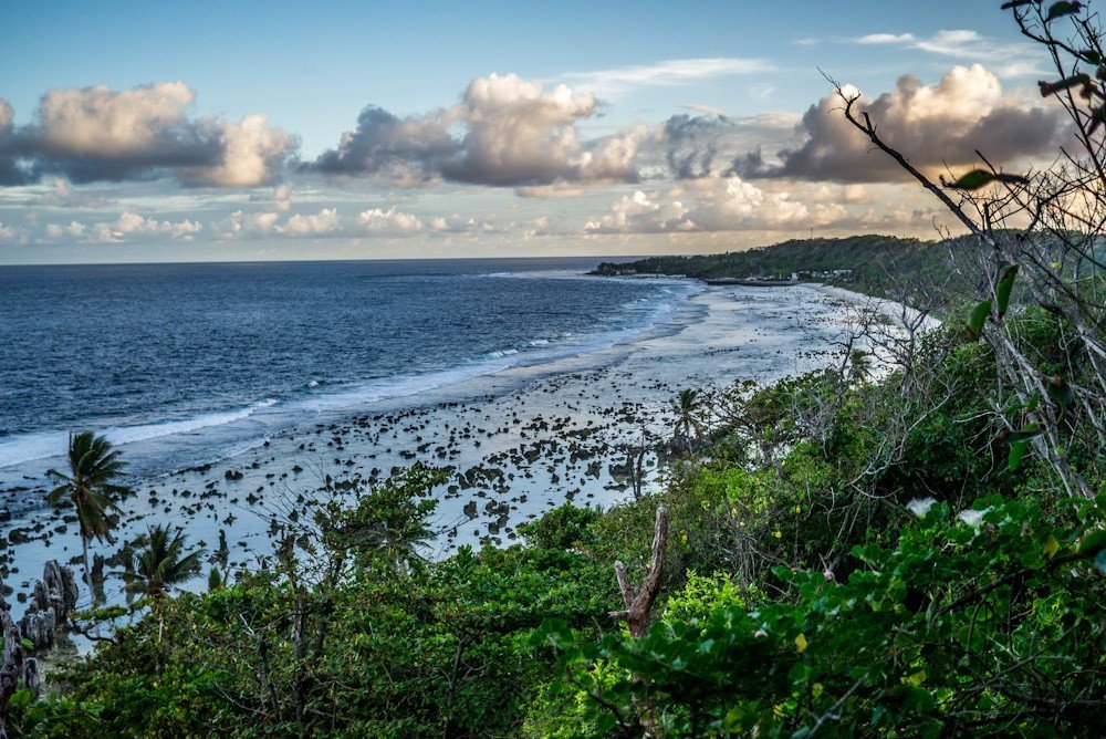
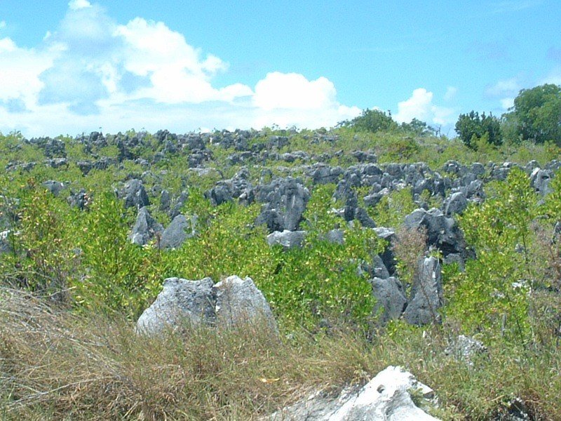
In its origin, Nauru is a coral island. Many experts in a number of printed sources, refer to Nauru as a raised atoll. According to scientists, the formation of the island began in the Pliocene, when corals formed a reef on the rim of an eroded volcanic cone and began to initially shape the outline of the island. Nauru originally had an inner lagoon, traces of which can be seen in the central part of the island, which was eventually filled with coral sand and silt.
.
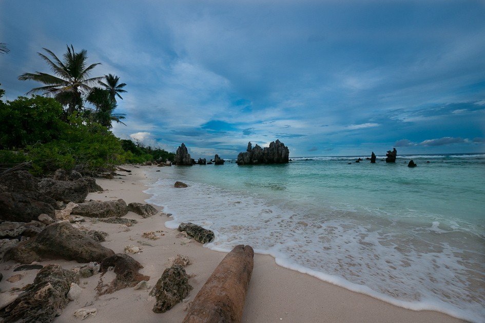
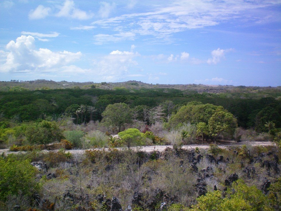
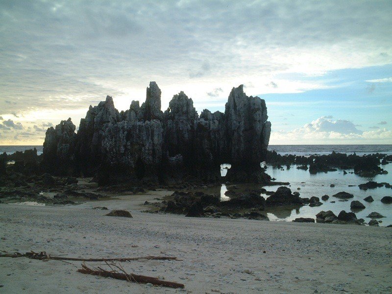
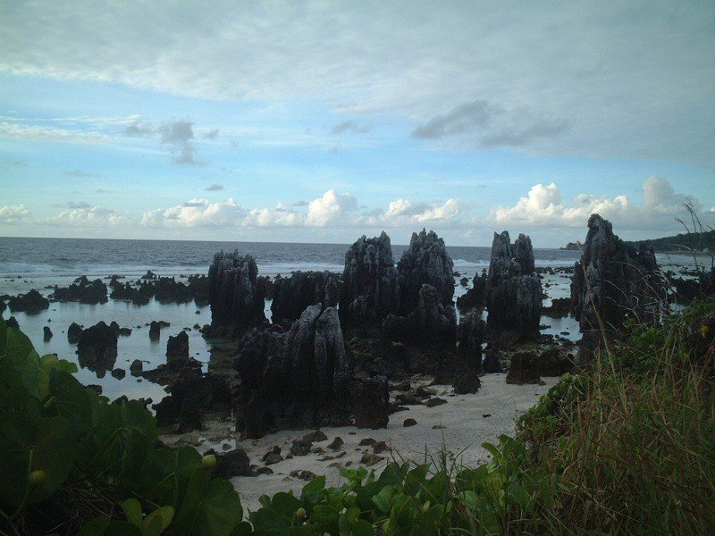
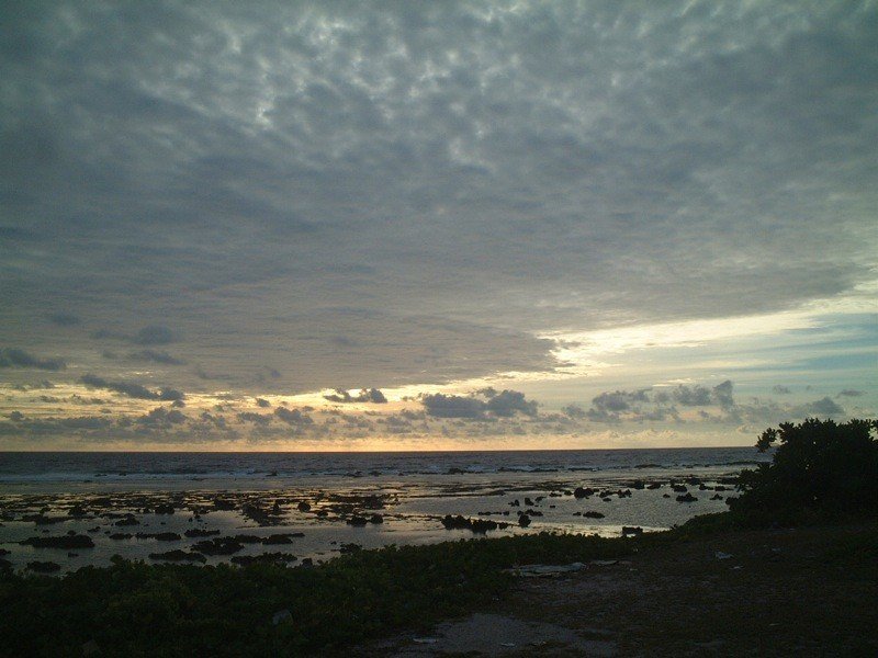
The island of Nauru has an almost regular circular shape, slightly elongated from southwest to northeast, with a length of 6 kilometers and a width of 4 kilometers. The coastline is fairly straight, with only one small bay, Anibar Bay, on the eastern side of the island. The length of the coastline is approximately 18 kilometers. The relief of the island consists of a narrow coastal plain with a width of about 150-300 meters, which surrounds a limestone plateau, whose height closer to the central part of the island reaches 30 meters. The plateau was formerly covered with a thick layer of phosphorites. The highest point of the island of Nauru is an unnamed hill with a height of 65 meters, located on the border of Buada and Aivo districts. In the central part of the island is the small, drying Lake Buada. The island is fringed by a narrow coral reef that ranges from 120 to 300 meters wide. During low tides, the coral reefs rise above the water surface with their peaks. Currently, 16 channels have been dug into the reef, allowing small boats to get closer to the shore of the island. At a distance of about 1 kilometer from the shore, the ocean depth exceeds 1,000 meters due to a sharp cliff.
.Climate
The climate on the island of Nauru is classified by experts as monsoonal equatorial, which means that it is almost always hot and humid. Given the proximity of the equator, there are no temperature fluctuations depending on the time of year here. The average annual temperature is approximately +28 °C, with daytime temperatures ranging from +27 °C to +35 °C and nighttime temperatures from +22 °C to +28 °C. Sometimes daytime temperatures can reach +39-41 °C, which makes the island uncomfortable, especially for visiting tourists. Precipitation on Nauru falls in the form of heavy tropical rains, and their average annual amount is about 2000-2500 millimeters. The rainy season on the island is from early November to mid-February, when the west monsoon blows. From March to the end of October, winds blowing from the northeast prevail. Occasionally, Nauru is hit by tropical cyclones, which occasionally bring destructive winds in addition to downpours.
.Population
At the moment, the island of Nauru is home to more than 10,000 inhabitants. Ethnically, almost all of them are considered Nauruans (Naurians), the percentages of Fijians, Europeans, Chinese and Tunguruans are relatively small. The official languages on the island are English and Nauruan, which belongs to the Micronesian language group.
.
Administratively, the island of Nauru is divided into 14 districts. But there are no cities on the island, nor is there an official capital of the Republic of Nauru.
The unit of currency in circulation on the island of Nauru is the Australian dollar (AUD, code 36), consisting of 100 cents..
Flora and Fauna
Due to Nauru’s remoteness from the continents, as well as uncontrolled phosphate mining, the island’s flora and fauna are quite poor. There are only 60 species of vascular herbaceous, shrubby and woody plants, among which there are no emdemic species. Coconut palms, ficus, pandanus, laurel trees and other woody species are almost ubiquitous on the island. The greatest density of vegetation is found closer to the coastal areas in a band of about 200-300 meters from the shore and near Lake Buada. Hibiscus, cherry, almond and mango trees are common in central Nauru.
The fauna of Nauru is even poorer than the flora. All the mammal species now inhabiting the island were introduced earlier by humans, and these include cats, dogs, pigs and rats. Of reptiles, lizards are common on Nauru. Only six species of birds nest on the island (terns, sandpipers, frigates, petrels, pigeons, and the island’s emdemic reed warbler (Acrocephalus rehsei)).
.The island’s coastal waters are home to several species of sharks, sea urchins, clams, crabs, and a large number of marine venomous animals.
.Tourism
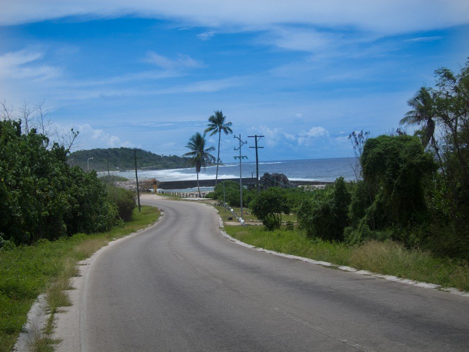
You can arrive on the island of Nauru either by sea or by air. An international airport has been operating on the island off the coast in the Yaren District since 1982, receiving flights from the Solomon and Marshall Islands, Australia and New Zealand, as well as from the Republic of Kiribati. By sea, the island can be reached mainly by small yachts and boats due to the danger of coral reefs girdling the island. Tourists arriving on Nauru are accommodated either at the Menen Hotel, the only hotel on the island, or in numerous private bungalows located off the coast. Tourists go to Nauru primarily for beach vacations. Tourist infrastructure is almost completely absent here, which attracts extreme tourists. Most beaches on the island are located in its southern and southwestern parts. There are two relatively large beaches with stunning white-pink coral sands, washed by clear azure coastal ocean water.
.