Mediterranean Sea
This attraction is related to the countries:TurkeyTurkey , SpainFranceMonacoItalyMaltaSlovenia, CroatiaBosnia and HerzegovinaMontenegroAlbaniaGreeceSyriaCyprusLebanonIsraelEgyptLibya, Tunisia, AlgeriaMoroccoThe Mediterranean Sea is the Mediterranean, an intercontinental sea of the Atlantic Ocean, connected to it on the west by the Strait of Gibraltar.

General information
The Mediterranean Sea is divided into the Alboran, Balearic, Ligurian, Tyrrhenian, Adriatic, Ionian, Cretan, and Aegean seas. The basin of the Mediterranean Sea includes the Sea of Marmara, the Black Sea, and the Sea of Azov.
.
The modern Mediterranean Sea is a relic of the ancient Tethys Ocean, which was much wider and extended far to the east. The Aral, Caspian, Black and Marmara Seas, confined to its deepest trenches, are also relics of the Tethys Ocean. The Tethys was probably once completely surrounded by land, and an isthmus existed between North Africa and the Iberian Peninsula, near the Strait of Gibraltar. The same land bridge connected southeastern Europe with Asia Minor. It is possible that the Bosphorus, Dardanelles and Gibraltar Straits were formed on the site of flooded river valleys, and many island chains, especially in the Aegean, connected to the mainland.
.
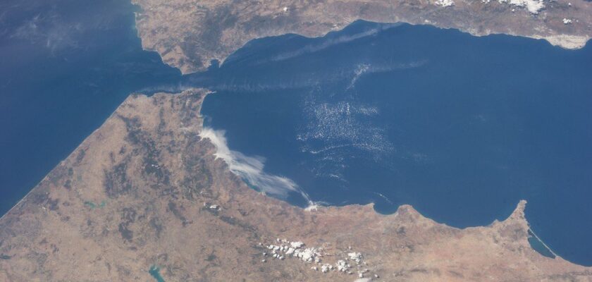
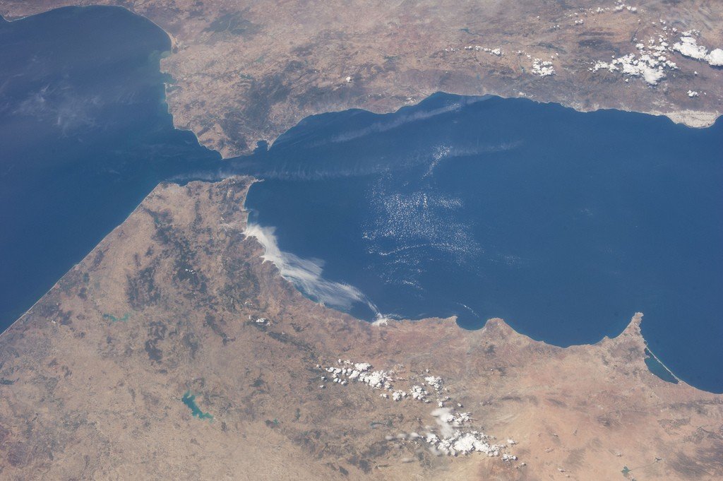
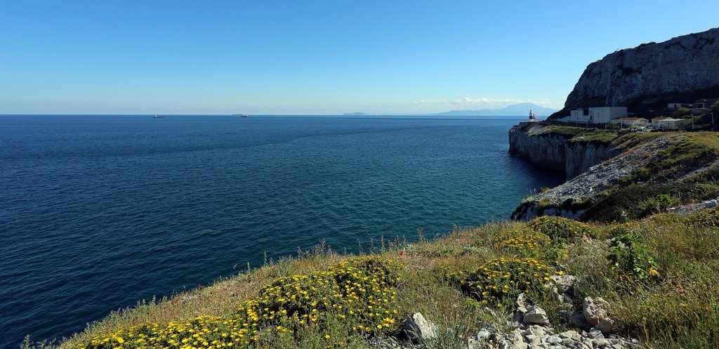
The Mediterranean Sea juts into the land between Europe, Africa, and Asia.
.The seas of the Mediterranean basin wash the coasts of 21 nations:
.Europe (west to east): Spain, France, Monaco, Italy, Malta, Slovenia, Croatia, Bosnia, Montenegro, Albania, Greece, Turkey, Cyprus; Asia (north to south): Turkey, Syria, Cyprus, Lebanon, and Israel; Africa (east to west): Egypt, Libya, Tunisia, Algeria, Morocco. In the northeast it is connected to the Sea of Marmara by the Dardanelles Strait and further by the Bosphorus Strait to the Black Sea, in the southeast by the Suez Canal to the Red Sea.
.Area 2500 thousand km².
.Water volume 3,839,000 km³.
.Average depth 1541 meters, maximum depth 5121 meters.
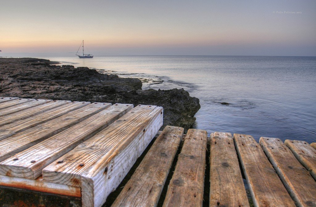
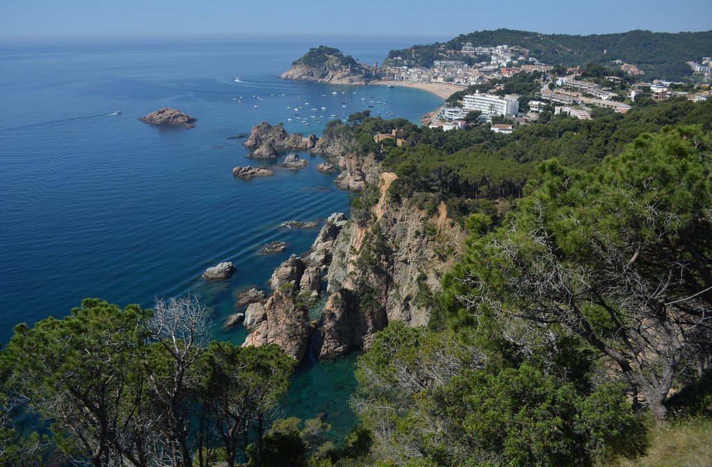
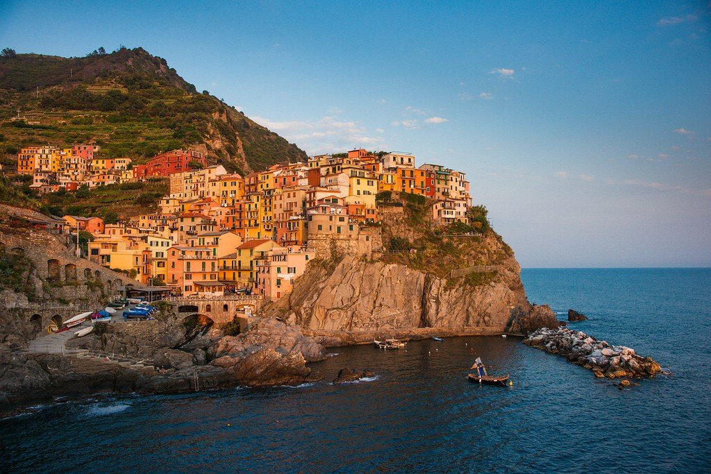
.The shores of the Mediterranean Sea are predominantly abrasion, leveled on the mountainous coasts, and lagoonal-limanic and deltaic on the low coasts; the eastern coast of the Adriatic Sea is characterized by Dalmatian-type shores. The most important bays are the Valencian, Lyon, Genoa, Taranto, Sidra (B. Sirte), Gabes (M. Sirte).
.The largest islands are Balearic, Corsica, Sardinia, Sicily, Crete and Cyprus.
.The major rivers Ebro, Rhone, Tiber, Po, Nile, etc. flow into the Mediterranean Sea; their total annual flow is about 430 km³.
.The bottom of the Mediterranean Sea breaks up into several basins with relatively steep continental slopes, 2000-4000 m deep; along the coasts of the basins are bordered by a narrow strip of shelf, expanding only between the coast of Tunisia and Sicily, as well as within the Adriatic Sea.
.Geomorphologically, the Mediterranean Sea can be divided into three basins: Western, the Algerian-Provence basin, with a maximum depth of over 2,800 m, combining the troughs of the Alboran, Balearic and Ligurian seas, and the Tyrrhenian Sea trough, over 3,600 m; Central, over 5,100 m (the Central Basin and the troughs of the Adriatic and Ionian seas); and Eastern, the Levantine basin, about 4,380 m (the troughs of the Levant, Aegean and Marmara seas).
The bottoms of some basins are covered with Neogene-anthropogenic strata (in the Balearic and Ligurian Seas up to 5-7 km thick) of sedimentary and volcanic rocks. Among the Messinian (Upper Miocene) sediments of the Algiers-Provence Basin a significant role belongs to the saline evaporite strata (1.5-2 km thick) forming structures characteristic of salt tectonics. Along the sides and in the center of the Tyrrhenian Basin there are several large faults with extinct and active volcanoes attached to them; some of them form large seamounts (Liparski Islands, Vavilova volcano, etc.). Volcanoes on the margins of the basin (in the Tuscan Archipelago, the Ponzian Islands, Vesuvius, and the Lipara Islands) spew acidic and alkaline lavas, volcanoes in the central, part of the Mediterranean Sea – deeper, basic lavas (basalts).
Part of the Central and Eastern (Levantine) basins are filled with sedimentary strata, including powerful products of river outflows, especially the Nile. At the bottom of these basins, according to geophysical surveys, the Gellen Deep Water Trough and the Central Mediterranean Shaft, a large arch up to 500-800 m high, are identified. Along the foot of the continental slope of Cyrenaica, the Libyan Trough is traced, very distinct in relief and poorly filled with sediments. The basins of the Mediterranean Sea are very different in time of deposition. A significant part of the Eastern (Levantine) basin was deposited in the Mesozoic, the Algiers-Provence basin – from the end of the Oligocene – beginning of the Miocene, some basins of the Mediterranean Sea – in the early – middle Miocene, Pliocene. At the end of the Miocene (Messinian age), shallow basins already existed over most of the Mediterranean Sea area. The depth of the Algeria-Provence basin at the time of salt deposition in the Messinian age was about 1-1.5 km. Salts were accumulated as a result of strong evaporation and brine concentration due to the inflow of seawater into a confined body of water through a strait that existed south of Gibraltar.
The present-day depths of the Tyrrhenian Basin were formed by the sinking of the seabed during the Pliocene and Anthropogenic periods (during the last 5 million years); several other basins were also formed as a result of the same relatively rapid sinking. The formation of the Mediterranean Sea basins is associated either with the stretching (extension) of the continental crust, or with the processes of compaction of the Earth’s crust and its subsidence. In some parts of the basins the processes of geosynclinal development continue. The bottom of the Mediterranean Sea in many parts is promising for oil and gas prospecting, especially in the area of salt domes. In the shelf zones, oil and gas deposits are confined to Mesozoic and Paleogene sediments.
The hydrological regime of the Mediterranean Sea is formed under the influence of high evaporation and general climatic conditions. The predominance of freshwater discharge over inflow leads to a lowering of the level, which is the reason for the constant inflow of less salty surface waters from the Atlantic Ocean and the Black Sea. In the deep layers of the straits there is an outflow of highly saline water caused by the difference in water density at the level of the strait thresholds. The main water exchange occurs through the Straits of Gibraltar (the upper course brings 42.32 thousand km³ per year Atlantic water, and the lower – takes out 40, 80 thousand km³ Mediterranean); through the Dardanelles flows in and out respectively 350 and 180 km³ of water per year.
.Water circulation in the S. m. is mainly wind-driven; it is represented by the main, almost zonal Canary Current, carrying water mainly of Atlantic origin along Africa, from the Strait of Gibraltar to the coast of Lebanon, and a system of cyclonic cycles in isolated seas and basins to the left of this current. The water column up to a depth of 750-1000 m is covered by a single cyclonic cycle. 750-1000 m deep is covered by unidirectional water transport along the depth, except for the Levantine intermediate countercurrent transporting Levantine water from Malta Island to the Gibraltar Strait. Malta to the Strait of Gibraltar along Africa.
.
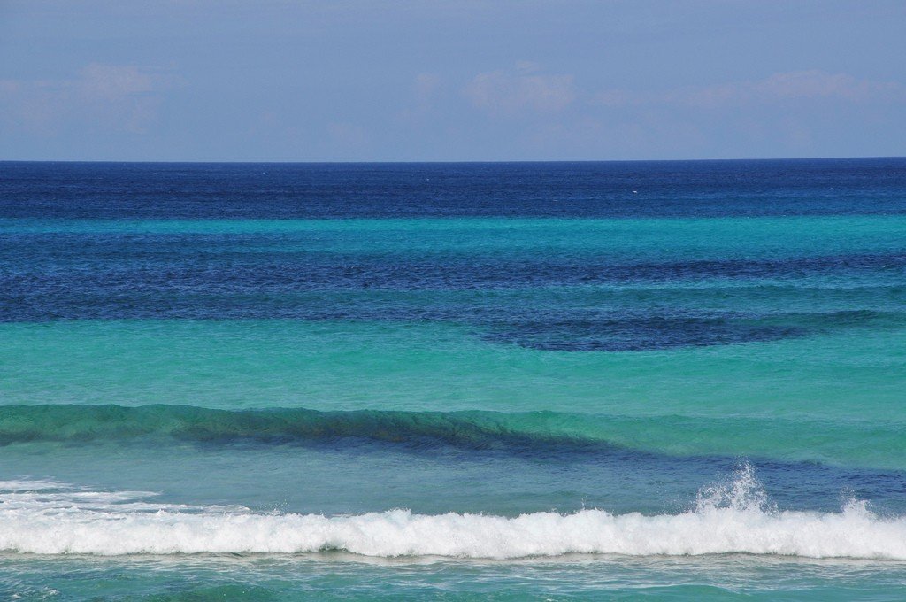
The velocities of steady currents in the open sea 0.5-1.0 km/h, in some straits – 2-4 km/h. The average surface water temperature in February decreases from N. to S. from 8-12 to 17 ° C in the eastern and central parts and from 11 to 15 ° C in 3. In August, the average water temperature varies from 19 to 25 °С. – In the extreme E. it rises to 27-30 °С. Large evaporation leads to a strong increase in salinity. Its values increase from 36 to – 39.5 from 3. to the east. Water density at the surface varies from 1.023-1.027 g/cm³ in summer to 1.027-1.029 g/cm³ in winter. During the winter cooling period, intensive convective mixing develops in areas with higher density, which leads to the formation of highly saline and warm intermediate waters in the Eastern Basin and deep waters in the N. of the Western Basin, in the Adriatic and Aegean Seas. In terms of bottom temperature and salinity, the Mediterranean Sea is one of the warmest and saltiest seas of the World Ocean (12.6-13.4 °C and 38.4-38.7 respectively). It has a relative water transparency of up to 50-60 m, and the color is intensely blue.
.
Tides are mainly semi-diurnal, their magnitude is less than 1 m, but in some points in combination with wind surges level fluctuations can reach 4 m (Genoa Bay, off the north coast of Corsica, etc.). Strong tidal currents are observed in narrow straits (Messina Strait). Max. excitement is noted in winter (wave height reaches 6-8 m).
.
The climate of the Mediterranean Sea is determined by its position in the subtropical belt and is characterized by great specificity, which distinguishes it in an independent Mediterranean type of climate, characterized by mild humid winters and hot dry summers. In winter, a low atmospheric pressure trough is established over the sea, which determines unstable weather with frequent storms and abundant precipitation; cold northern winds lower the air temperature. Local winds develop: mistral in the Gulf of Lyon area and bora in the eastern Adriatic Sea. In summer, most of the Mediterranean Sea is covered by the crest of the Azores anticyclone, which determines the prevalence of clear weather with little cloudiness and low precipitation. During the summer months, there are dry fogs and dusty haze brought from Africa by the sirocco southerly wind. In the Eastern Basin, persistent northerly winds, the etezias, develop.
The average air temperature in January varies from 14-16°C near the southern coasts to 7-10°C in the north, in August – from 22-24°C in the north to 25-30°C in the southern parts of the sea. Evaporation from the surface of the Mediterranean Sea reaches 1250 mm per year (3130 km3). Relative humidity varies from 50-65% in summer to 65-80% in winter. Cloudiness is 0-3 in summer and about 6 in winter. Average annual precipitation is 400 mm (about 1000 km3), it varies from 1100-1300 mm in the northwest to 50-100 mm in the southeast, minimum in July – August, maximum in December.
.Mirages are characteristic, which are often observed in the Strait of Messina (so-called Fata morgana).
.Vegetation and fauna of the Mediterranean Sea is characterized by relatively weak quantitative development of phytoplankton and zooplankton, which entails a relative small number of larger animals feeding on them, including fish. The amount of phytoplankton in surface horizons is only 8-10 mg/m3, at depths of 1000-2000 m it is 10-20 times less. Very diverse algae (predominantly peridinei and diatoms).
.
The fauna of the Mediterranean Sea is characterized by great species diversity, but the number of representatives of some species is small. There are crayfish, one species of seal (white-bellied seal); sea turtle. Fish 550 species (mackerel, herring, anchovy, mullet, mullet, coryphalus, tuna, pelamid, horse mackerel, etc.). About 70 species of endemic fish, including rays, species of hamsa, gobies, sea dogfish, guban and needlefish. Of edible mollusks the most important are oyster, Mediterranean-Black Sea mussel, sea date. Of invertebrates, octopus, squid, sepia, crab, lobster are common; species of jellyfish, siphonophores are numerous; sponges and red coral are found in some areas, especially in the Aegean Sea.
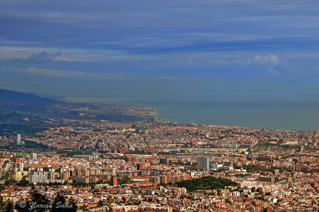
.The S. coast has long been densely populated, characterized by a high level of economic development (especially the countries along its northern coast).
.
Agriculture of Mediterranean countries: is distinguished by the production of citrus fruits (about 1/3 of the world harvest), cotton, oilseeds. In the system of international trade and economic relations S. m. occupies a special position. Located at the junction of three parts of the world (Europe, Asia and Africa), the N. M. is an important transportation route, through which the sea links between Europe and Asia, North Africa, as well as Australia and Oceania. Important trade routes linking Russia and Ukraine with Western countries and large cabotage lines between the Black Sea ports and a number of other ports in Russia and Ukraine pass along the S. M.
.The transport importance of the S.M. water area for Western Europe is continuously increasing due to the increasing dependence of these countries on imports of raw materials. Especially great is the role of the S. m. in the transportation of oil. The S.M. – is an important “oil” route between Western Europe and the Middle East. The share of southern ports (the main ones are Marseilles, Trieste, Genoa) in oil supply to Western Europe is constantly growing (about 40% in 1972). The ports of S. M. are connected by pipelines both with the countries of Western Europe, including Austria, Germany, France, Switzerland, and with the oil fields of the Middle East and North Africa. The transportation of various raw materials, metal ores and bauxites, agricultural products through the Suez Canal, through which the links between Western Europe and Asia and . Numerous industrial enterprises have been established on the S. coast and islands. Chemical and metallurgical industries developed on raw materials delivered by sea. Large nodes of chemical industry became in 1960-75 islands of Sardinia and Sicily in Italy, the mouth of the Rhône in France, etc. The production of oil and gas on the coast of the S. m. and islands of Sicily and Sicily has begun. Oil and gas production has begun on the shelf of the S. m. (the northern part of the Adriatic Sea, the coast of Greece, etc.). . Fishing in the S. m. compared to other basins of the Atlantic Ocean is of secondary importance. Industrialization of the coast, growth of cities, development of recreational areas lead to intensive pollution of the coastal strip. Widely known resorts of the Côte d’Azur (Riviera) in France and Italy, resorts of the Levantine coast and the Balearic Islands in Spain, etc.