Majuro Atoll
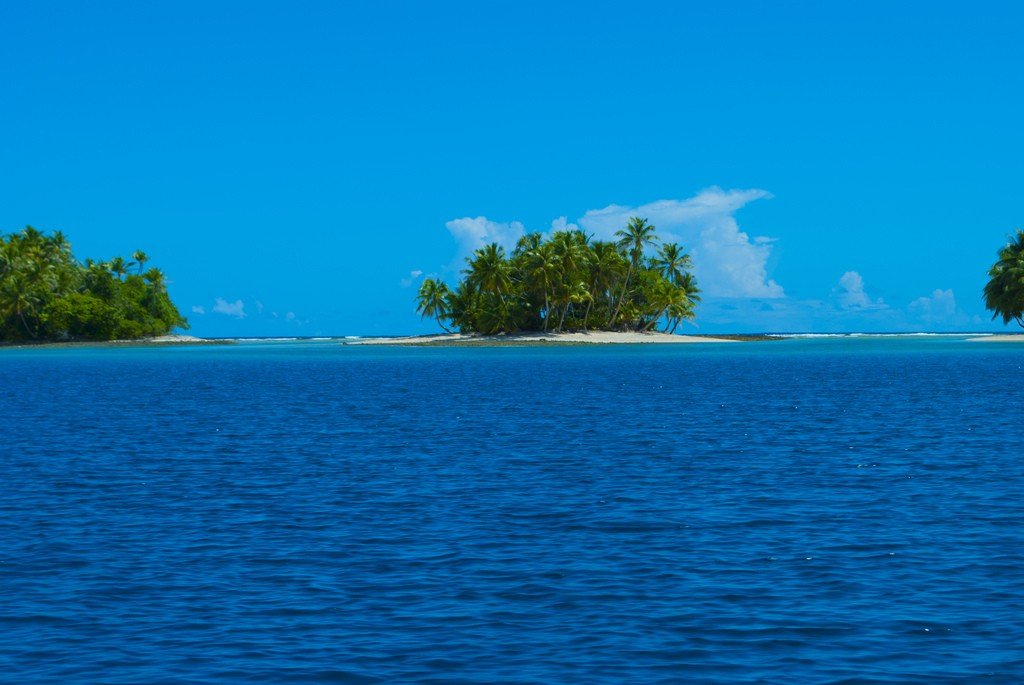
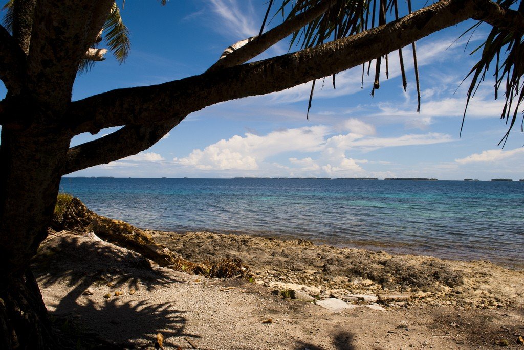
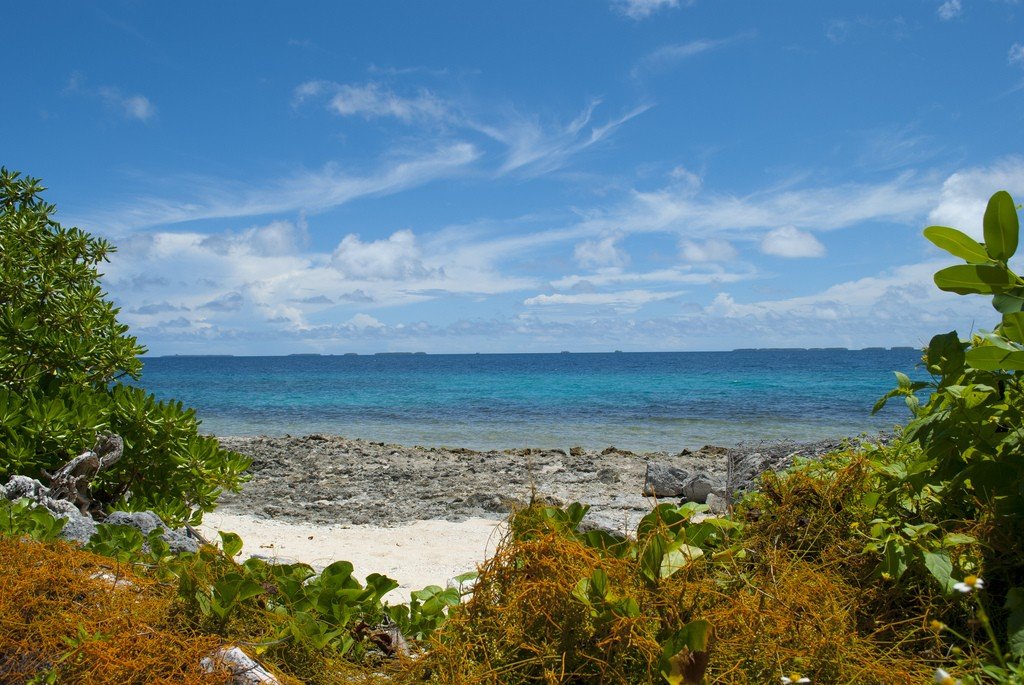
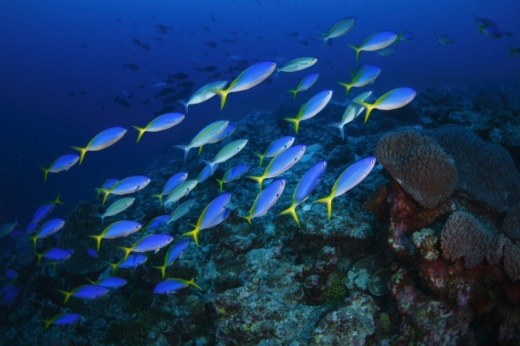
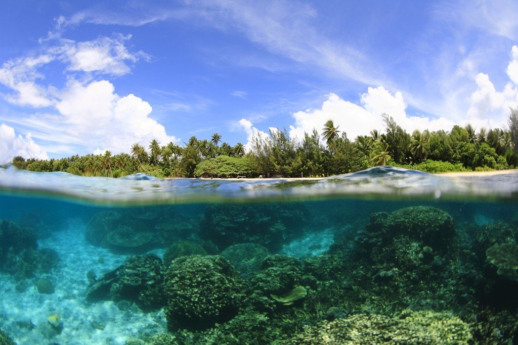
Majuro Atoll is located in the Pacific Ocean. It is home to Majuro Island, the capital of the Republic of the Marshall Islands. The atoll covers only 9.71 km² of land area and the surrounding lagoons cover 295 km². The economy has been based on tourism. Majuro is popular for sport fishing and diving.
Video: Majuro Atoll
General Information
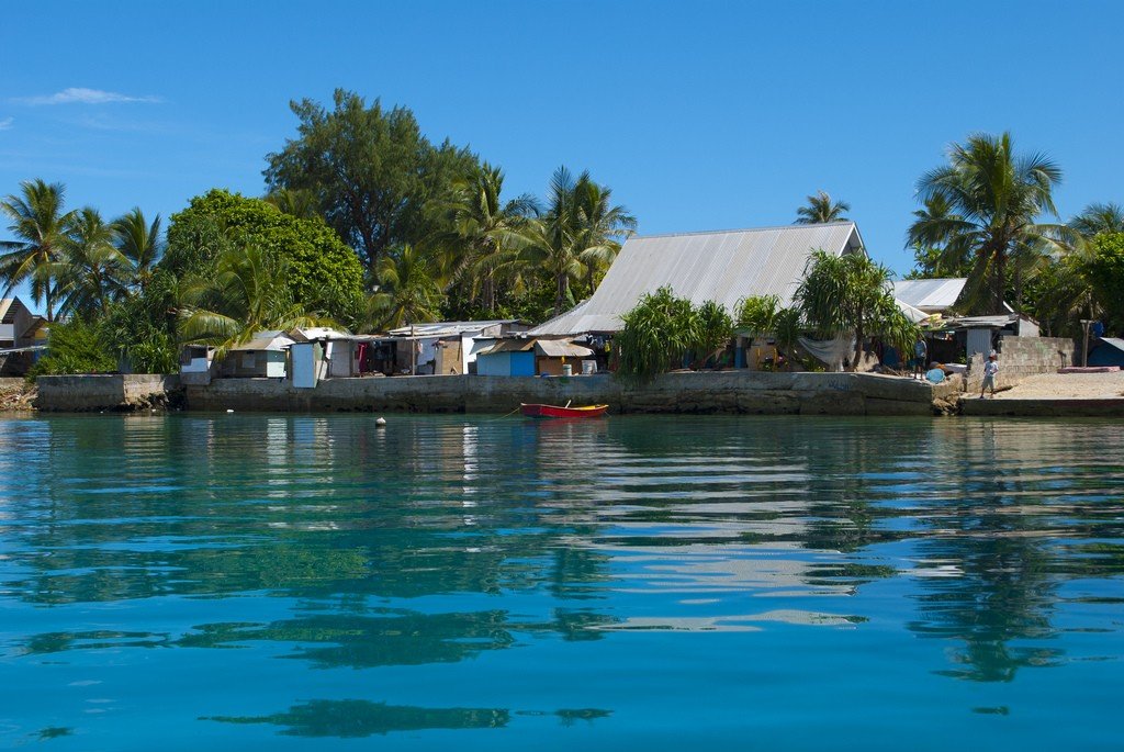
The atoll consists of 57 small islets, the most significant of which are connected by the islands’ only 55-kilometer road, which turns Majuro into one long and narrow island. Robert Louis Stevenson, visiting Majuro in 1889, called the atoll the “Pearl of the Pacific”, but with the development of the tourism industry, the atoll seen today has acquired many additional advantages in the form of a quite modern recreational infrastructure, carefully combined with island traditions. The three islands of Majuro – Delap, Uliga and Derrita (Rita) – are united in a separate municipality, forming the capital of the archipelago and one of the most densely populated places in the Pacific Ocean. It is no longer quite a “tropical paradise under palm trees”, but quite a modern place with a small selection of attractions.
.
The main business district, tourist and banking center is Uliga Island, where the elementary and high schools and the College of the Marshall Islands were built. Dalap Island is home to government offices.
The tropical climate with slight fluctuations in air temperature throughout the year (average temperature around +27C) is characterized by moderate winds and brief showers. The most favorable months for a trip to the islands are June – September. The population of the atoll, as of 2011, is 27,797.
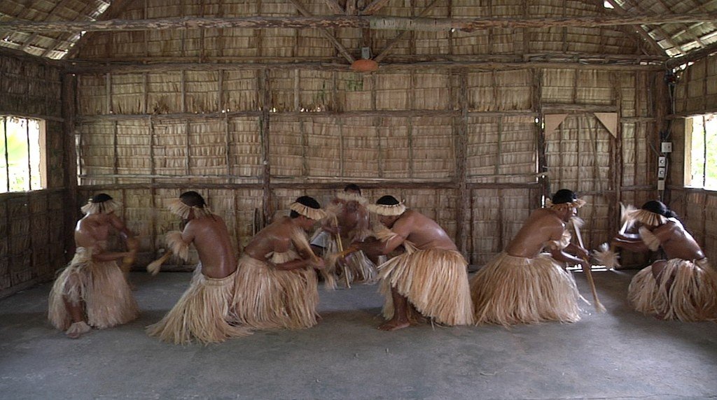
Located in the center of Majuro Island, the Alelele Museum (open Monday through Friday, 9 a.m. to 12 p.m. and 1 p.m. to 4 p.m.) is fairly small. 00) is fairly small in size, but its high-quality exhibitions present the early culture of the Marshall Islands peoples, the famous nautical charts made of intricate knots and interwoven pieces of wood , which ancient Micronesian seafarers used to navigate the vast Pacific Ocean, model canoes, weapons and tools without a single piece of metal, and various utensils (“alele,” a traditional wicker basket-bag made of pandanus leaves). Nearby are the library and the National Archives, traditionally named after the same utensil, which in the Marshall Islands is considered a symbol of value and knowledge. There is a store of local artisan craftsmen near the Museum.
.If you visit Laura Village on the far west side of the atoll, you can familiarize yourself with the rural lifestyle of the islanders, not much changed since Stevenson’s time. Meanwhile, Laura Village, near the airport, is home to the best beach on the atoll with its popular Laura Beach Resort, as well as the Majuro Pease Park war memorial, built by the Japanese and dedicated to all those who died in the fierce battles of World War II in the Pacific.
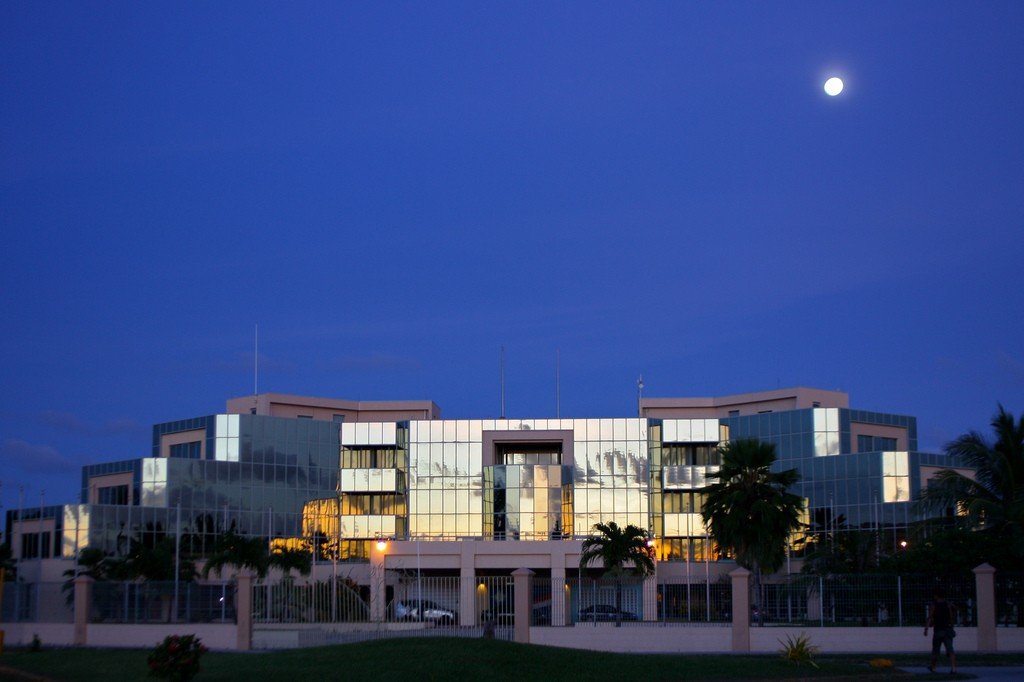
.Tourists will also enjoy the sorghum processing factory and the modernist Capitol building, the Ocean Reefs and Aquariums (ORA) marine farm famous for its giant clams (organized tours are offered 3 times a week for approximately $5 per person), and the traditional Marshall Islands Canoe House (Waan Aelon) in Majulee, near Marshall Islands Resort, the Tobolar copra processing factory, and a monument to the victims of the 1918 typhoon at the tip of Laura (since typhoons are rare in this area, the 1918 hurricane that struck the southern atolls and killed 200 people was long remembered by the locals, as was the Japanese Emperor’s contribution to the rebuilding of Majuro).
Majuro can be traveled around Majuro by cab or bus. Other islands in the archipelago can be reached by boat or by local airlines.
The international airport (Marshall Islands International Airport, or Amata Kabua International Airport) is based in the southern part of the atoll.
.