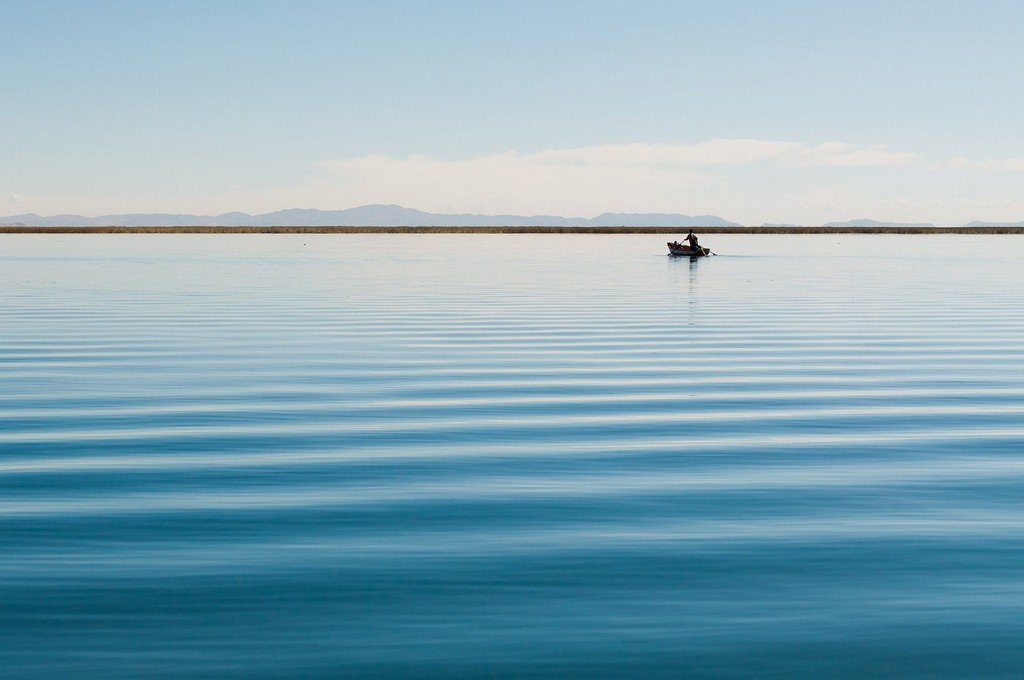
Lake Titicaca
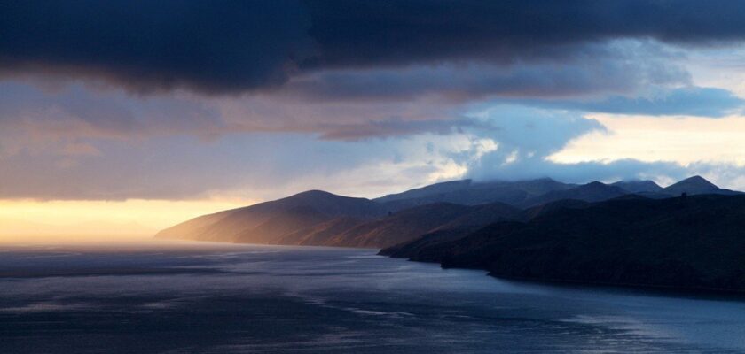
This attraction is related to the countries:PeruBoliviaTiticaca is a high-altitude lake located at an altitude of 3,812 meters in the Andes Mountains on the border of two South American countries, Bolivia and Peru. It is the largest freshwater lake in South America, the second largest lake in South America by surface area (after Lake Maracaibo, which is also sometimes considered a sea bay), and the world’s highest navigable lake. According to legends, at the bottom of the lake lurk countless treasures of the ancient civilization that once inhabited this territory. The body of water is surrounded by many myths and mysteries and has been a favorite among explorers and seekers of adventures and precious treasures for many hundreds of years.
Video: Lake Titicaca
” title=”YouTube video player” frameborder=”0″ allow=”accelerometer; autoplay; clipboard-write; encrypted-media; gyroscope; picture-in-picture; web-share” allowfullscreen> Contents- General information
- Name
- Ecology
- Animal life
- Climate
Legends of Lake Titicaca - Sights of Lake Titicaca
- Interesting facts
- Useful information
General Information
Titicaca is located between two Andean mountain ranges in the northern Altiplano on the border of Peru and Bolivia. The western side of the lake is located in the Puno region of Peru, the eastern side is located in the department of La Paz, Bolivia. The snow-capped Cordillera Real, over 6,400 meters high on the northeastern (Bolivian) shore of the lake, is one of the highest peaks of the Andes.
.The lake consists of two, almost separate basins connected by the 800 m wide Strait of Tiquina at its narrowest point. The average depth of the large basin is 135 m, with a maximum depth of 284 m. The average depth of the small basin is 9 m and the maximum is 40 m. Overall, the average depth of the lake is 107 meters, but the bottom slopes sharply towards the eastern shore of Bolivia, reaching its greatest depth of 284 meters near Soto Island.
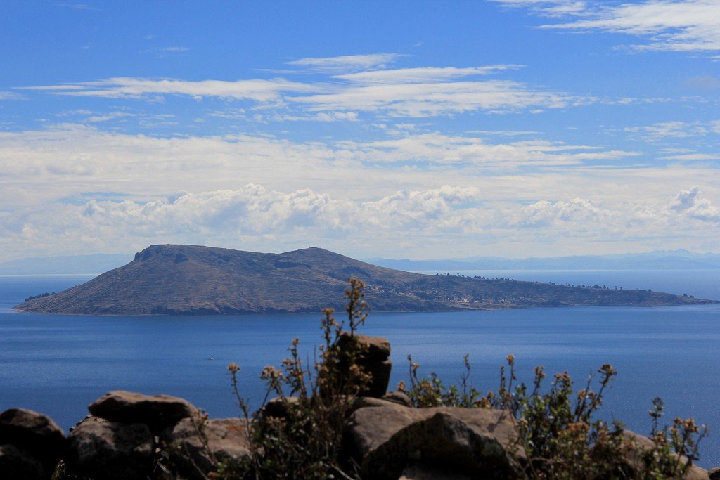
.Titicaca has 41 islands, some of which are densely populated. The largest of these, Isla del Sol, is near the city of Copacabana in Bolivia.
.
Water in Lake Titicaca comes from a combination of precipitation and meltwater. Glaciers in the mountains and throughout the high plateau feed approximately 27 rivers (five of which are major rivers), which then drain into the lake. The Ramis River is the largest of all. Flowing into the northwestern part of the lake, it accounts for about 2/5 of the water of the entire Titicaca basin.
.
Titicaca is almost a closed lake. Many rivers drain into it, but only the small Desaguadero River serves as the only water outlet. The Desaguadero drains about 10% of its water and then flows into Lake Poopo. The remaining 90% of the water is lost through evaporation by the hot sun and strong, dry Altiplano winds.
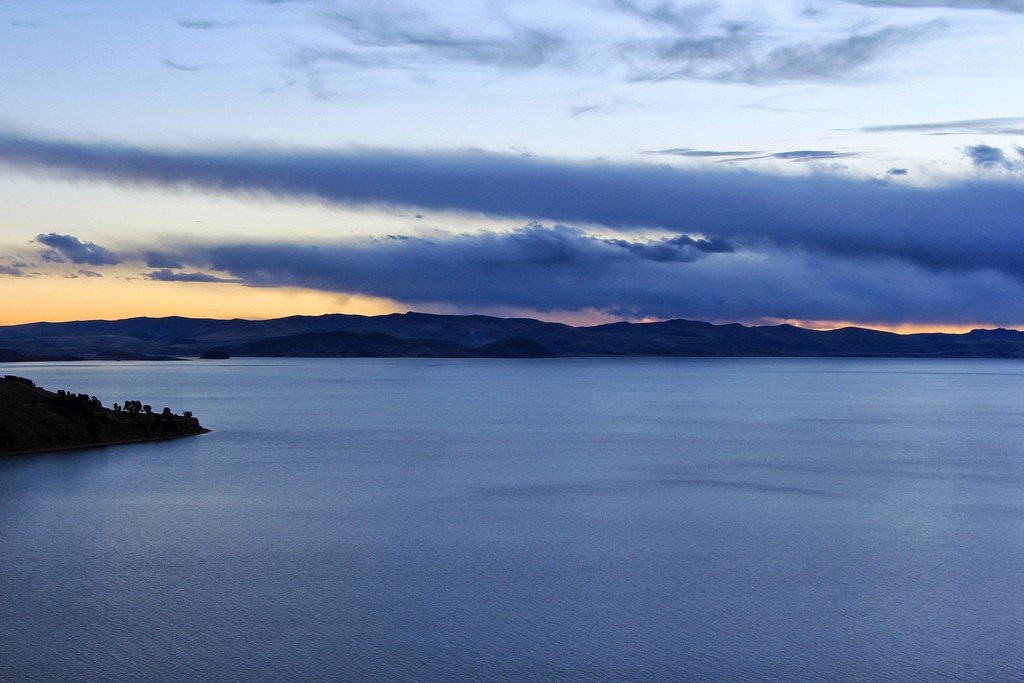
The level of Titicaca fluctuates seasonally throughout the year. The lake level rises during the rainy season (summer, December through March), and falls during the dry winter months. It was previously thought that Titicaca was slowly drying up, but modern research refutes this claim: the cycle of rising and falling water is more or less stable.
.Name
The lake got its name, Titicaca, from the Spanish. It consists of two words: “titi” (puma) and “caca” (rock), which means “mountain puma” in Quechua Indian language. The Aymara and Quechua peoples called the reservoir “Mamacota”. Even earlier, before the appearance of these peoples in the area, the reservoir was called “Lake Puquina”, i.e. it was located in the territory of the country of the Puquina people, which has now ceased to exist.
.Ecology
With only 10% of its water flow, Titicaca is effectively a closed lake. Millions of cubic meters of sewage are dumped into the lake each year. Waste discharged by industries decomposes in the water, producing methane, which poses a significant threat to the lake’s ecosystem. Unless urgent action is taken to protect the environment, Peru and Bolivia may just lose some of their unique treasure.
.Animal life
Lake Titicaca has a significant population of resident, migratory and rare bird species (over 60 species). For this reason, the lake was listed as a wetland of international importance on August 26, 1998. The endangered Titicaca flightless grebe inhabits the lake. Other birds include the cormorant, Chilean flamingo, thin-billed carawai, Andean swallow, common quack, and ducks.
.
There are 18 species of amphibians in Lake Titicaca, of which the Titicaca whistling frog is the most famous. These frogs live under rocks in the marshy and deep areas of the lake, rarely coming to the surface. Large skin and small lungs indicate that the frogs breathe underwater.
.
As for mammals, due to the high altitude and extreme temperatures, there are only a few species in the Lake Titicaca area. These include the vizcacha (a rodent similar to our rabbit), wild guinea pig, Andean wolf, llamas, alpacas, Andean skunk, and Andean fox.
In the 1930s and 1940s, non-native fish species were released into Lake Titicaca as economically more valuable than native species. The native fish species have since become rare and endangered. For example, one of them (orestrias cuvieri) became extinct after failing to compete with the lake char cristivomer released in the 1930s. The most common fish species today is trout (lake trout and rainbow trout). Trout became so accustomed to the lake that a cannery was opened in 1961, although it lasted only nine years.
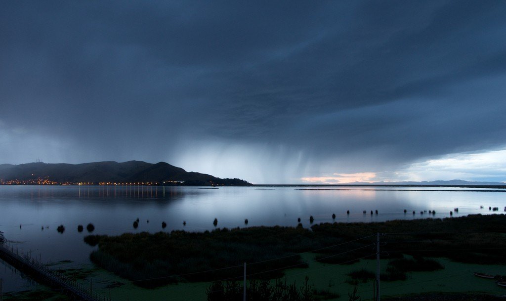
.Climate
Lake Titicaca is in the alpine belt, with cool and low temperatures characteristic for most of the year. The average annual precipitation is 610 mm. Winters are dry with very cold nights and warm weather in the afternoon.
The average temperature at the water surface varies from +10 to +14 °C. During winter (June-August), the temperature stays between +10, +11 °C as a result of mixing with deeper waters.
.
Legends of Lake Titicaca
Lake Titicaca is considered the cradle of the Inca civilization, Teotihuacan and other Andean peoples (Aymara, Quechua). According to Inca mythology, that once upon a time from time immemorial, the world experienced terrible cataclysms that caused a flood. The earth was plunged into an abyss of darkness and cold, and the human race was on the verge of extinction. Some time after the Flood, the god Viracochi emerged from the depths of Lake Titicaca. Traveling to the islands of Amantani, Isla del Sol and Isla de la Luna, Viracochi ordered the Sun (Inti) and the Moon (Mama-Kilya) to rise. Then, traveling to Tiahuanaco, he re-created man and woman and sent them off to all four sides, beginning the repopulation of the world. Tiahuanaco remains to this day a sacred site of the Andes.
.
Believing that the Sun and Moon first originated on Isla del Sol and Isla de la Luna (islands in the middle of Lake Titicaca), the Incas built temples to worship the celestial forces of nature, and the region itself became a popular pilgrimage route long before Europeans arrived here. The islands were so important that the Inca rulers themselves traveled to the lake to worship the shrines. Archaeologists studying the islands have discovered shrines dating back to 500 B.C., meaning that these islands were considered sacred sites of previous civilizations that preceded the Incas. The lake region once served as the cradle of the Tiwanaku civilization, which reached its peak around 600 BC but faded into obscurity around 1200 AD. The Incas did not create something new, they simply usurped the sacred sites of previous civilizations.
.Lake Titicaca sights
Исла-дель-Соль
Located in the southern part of Lake Titicaca, Isla del Sol (Isla del Sol) is one of Bolivia’s most famous places. According to legend, this is where Manco Capac, the founder of the Inca state, and his wife Mama Ocllo (Adam and Eve to the Incas) were born. Geographically, the area is a rocky and hilly island. There are no automobiles or paved roads. The population is about 5,000 inhabitants and their main economic activities are based on agriculture, fishing, tourism and subsistence farming.
.Isla del Sol has more than 80 archaeological ruins. Most of them date back to the Inca period (around the 15th century AD).
.
Highlights of Isla del Sol:
.- The Chinkana ruins are a huge complex of stone labyrinths that served as an educational center for Inca priests. Near Chinkana is the sacred Inca stone from which their civilization originated. Yumani/ Inca Steps. If you arrive by boat to the village of Yumani, you will have to climb 206 steps to get to the central part of the village. These steps are original Inca constructions, and lead to three sacred springs, called the source of youth..
- Pilko Kayna. From the top of the Inca steps, a path leads to Pilko Kayna (literally translated as “the place where the birds sleep”). This 14-room complex may have been used as a fortress to protect the young girls who lived nearby on Isla de la Luna (Isla de la Luna). You can get a good view of Isla de la Luna from here.Most tour operators offer a day trip from Copacabana to Isla del Sol with a fleeting stop at Isla de la Luna. You’ll leave Copacabana at 8:15am and arrive at the village of Challapampa around 10:30am. The main attraction of this place is the Chinkana (a labyrinth built by the Incas). If you wish, from here you can walk along the entire island (9 km long) and reach its southern tip. Many tourists make a trek through the hilly terrain, during which you will see wild llamas, ancient Inca ruins, local villages, rocky hills. As a matter of fact, the main attraction of Isla del Sol is hiking from one end of the island to the other. You can choose several routes, but if you do not follow the main one, you may not be back in time for the boat departure back to Copacabana at 16:00. Keep in mind that the crossing is quite grueling, taking over 4 hours, so you won’t even have time to rest and have a proper lunch. Otherwise you won’t get to the other side of the island in time, hence you won’t catch the last boat to Copacabana. The crossing at an altitude of almost 4000 meters with a series of steep ups and downs is quite grueling, so don’t forget to take food, water and sunscreen on the road.
Most tourists visit Isla del Sol on a day trip, but it is possible to stay in hotels here. After waiting for all the day-trip tourists to leave the island, you will feel the freedom here. Stay overnight and feel the magic of the beautiful island, the cradle of the Inca civilization.
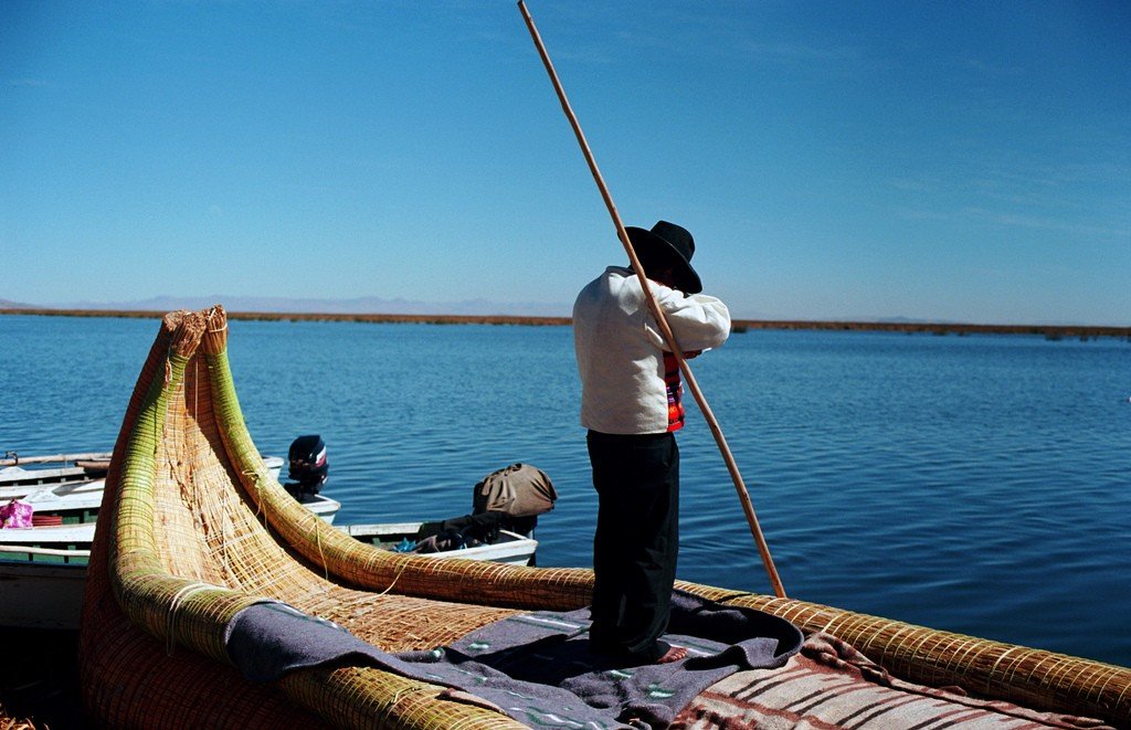
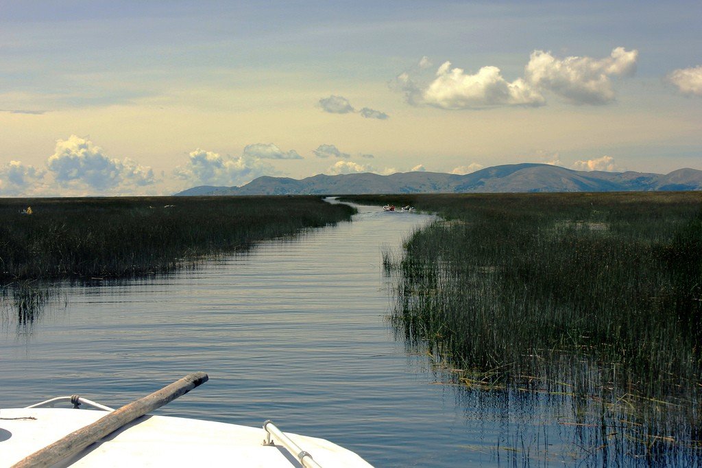
.Uros Islands
The reedy Uros Islands are located on the Peruvian side of Lake Titicaca, a 30-minute boat ride from the coastal city of Puno. The Uros Islands are one of the popular attractions of Lake Titicaca. At the time of the arrival of the Incas in the 13th century, the Uros lived on the coast. They forced themselves to create artificial shelters in the middle of the lake and did not submit to the powerful Inca Empire. The Uros are proud of their accomplishments, literally creating the land for themselves. The Inca civilization has long since faded into oblivion, but the Uros culture still exists today.
.Totora reed is a vital material for the Uros. They live on it, sleep on it, use it for food, and make tea from the plant’s flower. Just as the highlanders of the Andes rely on coca leaves to adapt to the harsh climate, the Uros rely on totora reeds in a similar way. From the totora reeds, the Uros build their floating islands. When the reeds dry out, they begin to break, absorb water and rot under the weight of humans, so new stalks must be added constantly. In the dry season this procedure is done once every three months, in the rainy season the reeds are replaced more often. The island has a life span of about 30 years. To date, there are 42 floating islands woven from totora reeds.
.
The largest islands are home to up to ten families, while smaller ones have two or three. The Uros cook their food over a fire stacked on top of rocks. There are no doctors or hospitals on the islands, so people rely on themselves. Traditionally, men help their wives give birth in their huts. A missionary school operates on one of the larger islands. The religion of the Uros is a mixture of traditional Indian and Catholic faith. It is customary for dead Indians to be buried on the mainland.
Traditionally, the islanders have lived off fishing in Lake Titicaca, bird hunting, and trading with the Aymara Indians, but today tourism has become a major source of income. A census in 1997 showed that only a few hundred of the 2,000 Uros descendants remain on the floating islands. The rest have already moved to the mainland.
.Until a few decades ago, the Uros Islands were cut off from the outside world. Today they are crowded with tourists. The development of tourism on Lake Titicaca in the last two decades has significantly changed the traditional way of life of the Uros. They have learned to make handicrafts and make a good living from it. Why work when you can take pictures with tourists and get tips for it? Or, without asking for their wishes, put tourists in their reed boats, take them around their floating island and get $10 for it.
.
You can learn a lot of interesting and informative things while visiting the famous floating islands of Lake Titicaca, however, many tourists leave very disappointed. Yes, it is interesting to see and listen to stories about how the natives build their floating island, learn about their customs and culture, how they sleep, cook food and so on, but the Uros Islands have long been turned into a place where tourists are “milked” for money. As soon as you get off the boat, its inhabitants immediately pose for photos (for money, of course), try to put on the guests traditional clothes, impose souvenirs at an obviously inflated cost. And on top of all this, you are forced to make a short voyage on their reed boats for 10 US dollars. There is little authenticity left here now, everything is built for tourists and it feels like you are visiting the islands just to make the inhabitants a little richer.
.
Takuile Island
Tacuile Island was one of the last places in Peru to be conquered by the Spanish conquistadors. It is located on the Peruvian side of Lake Titicaca, 45 kilometers from the coastal city of Puno. The 5.5 km by 1.6 km island is home to about 2,200 locals.
.
The islanders are known for their high skill in making high quality handmade textiles. Women only make yarn and weave. From the age of eight, knitting is exclusively done by men. All local people are dressed in traditional clothing, its production is an important part of their daily life, and it can be used to determine a person’s social status. In 2005, UNESCO proclaimed the textile art of the people of Takuile Island a “Masterpiece of the Oral and Intangible Heritage of Humanity.”
.
Unlike the Uros Islands, one can feel quite comfortable on Takuile Island. The local society, is based on the principles of collectivism and the moral code of ama sua, ama llulla, ama qhilla (don’t steal, don’t lie, don’t be lazy). There are no police or dogs on Takuila – no one breaks laws here, and therefore police and dogs are not needed to protect property. All decisions are made at meetings held on Sunday in a small village in the north of the island. On Takuila there is no electricity, no clinic and no roads, only paths and steps. There are also no hotels here – visiting tourists take turns sleeping in the homes of locals. Great food, kind people, and the atmosphere will make us feel welcome. The islanders live a subsistence economy and use only what they have made or grown themselves, except for some products (tea, sugar, rice). Their textile craftsmanship deserves the most flattering praise. A stay on this island usually ends with the purchase of these very products from local artisans. Receiving about 40,000 tourists annually, the well-being of the islanders is largely based on income from the tourist business..
Surikui Island
Suricui Island is located in the Bolivian part of Lake Titicaca. Suricui is considered the last place where the art of reed boat building survives. The artisans of Suricuí helped in the construction of several boats for Thor Heyerdahl, the famous traveler. The Ra II boat, built with the help of local craftsmen, successfully crossed the Atlantic Ocean in 1970. The famous Norwegian traveler’s previous expedition, organized in 1959, had failed due to design flaws in the boat that caused the porous reeds to absorb water and the boat began to sink. After making the 5,000-mile journey, the crew was forced to abandon it.
.
In 1970, to organize the Ra II expedition, Heyerdahl contacted specialists on the island of Surikui to build a boat out of reeds. They traveled to Morocco and participated in the construction of Ra II. In his book about the expedition Heyerdahl emphasized: “Their knowledge of building large boats was so perfect that no engineer, shipbuilder, or archaeologist could compete with them.” The boat successfully crossed the Atlantic Ocean, thus proving that our ancestors could make the journey to the New World.
- There are a huge number of legends, including the underwater city of Wanaku at the bottom of Lake Titicaca, where it is believed the Incas hid gold from the Spanish conquistadors. The story of lost treasures prompted the famous French oceanographer Jacques Yves Cousteau to explore the lake in a submarine in 1968, but he managed to find only ancient pottery. The influential American magazine National Geographic undertook a scientific expedition in 1988, but also without much success. .
- In 2000, archaeologists discovered the ruins of an ancient temple at the bottom of Lake Titicaca. The age of the archaeological site dates back to about 500-1000 AD, meaning it existed before the birth of the Inca civilization. It is associated with the civilization Tiwanaku Tiwanaku, the center of which was located near the eastern shore of Titicaca on the Bolivian side. The dimensions of the ancient temple are 200 meters by 50 meters, roughly the area of two medium-sized soccer fields.
- The highest cultivated piece of land in the world is in the Lake Titicaca region – barley is grown here at 4,700 meters above sea level. At this altitude, the grain never matures, but the stalks serve quite well as fodder for llamas and alpacas. These pack animals are an important source of meat for the Indians and serve as pack animals.
- The Bolivian Navy has a total of 173 small vessels, mostly stationed on Lake Titicaca. During the Second Pacific War (1879-1883), Bolivia lost access to the sea, and now contemplates regaining its status as a maritime power in the future. In 1862, the first steamboat, assembled in England and transported in parts by mule to the lake, began operating. Today, ships make regular trips from Puno, on the Peruvian coast, to the small Bolivian port of Guaqui. A narrow-gauge railroad connects Guaqui to La Paz, Bolivia’s capital. One of the highest railroads in the world runs from Puno to Arequipa and the Pacific Ocean, linking landlocked Bolivia to the Pacific Ocean..
- June through September is the peak tourist season. The main cities to visit the Lake Titicaca area are Puno in Peru and Copacabana in Bolivia.
Useful information
Visiting Lake Titicaca from the Bolivian side is a little different than from the Peruvian side. Copacabana on the Bolivian side is a touristy town, full of hotels, restaurants and bars. It’s a much nicer place to spend time, there are a few Inca ruins in the neighborhood, and tours to Isla del Sol depart from the marina in this town.
.Puno is primarily a city and secondarily a tourist center, it is quite dirty and unattractive. There’s not much here to interest tourists. But next to Puno are the floating islands of Uros, one of the main attractions of Lake Titicaca.