La Palma Island
La Palma is one of the Canary Islands. The island has two names, La Isla Bonita (The Beautiful Island) and La Isla Verde (The Green Island), and both suit it just fine. It is the only island in the Canary archipelago that has rivers, albeit very small ones. La Palma is the highest island in the world in proportion to its area. The height of the highest mountain, Roque de los Muchachos, is 2423 meters above sea level, so on its top is located the largest astrophysical observatory of the Northern Hemisphere. La Palma is a rather quiet place with only 80 thousand inhabitants engaged in rural labor. It is a fertile island with a good irrigation system. It has two small resorts, Los Cancajos on the east coast and Puerto Naos with a dark sandy beach on the sunnier west coast. Another center is in Los Llanos, near the spectacular Cal Dera de Taburiente and the national park. This giant volcanic crater (10km in diameter) is clearly visible from viewing platforms, which can be reached on foot. La Palma’s ridge of volcanic cones and craters ends with the southernmost volcano, Tenegua, which last erupted in 1971.
.
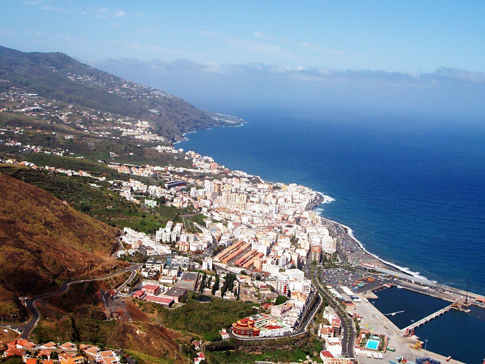
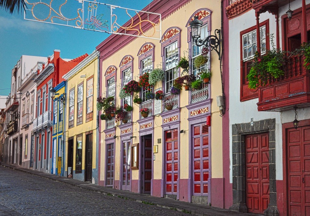
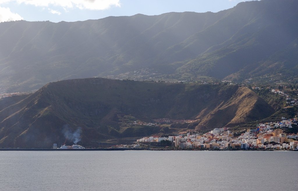
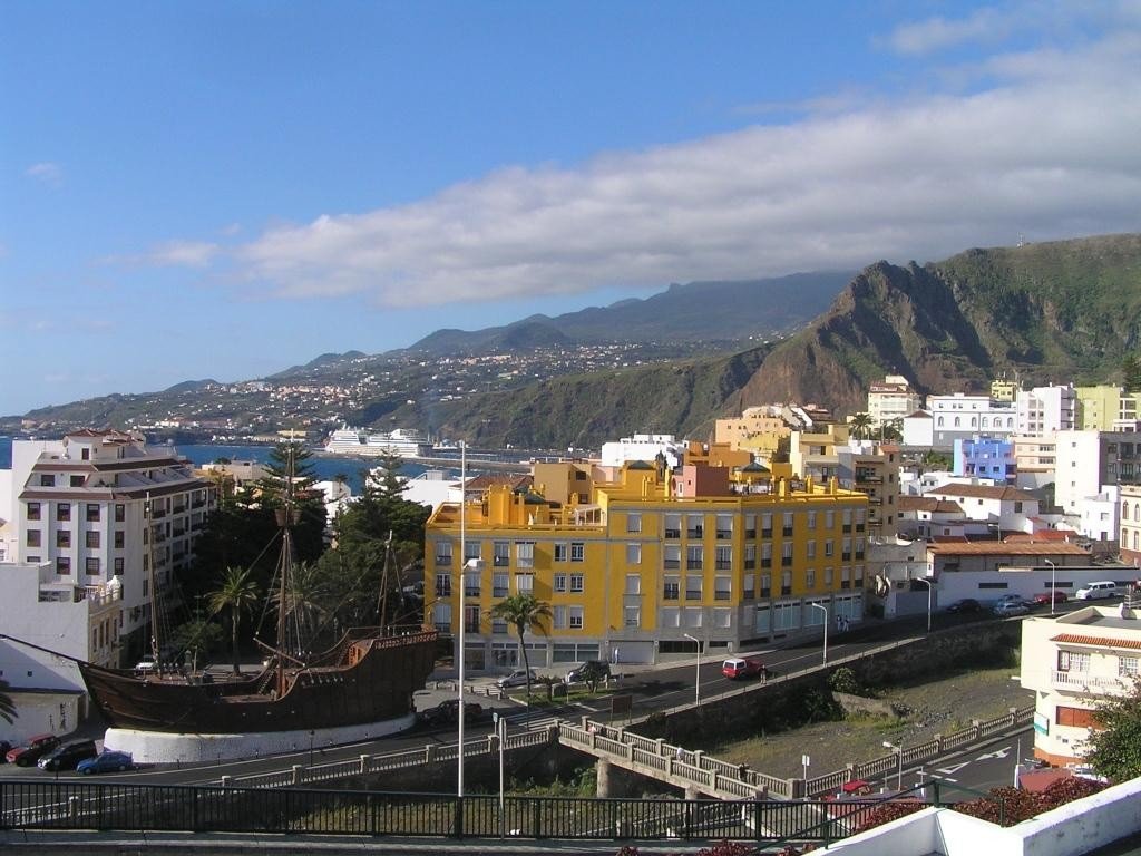
The island’s main town, Santa Cruz de la Palma, was once a major port; a charming coastal quarter with Renaissance houses and picturesque houses with distinctive openwork balconies remains. Explore El Salvador Church, then walk to the pretty Santo Domingo Square. Local cigars, silks, embroideries and wicker baskets are sold here. Try some tea (pine) wine.
Video: La Palma
South Road
Moving west from Santa Cruz, make your first stop at Las Nieves. This town is built on the side of a mountain. You’ll first see a roadside bar, followed by the Royal Monastery of Nuestra Señora de las Nieves, home to a highly revered terracotta statue of Our Lady of the Snows, which legend says appeared in Rome during a snowfall in August. The statue dates back to the XIV century. The feast of Our Lady of the Snows is celebrated on August 5. A special feast is organized every five years (2015, 2020, etc.). On this day, the statue is carried to Santa Cruz. The procession is called La Bajada de la Virgen (The Descent of Our Lady).
.Then enter the tunnel under the La Cumbre Nueva mountain range. This ridge runs through the very center of the island. Beyond the tunnel is the tourist center of the Caldera de Taburiente National Park. The main road then heads west to El Paso, a charming town where mighty prickly cacti tower around traditional houses. Outside the town is Paraiso de las Aves Park (open: daily 10 a.m.-5 p.m., entrance fee). The park is home to rare exotic birds. Excursions and educational programs are organized here. Also of interest is the Los Llanos de Aridane estate, located in the heart of the fertile valley. Here you can explore the traditional architecture surrounded by lush green gardens.
Before the southernmost part of the route, you can veer off to the El Timé mirador. This lookout above the picturesque valley has a restaurant and offers stunning views. From here you can also walk down to Tasacorta, a beautiful seaside town with many excellent fish restaurants. It was at this port that the Spanish conqueror Fernandez de Lugo landed on La Palma in 1492.
.
Follow the main road further south to Fuencaliente. This town is famous for its wonderful wines. The serpentine winds between the hills, which in spring are covered in bright colors, and leads to the El Faro de Fuencaliente lighthouse, located at the southernmost point of the island. The first stop is the Bodegas Carballo Wine Cellar (open: daily 11 a.m.-8 p.m., tel: 922-444-140), where you can taste surprisingly strong local wines and purchase one to your liking.
.In 1677, the San Antonio volcano erupted. The once fertile land was covered with a thick layer of ash – the layer was up to 2 meters deep. At the end of the century, local farmers developed a special way of farming. They dug deep trenches to reach the fertile layer of earth, planted vines and then covered them with volcanic ash. Thanks to this, the grapes calmly withstood the weather and even resisted phylloxera, which at the end of the XIX century ruined the vineyards of Europe.
.
Just off the road, you can explore the San Antonio Volcano (the visitor center is open daily 9.00-18.00) and go to the observation deck that sits above the crater. Today the crater, blown by all the winds, looks quite peaceful. You can’t even believe that once it could have caused so much damage. A little further south, you’ll see other signs of volcanic activity. The Teneguia volcano erupted in 1971. Fortunately, human casualties were avoided. The eruption sent lava flows into the valley – you can still see the petrified black lava on the mountainsides today, and the road is pierced right through it. Surprisingly, bananas seem to like these conditions and grow everywhere. (To learn about the history of banana growing in the Canary Islands, visit the small Banana Museum: Camino San Antonio; El Charco, Tazacorte; open: summer Mon-Fri 10.00-13.00, 16.00-19.00, winter Mon-Fri 10.00-13.30, 15.00-19.00.)
.As you approach the sea, you come to the small black beach of Playa de Samora. The beach is surrounded on both sides by surreal lava fields. Just off to the side, between two lighthouses sits a small fishing cove with a pebble beach. Stop by a beachside restaurant that serves deliciously fresh fish.
.Returning to Santa Cruz, stop at the Belmaco Archaeological Park (open: Mon-Sat 10 a.m.-6 p.m., Wed 10 a.m.-3 p.m., admission fee). The first archaeological discoveries in the Canary Islands date back to the 18th century, when ten cave settlements were discovered, inhabited by the Benaorites, the ancient inhabitants of Benaoare (as La Palma was called by its ancient inhabitants).
.
A little further on is the town of Maso, where you can buy replicas of ancient people’s wares, as well as local cigars. On the Feast of Corpus Christi (May / June), the streets of Maso are covered with real carpets of flowers, leaves and sand.
.
North Road
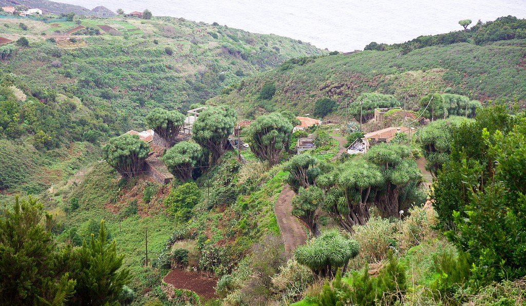
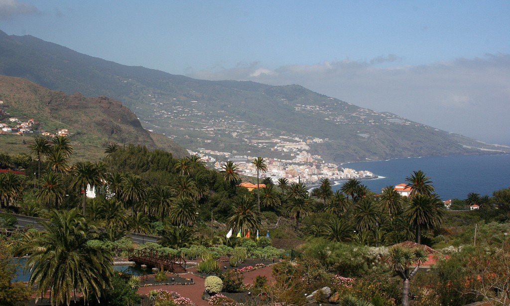
A scenic serpentine winds along the east coast of La Palma. Stop at the mirador of San Bartolome for a great view of the coast. Drive up to the seaside town of San Andréa, where you can swim in the natural pool of El Charco Azul. A little further off the coast, beyond San Andrés, begins the dense Bosquede Los Tiles forest of native Canarian laurel, which has become increasingly rare in recent years. Today this forest is a biosphere reserve and is protected by UNESCO. Maps and information about hiking are available at the Visitor Center (open: Mon-Fri 9.00-17.00).
.The northern part of the island is worth a trip if only to visit the Caldera de Taburiente National Park. The visitor center (open: daily 9 a.m.-2 p.m., 4 p.m.-6:30 p.m.) is located outside the park, on the road to El Paso. Here you can learn about the geology and geomorphology of the region, the flora and fauna, find out about camping opportunities and get a color-coded diagram of the hiking trails. The Caldera de Taburiente is a giant crater 1500 meters deep and 10 km in diameter. The crater originated 400,000 years ago. Today it is a green fertile valley.
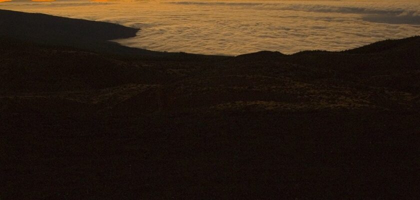
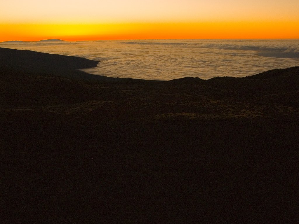
.From the tourist center, you have to drive 7 km to the mirador of La Cumbresita on a road through a wooded gorge, which is surrounded by peaks shrouded in fog. The viewpoint offers great views when the weather permits (which is not always the case). From here you can see the Roque de los Muchachos and the monolithic rock of Roque Idafe – believed to have been a sacred Guanche altar. You can drive through the caldera by car, but to feel the beauty of the place, it is better to hike..Heading to the caldera from the north, you need to turn off after Santa Cruz on the serpentine, which passes by Pico de las Nieves to Roque de los Muchachos – the highest point of the island (2426 meters above sea level). There are many ways to get here, but you should never forget the weather. Just because the weather is good on the coast doesn’t mean it will be the same at altitude. The weather changes very dramatically and quickly. When going to the mountains, stock up on raincoats, jackets and sturdy shoes. In addition to the beautiful views, you can check out the futuristic Astrophysical Observatory on the mountain (closed to the public except on special days in the summer; for information, visit www.iac.es). This is the most significant observatory in the Northern Hemisphere. It houses one of the world’s largest telescopes, the 400-cm Herschel Telescope. William Herschel telescope.
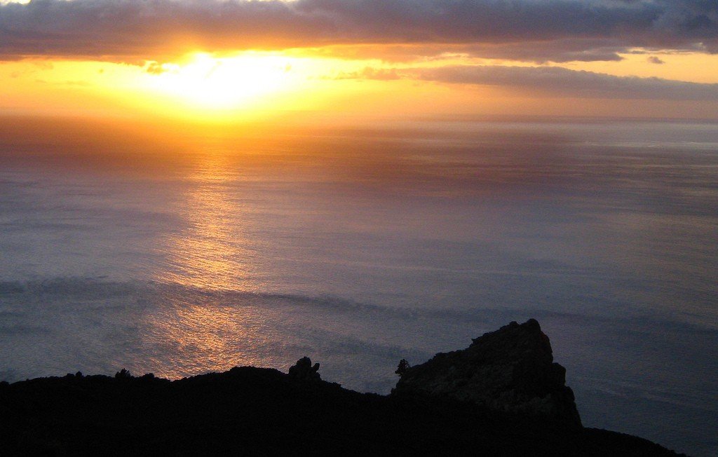
.From the observatory, the road heads northwest to the isolated village of Santo Domingo de Garafia. Powerful waves of ocean surf crash against the coastal cliffs. In places like this, one realizes more than anywhere else the weakness of man in the face of the forces of nature.
.Exploding Island
La Palma is the most volcanically active island in the archipelago. The last eruption of the Teneguia volcano occurred in 1971.
The temperature of the soil near the crater is still very high.