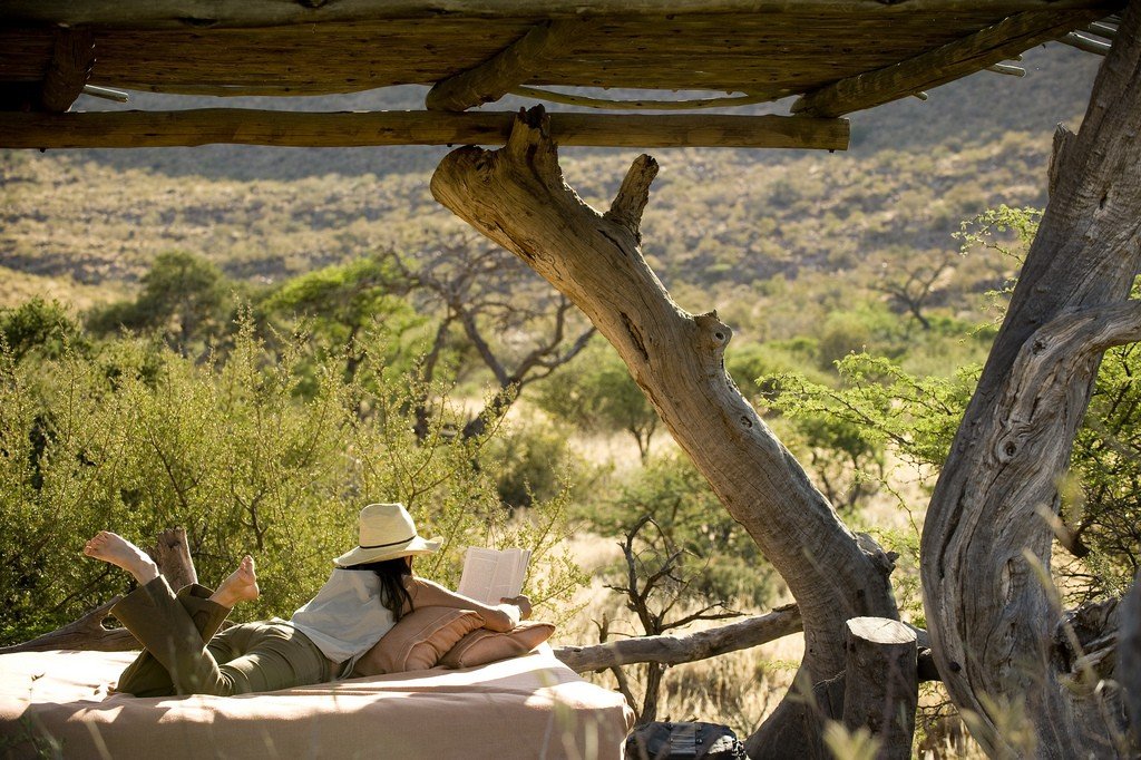
Kalahari Desert
This attraction is related to the countries:BotswanaBOTSWANA , SOUTH AFRICANamibiaThe Kalahari Desert is the largest of South Africa’s deserts, almost completely covering Botswana and occupying a large part of South Africa and Namibia. The Kalahari covers an area of about 600,000 square kilometers, but the desert is steadily growing in size and is already encroaching into Angola, Zimbabwe, and Zambia. The Kalahari is the largest expanse in the world covered entirely in sand, with no rocky areas as in the Sahara.
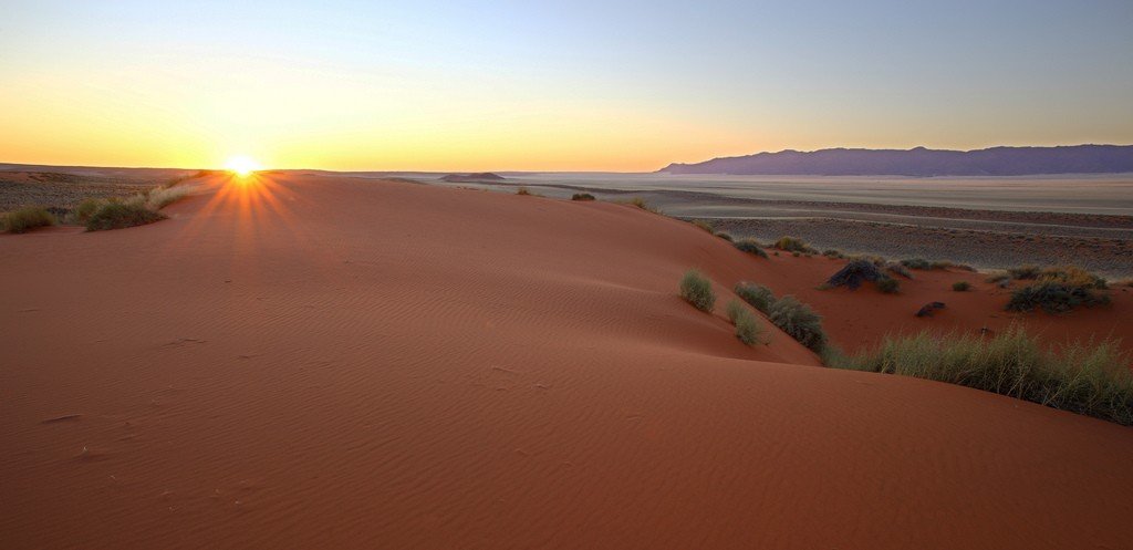
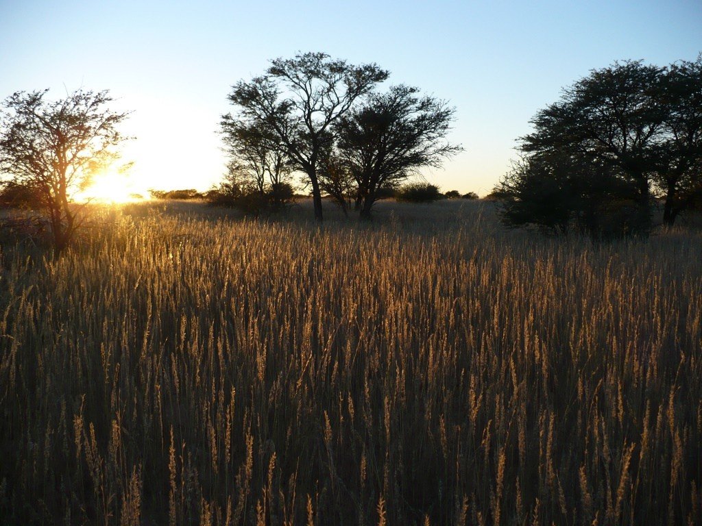
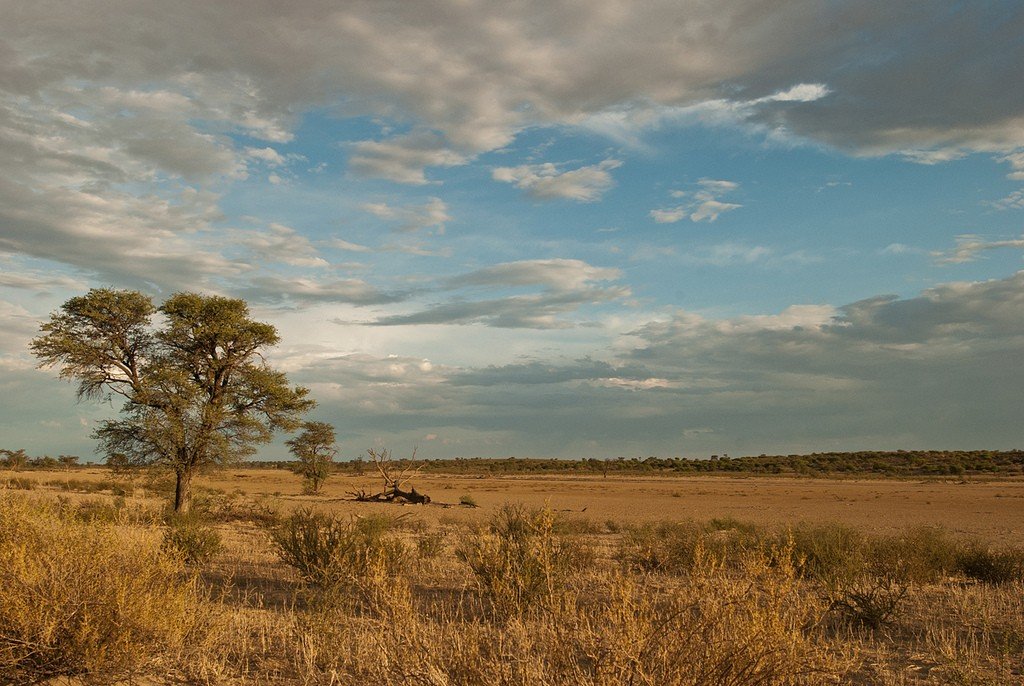
.The Kalahari is one of nature’s greatest monuments, created by the forces of fire, wind, water and sand. Approximately 65 million years ago, vast lava flows covered central South Africa. These undulating seas of lava, in places up to 8 kilometers thick, formed high ridges and deep river valleys. Gradually, under the action of wind and rain, the jagged landscape became flat, the mountains were eroded, and the valleys were filled with clay. Finally, huge amounts of sand brought here by the wind from the coast formed a flat, multi-colored plain the size of South Africa.
- Title
- Climate
- Relief
Flora and fauna - Population
- Interesting facts
Name
The word “Kalahari” is most likely derived from the Botswana word “curry-carry” – “thirsty”. The Bantu tribes living on the borders of the desert add to its name the epithet “kho-fu” – “terrible”. And all other variants of the origin of the name are reduced to the idea of “the land without water” (“Kgalagadi”). The concept of “desert” most often carries a negative meaning. But for nature it is a natural combination of geographical circumstances. Each desert has its own unique world. And any disruption of the biological balance due to increased heat or humidity can lead to unpredictable consequences. And the immutability and slowness of its life look so only at first glance.
.Climate
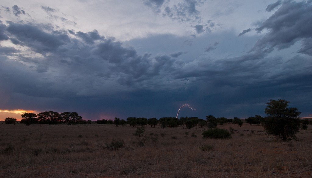
The climate of the Kalahari Desert is arid with summer maximum rainfall and mild winters, with aridity increasing towards the southeast. Precipitation (up to 500 mm) is confined to the summer period (November to April), but varies considerably both in time and area. Local variability is important for the recovery of drought-affected vegetation. Moderate droughts are typical once every 3-5 years, severe droughts once every 10 years.
.The Kalahari is one of the hottest areas of South Africa. The average maximum temperature is plus 29° and the average minimum temperature is plus 12°, with an evapotranspiration of 3,000 mm. Generally mild winters can be characterized by occasional hard frosts. The wind regime of the desert in the basin of the Molopo and Nosob rivers is characterized by constant dominance of north-western winds. Because of this, the sands move progressively to the southeast.
.Relief
The boundaries of the Kalahari in the south are the Molopo River. Molopo River to the west, the high plateau of Namibia to the west, and the Bushveld and plains of the Transvaal to the east. The Kalahari Desert occupies the southwestern part of the depression of the same name (its area is 2, 5 million square kilometers), located at an altitude of 900 meters. It occupies a syneclise in the body of the African platform, filled with continental Mesozoic and Cenozoic sediments formed as a result of weathering of rocks within the depression itself. On its periphery, marginal plateaus and mountains rise above the sandy plains. In the west, the edge of the Kalahari lies 1,500 meters above sea level, and even higher in the east; the lowest point of the desert is 840 meters above sea level. The surface of the Kalahari is composed of Tertiary and Quaternary horizontally lying continental strata (Karru layers) of sandstones, gravels, and breccias.
Three formations are distinguished in this continental strata. The lower one, or the Mantel Formation, is composed of sands, sandstones and gravels; the middle suite of sands, silicified sandstones and chalcedony limestones of Late Cretaceous age overlies the Mantel Formation unconformably and, in turn, is unconformably overlain by a suite of ochreous sands of Late Tertiary age. Above it are modern sediments with a thickness of 100-150 m, represented by iron-ore sandstones and gravels, red sands of “Kalahari type” and medium-grained aeolian sands.
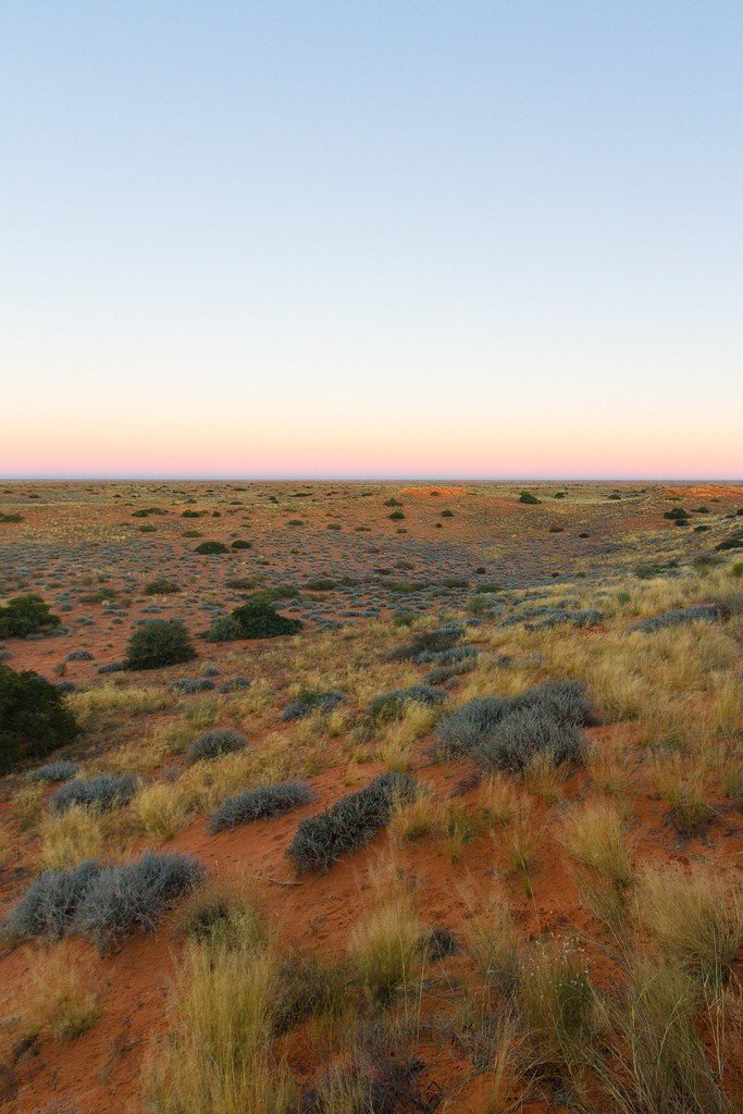
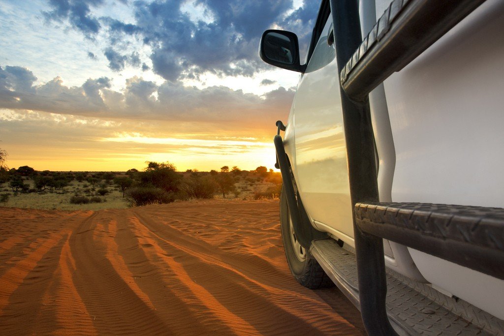
.The entire territory of the Kalahari is occupied by sand dunes, located, as a rule, in chains at a distance of 70-150 m from each other. Especially frequent is the cluster of longitudinal dunes – alab – in the vicinity of the Molopo and Kuruman rivers. Several types of Kalahari sands are distinguished here. The most common are the red sands, whose color can vary from bright pink to red to almost brown due to the presence of iron oxides.
.
The origin of red sands owes to the long-term destruction of Tertiary sandstones. Their grains are angular or rounded, mostly quartz, chalcedony or siliceous; mica and heavy minerals such as granite, tourmaline, zircon, etc. are also present. .Sands are predominantly fine-grained. Grain sizes are most often 0.15-0.4 mm; the fine fraction of sand is 30-65%.
.
Red-colored dunes are often referred to as the “red toes” of the Kalahari. Paleogene sandstones, when weathered during the Miocene arid period or even earlier, formed strata of light-colored sands due to their calcareous coating. These sands are known as the Kalahari sands. They are also present in Zambia, Congo, and South Africa.
It is believed that the Kalahari sands were transported by strong southwesterly winds from the Namib Desert, on the other hand, which is more likely, it is believed that much of the aeolian sands were formed in the process of dispersal of the ancient alluvium of the now dry rivers Molopo and Nosob and their tributaries. It is quite obvious that in the Quaternary time these rivers were high-water and brought a considerable amount of loose material, which occupied an extensive area. The Kalahari is characterized by the presence of “singing sands.”
The closed nature of the Kalahari Depression has determined the pattern of runoff. The transit rivers and temporary streams draining it are directed towards the center of the depression. The largest of these are the Nosob, Molopo and Awob. Their valleys are cut by several dry channels – omuram-bas; some of them are filled with water during the rainy season. The valley of the Nosob River is up to 3 km wide. Alluvial deposits of the rivers are strongly sandy. Therefore, quite thick accumulations of aeolian sands in the form of parallel rows of dunes (barchan chains) stretching for tens of kilometers (their height up to 15 m) with a general orientation from northwest to southeast are common here.
.The average height of ridges above inter-barchan depressions is about 8 m (maximum – up to 300 m). The average distance between chains (crest to crest) is about 225 m (minimum – about 35, 5 m, maximum – 460 m).
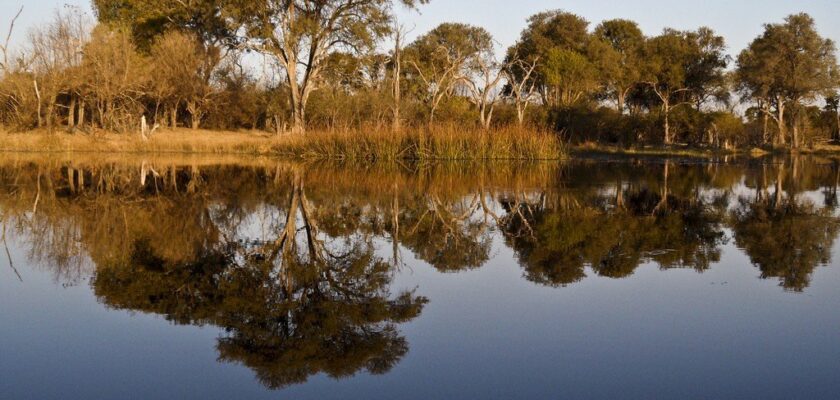
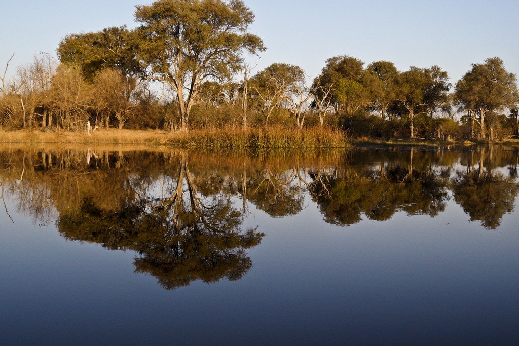
.Among the sands and island mountains there are often located vast flat depressions (pen, or vlei) with an area from a few square meters to hundreds of square kilometers, composed of dense weakly permeable clays. They can be considered as an analog of our takyrs. These depressions are collectors of local runoff water and are a characteristic feature of the Kalahari relief. During heavy rains they collect water and form temporary lakes, which dry up rather quickly, but play an important role in watering cattle.
.
Groundwater reserves in the desert are significant, but their depth exceeds 300 meters. The flow rate of wells is small. In sandy sediments water can be salty.
.
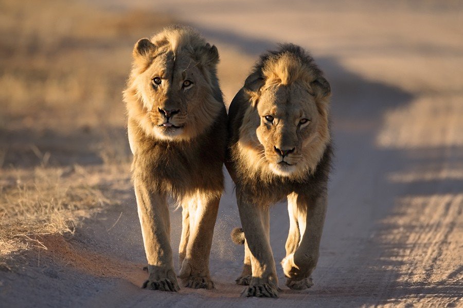
Soils are mainly red-brown and orange-brown, sandy, structureless, consisting mainly of coarse and fine sand, slightly acidic, with low fertility, which is due to the lack of nitrogen and phosphorus content. With depth, the color changes to yellow-brown in wetter areas, and the sand becomes compacted. In case of close bedding of dense rock, a carbonate horizon appears in the lower part of the soil profile, where siliceous deposits occur. The soil-forming process is similar to that on geologically ancient materials in . Kalahari vegetation is cereal grasses, shrubs, and semi-shrubby low-growing umbrella acacia. Despite its arid climate, the Kalahari provides shelter for a multitude of animals – some 46 species of mammals prowl the plains and grasslands. Mammalian meerkats and other swarming animals manage to find food in the early morning and towards evening, and then hide in burrows one and a half meters deep and deeper. Sulphurs, bubalas, duikers and other small antelope feed on long-leaf grasses growing between the dunes. . Not more than 100 years ago, herds of chamois, whose numbers numbered in the millions, would set off on grand migrations across the Kalahari Desert. The herds would stretch 200 kilometers long and more than 20 kilometers wide, damaging farmland and trampling people and animals to death along the way.Today, large herds of jumping antelopes still pass through the dry riverbeds of the Nosob and Auob rivers, kicking up golden dust into the sky. Along the banks, lions rest in the shade of thorny trees, waiting for night to fall and the hunt to begin. The sulphur bull can survive without water at all thanks to a natural air conditioner that regulates its body temperature. In the heat of the day, air inhaled by the animal passes over a fine network of blood vessels, cooling the blood flowing to the brain. At the same time, body temperature can rise, eliminating the need to sweat, allowing water conservation.Flora and fauna
The Kalahari is transformed into savannah by the Okavango River. This 1,600 km long river does not flow into any sea and forms the world’s largest inland delta on land. It enters the Kalahari and is lost in its northwest in the wetlands. The diversity of flora and fauna here is such that the Moremi Game Reserve in Botswana can be considered one of the richest places where nature shows itself in all its beauty and diversity. Here you can see white elephants, buffaloes, giraffes, lions, leopards, cheetahs, hyenas and jackals, crocodiles and hippos, antelopes of all kinds and sizes. In addition, Moremi is home to 30% of the world’s entire wild dog population.
.The Kalahari Desert does not appear to be explored and predictable. Right now its sands are anchored and contained by plants, but the desert’s “red fingers” could become a clenched “fist” of long “arms” that could shatter the world familiar to humans.
Population
The Kalahari is inhabited by the Bushmen. Today there are about 55,000 of them left, of whom only less than 2,000 live as hunter-gatherers.
For these nature-deprived sand dwellers, gathering and hunting are still the main occupations, as they were for ancient peoples. Only not very long ago they began to master farming and animal husbandry. But ecologists give pessimistic forecasts: these activities may again be limited by the activity of the almighty desert. The fact is that the Kalahari may wake up, say the planet’s climate researchers. Its sands are now anchored and contained by plants, but it wasn’t always so. They even suggest that the once endless sands of the Kalahari were once brought by winds from Namibia, and held back by small groves, they settled and consolidated. The climate is changing, with winds becoming more active and rainfall less and less. Wandering sand can therefore recapture savannah lands barely developed by humans.
.
During the dry season in August and September, there is virtually no water on the surface of the Kalahari. The Bushmen of the central and southern Kalahari survive by digging holes at the bottom of dried riverbeds and in lowlands. The water collected in this way is stored in the shells of ostrich eggs. When underground water sources run dry, the Bushmen extract water from the stomach contents of the antelopes they hunt. Tsamma melons become another source of water – the Bushmen eat up to 3 kilograms of them per day.
.Interesting facts
- Tsamma melons are dedicated to the ritual dance of the Bushmen, during which they clap their hands quickly and rhythmically, pound the ground frantically with their bare heels, and make shrill sounds. And after performing these movements in the center of the circle, the dancer throws the melon to another, who continues its performance.
- The emergence of the Kalahari is attributed to the strong southwesterly winds from the Namib Desert. .
- The “singing sands” are found in the Kalahari. Legends say that this is how evil spirits imprisoned under the ground sing, the sound of drifted human settlements. Scientists have not found an answer to all the questions related to the occurrence of such an unusual phenomenon, to decipher the secret meaning of their “songs” man may not be given. This natural phenomenon is vividly described by Jack London in his novel “Hearts of Three”: “Every step on the sand caused a cacophony of sounds. People froze on the spot – and everything stopped around it was worth to make a step and the sand again began to sing … – When the gods laugh, beware! – cried out the old man. He drew a circle on the sand, and while he was drawing, the sand howled and shrieked; the old man knelt down – the sand roared and trumpeted…”
- “The gods must have gone mad” is the title of a movie made in 1980. Its protagonist, the bushman Hiko, found in the desert, a bottle of Coca-Cola. This discovery disrupts the usual life of the primitive tribe. Hiko decides to take it to the edge of the world, experiencing along the way many encounters and adventures with modern civilization. But in the end he returns home. Interestingly, the actor who played Hiko, a real Nixau Bushman, traveled roughly the same path in life.”
- In Kornei Chukovsky’s poem “Aibolit”, the sick animals inform the doctor that they live in Africa: “We live in Zanzibar, in the Kalahari and the Sahara, on Mount Fernando-Po, where Hippo-Po walks, along the wide Limpopo.” The Kalahari has considerable water reserves, but it is about 300 meters deep.
- The Kalahari is so mysterious that fantasists looking out for UFOs have high hopes with it. In particular, there is top secret information that the South African Air Force managed to shoot down a UFO over the Kalahari Desert on May 7, 1989.
- Augrabies Falls National Park (South Africa) is famous for its water “cauldron”. River Orange, passing along the southern border of the desert, falls here in a narrow stone gap, hits the rocky bed, raising a column of water dust height of 100 meters. Over Augrabis constantly hangs a rainbow, and its rumbling can be heard for many kilometers around.
- The documentary “Suricats” (2008) tells about the life of a family of these animals in the harsh realities of the Kalahari Desert.