Golan Heights
According to the UN classification, the Golan Heights is a territory occupied by Israel. In 1981, Israel annexed the region to its territory, but this act was not recognized by the international community. Thus, the land remains disputed. This guide includes the Golan Heights solely because of its tourist appeal, and this fact does not reflect the political views of the author or the Thomas Cook Company.
General Information
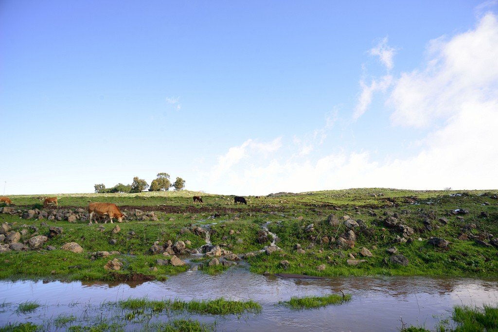
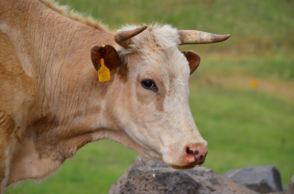
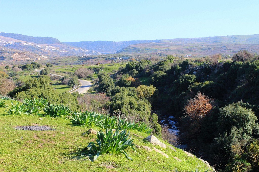
The Golan Heights are among the most remote, undeveloped, and beautifully rough-hewn areas of the country, and a trip there can be extremely interesting. Green slopes rise from the shores of the Sea of Galilee to the highlands of the southern Golan Heights, with sparse villages and kibbutzim, meadows where fat herds graze, and a boom in rural tourism. The transportation network here is sparse, towns are virtually non-existent, and so are the stores. Nevertheless, it is one of the most attractive, unique regions of the country, where one can enjoy the delights of unspoiled nature and village life.
.The northern part is quite different – both in appearance and spirit. Here you will see rocky peaks, rushing rivers, waterfalls, Druze villages, and eagles soaring in the sky over the ruins of Crusader castles. Minefields, bullet-riddled, long-empty houses – all are the legacy of a brutal past, but the nature here is incredibly beautiful.
.
There are rudiments of a transportation network in the Golan Heights, but waiting for buses is time-consuming, and if you want to deviate from the beaten path (avoiding the minefields, of course), it is better to rent a car, which will give you independence and flexibility of schedule.
.The easiest and cheapest way to explore the natural beauty of the region is by hiking trails.
.In addition to such famous places as the Yaar Yehudiya Nature Reserve and Hermon National Park, check out the magnificent Nahal El-Al route with its two waterfalls, whose names translate from Hebrew as “black” and “white” (according to the color of the rocks from which they fall).
.
Nahal El-Al is located in the south of the Golan Heights near the tiny village of Avnei Eitan; it is an easy half-day route.
.Two other beautiful routes start from the mountaintop village of Nimrod and diverge in opposite directions. One takes you southeast to the Bir Kat Ram Nature Reserve in the crater of an extinct volcano; this trail is visible from the village and takes one hour to walk. The second trail heads west to the valley at the foot of Mount Hermon and Nimrod Fortress; it is recommended that you plan your walk so that you reach the fortress at sunset, when it is particularly beautiful.
.History
The narrow strip of land that comprises the Golan Heights has been the scene of dramatic events for centuries. By fate, this place of bloody wars and brutal battles turned out to be strategically important – the dominant heights and the crossroads of trade routes were a tidbit for both ancient empires and modern states.
.
In 953 B.C. these lands were conquered by the Kingdom of Israel, in 586 B.C. by the Kingdom of Aramaea with Damascus as its capital, and in 332 B.C. the entire region became part of Alexander the Great’s empire, and the population here grew considerably. The Golan was then conquered by the Romans, and during this period cities such as Banias, Gamla, Hippos and Gadera sprang up. They flourished until the revolt of the Jews against Roman rule, when fierce battles were fought in the area, such as at Gamla, which was considered the capital of the Jewish Golan. Under the leadership of Josephus Flavius, commander of the Galilean forces, the inhabitants fortified the city and gave battle to the Roman legions during a bloody revolt that ended with the deaths of all the Jews of Gamla.
.After the collapse of the Byzantine Empire, the region fell to the Syrians and was forgotten until the Crusader era, when the road from the Holy Land to Damascus passed through these places. The grandiose castles built here witnessed bloody battles between the Crusaders and the Arabs..
In the 16th century, the Golan Heights became part of the Ottoman Empire and remained Turkish until the end of World War I, when several states were formed in the Middle East and France was given the mandate to govern Syria. The announcement of the establishment of the state of Israel on May 14, 1948, triggered the brutal Arab-Israeli War of 1948-1949, during which the Golan Heights played a strategically important role for Syria – from them the Syrians shelled Israeli troops. The Israelis, in turn, seized major water sources.
Border skirmishes continued until the Six Day War of 1967, when Israel occupied the Golan Heights (along with Egypt’s Sinai Peninsula, the West Bank and the Gaza Strip). Since then, the Syrians have tried many times to reclaim the territory, including during the bloody Doomsday War in 1973, but tshetno. The Sinai Peninsula was returned to Egypt, but the defensive line on Mount Hermon was too important to the Israelis, and they refused to hand over the Golan Heights to Syria; the situation reached a stalemate.
The Golan Heights became a stumbling block to possible peace talks between the two countries, and UN peacekeeping troops were brought into the region to maintain a ceasefire. The desire to regain lost territory has led to Syria’s support for armed anti-Israeli militias such as Hamas and Hizbullah. They are also supported by Iran, which has led to horrific consequences – shelling, rocket attacks and wars.
.
In 1981, Israel annexed the Golan Heights and incorporated it into a state, but the move drew mixed reactions and was not approved by the UN and the international community. The land is now considered occupied territory.
The scars of the distant and recent past are clearly visible in the Golan Heights, from ancient ruins and fortresses to minefields and bullet-riddled homes. Yet traveling through this beautiful, wild strip of land, one can hardly imagine how much violence it has seen in its lifetime. The serene landscape: mountains, plateaus and rivers is a true gem of the Middle East, no matter who owns it.
South of the Golan Heights
Hamat Ghader
Hot springs have been flowing at this location in the very south of the Golan Heights for several thousand years. According to archaeologists, Hamat Gader was inhabited from the 2nd to the 9th century A.D. – people were attracted by the healing properties of the mineral waters.
.
These properties are highly valued even today – hot, sulfur-smelling springs have turned into an extremely popular resort with a huge number of pools, a luxury hotel and even an exotic crocodile nursery. It can get very crowded in the summer and it is not recommended to visit during this period.
. Tel: (04) 665-99-64. www.hamat-gader. cell. Open: Mon-Fri 8.30-22.00, Sat, Sun 8.30-17.00. Entrance is paid. Bus 24 (leaves Tiberias once a day at 9.15, return trip at 15.15)..Katzrin
If there is anything resembling a city in the southern Golan Heights, it is Katzrin. The region’s few bus routes pass through it; there are two small shopping centers and major government offices.
Katzrin
There’s not much to see or do in Katzrin, and it’s not exactly pretty, especially compared to the surrounding villages, but it’s a convenient transportation hub that you can’t miss anyway..About 2 km from the town is a new shopping center with a tourist information office, banks, ATMs, several pubs and restaurants. It also showcases a multi-sensory, 180-degree viewing angle movie, “The Magic of the Golan”, which tells the rich history and geography of the Golan Heights. Between the shopping center and the city is the ancient village of Katzrin, a large-scale reconstruction of a Talmudic-period village with a synagogue. It was built on the site of an ancient settlement destroyed by an earthquake in 746 A.D. Visitors have the opportunity to see dwellings, wine and olive presses and imagine what the many ruins of the Galilee and the Golan Heights originally looked like.
.Also of interest is the Golan Heights Archaeological Museum in the city itself, whose exhibits tell the story of the distant past, from prehistoric times to the Talmudic era (70-500 CE).
> “Magic of Golan”.Tel: (04) 696-36-25. www.magic-golan.co.il. Open: Mon-Fri 9.00-17.00, Fri 9.00-16.00, Sat 9.00-17.00. Admission is paid..Golan Heights Archaeological MuseumTel: (04) 696-13-50. Open: Mon-Fri 9.00-16.00, Fri 9.00-15.30, Sat 10.30-13.30. Admission is payable.. Katzrin Ancient VillageKatzrin Rd East. Tel: (04) 696-21-42. www.parkqatzrin.org.il. Open: wpm 9.00-16.00, pt 9.00-14.00, Sat 10.00-16.00. Admission is paid..Bus 966 from Jerusalem to Katzrin departs twice a day at 8.45 and 5.15, with return trips at 6.00 and 13.00;. Bus 55 leaves Katzrin for Kiryat Shmonah at 11.30 and stops at all the major villages in the north. Buses 15, 19 run between Tiberias and Katzrin three times a day, circling the Sea of Galilee.
.Mount Bental and Merom Golan
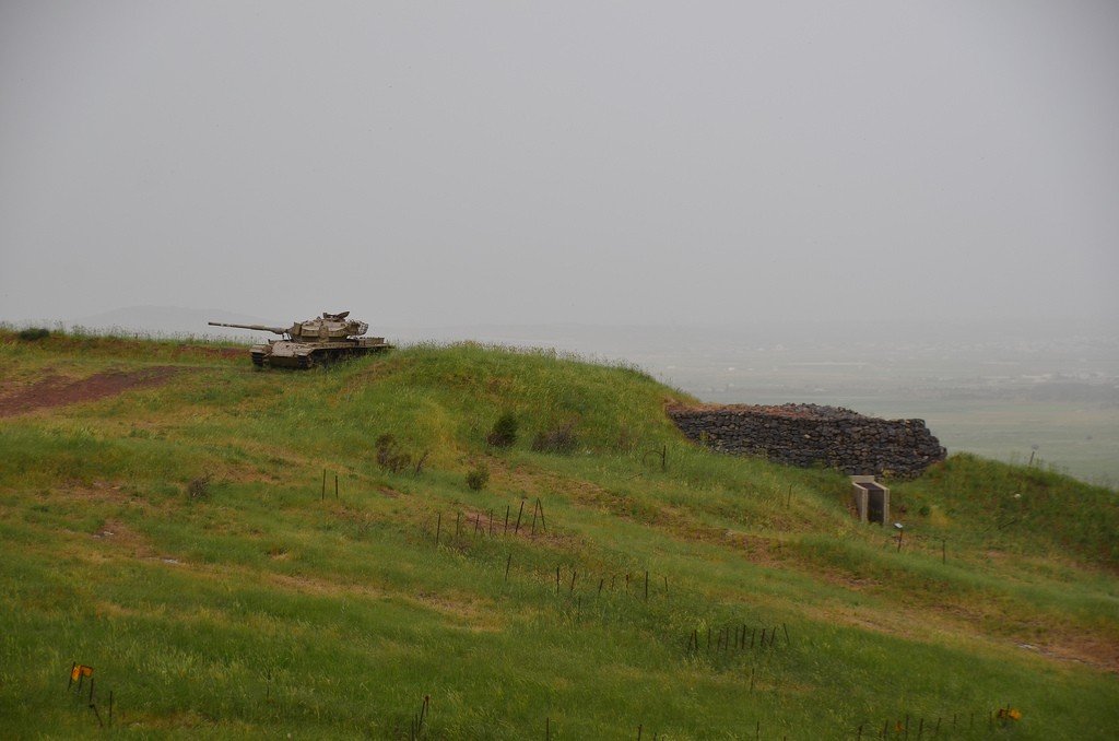
Mount Bental rises above the surrounding landscape at a height of 1,170 meters. It is a strategically important observation point on the border with neighboring Syria, which played a role in the 1973 Doomsday War and the capture of the Golan Heights.
The top of the mountain has been turned into a sad monument to one of the bloodiest battles of that war that unfolded in the valley below – it is called the Valley of Tears. A bunker and other fortifications remain on the mountain, and the top overlooks the valley, which has now been turned into a demilitarized zone separating Syria and Israel, and the ruins of the Syrian village of Quneitra, which was at the center of the battle.
>
At the foot of the mountain is the small, picturesque kibbutz Merom Golan. Here tourists are offered a restored meat restaurant, cute guest houses and many village activities. Especially popular is the excellent horseback riding center. Jeep and all-terrain vehicle rides, a swimming pool, and a convenient location in the center of the Golan Heights make the kibbutz a convenient base for exploring the region. Bus 55 leaves at 12:15 pm to Kiryat Shmonah, bus 58 leaves at 5:30 pm to Katzrin.
.Ramot
Ramot is the quintessential southern Golan village. A tiny village overlooking the Sea of Galilee, it offers an array of family-run guesthouses, rustic restaurants and a variety of rural activities to which numerous signposts will direct you. Horseback riding, off-road excursions, bicycle rentals, and the village’s convenient location are perfect for exploring nearby nature reserves such as Yaar Yehudiya, the archaeological sites at Kursi, and the beautiful Nahal El-Al River with its two waterfalls.
.Buses 15, 22 leave from Tiberias several times a day.
.Ya’ar Yehudiya Nature Reserve
This reserve, which is widely regarded as one of the most beautiful in Israel, occupies a vast area in the southern Golan Heights. It is shaped like five outstretched fingers, and on its territory you can see waterfalls, valleys, rivers and lakes. The wealth of plant and animal life is astounding: vultures, eagles, jackals, red foxes and wild boars.
.
One of the main attractions is the Meshushim lakes, which can be accessed from either side of the park. Unusual geological formations in the form of pentagonal columns surround the lakes with crystal clear water, and even a walk to them is a great pleasure. The park has a huge number of excellent trails, and the management office will offer maps and help you create routes. Keep in mind that some of the trails are extremely difficult, so you should have an idea of what lies ahead.
.
There is a campground near the directorate – for those who want to get out early. Highway 87. Tel: (06) 696-28-17. www.parks.org.il. Open: daily 8.00-17.00 (closes an hour earlier in winter). Entrance fee. Bus 15 (Tiberias – Katzrin) stops at the fork by the park’s directorate.
.North of the Golan Heights
Druze villages
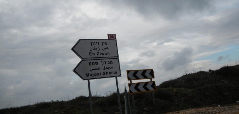
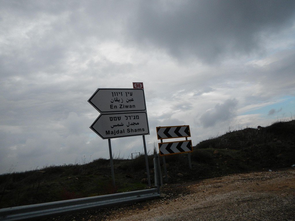
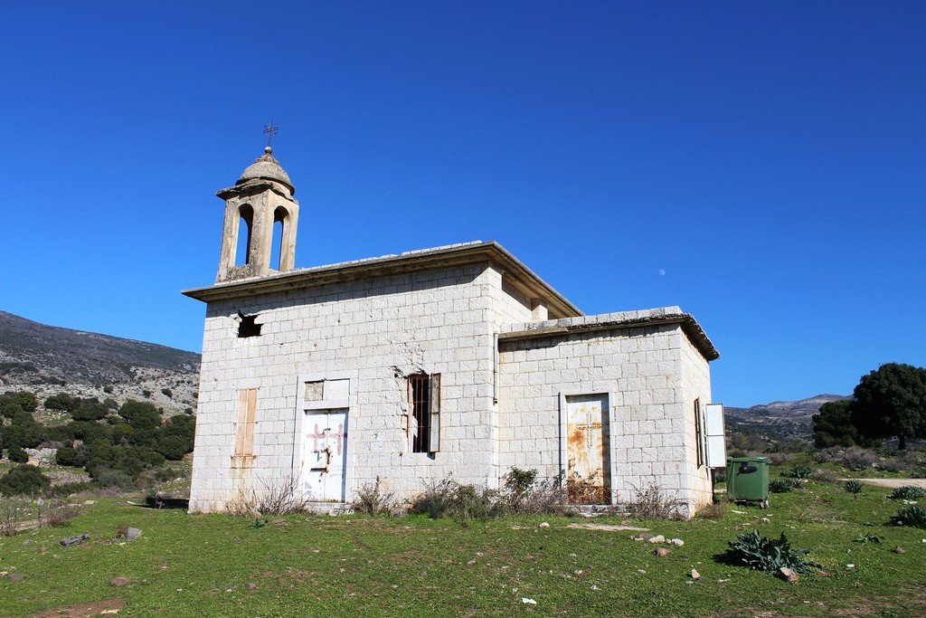
Scattered on the slopes of Mount Hermon, closer to the foot, are the small towns (or large villages) of Majdal Shams, Masada, Ein Kinya and Bukata; the largest of these are Majdal Shams and Masada (not to be confused with the Dead Sea fortress of Masada).
.These villages are home to Druze communities whose hospitality, traditional cuisine, and colorful bazaars are known throughout the country. Agriculture is the mainstay of the villages’ economy, with young shepherds driving herds of goats through the villages, farmers riding horses through the streets, tractors pulling trailers loaded with fresh fruit and olives. Nevertheless, these villages are quite affluent – new cars and modern homes are not uncommon here.
.
Visitors to the region should keep in mind that Druze villages do not seem attractive at first glance. However, the amazing culture of the people who live there is best observed by looking out for visitors at one of the humble eateries on the main street. Sumptuous homemade hummus, labaneh cheese, marinated new harvest olives and tender meats are all served with a smile and genuine hospitality.
The story of the Druze families living in the Golan Heights is a very sad one. Since the 1967 war, much of the region has been controlled by Israel, having been taken away from Syria. The Druze communities that lived there were cut off from neighboring villages: some now live in Israeli territory, while others remained in Syria. Since then, there has been no communication between the two countries – no telephone, postal or border crossings – so until the advent of cell phones and the Internet, the Druze communicated with each other by means of a hill near the village of Majdal Shams. It was called the “shouting hill” because families would gather there on the day of weddings, funerals or other important events in their lives and announce the news to relatives on the other side through a megaphone. But the Druze were not embittered. A peaceful people, they have accepted the citizenship of the country in which they live, and some even volunteer to serve in the Israel Defense Forces.
.
Hermon National Park (Banias)
Hermon National Park (usually referred to simply as Banias) attracts with its alpine beauty and interesting archaeological sites; it is a pleasant place to spend a day.
.
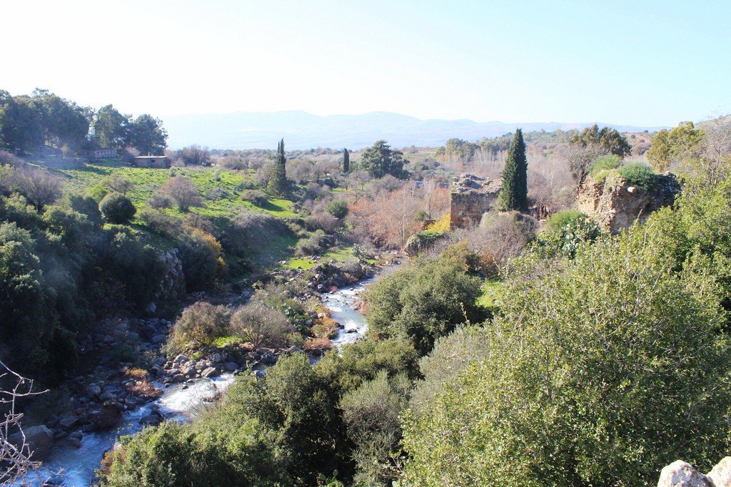
The spring that feeds the park begins at the foot of Mount Hermon, where meltwater flows down from the snow cap that lies on the summit almost year-round. The water flows down the steep slopes and into a canyon-like gorge, from where it tumbles down into the national park in the form of a delightful waterfall. This waterfall, considered the most beautiful in Israel, is at its fullest in April and May. The Banias Brook then merges with the Dan River, and together they flow into the Jordan River.
.
A path near the spring leads to a cave, in front of which are the ruins of a temple built by Herod the Great. Here his son Philip built his capital and named it Caesarea Philippi; in time the city became a pilgrimage site for Christians.
.
The marked trail leads past waterfalls to Roman and Crusader ruins, forming a closed loop (90 min). There are other, longer and more difficult routes, which you can ask the park management about.
.
Tel: (04) 695-02-72. www.parks.org.il. Open: Sat 8.00-17.00, Fri 8.00-16.00. Entrance fee. Bus 55 leaves Kiryat Shmonah once a day at 1:30 p.m., bus 58 at 4:40 p.m.; both stop at the park entrance..Mount Hermon
When you think of the Middle East, a ski resort is probably the last thing that comes to mind. However, Mount Hermon is home to the country’s only ski resort – small and, in recent years, not very snowy. Mount Hermon has long played a strategically important role in the defense of the Golan Heights, and on its summit at an altitude of 2,224 meters is a large military base, nicknamed “the eyes of Israel.”
The mountain itself is very picturesque, with villages scattered on the lower part of its slopes. Traveling along the winding road will give you the opportunity to admire the magnificent views and feel a significant drop in temperature, so warm clothes won’t hurt. It’s a real alpine area here – streams of meltwater and waterfalls tumble down the valley, the air is clean and fresh (and very cold in winter)..Ski resort. Tel: (04) 698-13-33. www.skihermon.co.il. There is a fee to enter. There are no public transportation routes to the mountain.
.Nimrod Fortress
When the sun sets in the Golan Heights, its last rays illuminate the rock on which the ruins of the Nimrod Fortress are located. In Crusader times, the fortress, located on the ancient trade route to Damascus, was of great strategic and defensive importance; it was built by Saladin’s nephew Osman al-Aziz during the Sixth Crusade in an attempt to block the Crusaders’ route to Damascus from their capital of Acre. The castle was later expanded and fortified by Sultan Beibars, but after the fall of the Crusader capital, Acre lost its strategic importance and fell into disrepair. Today, the fortress offers spectacular views of the northern Galilee and the Golan Heights, and is well worth spending a couple of hours at.
.Mines
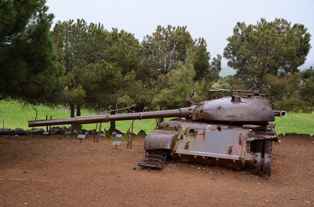
.Many signs can be seen in the northern Golan Heights warning drivers and pedestrians of the dangers of mines. Many tourists are shocked by these roadside signs, but it should be remembered that not long ago this region was the scene of bloody battles, the traces of which are still clearly visible. In addition, there are regular exercises of the Israel Defense Forces, so do not be alarmed if in the distance, on the hillsides, you see tanks. In any case, pay attention to the warning signs and stay on the road.
.