Etna volcano
Southern flavor, ancient ruins and beautiful weather attract thousands of tourists to Sicily every year. One of the local attractions is the giant volcano Etna, not only the largest active volcano in Europe but also one of the largest volcanoes in the world.
Video: Etna Volcano
Contents- General information
- Etna Nature Park
- Eruptions
- Unprecedented forces
- New life on the ruins
Etna’s surroundings - Lookout around Etna
- Climbing Etna
- Etna – South
- Etna – North
General Information
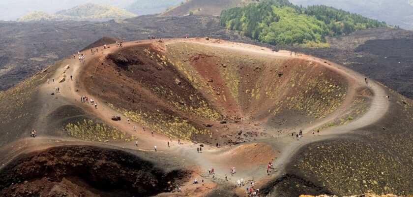
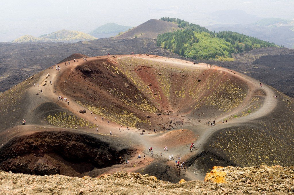
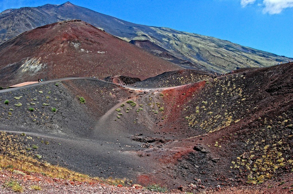
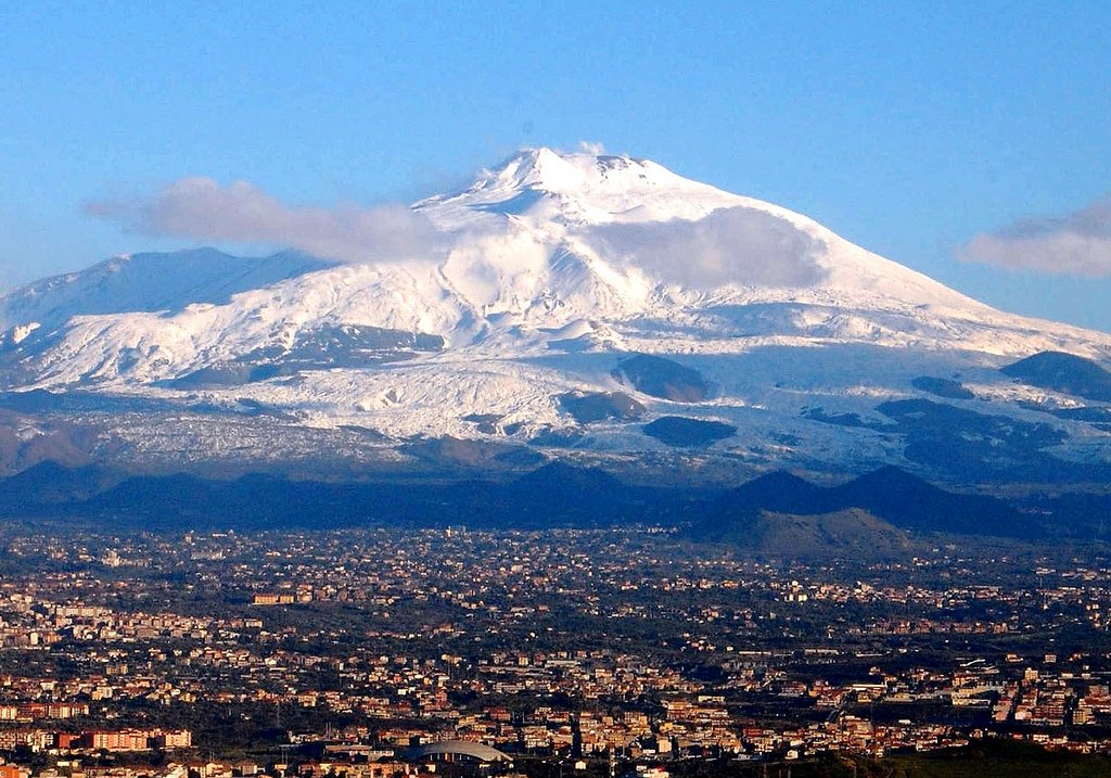
Etna is Europe’s largest and tallest volcano with a circumference of 140 km occupying an elliptical-shaped area of about 1,400 square kilometers. Above a slightly sloping plateau with a height of 2900 m rises a cone-shaped peak, its height due to volcanic activity varies – today it is equal to 3369 m.
.
The Greeks believed that the forge of Hephaestus, the god of fire, was located here, and the one-eyed Cyclops lived here. Now it is a real paradise for skiers in winter, and for tourists who like hiking – all year round. There are several towns at the base of the volcano, but there is almost no housing on the slopes of the mountain, because in many places gases burst out of the ground, and it is impossible to predict where the next eruption will begin, whether it will cause the flow of large amounts of lava or just throw out steam and ash.
.There are several smaller peaks on either side of Etna that are pleasant to walk on. The hiking trail on Monte Gallo will lead you to a shelter in an oak grove. Pine, beech and birch forests also grow here. Climb up to the marvelous beech forest on Monte Spagnolo and relax while exploring the caves, of which there are many on Etna.
.
Walking along the hiking trail, you can see lizards, rabbits, porcupines, snakes and even wild cats. There are many birds of prey – falcons, golden eagles, as well as owls and partridges.
.
Climbing to the top of the volcano is strictly forbidden, moreover, if Etna starts an active phase or shows signs of volcanic activity, all the trails below are closed, the situation can change depending on the wind direction.
.Etna Natural Park
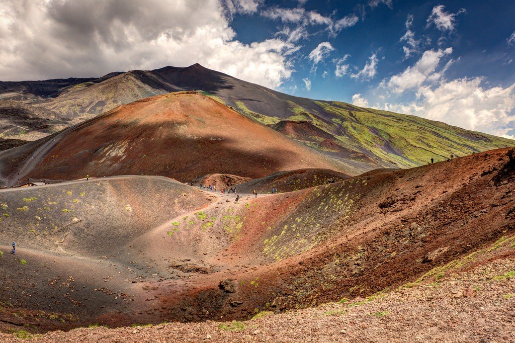
In Etna Natural Park, the soil contains many minerals and is therefore exceptionally fertile; different vegetation zones are arranged in circles on the cone of the mountain. In 1981, the area around the mountain was declared a nature reserve. People have always sought to settle higher up. The remains of the ancient Tower of the Philosopher are found on the slope at an altitude of 2917 meters. Today’s settlements, oblivious to the danger, move surprisingly far – in the west and in the north they are 15 kilometers from the main crater.
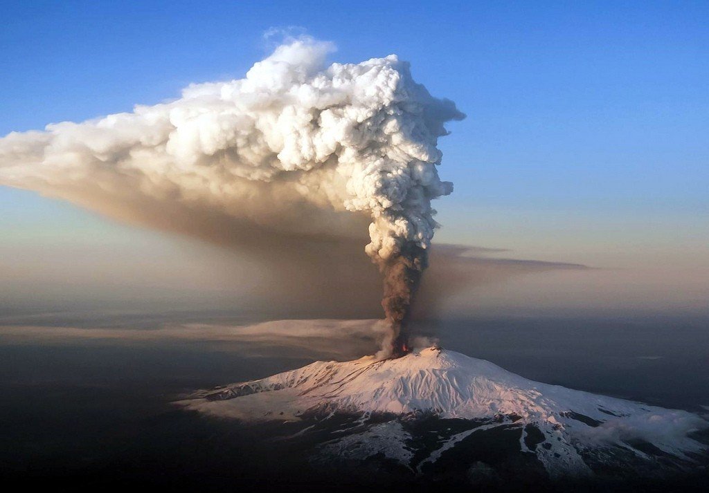
.Eruptions
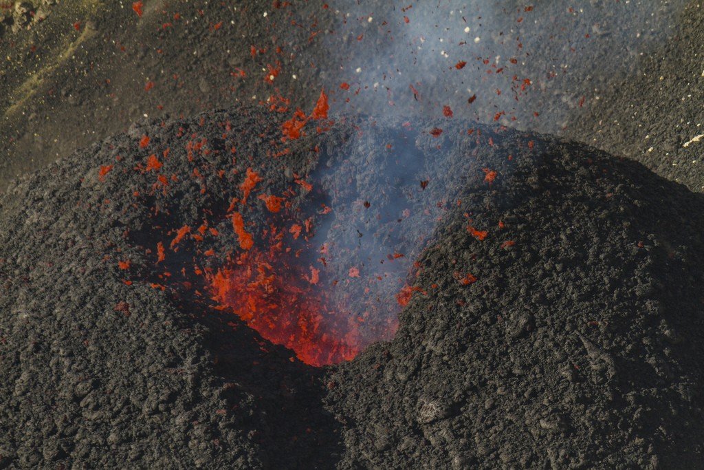
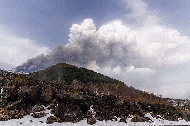
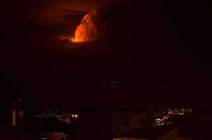
Etna’s eruptions have always threatened the locals, who still look warily at the Mountain of Mountains – Mongibello: this is how the Sicilians call the volcano, combining two words into one (mountain: Italian – Moite and Arabic – Jebel). Large eruptions of Etna have been carefully recorded since the time of the Greek poet Pindar and the playwright Aeschylus, who reported such an event around 478-474 BC. During one of the most recent eruptions in 1983, an attempt was made for the first time to weaken the volcanic power with directed explosions – alas, it was unsuccessful. The power of nature was stronger.
.
History has preserved memories of about one hundred and forty powerful eruptions, of them in Modern times: in 1669. – the destruction of Catania; in 1893. – formation of the Silvestri crater; in 1911. – the formation of the northeastern crater. In 1989, two new craters were formed, and in 1992. – The lava flow stopped near Zafferana Etnea. The volcano spewed lava for the last time in 2001, destroying the cable car to the crater.
.
Unprecedented forces
Volcanic activity in Southern Italy is directly related to the folded nature of the Apennines, which run north-south across Italy; the volcano is part of this range. From the early Quaternary epoch Etna was on a tectonic fault line running along the east coast of Sicily from the Lipari Islands to the southwest, piling huge masses of lava and tuff around it. New eruptions followed mainly from fissures and lateral craters, with about three hundred known to date. Today the height of the volcano is 3369 meters, the diameter of the base is about 35 km, and the surface is more than 1.4 thousand square kilometers. Tectonic features are also associated with frequent earthquakes, which, as well as eruptions, fell on people from antiquity to our time and have always been associated with countless victims. Especially severe was the earthquake of the 6th century, which destroyed the ancient temple in Selinunta – in the southwest of the island. However, most earthquakes have occurred in the area of the tectonic fault – south of Etna, the most powerful of which (1693) devastated the entire southeast of the island.
.New life on the ruins
But destructive events also have positive consequences – this is the flip side of volcanic eruptions. The destruction caused by that terrible earthquake of 1693 led to new construction. “New life grows out of the ashes” – and the whole southeast of Sicily got a new Baroque look. Thus the landscape at the foot of Etna was also domesticated. The need to erect new buildings was directly related to the Baroque desire for solemnity. The practical political interests of the landowners should not be forgotten. Every village or town settlement with at least eighty families brought a noble lord a vote in parliament!
.
In 1607. – long before the earthquakes mentioned above, the Spanish viceroy Marcantonio Colonna founded a new town in today’s province of Ragusa, naming it after his daughter Vittoria (Victoria). The architects’ and builders’ desire for a Baroque systematic layout contributed to giving the new, still sprawling city the appearance of a chessboard.
.
After 1693, beginning with Caltagirone and Niscemi in the west and Augusta and Syracuse in the east, from Palagonia and Acireale in the north to Ispica, Modica and Scicli in the south, and to a large extent throughout Catania, destroyed towns began to be rebuilt in their original locations. But sometimes the damage was so great that the city was moved elsewhere, as happened to Avola, Francofonte, Giarratana, Grammichele and – last but not least – Noto. And everywhere the love of geometry was evident: a regular pattern was always chosen for the construction of the street grid. Avola and Grammichele both used a heptagonal grid.
Ragusa stands apart. Here not only restored the Old Town (Ragusa Ibla) with its winding on the slopes of tangled streets, above which from Rosario Gagliardi rose the grandiose church of San Giorgio (San Giorgio), but at the same time on the hill erected a new town Ragusa Superiore with a chess layout of streets (as was done before in Vittoria).
.The erection of numerous churches and palaces throughout Sicily fundamentally changes the architectural face of the island: in the 18th century, the Baroque becomes the third, along with Antiquity and the Middle Ages, great epoch in the artistic – and above all architectural – history of the island.
.Etna neighborhood
A trip around Etna’s surroundings reveals signs of devastation: old and new lava flows winding through the ground. In Catania, natural elements are also visible in the city itself: frozen lava near the Staufen castle of Ursino, which stood by the sea. However, in 1669, as a result of a powerful eruption, the lava flow ran to the sea, surrounded the castle and destroyed numerous villages, the western part of Catania and the port. After the catastrophe, which claimed at least 20 thousand lives, the sea was removed from the castle by about 500 meters.
.
On the other hand, the weathering of volcanic rocks makes the soil incredibly fertile; that’s why people cling to the land on the slopes of Etna, despite all the vagaries of nature. Etna’s famous vineyards, as well as citrus, olive, fig and fruit trees, grow on the slopes up to a height of 1000 meters. At this altitude it is rare to speak of a cultural landscape. Chestnuts grow up to 1600 m. The next vegetation zone is more modestly represented: acacia, woodruff and barberry. Ferns are found at an altitude of 1500 to 2500 meters, and above that the terrain is already bare.
.Viewpoint around Etna
The best way to explore the landscape belts of the mountain is from the Cirkumetnea train. It takes about 3.5 hours to travel 110 kilometers. The ride on this narrow gauge train starts at the F. S. E. in Catania and ends in Giarre, from where you can return to Catania by regular train or bus. It is also possible to drive around Etna by car, the roads running parallel to the railroad.
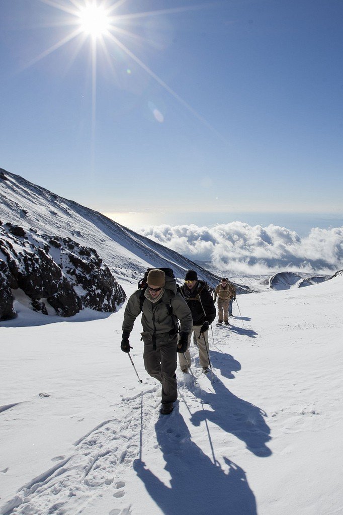
.Climbing Etna
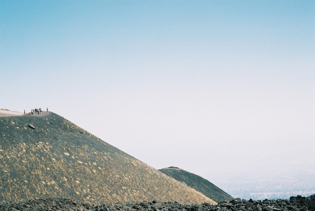
This climb is one of the most powerful experiences of traveling in Sicily; it is relatively easy to do, but even in summer it is necessary to bring warm clothing, provided for all weather changes.
.Etna – South
The southern road to Etna runs from Catania along the Strada Etnea towards Gravina (8 km), and from there along the volcanic fissure and solidified lava of 1669 to Nicolosi. From Nicolosi a good road leads to the turnoff to Grande Albergo Etna (1715 m), where there are excellent opportunities for winter sports, and to Rifugio Sapienza, shelter of the Mountaineers’ Union (altitude 1935 m). The plateau in between is completely covered with restaurants and souvenir stores. Those who don’t want to go higher can stay to see the Srategi Silvestri, dating back to 1892. There is also the possibility – unfortunately at a very steep cost – to take a bus in good weather to Piano del Lago, then to the ash-filled (1971) observatory, and if the volcano allows it, to the Tower of the Philosopher (2918 m), near the Main Crater.
.Etna – North
On the northern slope, the path along the 20-kilometer Mareneve lookout road to Etna starts from Linguaglossa towards Piano Provenzana: groups climb to the top from here in summer and ski in winter. The highway goes on to Zafferana Etnea.
.