Dniester River
This attraction is related to the countries:UkraineUkraine , Moldova (Moldavia)Dniester River runs through Eastern Europe and is located on the territory of two countries – Moldova and Ukraine. It flows from northwest to southeast and then flows into the Black Sea. The Dniester is translated from ancient Iranian as “border river.”

Geography
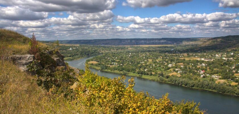
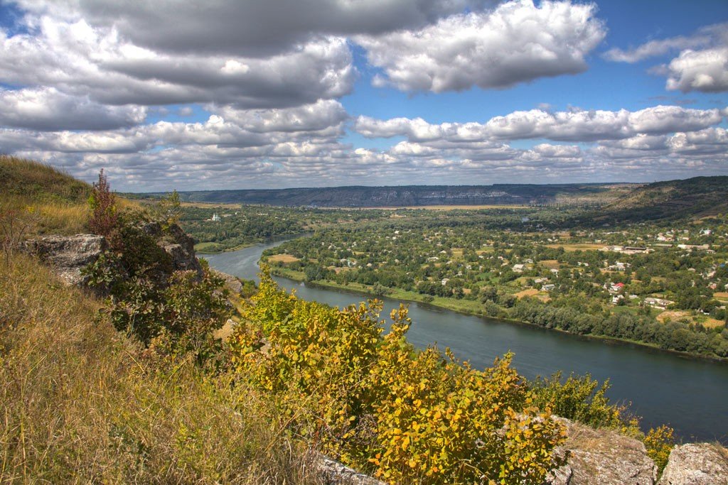
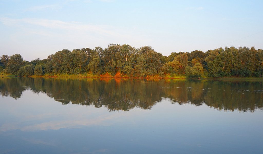
The Dniester River is 1352 km long, with a basin area of 72,100 km². It originates in the Ukrainian Carpathians near the village of Volchye on the slopes of Mount Czentyovka (the Sarmatian Mountains in Dlugosz’s Chronicle) at an altitude of 900 m. It flows into the Dniester estuary, which is connected to the Black Sea. The average water flow in the lower reaches is 310 m³/s. The volume of annual runoff is 10 billion m³.
.
In its upper reaches, the Dniester flows in a deep narrow valley and has the character of a fast mountain river. The flow velocity in this area is 2-2.5 m/s. A large number of tributaries flow into the Dniester from the slopes of the Carpathian Mountains, mainly from the right. The largest of the tributaries in this section is the Stryi. Below Halych the stream becomes calmer, but the valley remains narrow and deep.
.
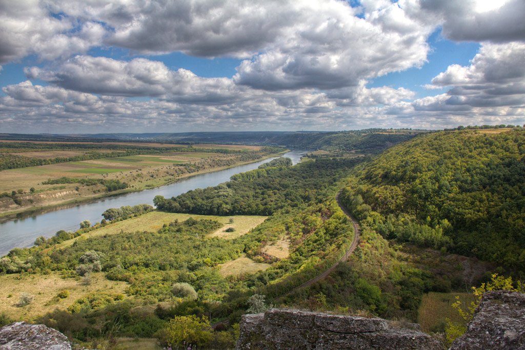
In the middle reaches, tributaries flow only to the left: the Zolotaya Lipa, Strypa, Seret, Zbruch, Smotrich, and Murafa.
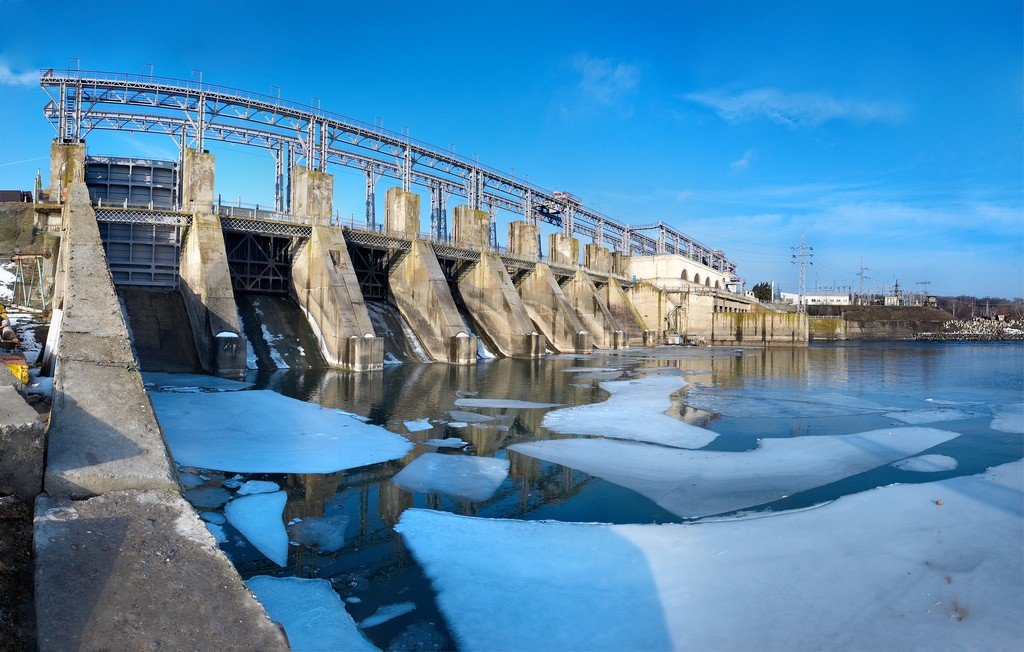
.On the territory of Ukraine (Khmelnytsky, Chernivtsi and Vinnitsa regions) there is the Dniester Reservoir, formed during the construction of the Dniester Hydroelectric Power Plant (677.7 km from the mouth of the Dniester, Novodnestrovsk, Chernivtsi region).
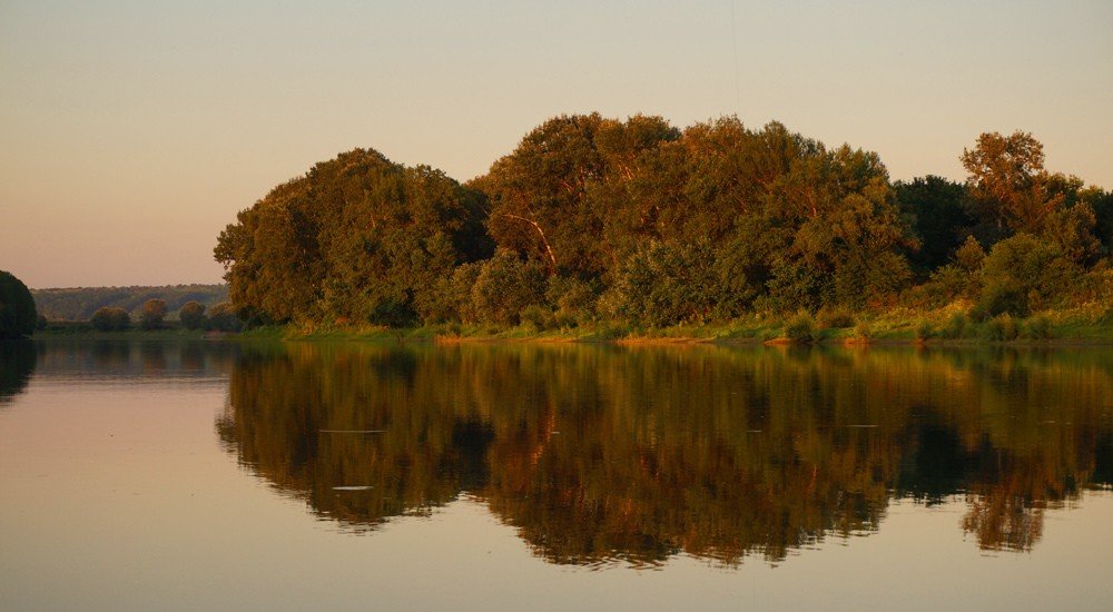
.The length of the Dniester within Moldova is 660 km. The area of the basin within Moldova is 19,070 km², which is 57% of its territory. Below Mogilev-Podolsky the valley widens somewhat, but up to the village of Vykhvatintsy in Rybnitsy District (Transdniestrian Moldavian Republic) the Dniester still flows in a narrow and deep canyon-shaped valley with high steep and rocky banks cut by ravines.
The Dniester’s length within Moldova is 60 kilometers.The Dubasari reservoir stretches from the village of Vyhvatintsi to the town of Dubasari and is about 120 km long. South of Dubasari, the Dniester valley widens considerably, reaching up to 10-16 km in its lower reaches. Here the gradients of the riverbed are very low and the river forms large meanders, and the plavni begin to flow.
.
In its lower reaches, the Reut, Byk and Botna flow into the Dniester from the right. 146 km before the mouth, below the village of Chobruchi, the Turunchuk branch branches off to the left of the Dniester and rejoins the Dniester through Lake Beloe, 20 km from the mouth. The Dniester flows into the Dniester estuary, which is 40 km long.
.
The Dniester Delta is a nesting ground for a large number of birds, and a large number of rare plant species grow on its territory. The lower reaches of the Dniester, in particular the area of the confluence of the Dniester and Turunchuk are included in the international list of the Ramsar Convention on the Protection of Wetlands.
.
On the territory of Odessa Oblast, the protected tract “Dniester Plavni” was created in the plavni, which later became part of the Lower Dniester National Nature Park.
.The Dniester is fed by snow and rain. The river often experiences sudden rises in water level, especially from summer rainstorms, often causing floods. Ice break is short, in warm winters the river does not freeze at all.
.The mineralization of Dniester water increases downstream from 300 to 450 mg/dm³.
.Dniester water is used for water supply to many settlements (e.g. Odessa, Kishinev), irrigation; in the upper reaches of the river, the river is used for logging.
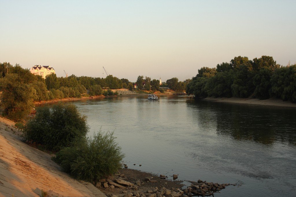
The Dniester is navigable by ship.Navigation is carried out in the sections from the town of Soroca to the Dubasari hydroelectric dam and from the hydroelectric dam to the mouth.
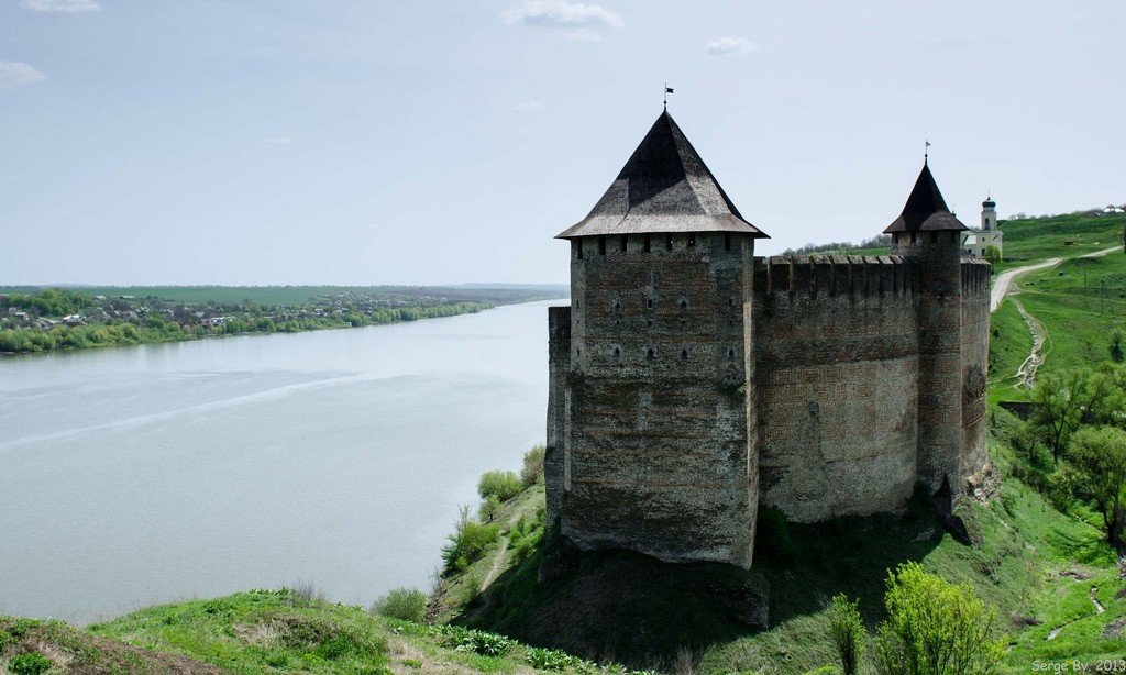
.The towns of Khotin, Mogilev-Podolsky, Yampol, Soroki, Zaleschiki, Kamenka, Ribnitsa, Dubossary, Grigoriopol, Bender, Tiraspol, Slobozia, Ovidiopol, Belgorod-Dnestrovsky (Akkerman), etc.
are located on the Dniester.The Dniester is part of the state border between Ukraine and Moldova.
.Fish
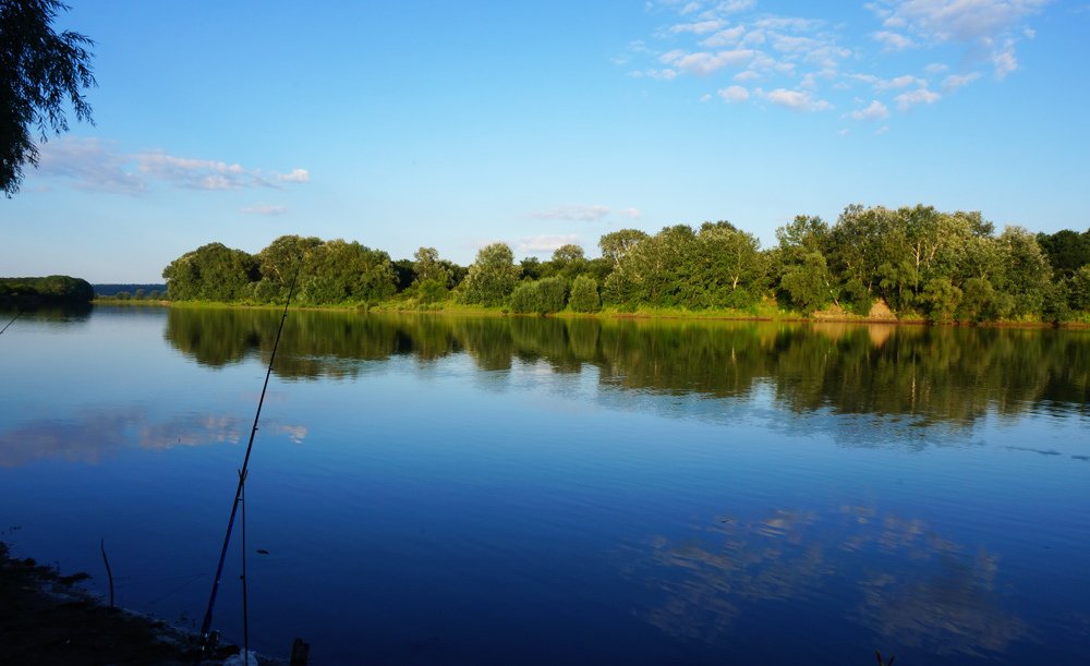
The Dniester is permanently inhabited by roach, pike, pike, cutthroat, spruce, chub, chub, yaz, minnow, redfin, redfin, stud, tench, crucian carp, carp, carp, carpion, podust, mustache, eel, catfish, burbot, bream, various gobies, river flounder and others. In the upper reaches of the river there are trout and grayling, and in the lower reaches the sturgeon and starred sturgeon enter the Dniester from the Black Sea.
.History
Since time immemorial, the Dniester has served as a busy waterway for the export of goods produced in the Transnistrian region. Herodotus mentions the river Tiras (the ancient name of the Dniester) and the colony of Tira, located at its mouth, which supplied ancient Greece with local products. Sources dating back to the 1st century AD indicate that the inhabitants of Tira were granted the right of duty-free transportation of goods.
.
Later, in the XII century, Russian chronicles indicate the existence of the colony of Belgorod at the mouth of the Tyras, which arose on the site of the Greek polis of Tyre. From the same time, the Genoese trade influence on the Dniester increased. They established a number of factories on the river, for the protection of which they built fortresses in Bender (Moldavian Tigina, Tigina, Tur. Tiaginya Caca), Soroca (ancient Olhion), Khotin and Belgorod, the remains of which have also survived to this day. The most important Genoese trading point was Belgorod (Italian: Moncastro, Moncastro, Moldavian: Cetatea Alba, Cetatea Albe), which was protected by an earthen rampart and turned into a fortress. The Genoese are credited with introducing on the Dniester, for rafting cargo, a type of vessel known as a galley (which is a rectangular box) with a carrying capacity of 12 tons. The shallow draft allowed the galleys to pass even the shallowest parts of the Dniester.
.
Later, with the capture of Monkastro by the Turks, which they renamed Akkerman, as well as the transfer of the Lower and Middle Dniester region under Turkish rule, the trade importance of the Dniester began to decline and the region adjacent to it became an arena for frequent wars between the Ottoman Empire, the Polish Kingdom and the Zaporizhian Sich. Only with the annexation of the area between the Southern Bug and Dniester to Russia in 1791, according to the Treaty of Jassy, did local wholesale trade and Dniester shipping begin to revive again, and by the beginning of the 20th century it had reached a large scale.
.
The only existing vessel on the river, a galley, actually served as the initial reason for the government’s concerns about the establishment of Dniester shipping. In 1881, the Bessarabian zemstvo submitted a report to the Minister of Railways, in which it was found out that the ever-increasing competition of the North-American States, which had already displaced Russian wheat from some markets of Western Europe, due to the danger and high cost of bread transportation along the Dniester, put the Transnistrian region in a critical situation, despite the fact that the actual cheapness of bread production, compared to America, remains on the side of the Bessarabian producers. Indeed, the cost of delivering a pood of wheat taken on the banks of the middle Dniester (between Mogilev and Soroca), passed through Odessa stores and delivered to a ship in the port of Odessa for shipment abroad, reached up to 40 kopecks and more, and even then only under favorable conditions.
.A number of attempts were made to open steamship traffic on the Dniester. Thus, in 1843 the Russian government ordered a steamship in England, called “Dniester”, but in the first voyage he was unable to pass the Chobruchi bends (rolls near the village of Chobruchi) and reach the city of Tiraspol. In 1847, the steamship “Luba” appeared on the Dniester, 90 feet long, 14 feet wide and with a draft of 2 feet, but it too encountered serious difficulties in navigating the river and soon left the Dniester. With the establishment of the “Russian Society of Shipping and Trade” in 1857, it sent the steamship “Brother” to the Dniester, which was also forced to abandon the river. Popovich’s attempt in 1864 with the steamship “Maria” had the same disappointing result. In 1867, Prince Lev Sapega formed a steamship company, but the first steamship, the “Dnestr”, having traveled down the river, was forced to leave for good for the Black Sea, and the company itself disintegrated. Finally, in 1872, Pomerleau, taking advantage of high water, traveled by steamboat down the Dniester to Mogilev and back, but this fact failed to restore steamboat traffic on the river.
.
Among all these attempts, the expedition undertaken in 1881 by the “Russian Society of Shipping and Trade” to finally resolve the question of whether the Dniester in its natural state is capable of steamboat traffic deserves special attention. This expedition led to the conviction that serious preliminary measures to improve the riverbed were necessary for the establishment of steamboat traffic on the Dniester. Since 1884, it was decided to dig stones out of the Dniester riverbed, clear rapids with dynamite and deepen the most shallow Dniester river channels by building stone correctional structures and dredging. To reimburse the costs of the government to improve the river Highly approved by the opinion of the State Council of November 29, 1883 was established a special fee of 1% of the cost of the Dniester over ¼-percent shipping fee existing on all rivers of the Russian Empire.
.From the beginning of the works in 1884 until 1893, about 1 million rubles were spent to improve the Dniester, and thanks to the works done, the river became available for towing and passenger shipping, which was not slow to develop on it, and the amount of cargo began to increase rapidly and increased 4 times, as can be seen from the following table:
.In 1887 the society of steamship and trade in Bender built a vessel adapted for navigation along the Dniester, called “Dnestrovka.”
The following table shows:In 1900, the Dniestrovka was built on the Dniester River.
In 1900, two cargo-passenger steamships made regular trips along the Dniester on the line Bender-Tiraspol-Akkerman. In the period until 1917, the steamers “Bender”, “Bogatyr”, “George the Victorious”, “Korshun”, “Maria” and others traveled along the river.
From 1918 to 1940, the Dniester served as a demarcation line between Romania and the USSR and was strictly guarded. In coastal villages, the Romanian authorities allowed lights to be switched on in houses only when the shutters were closed tightly. During this period navigation along the Dniester was stopped and resumed only in 1940.
.
During the Great Patriotic War, the Dniester became the scene of battles between the German-Romanian invaders and the Soviet Army (see Iasi-Kishinev operation).
.In 1954, a lock-free hydroelectric dam was built near Dubasari and the Dubasari reservoir was created. In this regard, regular navigation became possible only in two isolated sections: from the town of Soroca to the dam of the Dubasari HPP and from the dam of the HPP to the mouth.
.In the 40s-70s, sand and gravel mixture used in construction was extracted from the bottom of the river. In the late 1980s, ecologists came to the conclusion that further extraction of the mixture could cause damage to the Dniester, and it was stopped. Due to the collapse of the USSR and the economic crisis in the 1990s, navigation on the Dniester significantly decreased, and in the 2000s it practically stopped, except for the navigation of small vessels and pleasure boats in the area of Tiraspol and Bender.
.