Death Valley
Once in the oven-hot Death Valley, it’s hard to imagine that it was once covered by a meter-long layer of ice. Twice in its history, Death Valley has been an ice field.
Death Valley is one of the most beautiful places in California, as well as a U.S. National Wildlife Refuge. It is located in the eastern part of California, almost at the border with Nevada and is part of the Mojave desert, surrounded by mountains to the east and west. It takes about 2.5 hours one way from Las Vegas, but it’s worth it! This place is considered to be the hottest place on earth. According to statistics, in July 1913, the temperature of 57°C in the shade was registered here. However, the devil is not as bad as they make it out to be. The main thing is not to forget water, lots of water. Death Valley is the largest national park outside Alaska (7800 km²). The peak season is during the spring months when the flowers are blooming. Furnace Creek is the center of the park.
Video: Death Valley
” title=”YouTube video player” frameborder=”0″ allow=”accelerometer; autoplay; clipboard-write; encrypted-media; gyroscope; picture-in-picture; web-share” allowfullscreen>%https://www.youtube.com/embed/uvJfZutjpHA” title=”YouTube video player” frameborder=”0″ allow=”accelerometer; autoplay; clipboard-write; encrypted-media; gyroscope; picture-in-picture; web-share” allowfullscreen> ContentsHighlights
The very name of the park conjures up a picture of all that is most harsh and terrible – a barren, desolate, lifeless place of Old Testament savagery. But upon closer inspection, you realize that Death Valley’s nature puts on a spectacular show before you: water-carved canyons, singing sand dunes, palm-fringed oases, weathered mountains, and a variety of native wildlife.
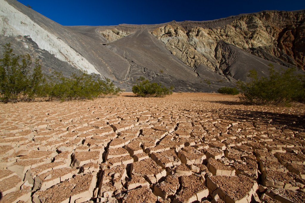
.It’s always incredibly dry and hot in Death Valley. There is a constant suspension of tiny grains of sand in the air. In summer, the temperature can easily exceed 49 ° C. Although it is only a few hundred kilometers from here to the Pacific coast, it is one of the driest regions in the world. Water vapor saturated air brought from the ocean shores rains long before it reaches these places.
.
Despite the harsh and sometimes dangerous conditions, Death Valley is not at all uninhabited. Archaeologists constantly find here rock paintings, remains of hearths and other traces of human presence. In modern times, however, only a small tribe of the Timbisha-Shoshone clan of the Furness Creek Ranch area lives here permanently.
.Death Valley has a dozen landscapes where you will not see a dull landscape of sand dunes, but an endless variety of terrain, rock formations, colors and vegetation. In winter, you will see a carpet of spring flowers blooming after the rare rains in the valley. But above all, the light is fascinating, incomprehensibly transparent, distorting the perspective, pink at dawn, milky in the morning, silvery at noon and increasingly golden in the afternoon.
.Geologically, Death Valley is a relatively young formation, only a few million years old. And yet this short geologic past has been quite eventful. At least four periods of volcanic activity followed by three or four periods of sedimentation have shaped its landscape. It has also experienced occasional periods of increased tectonic activity and two glacial advances.
.Death Valley Attractions
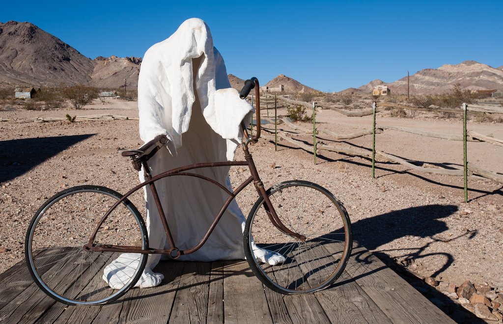
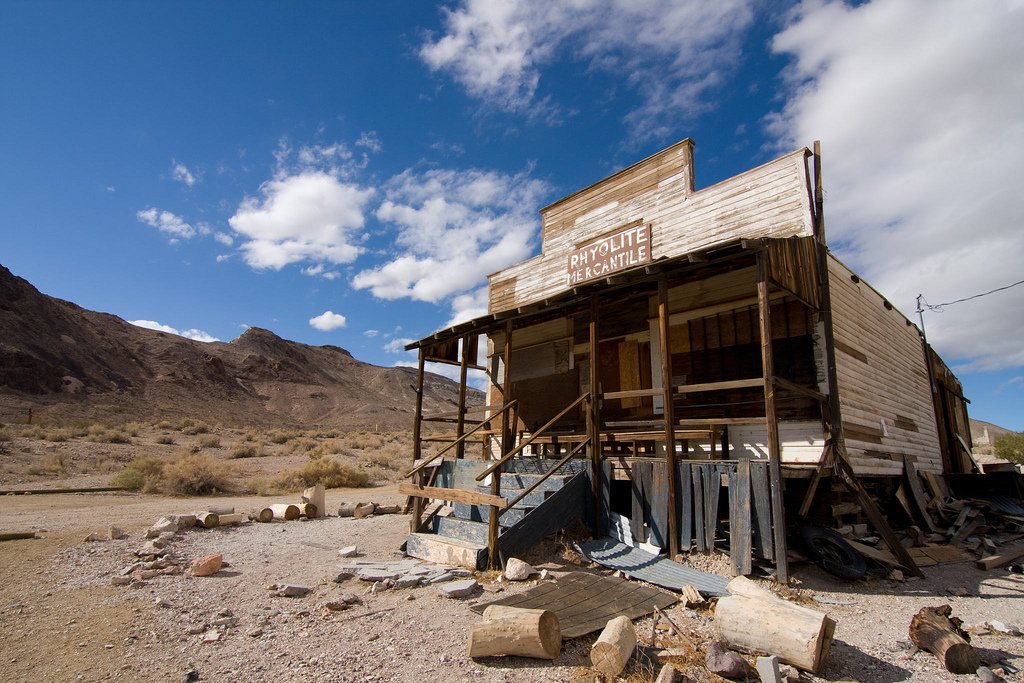
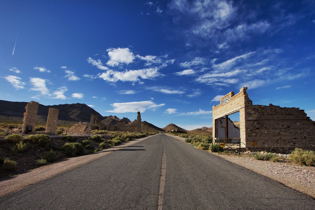
The ghost town of Rhyolite
There are about five thousand abandoned towns in the United States. They are located mostly in the west and have at least two things in common: most of these towns have no people living in them, but each has at least one good or evil spirit.
.I recommend starting your trip to Death Valley from Las Vegas on the Nevada side, with a visit to the ghost town of Rhyolite, an old, long-abandoned mining and prospecting town whose unusual sculptures are stunning. It’s probably the fastest changing town – at the beginning of the last century it was home to 16,000 people, a station where three major railroad lines intersected, and where silver ore was shipped to the coast. Only a few buildings have survived, including the Botlle House, made of cement-bound beer bottles. According to one of the town’s few residents, it is home to musical spirits. Sometimes at night they wake up the old residents by playing their invisible brass band. Meanwhile, it is known that the orchestra last played in Riolaita in 1910. Now it’s a haunted place.
.Not far from Rhyolight, a one-way road begins leading into Titus Canyon. Climbing higher and higher into the Grapevine mountains, the road begins to loop, at some turns you want to get out of the car – you just can’t believe that you can drive on this bumpy strip slanted towards the cliff and stay alive. You cross White Pass, make a short stop at Red pass if you want, go downhill and leave behind another ghost town – Leadfield.
.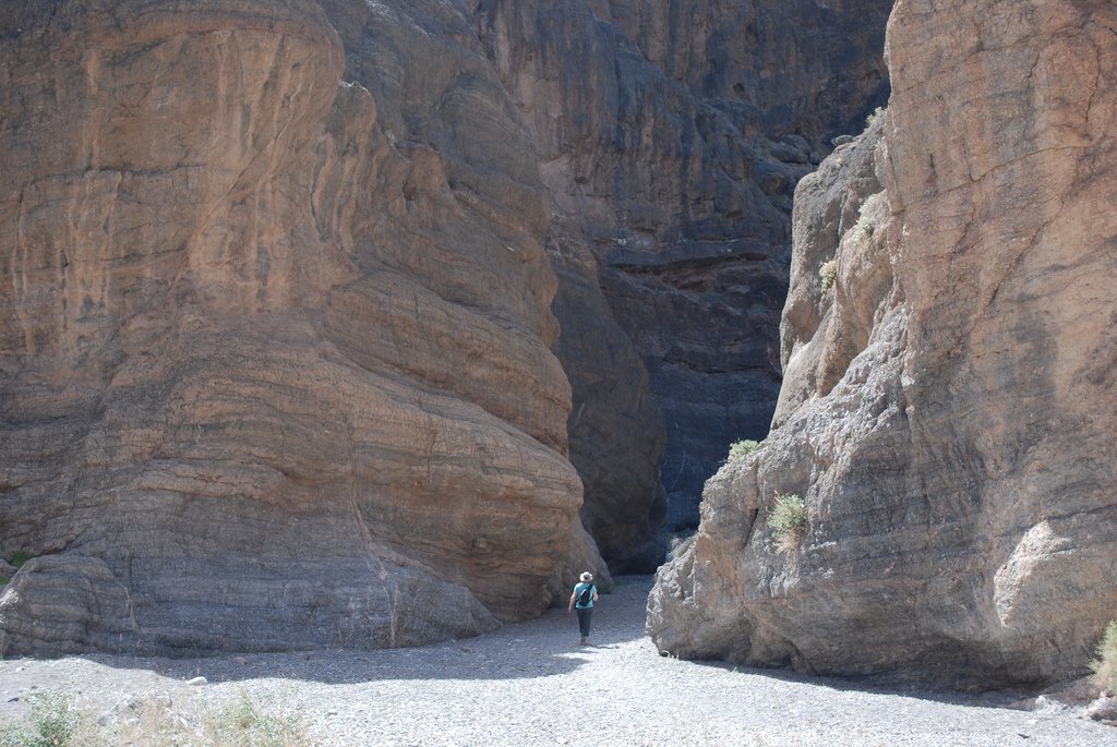
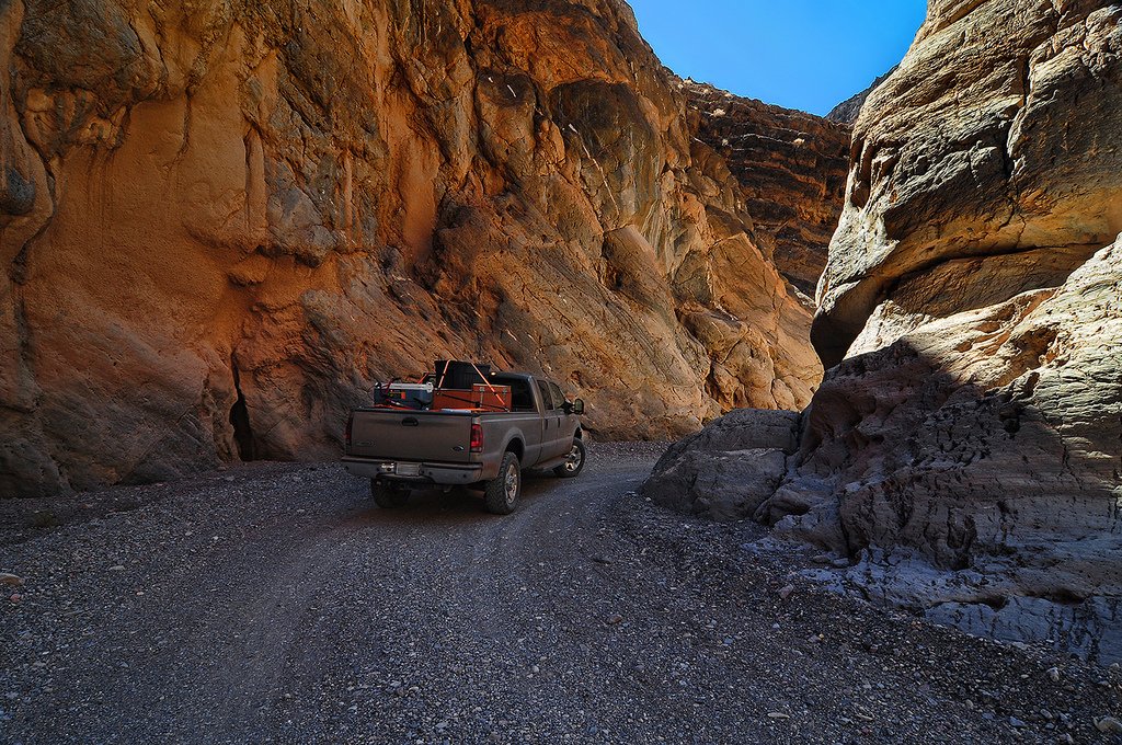
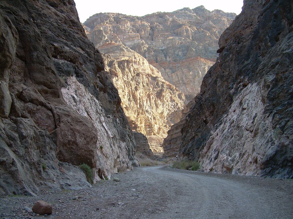
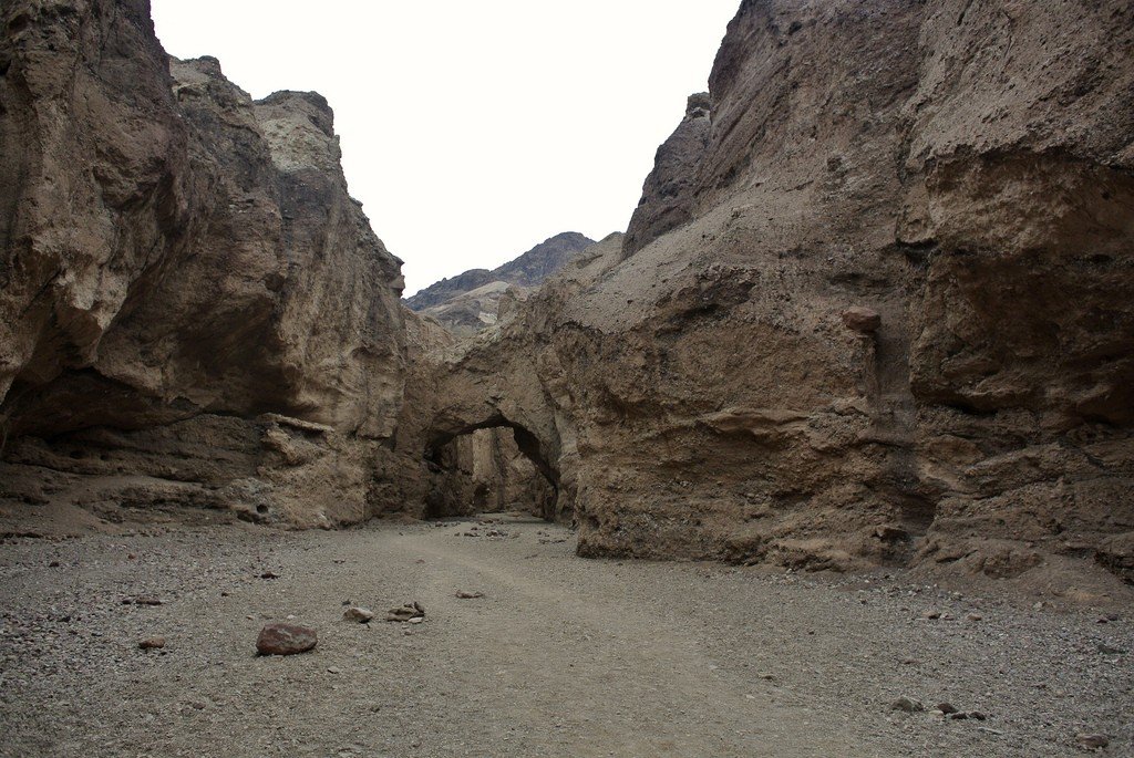
And then, after a hundred and one turns with puzzling descents or ascents, a sign appears in front of you saying that you have reached Titus canyon. Everything around you changes – the road narrows as if it is failing, the dark walls around you rise like stone guardians. The temperature is also rising and the sun is starting to bake, you can stop where you like and look at the petroglyphs.
.A few more turns, and before you stretches the Valley – a parched space with lilac patches of mountains and a gray ribbon of paved road, which is lost in the quicksand.
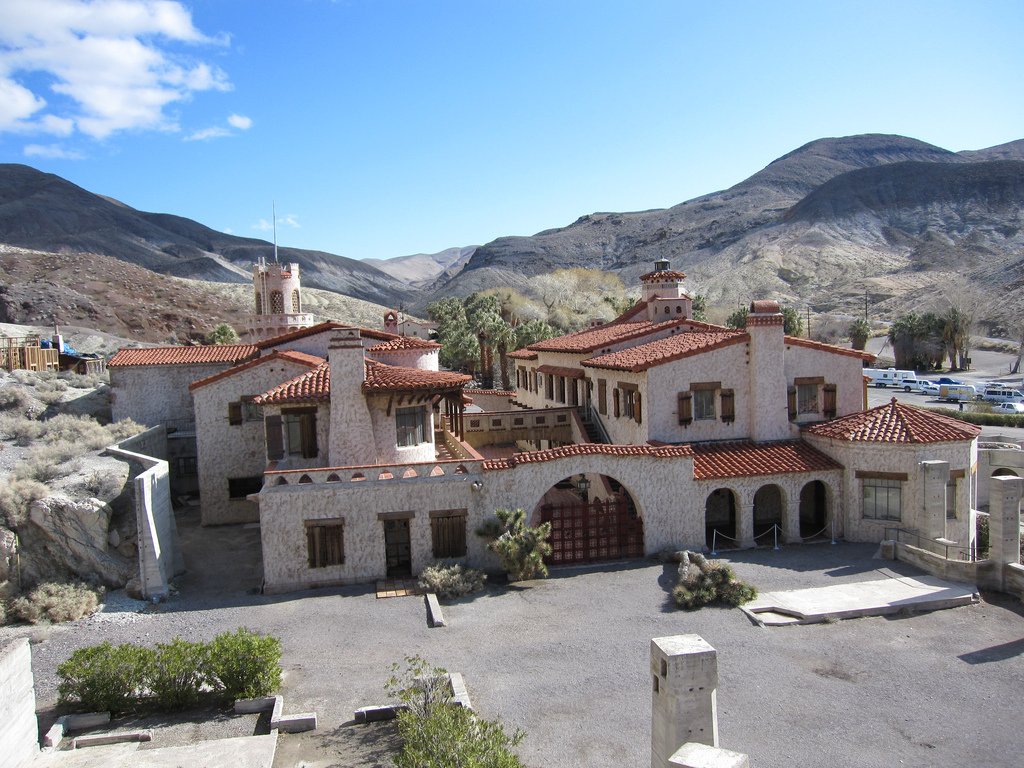
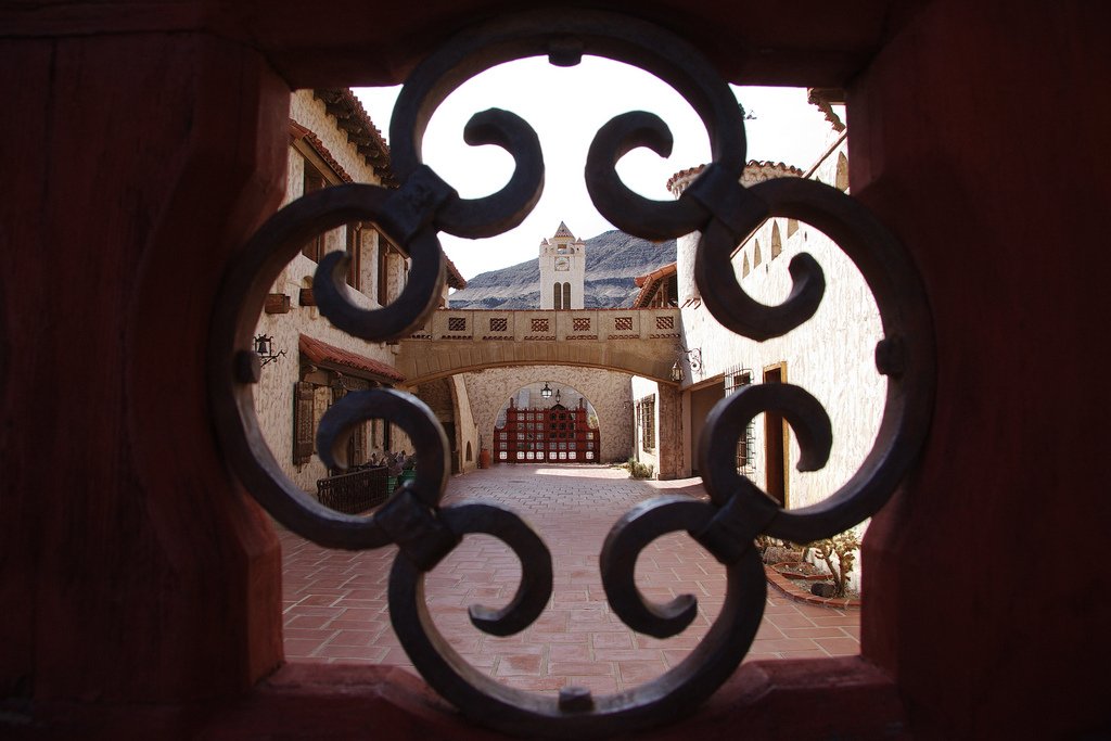
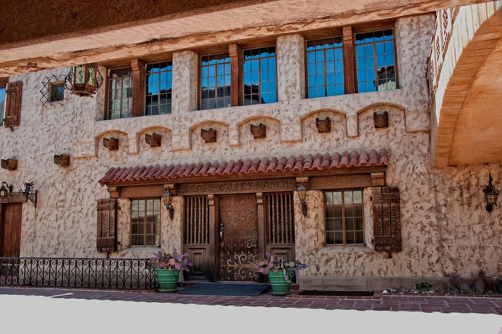
.Scotty’s Castle
In the northernmost part of the Valley, in a small ravine, there is a castle manor, built in the Spanish style in the early XX century by Chicago insurance magnate Albert Johnson. The manor surrounded by green, lush groves and lawns looks fantastic, especially against the harsh nature of these places.
.
The history of the castle is amusing and mysterious at the same time. In the mid-20s, Scotty Walter announced that he had found untold gold mines in the Death Valley area and that he needed financial help to develop the mines. That’s where Albert Johnson comes in, agreeing to finance such a lucrative venture. Needless to mention that there have never been any gold mines in the Valley…
.
A couple years later, Johnson, deciding to check on his “investment,” writes a letter to Scotty about his intention to visit the mines. Deciding that the case is in the bag, Scotty invites the banker to visit Death Valley in… in mid-July, when the temperature is over 50 degrees. It should be noted that Albert was not known for his good health: he suffered from asthma, rheumatism, and God knows what, yet he arrived in California in the middle of July. After wandering around Death Valley for a couple months and finding (naturally) no gold mines, he found something more: health! The hot, dry desert air had cured all his ailments. The beauty of this rugged place so enchanted him that Johnson began coming to the Valley regularly with his wife, Bassey.
.
Bessie was not thrilled about living in a tent, next door to snakes, scorpions and other desert dwellers. Johnson then decides to build a suitable residence for his wife, a Moorish-style castle. Construction of the castle began in 1929.
. You may ask: why is the castle named after Scotty if Johnson was the owner? Very simple. The thing is that Scotty, being by then a great friend of the Johnson family, giving interviews to journalists, claimed that the castle – his, and it is being built on the money received from the sale of gold. And the gold mine is just under the house. Albert Johnson only chuckled at Scopie’s claims, finding them amusing. And so the three of them lived in the castle: the Johnson couple and the knave Scopie, the consummate storyteller.. To this day, the castle is a model of engineering. The castle had air conditioning, electricity, plumbing, and huge cold rooms (considering the house was built in the 30’s – that’s no small thing)..
Ubehebe Crater
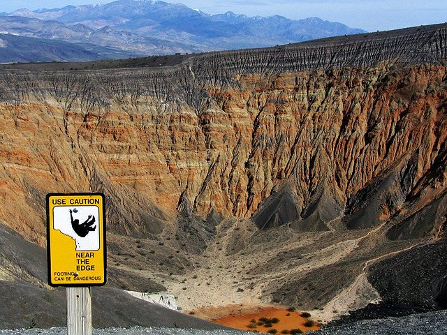
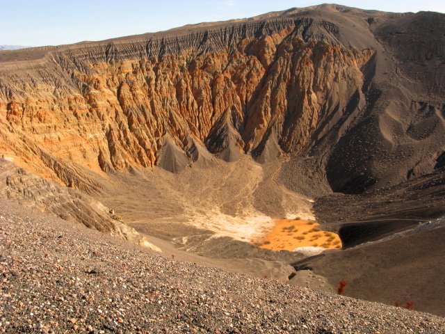
The name of the crater means “Big Basket” in the language of the local Shoshone Indians. The crater was formed when groundwater met with rising magma. The water instantly turned to vapor and literally ripped the surface, sending debris high into the sky and covering the hills with black ash. An impressive sight would be on your left side.
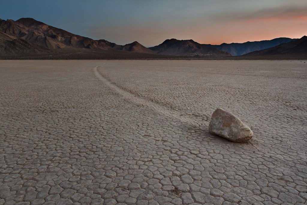
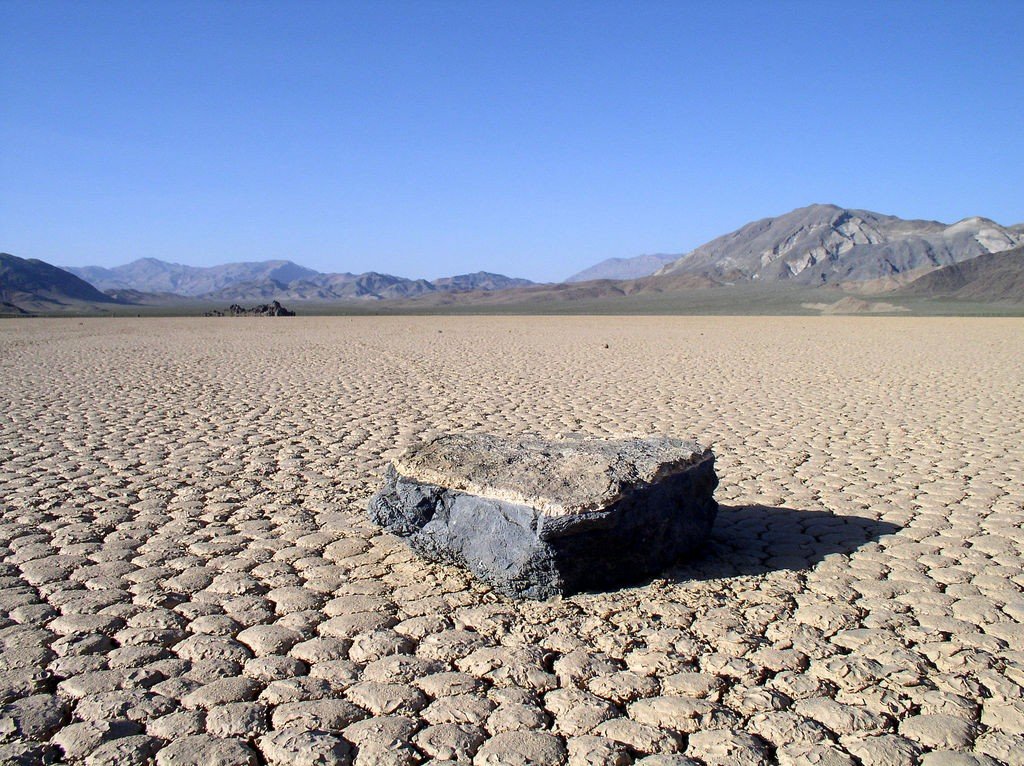
.Racetrack Valley
.’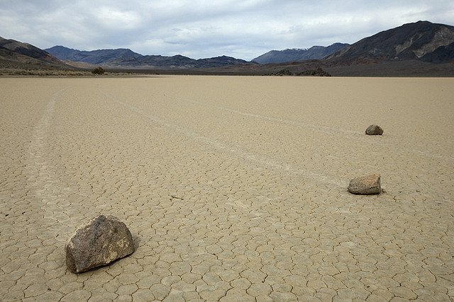
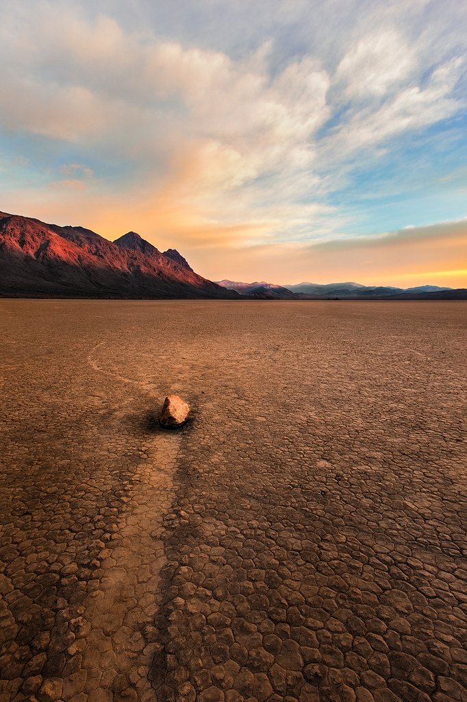
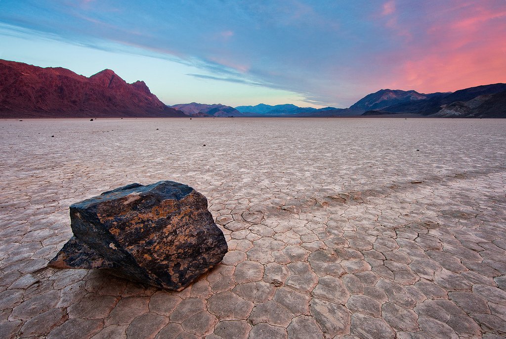
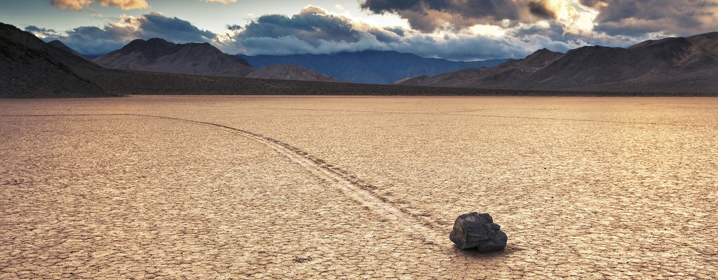
The Waley Racetrack is like a washboard, it’s hard to drive on it, you can only crawl – the car shakes so much that at times it looks like it’s about to fall apart. But the upcoming picture is worth it! Stones of different sizes leaving a crawling trail on the dried soil is a fantastic sight! They constantly change their location, as if they are being pushed by someone’s invisible hand. The last 50 years of research have yielded little in terms of explaining how hundreds of stones, from small to very heavy, can move in different directions, leaving behind them a muddy furrow, turning, crossing their own trail, sometimes alone and sometimes in groups. Various hypotheses have been put forward about the nature of this phenomenon: the stones slide on the thin crust of ice that often forms on the surface of the plain; they are moved by the wind when the plain is moistened in a certain way, and the like. But none of these has yet been proved.
.Devil’s Golf Course
.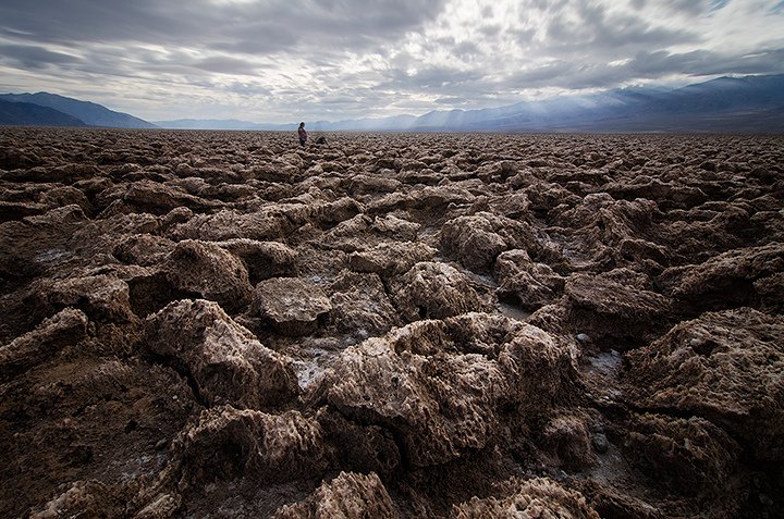
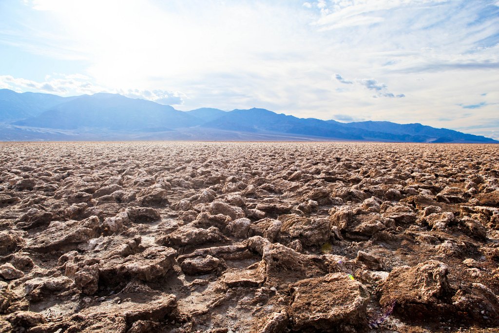
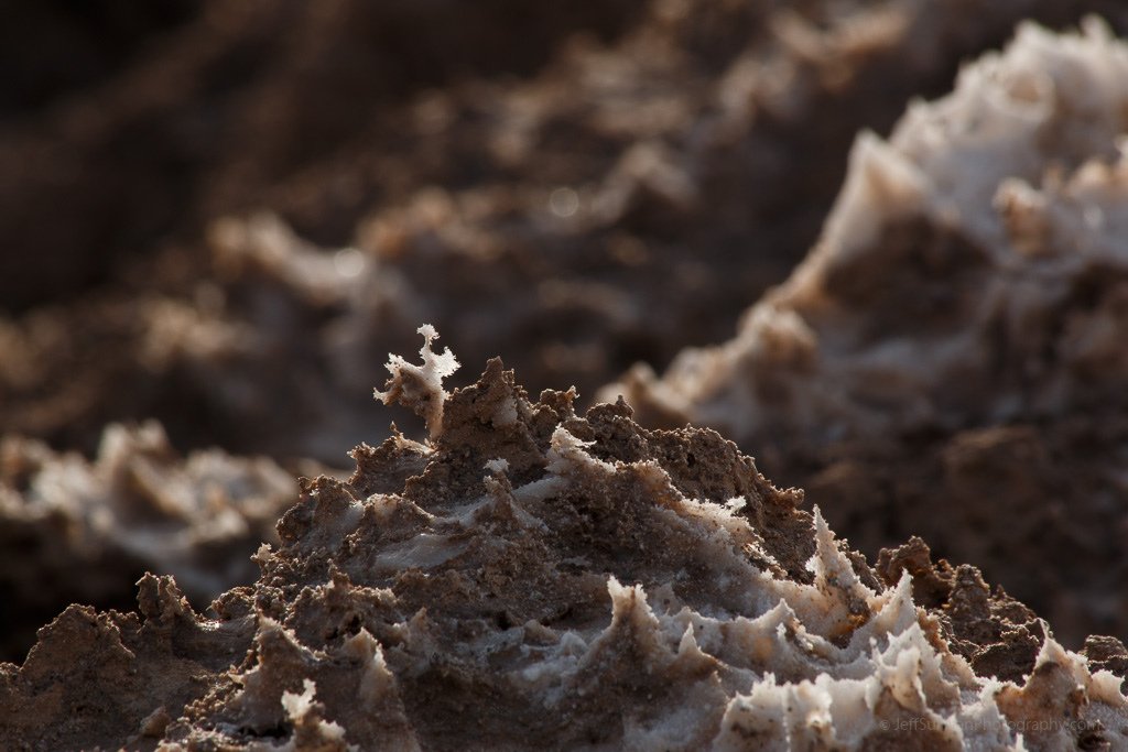
When you see Devil’s Golf Course, it feels like you’re on another planet. Petrified salt, eaten away over the years by rain and wind, mixed with clay and sintered in the sun into a glass-like mass of sharp salt peaks, covers this section of the valley with a brownish mess that from a distance resembles a plowed field, humorously named the Devil’s Golf Course. If such a salt peak is struck hard with a hammer or knife, the piece breaks off with the sound of shattering glass.
.
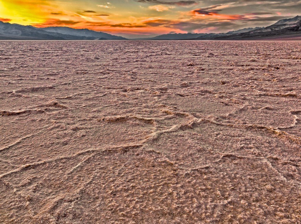
Bad Water Lake
.’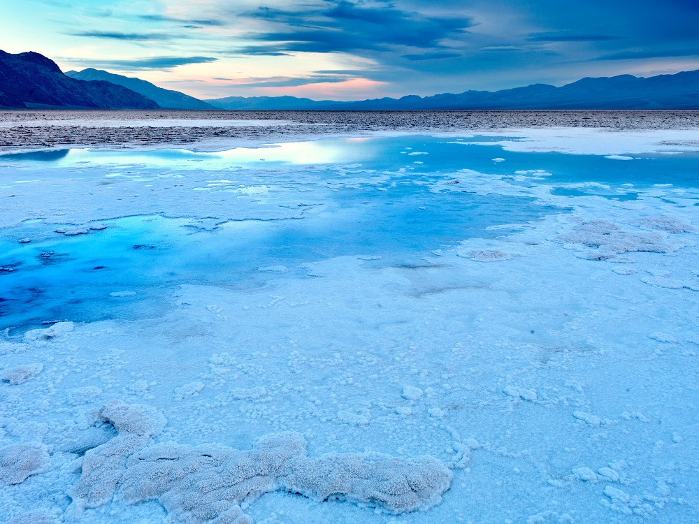
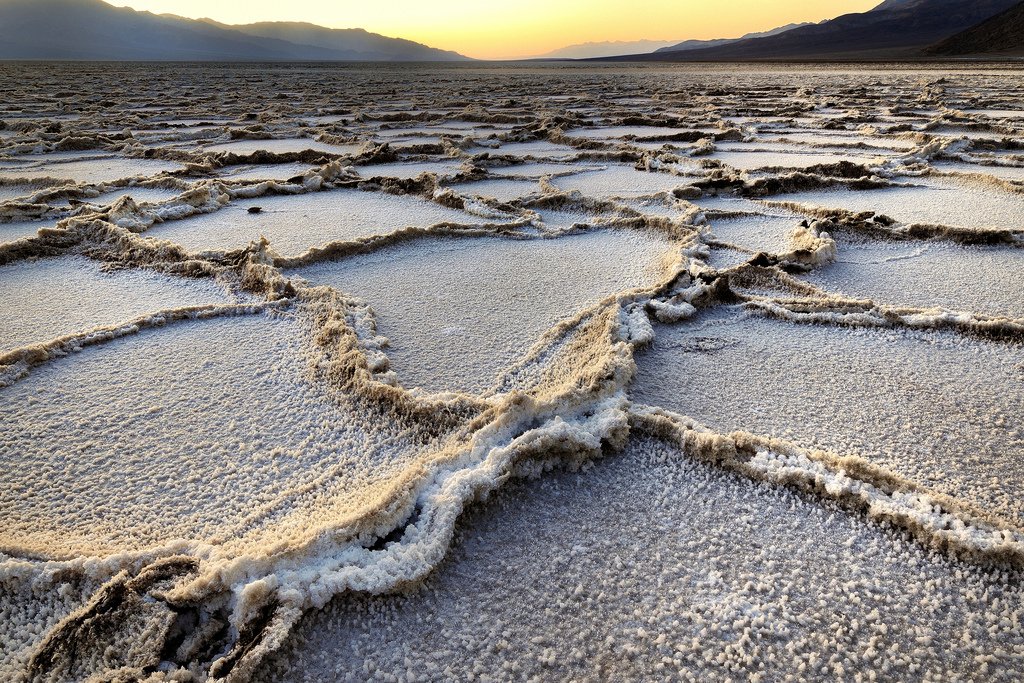
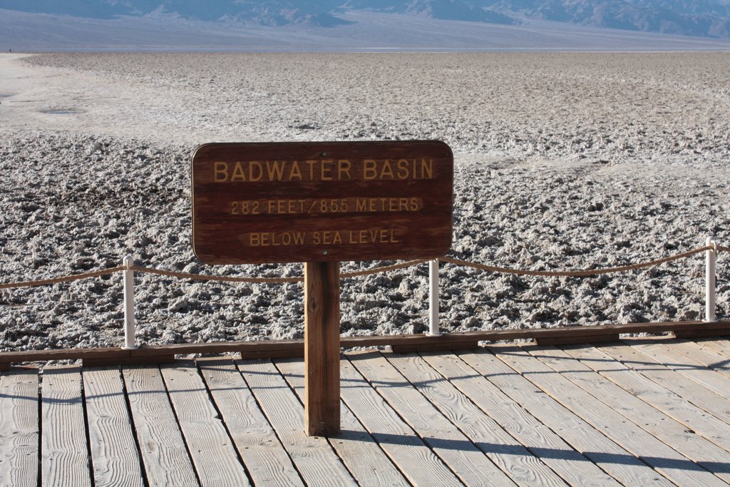
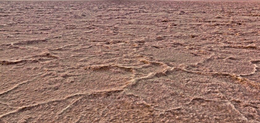
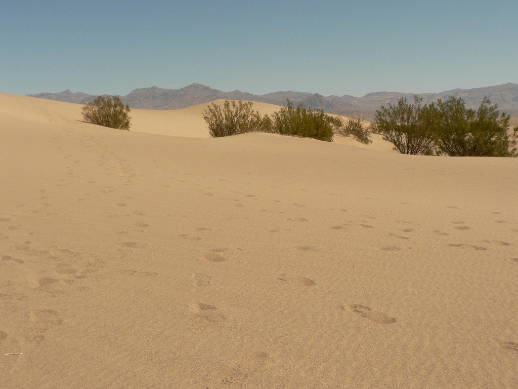
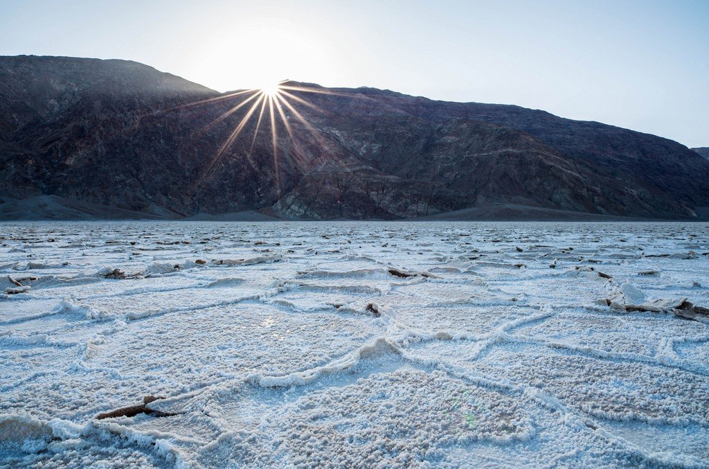
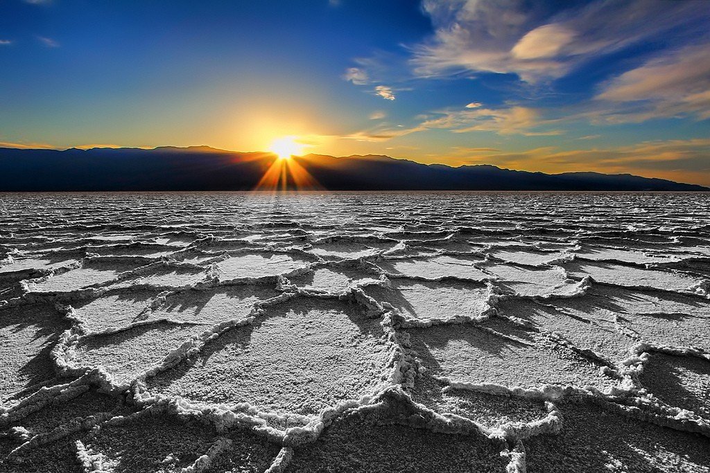
Badwater (Bad Water) Salt Lake is the lowest point in the Western Hemisphere (lowest in the world at the Dead Sea) and simultaneously the hottest place on Earth. The salt lake evaporates by May, turning into a white cracked surface with interesting salt patterns. Nearby is a classic sand desert with dunes, snakes and coyotes. It’s an unusual sensation to go behind a dune so that the road and car are out of sight. Lunar landscape all around with no hint of human activity. It’s so nice to be alone in this element, knowing that a few steps and you’re back in civilization with the Internet and ATMs.
.Dante View
.’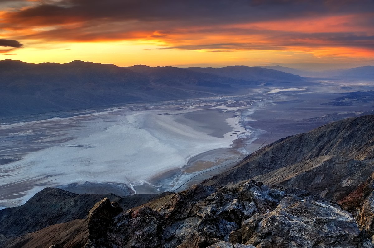
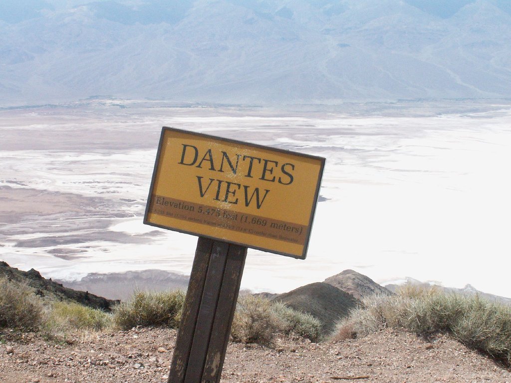
Dante’s View is a flat-topped peak rising above Death Valley at 1669 meters, offering an absolutely stunning view of Death Valley. The glistening white salt flats of Badwater Lake, the snaking strip of highway and the contrasting red-gray slopes of the Panamint Mountains surrounding the Valley on the opposite side are spread out in front of you.
.
This view makes you think of all things, of the fragility of human life, of beauty that is sometimes deadly…
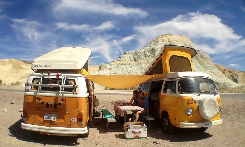
.Tourists
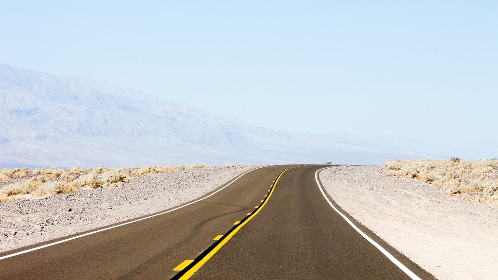
It’s common to time your Death Valley sightseeing with a trip to Las Vegas. Either drive here from the east on Interstate 95, turning off at the Death Valley intersection onto Highway 190, or head further north through the Nevada town of Witty on Highway 58.
.Before you start traveling through the best parts of Death Valley, be sure to ask about any roads that may be washed out. This will help you save time on your trip. The best time to explore the Valley is early morning or evening. The fact is that during the day, the sun’s rays are reflected off the salt beds and surrounding mountains, so almost everything around you appears faded and lifeless. Plus the heat, which leaves only one desire – to get in the car, turn on the air conditioner on full blast and get away from here as quickly as possible.
.
Don’t be misled by the name Death Valley. So it was dubbed by those hapless people who decided to try their luck during the “gold rush” and had to endure great hardship here, moving through Arizona and Nevada. The Furness Creek Oasis now has all the conditions to welcome tourists. However, when crossing the desert in summer, do not drive off the main road and in case of car breakdown wait for a police patrol car. Also, stock up on gasoline and drinking water.
.
Accommodations within the park are expensive, plus, especially in the spring, everything is reserved well in advance. The closest town with inexpensive hotels is Beatty, Nevada (70.4 km from Furness Creek), but there are more choices in Las Vegas (192 km southeast) and Ridgecrest (195.2 km west).
.Death Valley has nine camping sites (tent sites $0-18), but they fill up by mid-morning, especially on weekends. Advance reservations (tel: 877-444-6777; www.recreation.gov) are only available at Furnace Creek (mid-April through mid-October). During the summer, Furnace Creek sites are purchased on a first-come, first-served basis. Other operating campgrounds include Mesquite Spring, near Scotties Castle, and campgrounds along Emigrant Canyon Rd, west of Stovepipe Wells. Some sites are only accessible by high clearance vehicle. Campgrounds on the valley floor – Stovepipe Wells by the road, Sunset, and shady Texas Springs – provide sites primarily for residential RVs; they are open October through April.
.Camping in remote areas (campfires are prohibited) is allowed 3.2 km from paved roads, away from developed infrastructure and tourist areas, and 100 yards from any water source; free permits can be picked up at the visitor center.
.Public showers are available at Furness Creek Ranch and Stovepipe Wells Village ($5, including pool admission).
.Death Valley permits ($20 per vehicle) are valid for seven days. They can be purchased at payment machines throughout the park. Show your receipt at the visitor center in Furness Creek (tel: 760-786-3200; www.nps.gov/deva; 8 a.m.-5 p.m.) and receive a free map and newspaper. In Furness Creek, in addition to the center, you’ll find a convenience store, gas station, post office, ATM, Internet, hotels and restaurants. Stovepipe Wells, a 30-minute drive northwest, also has a convenience store, gas station, ATM, motel and coffee shop. In Panamite Springs, on the western edge of the park, you’ll find fuel and snacks. Cell phone signal in the park catches poorly, if at all.
.Interesting facts
- History and Location: Death Valley was designated a National Treasure in 1933 and a National Park in 1994. It is located in the states of California and Nevada, covering an area of about 13,628 square kilometers. .
- Elevation differences: Death Valley is known for its large elevation differences. The lowest point, Badwater, is 85.5 meters below sea level, while the highest point, Mount Telescope, is 3,368 meters higher. Number of visitors: About 1 million tourists come here every year..