Cave of the Hands (Cueva de las Manos)
In the south of Argentina, in the province of Santa Cruz is the amazing Cueva de las Manos, if translated as “Cave of the Hands”. This name describes it very accurately, because in this cave there are hundreds of images of palms left by ancient people. It is surprising that people of antiquity, just like us in childhood, liked to circle their hands and make their images.
Highlights
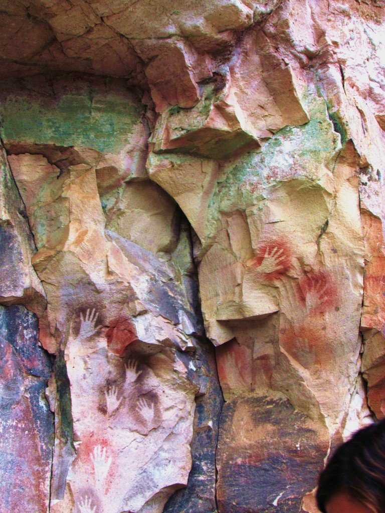
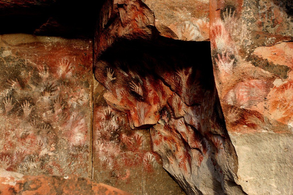
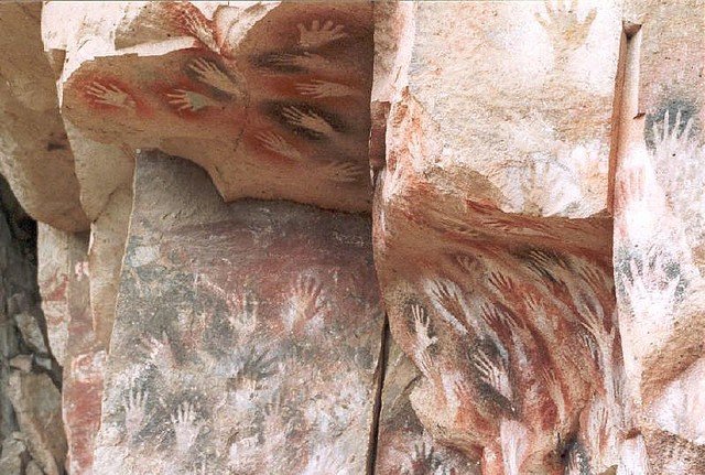
In fact, the Cave of the Hands is not one, it consists of several caves located in the valley of the Pinturas River. Their total length is 160 kilometers, there is room to get lost. But, of course, not all the caves are allowed to tourists, only the safest and most interesting ones are open. Tourists can enter the most important cave. Its height is 10 meters, and the depth reaches 24 meters. At the same time, the cave is quite wide, and in the widest place has 15 meters. Local tribes used to live here. And they lived in this cave for quite a long time, up to the 8th century, although the cave began to be used in the 10th century BC.
.Drawings and their colors
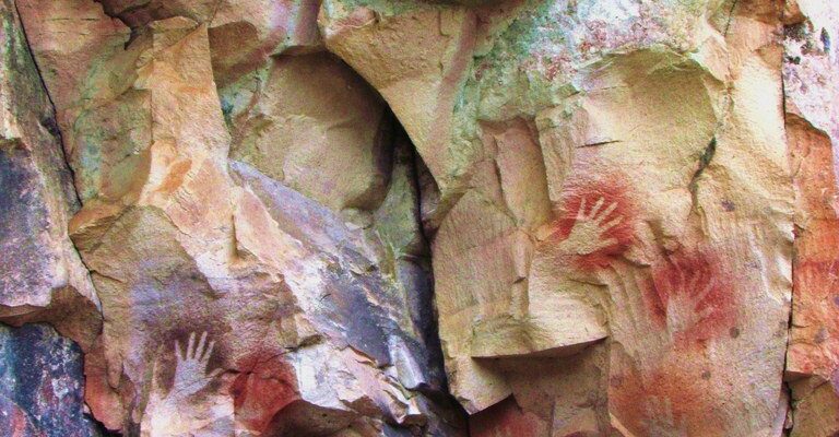
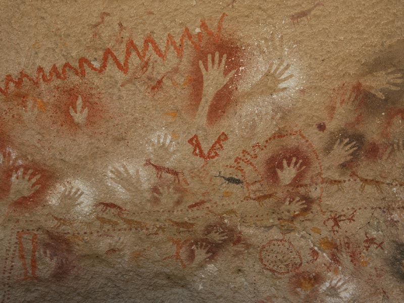
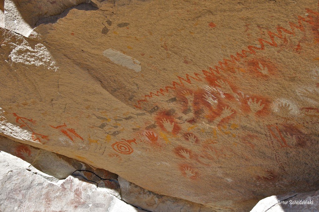
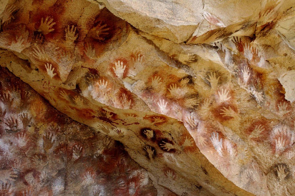
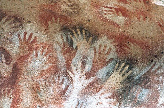
It is in the main cave of Cueva de las Manos that the most images of human palms are found. The images are mostly negative, but there are also positive ones that appear a little later. The colors of the palm prints in the cave can be red, yellow, white, black. The oldest prints date back to the 9th millennium BC, and the most recent ones date back to the 10th century.
.
The drawings in the cave were preserved through the use of mineral paints. For their application used bone tubes, which were found here in the cave. With the help of these tubes and was able to determine the age of the drawings. To get purple color in the tube was poured paint with iron oxide, for white color used white clay, black color was obtained due to manganese oxide, and yellow – natrojarosite. It is not clear on what principle this or that color was chosen for application, but the handprints in the cave have different colors.
.Who do the palms belong to?
After examining the prints, it was found out that they mostly belong to teenage boys. Moreover, the left hand was used to create the print. According to scientists, the left hand was chosen because the right was more convenient to hold the tube and draw, the one who could perform the drawing with the left hand, left the prints of his right hand. Such data suggested that imprinting of their palms was part of the initiation ritual. That is, when a teenager was preparing to become a man, he underwent rituals that necessarily included the application of his palm on the cave where the tribe lived.
.
The fact that the cave was not only a sacred place, but also a place of residence for the tribe, is evidenced by the household items found at the site and the drawings applied to the caves. It was determined that it was mainly lived here by the “Tehuelchez” tribe, they created such an interesting tradition, and maintained it for thousands of years.
.
Tourists
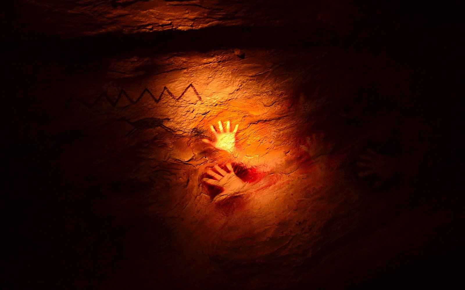
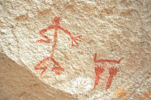
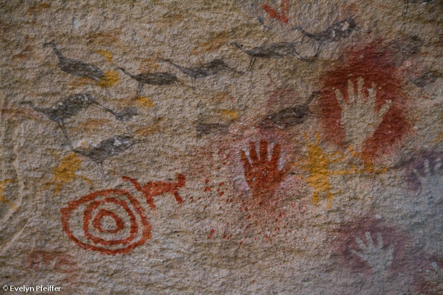
When you visit Cueva de las Manos, you have the opportunity not only to see the palms of the people of antiquity, but also their drawings, which depict aspects of the tribe’s life. These are mostly hunting scenes. From such drawings it is not difficult to determine who the inhabitants of ancient Patagonia hunted. They depict ostrich-nandu, guanaco, some species of cats and other animals. In the caves you can also see paw prints of these animals. There are also geometric figures inscribed by the inhabitants of the cave.
.For Argentina, the Cave of the Hands is an important attraction. In 1999, it was even added to the UNESCO list. To get to the main cave travelers should take the dirt road PR 41 or the paved Ruta 40. The caves are located in the Francisco Moreno Park. Already on site, it will be possible to arrange a guided tour with an experienced guide who will be able to clearly explain the significance of each drawing..Location of the Cave of the Hands:
Patagonia, near the town of Bajo Caracoles, on the banks of the Rio Pinturas River.
.How to get there:
.By car along the dirt road RP 41, which turns off the Ruta 40 route near the town of Bajo Caracoles. It then goes 46 kilometers to the south bank of the Pinturas River Canyon.
.