Atysh Waterfall
Atysh Waterfall is a unique geographical object and a protected natural monument in the Beloretsky district of the Republic of Bashkortostan, which was born as a result of an underground river coming to the surface.
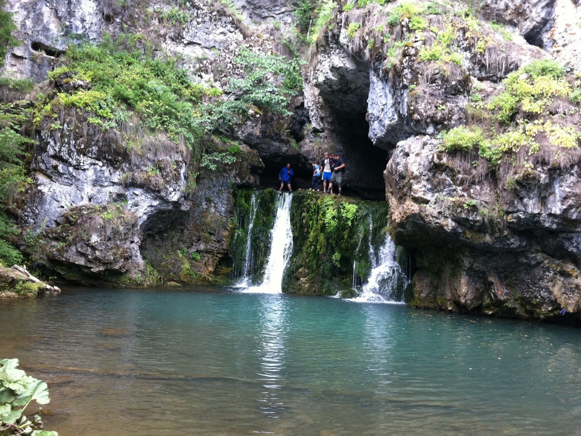
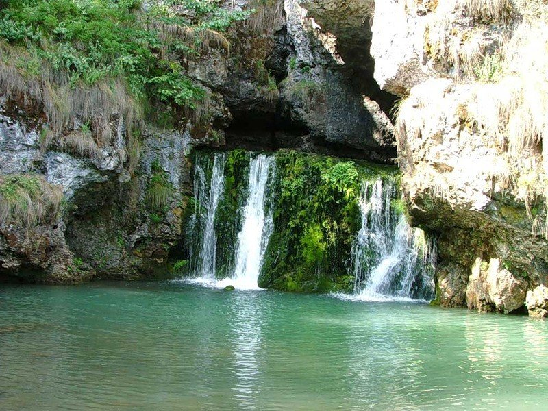
Atysh is not the most accessible attraction of the Southern Urals. Often get to this amazing natural creation has to off-road vehicles or on foot, with the use of special equipment. However, any inconvenience loses its significance when you look at the delightful bubbling streams erupting from the fabulous cave and filling the emerald reservoir at the foot of the grotto.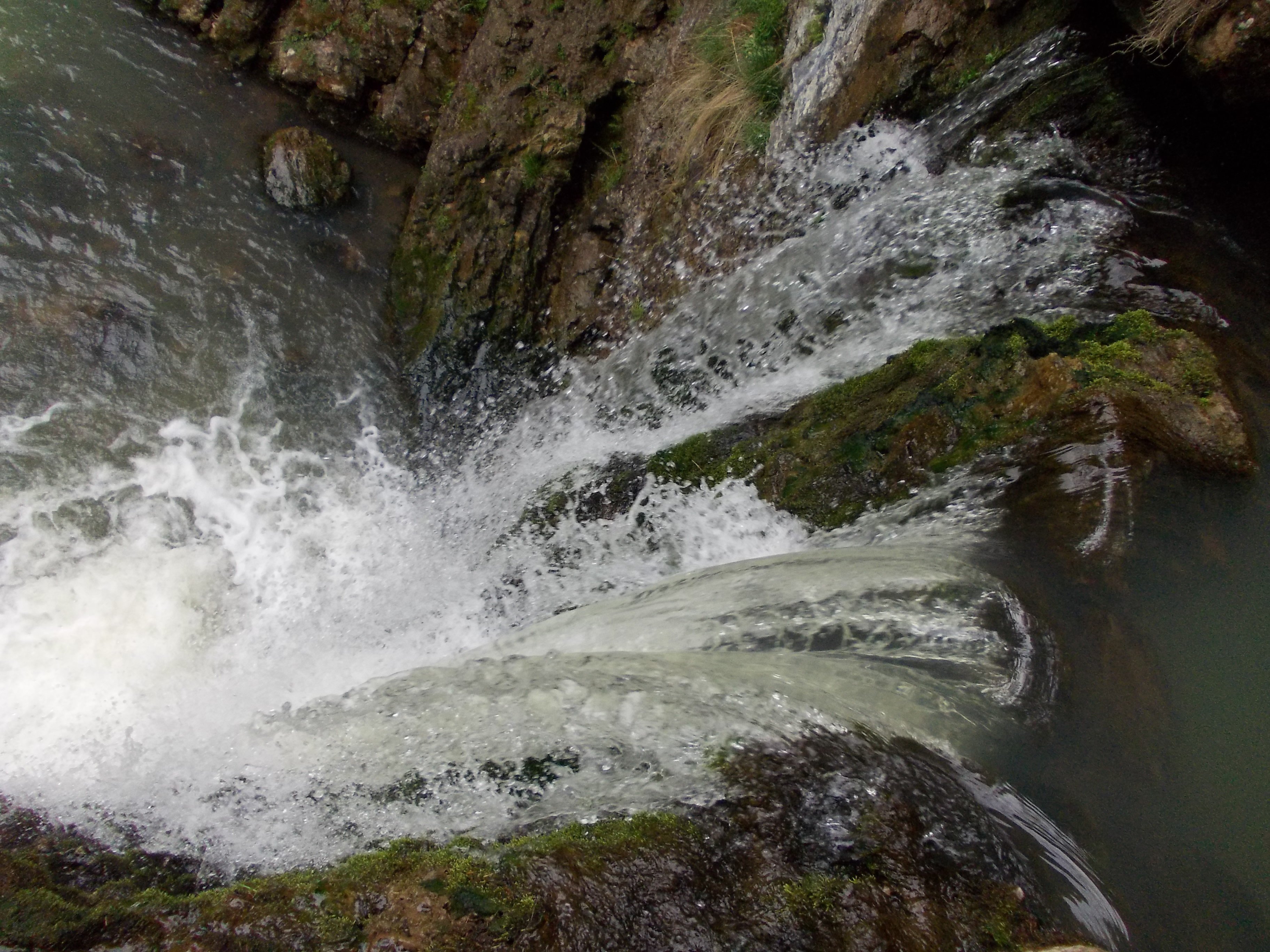
Video: Atysh Waterfall
Contents- General information
- Best time to visit
- Ecological situation
- How to get there: peculiarities of hiking route and traveling by car
General information
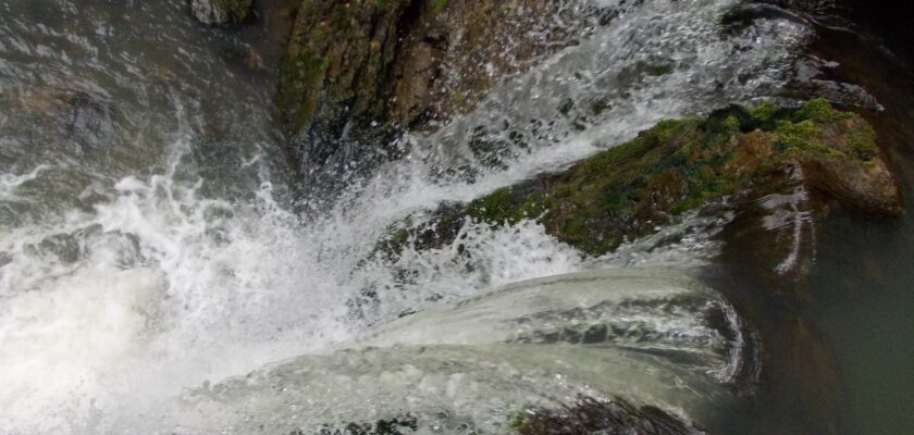
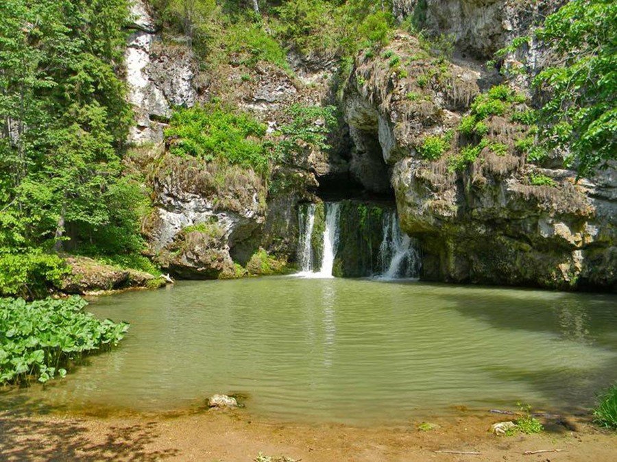
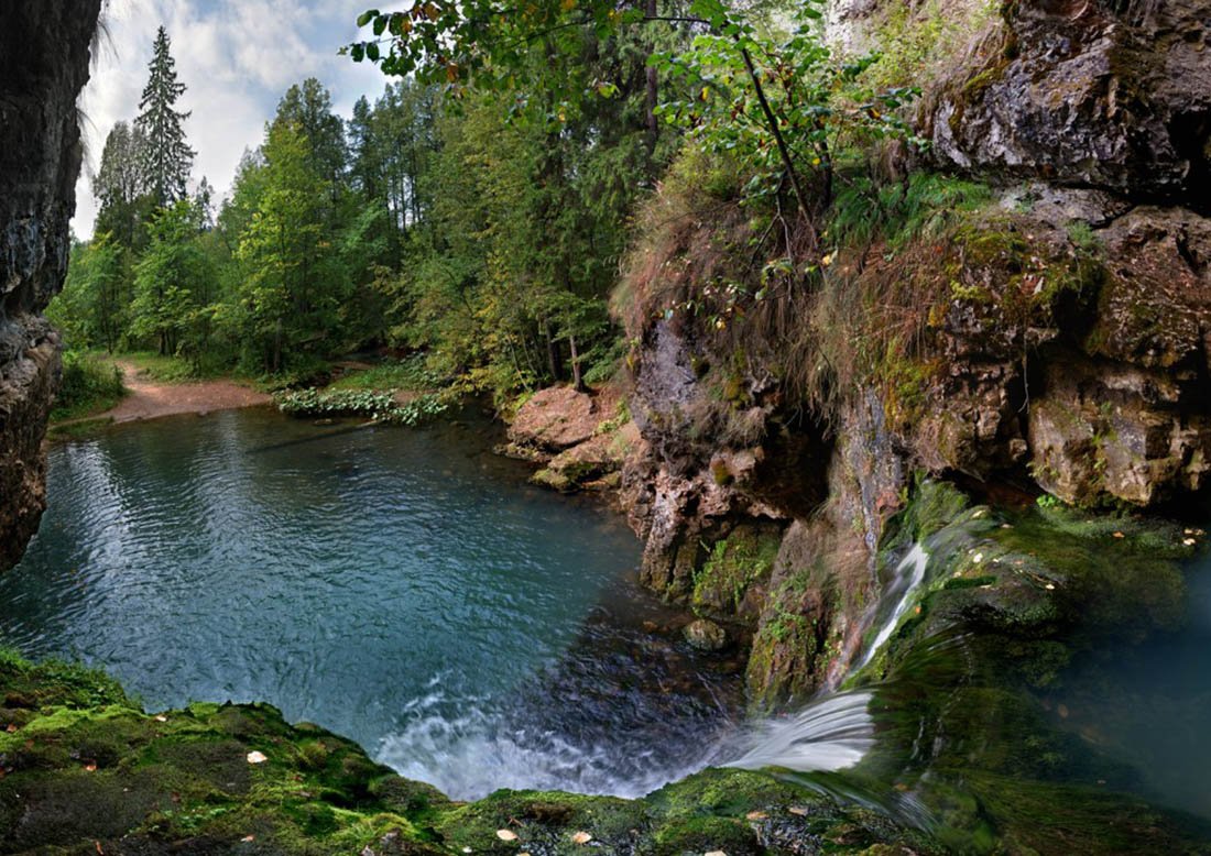
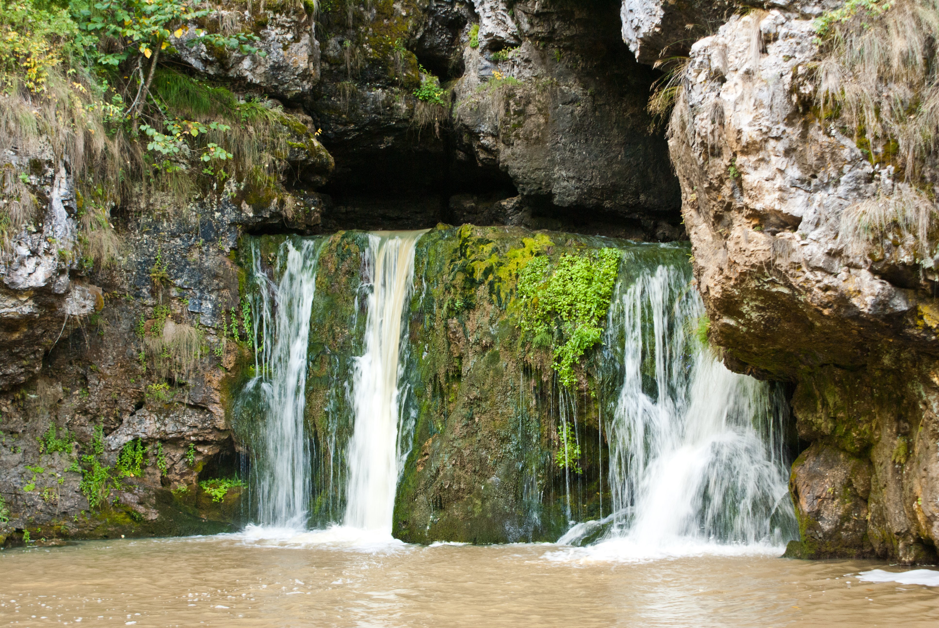
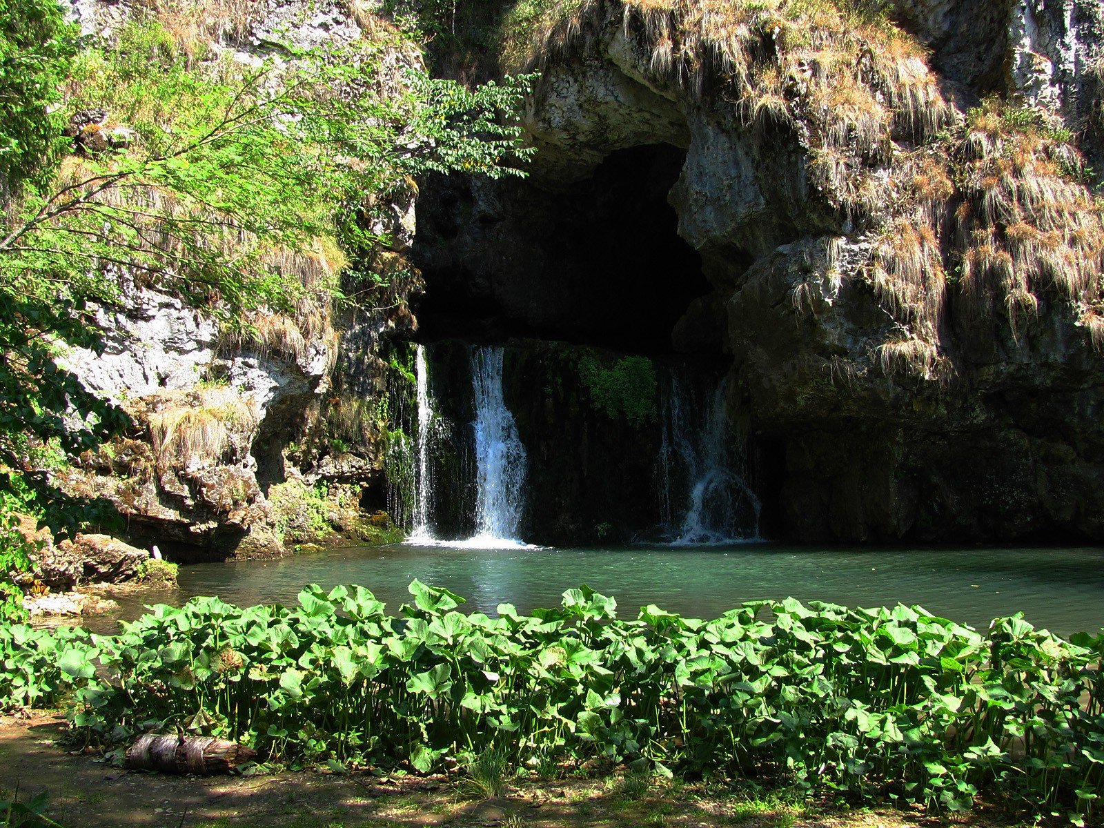
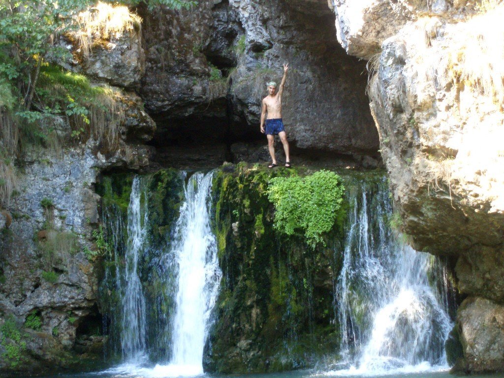
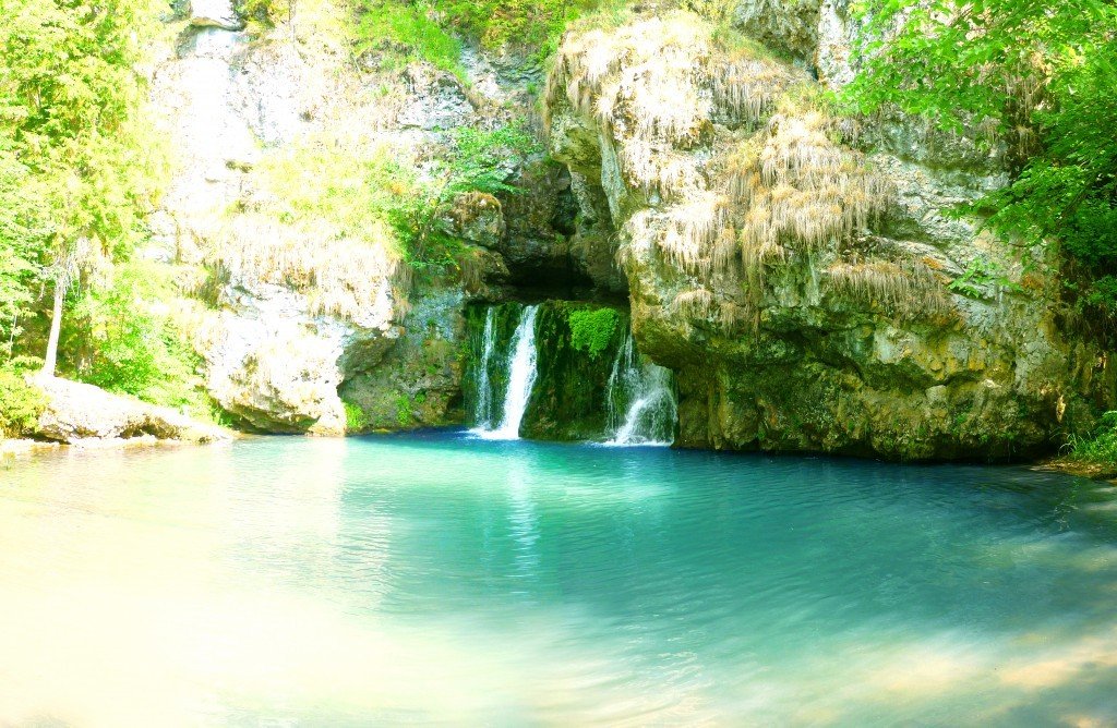
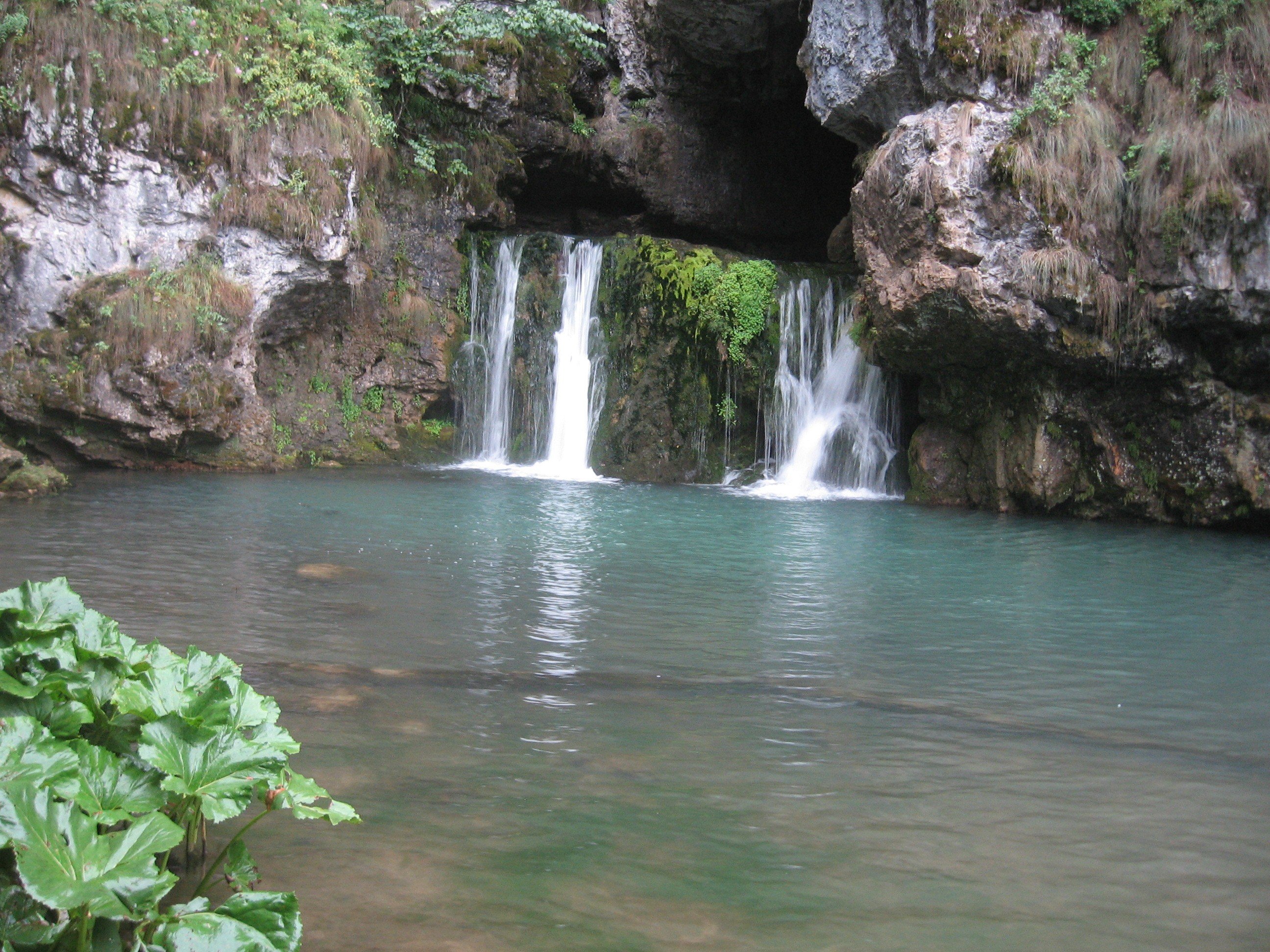
In translation from Bashkir the name of the waterfall sounds like “shooting”. This amazing cascade is formed by the rivers Atysh and Aguy, which broke their way through the rock and came to the surface on one of the sections of the mountain Yash-Kuz-tash. The Atysh waterfall is unique in that the water mass coming out of the grotto falls almost plumb. The jets, which are about 6 meters wide and more than 4.5 meters high, fall down to the foot of the cave, resulting in the formation of a small but extremely deep lake (7 to 10 meters deep). From it the Atysh continues its way, flowing into the larger Lemeza River.
.
Interesting fact: in ancient times the waterfall was much higher, but gradually the water eroded the rock, and Atysh began to steadily descend. Scientists predict that in a few millennia, the stream will completely wash away the stone slabs and one of the most beautiful sights of the Southern Urals will cease to exist.
.Best time to visit
Atysh is beautiful at any time of the year, so there are simply no specific instructions for visiting the waterfall. Delightful landscapes and clear, crystal-like water meet tourists in summer and fall. During the spring floods Atysh demonstrates its stroppy character, turning into a destructive foamy stream. In winter, the mountain is covered with a thin snow carpet, and the water jets are enveloped by a mythical fog. You can observe a truly fantastic picture if you climb into the grotto from which the waterfall emerges. Ice icicles and growths completely transform the interior of the cave. Especially curious people can see how Atysh and Aguy disappear in the rock to come to the surface a few kilometers later in the form of powerful gushing jets. To admire this interesting phenomenon, one should go to the north of the waterfall. Locals call this place Atysh-Sugan, which translates as: Atysh dived or Atysh fell.
. Useful information. Going on a hiking excursion to the waterfall, it is worth taking with you everything you need for an overnight stay (tent, food stock). Since the length of the route is about 10 km, it will be difficult to get to the destination and back in one day..
Environmental situation
The area where the Atysh waterfall is located can be called without exaggeration one of the most picturesque corners of the Southern Urals: clean, clear rivers, small passes, forests of deciduous and coniferous trees… However, recently the ecological situation in the vicinity of Atysh has noticeably worsened. The reason for this is household garbage left by irresponsible tourists and travelers. The crossing of rivers by automobile transport, which has become especially popular in recent years, also has its negative results. As a result, fuel oil stains appear on the water, and the coastal area turns into a continuous unturned rut.
.How to get there: peculiarities of the hiking route and traveling by car
Those who want not just to admire the waterfall, but also to look at its surroundings, should prefer the walking route. From the capital of Bashkortostan, it is better to get out by train Ufa-Inzer, which will take you to the starting point of the journey – the 71st kilometer. Since on the way you will have to force at least two reservoirs, try to buy rubber boots with a high shank and the most comfortable clothes in advance. The first obstacle that meets tourists immediately after disembarking from the train is the Inzer River. The water body is shallow, with a calm current, so it is usual to cross it by wading. For its thoroughness and unhurriedness the locals nicknamed the river “man.”
.
After a successful crossing, travelers are waiting for a kilometer hike through dense thickets leading to the pass. The walk along rocky trails interspersed with maple groves will be long (about 8 kilometers). Gradually, the road descends into the valley, where there is a second water obstacle – the Lemeza River, or “woman”, as it is dubbed by local residents for its wayward nature. Despite the fact that the water body is relatively shallow, its underwater rocks are covered with a thin layer of silt. Accordingly, it is necessary to cross it with certain caution. From Lemeza to the waterfall – literally a few steps.
.Those who do not complain of multi-kilometer hikes, you can try to get to the waterfall by car. Drive from Ufa to the village of Verkhniye Lemezy, where you turn off on the path leading to Atysh.
.